Weekend away Pickering 18th – 20th October 2019

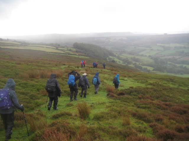
The ‘Long walkers’ at Simon Howe.

Overview by Ann Thompson

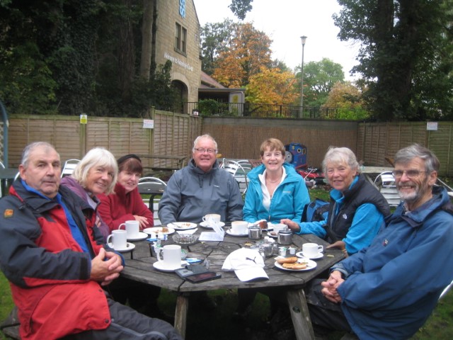
Nearly 40 members of the group participated in this weekend on the southern edge of the North York Moors. Staying in various locations but centred on the Forest and Vale Hotel in Pickering, there were group meals as well as three different walks each day. It was agreed that the hotel provided excellent service and food and for those staying there were a goodly number of radiators for drying clothing. The weather of early October meant the area had had 136% of its October rainfall already and mud was the order of the day.
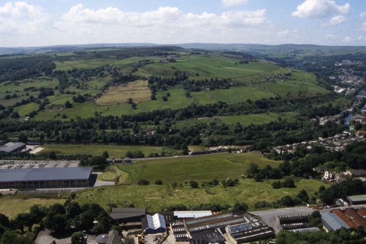
The Saturday walks were all linear in the Pickering area. The short walkers enjoyed a steam train ride to Levisham Station which brought back childhood memories of steam travel to many of us. The group then ascended out of Newtondale, a splendid glacial overflow channel, up to Levisham village with its wide verges and stone farms in a linear format. The Three Horseshoes pub had opened early so coffee could be bought or the break could be enjoyed outside in the benches. The walk then continued via Levisham old ruined church to cross the railway three times as well as Pickering Beck to arrive back in Pickering via a mixture of woods, field paths and tracks. The medium walkers caught a bus to the Hole of Horcum which is a magnificent semi-circular hollow formed by spring sapping at the end of the ice age. They traversed this feature to arrive in Levisham to eat lunch with the possibility of a drink at the pub, and then followed the short walkers on a similar route into Pickering. The weather was reasonably kind to these groups with only one prolonged shower around midday. The long walkers used car sharing to reach Goathland and walked back to Levisham. Their walk was a varied trek with views of the Fylingdales early warning station and glimpses and sounds of the railway. Refreshments were enjoyed at Levisham Station at the end but the weather however was not so kind with further heavy rain in the later afternoon.
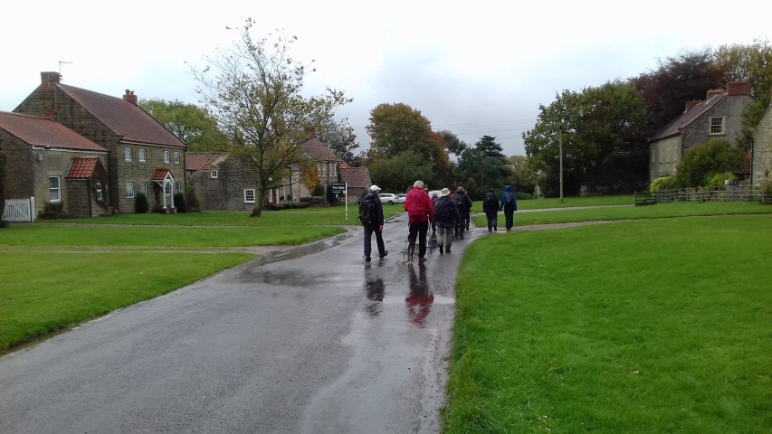
Sunday saw the short and medium walkers start from Sinnington, another delightful village with extensive green areas and a fast flowing river. The short walkers left the village passing an interesting old barn and proceeded to Cropton for a coffee break under a conveniently large horse chestnut tree as it was raining. The group then descended into the Seven valley and up to the village of Appleton-le-Moor where the church said ‘church open’. Here we found a wonderful shelter from the rain for lunch amidst harvest festival decorations and tea and coffee on offer on a ‘help yourself’ basis. The nearby pub offered toilets in return for a donation to the air ambulance, so a very welcoming village. Our return to Sinnington even had a little sunshine. The medium walk headed up the valley to Lastingham where the church service had ended and we could visit the crypt church. The church is Norman with alterations but the crypt church has not changed since 1078 and is said to the oldest Norman crypt in the world. After eating our picnic in the sunshine the rain returned as we headed to Appleton with its splendid Victorian church and school buildings before continuing heading back to Sinnington where we enjoyed a pot of tea in the Fox and Hounds pub using their residents lounge. The long walkers started from the village of Hutton le Hole heading over the moors to Rosedale Chimney and Rosedale and returning along the valley. Overall, some lovely walks but rather too much rain and mud.
Due to the newspaper proforma restrictions, a shorter version of this write up will appear in the Macclesfield Express on Wednesday 6th Novermber.

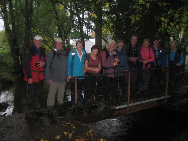
Goathland to Levisham linear walk – (LONG WALK) Saturday 19th October (by Brian Richardson)

Ten walkers started out from Pickering in cars, and managed the logistics preparation by leaving a car at the walk’s end, at Levisham, and drove to Goathland to start the walk.

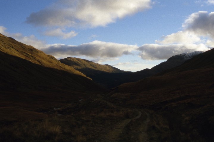
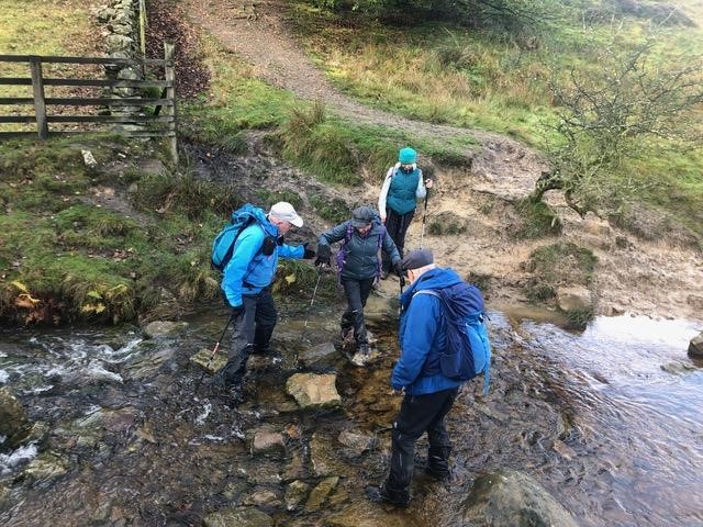
Under light clouds, we ascended southwards onto Two Howes Rigg, passing Simon Howe Cross (at 260metres), following Simon Howe Rigg down to Blawarth Beck. This open country overlooked distant moorland and forested horizons and to RAF Fylingdales.  We climbed over forested Wardle Rigg and followed a pleasant path down through a wood, in a heavy shower, to the North York Moors Railway station at Newtondale Halt. After a rather slippery walk beside Pickering Beck below the raised rail track, we turned south to ascend steep wooden steps in bracken in a very picturesque water-cut clough between gritstone cliffs to reach Hudson’s Cross (in name only) and Yewtree Scar.  We could hear, but not see, steam trains occasionally, hooting in the narrow valley cut in the moor below and beyond the wooded escarpment we had climbed.

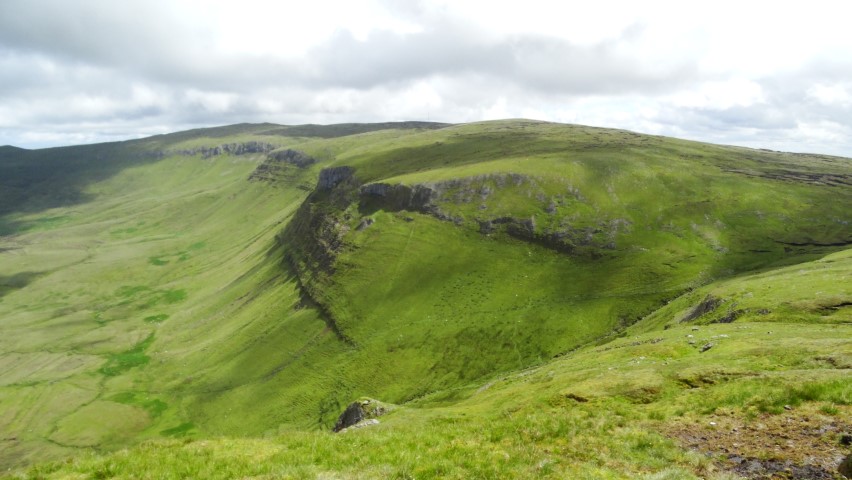
We crossed the scar and climbed in bracken to Gallows Dyke and emerged to a spectacular view at the head of Hole of Horcum at 270 metres. Here, a half-kilometre wide gouge in the high moorland is created by softer ground eroding and undermining the tougher moorland surface crust for two kilometres southwards. The widened valley then reverts downstream to a narrow V-shaped cleft typical in this moorland.

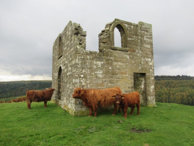
After picnic lunch in a light but cold northerly breeze we headed west across Levisham Moor to Dundale Rigg and turned northwest, to seek the ruinous stone shell of Skelton Tower on Levisham Bottoms – a moorland mid-height ‘shelf’.  We were welcomed there by a herd of Highland Aberdeen Angus cattle (wide sharp-pointed horns in evidence, borne by the meekest and mildest animals you could imagine).  We took photos of course with them framed in stone doorways and windows of the tower, and sipped hot drinks before heading south, down the steep valley side to seek out Levisham Station.  Descending to the track crossing point, we were rewarded by a spectacle of a noisy steam train, engine belching steam, as it accelerated from the station to climb the valley towards Goathland.

At Levisham Station and level crossing, several of our group ate ice-creams or cakes at the station shop. Our final two kilometres took us up a long, grassed incline path to fields and across to Levisham and the Horseshoe Inn. Most of the group relaxed with teas there whilst drivers were driven back to Goathland to collect cars. We were blessed with very little mud under foot for this walk, despite the recent days of heavy rains, and some showers during the day. Overall 12.6 Miles were covered with 1690 ft ascent.

Hutton-le-Hole – Rosedale Circular Walk (LONG WALK) – Sunday 20 October 2019 (by John Gilligan)

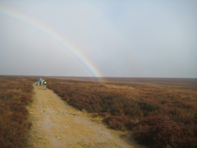
On day two of the Pickering weekend a group of 16 assembled at Hutton-le-Hole car park for a day’s walking across Spaunton Moor towards Rosedale. The weather was supposed to be mostly fine with some rain in the afternoon, though there was some light mist as we set off. The route took us along part of the North York Moors Inn way towards Lastingham along first a wooded trail and then skirting the edge of Spaunton Moor to near Lastingham. Heavy rain over the previous week made what had been just a hop over Hole Beck a tricky crossing over a swollen stream. It was to be the first of several such crossings. Climbing up from the beck we reached the main path from Lastingham and a crossing of tracks.

We then turned north following a well-defined stone and gravel track along Lastingham Ridge to Ana Cross. Looking ahead we could see a huge rainbow in the sky with the left end little more than a few hundred yards away. Further along the track we could see the right end of the rainbow again a few hundred yards away. By now the rain was starting to get heavier, necessitating full waterproofs when we stopped for our morning break at Ana Cross.

Resuming our walk we followed the track to the top of chimney bank, a steep 1 in 3 road up from Rosedale Abbey known by cyclists as the chain-breaker.

Rosedale Abbey (which doesn’t have an abbey) is a former industrial area where ironstone was quarried at the end of the 19th and early 20th Century. A mineral railway had been built to carry the stone towards Teesside and it was the former track bed that we continued along, past Thorgill Head before  turning west across the moor to the Blakey Road.

This now took us to the return half of the walk, starting with a descent into the Dove River valley. The descent involved navigating a notional path across the heather to find a navigable gully to take us down from the open access area. At the bottom of the gully, there was a sheltered flat area, protected by the hillside from the biting wind and with the rain stopping for a brief interlude as we stopped for lunch. The spot afforded us a lovely view down the valley before the mist closed in again.

After lunch we continued downhill through a farm to Rawson Syke where a bridleway along the river valley would take us back towards Hutton. There was probably more water under foot than falling as rain, though the rain continued.  The bridleway took us for 2-3 miles along a tree-lined route to Lowna Bridge, before we followed the road for a mile or so back to the car park and our drive back to Pickering.


Sinnington (SHORT WALK) Sunday 20th October (by Melanie Davy)

The short Sunday walk took us through the pretty village of Sinnington past the church and through a variety of deciduous woodland to the village of Cropton.  We sheltered under a stunning Horse Chestnut tree for our coffee stop and then set off south down Low Lane through the woods. We crossed the River Seven at Appleton Mill Farm.  After a stiff climb up the farm drive we arrived in Appleton-le-Moors.  This has to be one of the most welcoming villages in Yorkshire. The plan had been to use the benches outside the village hall for our lunch break, but the heavens opened as we arrived in the village.  We spotted a large sign outside Christ Church saying “Church Open” and ventured inside where we found a church beautifully decorated for the Harvest Festival and tables laid up with tea and coffee and a sign saying “Help Yourself”.  We had a welcome break inside the very pretty church.  As we left, we called into the Moors Inn to enquire if there were any public toilets in the village and they said we could use theirs for a contribution to the Air Ambulance fund! Happily the sun came out again as we walked across fields to Bishop Hagg Wood and then followed the river back to Sinnington.

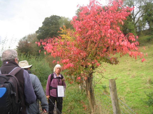
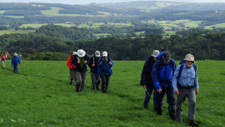
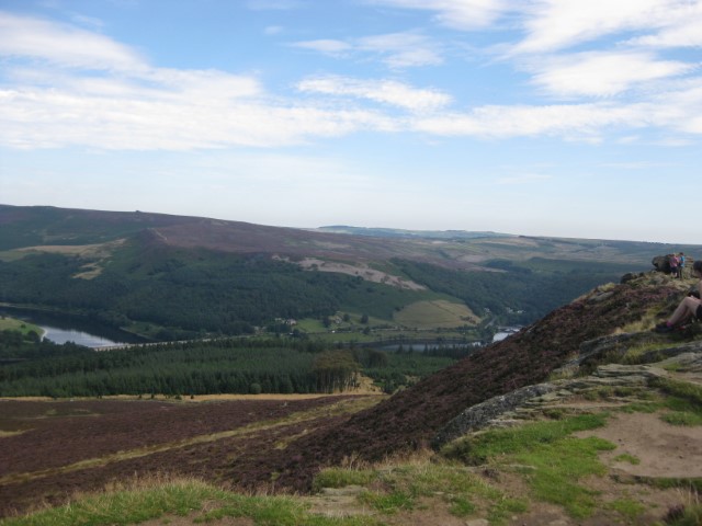
Autumn colours on the ‘Medium walk’.

The ‘Medium walkers’ enjoying morning coffee near the Hole of Horcum.
The North York Moors Railway as seen from near Skelton Tower on the ‘Long Walk’.
Highland cattle at the ruins of Skelton Tower ‘Long Walk’.
Crossing the moors on a wet day ‘Medium walk’.
One or many awkward stream crossings on the ‘Long walk’.
The ‘Medium walkers’ entering a rather wet Levisham village.
An afternoon rainbow on the moors ‘Medium walk’.
Medium walkers enjoying afternoon tea at the end of the walk in Pickering.
Medium walkers on footbridge at Farwath, north of Pickering.

If any of the photographs have the wrong caption or can be elaborated on please E-mail Colin Park and I will amend text.

A winter Munro

On the summit of Beinn Tulaichean with a view towards Cruach Ardrain.

On my many winter visits to Scotland over the years I have always stayed low and not really ventured onto the higher tops but sometimes the weather is so good that it is worth the extra effort to bag an easier Munro.
On this occasion Beinn Tulaichean (946 metres) which is located at the western end of the Braes of Balquidder seemed a feasible walk to undertake. Climbing a Munro in winter throws up another problem is that it gets dark early and for this walk I really left it a bit late to set out as this was an afternoon walk.
Time would play a major factor for this walk and furthermore, there was snow above 600 metres and I didn’t know what under foot conditions would be like. Beinn Tulaichean was the main objective but I was just hoping to bag the mightier Cruach Ardrain if time permitted.

A winter afternoon at Inverlochlarig close to the start of my walk.

I left the car in the empty car park near to Inverlocharig. The notice board said that walkers were welcomed here which was pleasing. A half mile walk in fine afternoon sunshine led me to the few farm buildings at Inverlochlarig where I crossed gates and rounded muddy fields to gain the open moorland. A good track led up Inverlochlarig Glen but I soon left this and started to climb to the left up across rough ground. The going wasn’t exactly easy as the grass was long and there were, several crags to avoid. Slowly I gained height and the views began to open out. Now and again I picked up a sheep track only to lose it again. Time was indeed pressing and I didn’t want to find myself out at night time. At around 600 metres I encountered the first snow which didn’t present any problems but as I climbed it was getting deeper. The views were, excellent with the snow clad summits around me with low sunlight and dark clouds. As I reached the southern end of the ridge the snow was much deeper with drifts.

Nearing the summit of Beinn Tulaichean.

Ahead I could see the summit and I followed some footprints ahead. It was colder up here but the views were unbelievable and I took several photographs. I finally reached the 946 metre summit and paused awhile. After taking more photographs I decided that with time pressing on and Cruach Ardrain being up in the clouds I would leave that peak for another day.

Sunlight on Stob Binnein from the summit of Beinn Tulaichean.

The view towards Ben Vorlich from the summit of Beinn Tulaichean.

Footprints in the snow on Beinn Tulaichean.

The decision now I had to make was to return the same way or to press on to the col to the north of me then down the eastern flank of the mountain. I chose the latter. The snow was partially frozen at the surface and crampons might have been useful. For one thing, my walking pole was coming in handy as I descended the easy slope to the col. I was concerned about the rocky eastern side of the mountain as I didn’t want to slide over one of the many crags. As I descended the steepening slope I used my walking pole to steady me and it came in very useful. The snow was softer here and I was able to make steady progress and chose an easy way down. The snow seemed to go a long way down the eastern slope but soon I was on barren hill side making my way down over tussocky grass to a lonely empty valley. From the col to the track took just a half hour. The valley was in deep shadow as the sunshine lit up the hill side high above on my left. It was a good track back towards Inverlochlarig and I was pleased with myself that I had bagged another Munro. As I neared Inverlochlarig I was back in sunshine briefly as it shone down the valley from the west. At Inverlochlarig I returned along the drive back to the car to complete a very satisfying walk.

Heading back along the lonely Inverlochlarig Glen at the end of the day.

Group walk report 9th October from Darley Dale

The group on Oaker Hill towards the end of the walk.

For once it was a fine day but showers were forecast although as it turned out we appeared to be in a favoured location and missed all but one shower. From the car park at Darley Dale fourteen of us set out at 10am towards Churchtown in the bright sunshine. After walking across some squelchy fields we were soon at St Helen’s Church. Here I pointed out some features of interest. The churchyard is dominated by the Darley Yew, a 2000 year old yew tree with a massive girth. The church porch contains some fine Saxon coffin lids and further out in the churchyard we diverted to visit the grave of Sir Joshua Whitworth, inventor of the Whitworth Screw and rifle. The Whitworth thread was the world’s first national screw thread standard, devised and specified by Joseph Whitworth in 1841. Until then, the only standardization was what little had been done by individual people and companies, with some companies’ in-house standards spreading a bit within their industries.
Our walk continued beside the preserved Peak Railway which now runs between Matlock and Rowsley Stations. This railway line was once the mainline between London and Manchester. A field walk next led across the busy A6 and up to Two Dales. The village was once known as Toad Hole but a squeamish rector of Darley in the late 19th century insisted that the name should be changed to Two Dales.
The village is dominated by the former flax mill buildings. In the late 18th century, Daniel Dakeyne harnessed the stream that runs through Sydnope Dale to power his new flax mill. Daniel’s sons, Edward and James Dakeyne, designed a machine called the ‘Equilinium’ to prepare the flax for spinning and they went on to develop a hydraulic disc engine designed to make better use of the high-pressure water available at the mill. Given its tendency to groan and roar, the device was christened the ‘Romping Lion’ by local people. The large former flax factory, known as Ladygrove Mill, now provides accommodation for various businesses.
The deep wooded valley of Sydnope Dale was next followed with a morning break part way up. We later doubled back on a higher path before ascending to reach a road and soon entering the wooded summit of Matlock Moor. The walk over the top was easy to follow and on the descent we stopped within the woodlands for lunch.
Soon after lunch we emerged onto a track which we followed to the A632 and we continued along this road towards Matlock before branching off along Wellington Street to view the Old Tram Depot which is now a garage. The tramway was built to the Hydro Spa Hotels, bringing customers from the railway station near the River Derwent. One of the tramway’s directors, Job Smith got the idea for a steep-gradient tram for Matlock while in San Francisco in 1862. The original plan for the tramway was to run between Matlock Railway station and the Hydro Spa Hotels of Smedley’s and Rockside. The risk of flooding forced the terminus to be set up on Crown Square. Tram services started on 28 March 1893. It was the steepest tramway in the world on public roads, featuring a 1 in 5½ gradient. The tramcars had no independent power but were pulled by a cable situated below and between the tracks. The depot was situated on Rutland Street and contained a boiler and a stationary steam engine which pulled the cable and lifted the trams 300 feet up Bank Road. Fares used to be ‘Tuppence up, Penny Down’. Bank Road was not wide enough for two tracks, so a single track was used, with a passing place where the trams met. The up and down cables had to run in the same tube between the rails. The trams averaged 5½ mph, and had the advantage of the down-tram balancing the up-tram, and saving power in the Depot steam engine. A spare tram was kept in the Depot. In the 1920’s the tramway started to lose money and by 1927 the council decided to replace the tramway with motor bus operation, and tramway services ended on 30 September 1927. The Council agreed in February 1928 to put the tramway up for sale.
Rather than follow the road down through Matlock, we took a series of enclosed cobbled paths and later emerged in Hall Leys Park. At the northern end is located the restored tram shelter which has been relocated from Crown Square.
A brief but sharp shower came and went and we were soon ascending the Limestone Way on a steady slope across fields and later this was followed by a long descent to the village of Snitterton. I was keen to fine Magpie Cottage which was the place where William Wordsworth stayed and wrote his sonnet to Will Shore’s Tree. Ironically as we reached the road, the cottage was on our right. The road was followed through the village before taking another field path. We were soon ascending again and this time Oaker hill was our objective. Near the summit we stopped for an afternoon break before walking along the summit ridge which is dominated by the large sycamore tree. This lone tree tells the tale of two local brothers, Will and Tom Shore, who each planted a Sycamore tree atop the hill. The brothers quarrelled and went their separate ways; Will who stayed, flourished and prospered, whilst Tom who left, fell into penury and perished, and appropriately his tree withered and died. Hence for almost two hundred years, there has been a single Sycamore tree standing proud and alone on the summit of Oaker Hill. After visiting the trig point which included a group photograph we descended steeply down the grassy slope before following the village road through Darley dale back to the cars.

A shorter version of this walk will appear in the Macclesfield Express.

The following photographs were taken on the reconnoitre. (December 2018)

The waterfall above Potter Dam in Sydnope Dale.
The view towards Darley Dale from Farley Lane above Tax Farm.
One of the many forest rides on Farley Moor above Matlock.
One of the paths we walked crossing Matlock Moor.
On the summit of Oaker Hill. This photograph was taken just after sunsrise on a perfect winter’s morning with hardly a breath of air.

Conwy Coach Walk 28th September report

The strenuous walking group at Aber Falls.

Thirty eight, East Cheshire Ramblers recently went on a coach trip to Snowdonia where three walks were offered. The short and medium walks started in the picturesque and historic town of Conwy and ventured up onto Conwy Mountain to reach the Sychnant Pass to the west of the town. The groups were rewarded with fine views out over the Great Orme’s Head and beyond. Meanwhile a more strenuous walk of 12.5 miles was undertaken and started further west from the village of Abergwyngregyn and led by Rob Stevenson. In his capable hands we were on a steep ascent within minutes powering up on the C’aer Mynydd grassy path towards our key land mark; the Aber Falls (Rhaeadr-fawr) which proudly gush at the foothill of the Carneddau range. With much recent heavy rain the falls were an awesome sight.
Views of the whole area gradually opened up to us the higher we climbed. Across Conwy Bay we could see Puffin Island which still has the remains of a 12th Century Monastery, hence the island was formerly known as Priestholm Hermitage established around the 6th Century. The Island is now privately owned by the Baron Hill estate. The island of Anglesey and the Menai Strait was also visible even as a rain soaked mist blew over.
We had our morning break at the Aber Falls which plunges thunderously down 120 feet or so over a ledge of rock into the Afon Rhaeadr-fawr. We descended near the stream on the North Wales Path towards the Bont-Newydd Car Park passing many ancient ‘incisor’ standing stones including the remains of the Iron Age Coed Aber Roundhouse, a reminder of  the wealth enjoying the magical splendour of nature in shading times gone by.
Our second ascent brought us to our lunch stop high above the trees in peace and tranquility. Descending then ascending once more amid the heather and gorse we could see below us the town of Penmaenmawr. Our drop down into the town was past hedge rows heavy with sweet blackberries and too tempting not to try a few. Dry and thoroughly walked, we reached this well kept town where our challenging walk ended.

One of the many way-markers along the route.

Continue reading

Taking on The Gobbins

The entry to The Gobbins cliff path means squeezing through Wise’s Hole to start the adventure.

The website describes this walk as ‘The most dramatic walk in Europe’ and so here I was on a miserable July morning ready to take on the challenge. You can’t drive to the place and you are directed to the Visitor Centre some two miles away before kitting up with waterproof gear, sturdy boots and a hard hat. So on this miserable morning we started off with a safety briefing then taken by minibus to a cliff top road where the adventure began.
So where am I? Well this is one of Northern Ireland’s newest tourist attractions and is located on the Antrim coast some fifteen miles north of Belfast. The Gobbins is a path which literately clings to the cliff face along a scenic section of the Antrim coast and was created by the Irish railway engineer Berkeley Deane Wise and built as a tourist attraction and first opened to the public in 1902. Plans were quite ambitious with the original aim was to make it 3.25miles long but dogged with rock falls meant that the length of the walk had to be shortened and his bigger plan never came to fruition. In the early part of the 20th century it was a popular tourist attraction with many visitors from England and Scotland coming across to Larne on the steamer for the day but the railway company who operated the venture eventually ran into financial difficulties by the 1930’s and was eventually closed just prior to World War II. It reopened briefly after the war but again closed in 1954, that is until 2015 when funding from the local council and the EU carried out extensive work to reopen the path as a new tourist attraction with a difference. A series of walkways and bridges were built just above the high water line to provide the visitor with a safe route to explore this dramatic coastline.
Our group consisting of around fifteen of us plus a guide descended from the road via a steep driveway to the coast but today it is raining and not even Scotland could be seen. It might have been June but a bitter north easterly was blowing and it felt more like January. The Gobbins was entered via a hole cut in the rock face called Wise’s Eye. This was where fares were once collected. Over the next mile and a quarter we edged our way along the cliff face on a series of rock cut steps, bridges and walkways with the guide giving a potted history of the surroundings including flora and fauna and the interesting geology of the area which included places where we could see the rare Gobbinsite mineral which occurs only in a few places in the world. At one point the path disappeared into a sea cave and descended then ascended via a series of steps which took us down below sea level. In places the route of the old path could be seen and all of the original bridges had either been removed or had been washed away. The walk went a little further than a suspension bridge which spanned a watery chasm but today this is where our walk ended as there had been a recent rock fall a few days earlier and the last little part of the path was closed. It was now time to retrace our steps and squeeze past a couple of other parties on later tours.
Full details of the walk can be found on;- www.thegobbinscliffpath.com

The adventure begins along The Gobbins cliff path.

A typical section of the path.
Part of the original path from 1902.
Clinging to the cliff face on The gobbins cliff path.
Entering the sea cave.
A canopy along this section of the path to protect from rock falls.
The rare Gobbinsite mineral which only occurs a few places in the world.

Group long walk report 31st August

There was a healthy attendance for a recent walk from Monyash despite the weather forecast indicating a wet day.
Led by Graham Bothwell we set off at 10am southeast along the Limestone Way with the last of the sunshine soon disappearing by the time we reached Fern Dale. By now the weather was taking on a threatening look to the west as we continued via One Ash Grange Farm then crossing the wooded and deep Cales Dale. Ascending towards Calling Low, the rain started and so it was a stop to don waterproof gear but the rain didn’t really materialise. North of Calling Low we stopped for our morning break in the shelter of a tree belt.
Following more field paths and quiet lanes we descended to cross the River Lathkill at Coalpit Bridge where we intended to stop for lunch. By now the rain had set in and we retreated to the shelter of nearby woodland.
The first objective of the afternoon was to reach the village of Over Haddon by which time the skies were clearing to the west and at the village with the sun now returning it was time to get out of those waterproofs.
A sunny afternoon followed but the wind had freshened as we crossed fields passing to the north of Bole Hill to reach the Magpie Mine where we stopped for a short break. The final part of the walk was again across fields to reach Monyash where the group rounded off the day with tea and cakes in the Old Smithy Tearooms.

Graham leads the group at Fern Dale with the threat of wet weather just looming.

The cows are sitting down so it must mean rain is not far away.
The sunshine returns as the group heads out of Over Haddon.
Graham leading the group towards Bole Hill.

Group walk report 26th August 2019

Wainhouse Tower which claims to be the ‘Worlds tallest Folly’.

It was a fine summer’s day for this walk starting out from Ripponden and led by Steve Hull. A small group of East Cheshire Ramblers set out by crossing the River Ryburn and making a steady ascent up onto Norland Moor which afforded some fine views over the surrounding countryside including to the objective of today’s walk, a visit to Wainhouse Tower.
The northern slopes of Norland Moor are one of best locations of a feature almost unique to Lancashire and upland Yorkshire. Lines of upright stones along some field boundaries are known in these parts as vaccary walls. In the thirteenth century numbers of vaccaries were carved out of the old private hunting chases of the nobility, who created them in an attempt to get some revenue back from their holdings. Vaccaries were small-scale commercial cattle farms – in places, as around Pendle (more famous for its witches) you can still see the big stone-slab walls that kept the cattle enclosed. The word comes from the medieval Latin vaccaria, derived from vacca, a cow. Vaccinate is closely linked, since that derives from the Latin vaccinus, of or from a cow, as cow-pox serum was used to protect people against smallpox.
Our walk continued via lanes and paths descending then ascending over the Calder Valley and the Calder & Hebble Navigation. After a stiff ascent we reached the Wainhouse Tower which today was open to the public. This building has the claim of being the world’s tallest folly at 275 feet tall and was built between 1871 and 1875. There are 369 steps to the lower of two viewing platforms. One driving force behind the erection of the viewing platforms was a long-standing feud between landowning neighbours John Edward Wainhouse (1817–1883) and Sir Henry Edwards (1812–1886). Edwards had boasted that he had the most private estate in Halifax, into which no one could see. As the estate was on land adjacent to the chimney’s site, following the opening of the viewing platforms, Edwards could never claim privacy again.
After stopping for lunch nearby, the return walk was along the canal towpath through Sowerby Bridge before following the former railway track bed of the Ripponden Branch Line which is now a footpath along the wooded valley of the River Ryburn to reach Ripponden.

A medieval Vaccary wall on Norland Moor.

A view from the top of Wainhouse Tower towards Sowerby Bridge.

At the top of Wainhouse tower with a view across Norland Moor.

A view below, from the top of Wainhouse Tower.

Ireland’s Table Mountain

View towards Ben Bulbin from near Rathhugh (taken in 2016)

The eastern third of County Sligo is occupied by The Dartry Mountain’s of which the most famous mountain is probably Ben Bulbin. It’s not the height by any means, it purely its shape which is a landmark for many miles around. I have passed it many times on my travels but have never got around to climbing it, that is until this summer. One reason for this is that walkers aren’t necessarily welcomed to this area and so this walk may throw up a few issues.

From my base in Strandhill it is only a short drive to Ben Bulbin, and quite wisely I park up at the official car park at Gortarowey which lies at the end of a cul-de-sac where some signed forest trails lead off. It is a fine morning as I set off for this walk to climb Ben Bulbin but there is no direct access from this area as the mountain is lined with cliffs.

I start out by walking away from the mountain down the cul de sac lane which I have just driven up before turning left via a long straight road with views northwest towards Sligo Bay. Eventually at a T-junction I turn left to be met by signs stating to park here would be an offence and walkers are not welcome. Ironically, this is a spot indicated in older guidebooks on where to park. A track soon leads uphill and notices make it quite clear that to proceed further will mean that you will be trespassing. With no one around I take a chance. The track is enclosed with good hedges and I will be soon out of sight, or will I? Ironically before I am out from view I can see a lone figure some distance behind me. Is this another walker or an irate farmer? I press on and I am soon well hidden and ascending the enclosed track to reach another gate crowned with an array of wire together with another trespass notice and making it impossible to proceed and further. It is fortunate that a couple of parallel rungs on the gate have been prized apart and removing my rucksack I am able to squeeze through. So far, so good!

Track leading up to Ben Bulbin at Cartronwilliamoge which gives me enough cover not to be seen from below.

The hillside is more open but thankfully I am quite camouflage with my beige jacket and beige trousers so I am expecting not to be noticed. Every time I stop I do so where I can’t be seen from the farms below. I zigzag my way up on the track which thankfully although open gives me fairly good cover. The other person that I had spotted earlier is indeed a walker but he making his way up the hillside further northwest of me. The terrain later became rougher and as the slope eases off I can for awhile be probably seen on the skyline. In many respects I am glad to be out of sight of the farms which lined the valley far below.

The plateau on Ben Bulbin leading out to ‘the prow’.

On ‘the prow’ which feels as if you are in an aeroplane.

The view east along the cliffs towards distant Benwiskin.

The view west along the cliffs across county sligo to the blue Atlantic beyond.

Ahead lies a flattish area of boggy moorland with a few spots fenced off with water filled swallet holes which look to be bottomless. I keep well away and make my way out to Barnarobin, the nose or prow of the mountain that faces west from Ben Bulbin. The other walker isn’t far away now but had reached the nose some ten minutes before me. The view is impressive here with a wide view out over an array of little green fields to the blue Atlantic beyond. A few showers are around but for now I mostly have the sunshine to enjoy. It feels almost as if you are in an aeroplane at this location. After taking a few photographs I opt to follow the cliff top north eastwards and passing the other walker on the way. He is German and we manage to have a brief conversation with his broken English, and he asks me to use his camera to take his photograph. We go our separate ways but the way along the cliff top isn’t that straightforward as I have to cross numerous rivulets which drain from the wet and boggy summit.

The trig point on Ben Bulbin 526 metres lies at a slight rise on the peaty moorland.

My route down on the eastern side of Ben Bulbin. The path can be seen running diagonally from top right to bottom left.

Veering away from the cliffs I go to visit the trig point which is located on a slight rise at 526 metres. The landscape is very peaty but from here on there is a path albeit a peaty one. With shower clouds becoming more apparent I head southeast over a secondary summit to reach a col. I have spotted a path which leaves the plateau and runs northeast parallel with a stream. Descending this is the easiest way which eventually takes me onto a bog track and later a minor lane. Showers come and go giving brief spells of heavy rain but with the stiff breeze the sun soon came out again and I quickly dry out.

My route back via Luke’s Bridge among banks of rhododendrons.

Easier walking along the top edge of the forestry plantation and a signed path.

I now descend via Luke’s Bridge and head west along this minor lane through the rough moorland with copious amounts of flowering rhododendrons either side. I now want to join the Ben Bulbin Loop Path (a signed trail) which will lead me back to the car park but getting to it is another matter. It might be only two hundred yards away but this means climbing two fences and crossing watery ditches and negotiating an area of tussocky grass pitted with holes. It takes awhile but I manage it without getting wet feet. Once on the Ben Bulbin Path I am now on a good surface for the last mile walk back to the car. This path runs along the top edge of a forestry plantation with good views up to the serrated cliffs of Ben Bulbin.

The view back up to Ben Bulbin towards the end of my walk.

Group walk report 24th August

On the ascent to Win Hill

By Sue Thersby

From the top of Winnat’s Pass there was cold air inversion en route to this walk with Mam Tor bathing in early morning sunshine whilst the valley below was engulfed in thick mist. The drive through Castleton felt eerie but as we arrived at Hope, the start point of our walk, the sun was out giving the prospect of a lovely summer’s day. The village of Hope is situated where the River Noe and Peakshole Water meet. It was mentioned in the Doomsday Book as having both a priest and a church and the present church, dedicated to St Peter dates from around the 13th century and is famous for its gargoyles, a Norman font and the stump of a Saxon Cross in the churchyard. There were only a small number of walkers setting out on this trek Our first objective was Win Hill, which was reached via Aston and Thornhill Carrs. Lose Hill lies about two miles to the west. In relatively recent times, the two hills’ names have prompted a fanciful tale concerning the outcome of an imagined battle. There is no historical basis for the tale whatsoever, and no evidence of any battle ever being fought here. We had our morning break at the trig point on Win Hill, enjoying spectacular views of Ladybower Reservoir. From here we went along the ridge to Hope Cross, which is 7 feet high with a square capstone bearing the names of Edale, Glossop, Hope and Sheffield on its faces. Then we descended a rocky path to reach the shores of the Ladybower Reservoir we had seen earlier. It is a large Y-shaped reservoir in the Upper Derwent Valley. It was built between 1935 and 1943, and was opened by King George VI on 24th September 1945. During construction, the villages of Derwent and Ashopton were flooded. The inhabitants of the two villages were relocated to Yorkshire Bridge estate, just downstream of the dam. After walking along the banks of the reservoir beyond the dam, we took a south-easterly path through woods and fields back to Hope, passing Ryecroft, Hallum Barn and Hope Station on the way. We indulged in refreshments in Hope before making our way home.

Heather on Win Hill summit

Morning break on Win Hill

View from Win Hill to Ladybower Reservoir

Roger leading off from Win Hill

Hope Cross

Lunch by Ladybower Reservoir

A cup of tea after the walk