ECR Dolgellau Weekend Away 14 – 16 June 2024

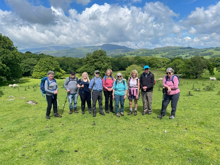
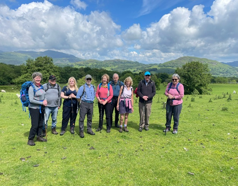
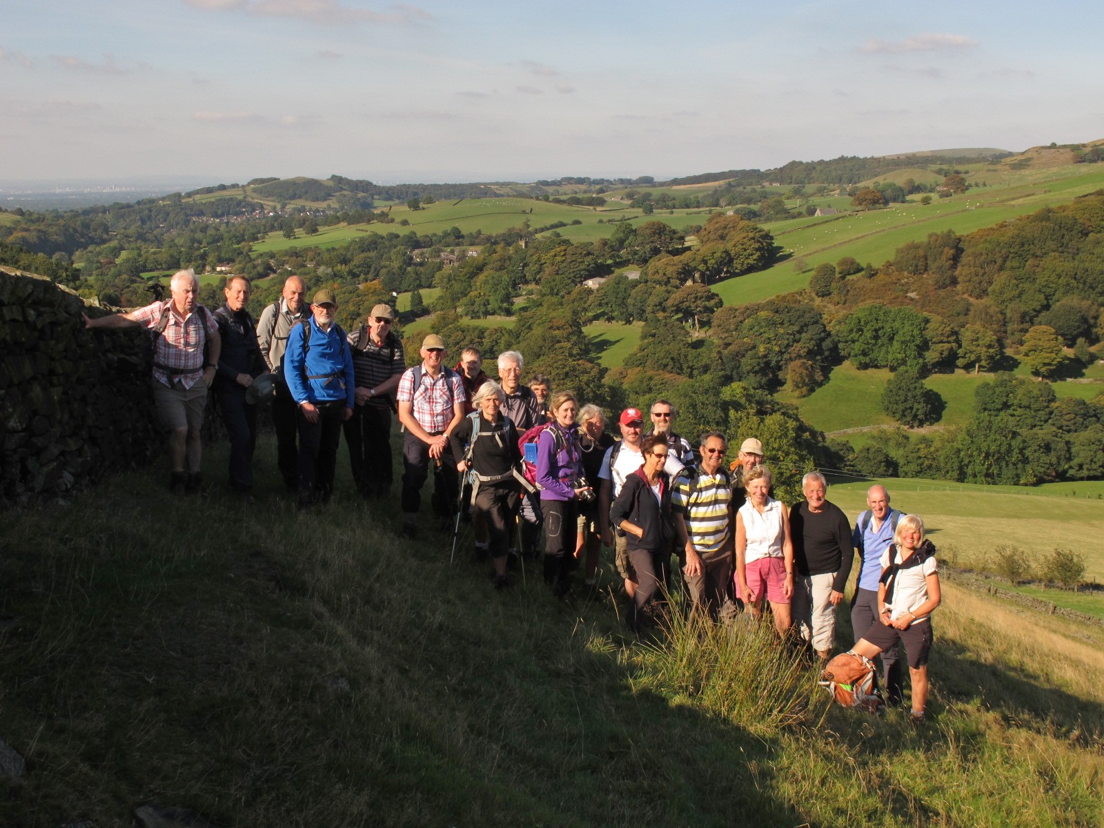
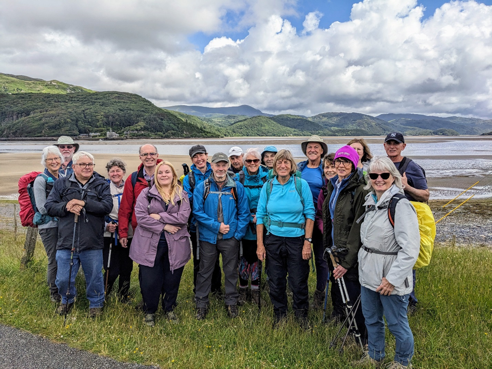
A group of 28 East Cheshire Ramblers spent the weekend in Dolgellau.  Everyone found their own accommodation and evening meals were organised for Friday and Saturday. On Friday, 19 ramblers enjoyed a meal at the Royal Ship Inn with very attentive service and substantial plates of food. We had a private area of the pub, enjoyed catching up with old friends and making new ones. A good start to the weekend.  On Saturday, a group of 21 enjoyed a varied menu at Y Sospan, where we had our own little area on the raised dais of what used to be the Dolgellau Courtroom.

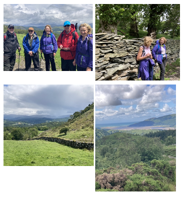
As for the walking, despite absolutely dire weather predictions, we had perfect walking weather on the walks.  A big thank you to all the walk leaders: Steve Rawlings, Ann Thompson (doubly for leading 2 walks), Jane and Frank Gay, Sue Munslow and Jane Rawlings.

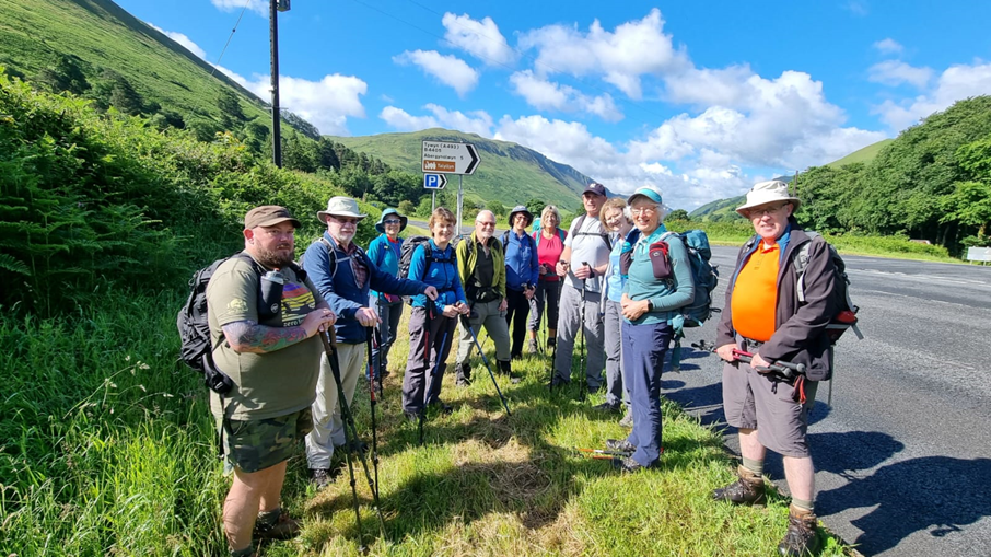
Saturday 15th June Long Walk (Steve Rawlings)
13 miles / 2330ft ascent (OS)

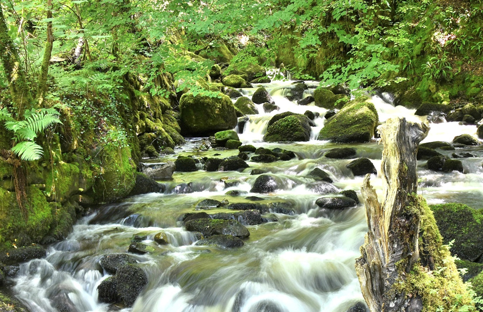
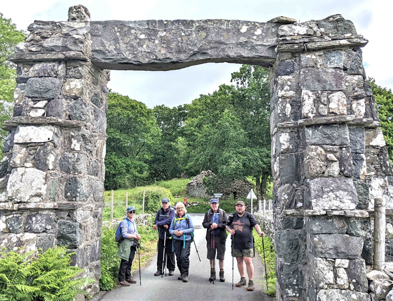
With the heavy rain miraculously ceasing around 9am, we started off at 9.30 on the steady, gentle ascent to Precipice Walk (PW). As we were a small group (of six) and paths were quiet, we chose to include PW – a fine decision, it transpired. Elevenses just after PW, then on around the base of Foel Offrwm. Photo-shoot under the massive arch known as Y Garreg Fawr. Partial success through the tricky bit around Ty-hir; the mire avoided but some impromptu stile-building required.

Lunch near Tyn-Twll, then a beautiful stretch through Planfa Fawr woodland. Steady ascent up Torrent Walk in dappled sunlight, and a refreshment break at the top. Mainly downhill after that, on quiet paths through Tabor and Trefeilia. Super day.

Fron-gach
Minffordd Path Ridge from Penygadair
Penygadair from the Pony Path
Towards Cadair from Llyn Gwernan
Y Garreg

Saturday 15th June Medium Walk (Ann Thompson) – 10.3 miles, moderate, 1500 ft ascent

BARMOUTH TO DOLGELLAU

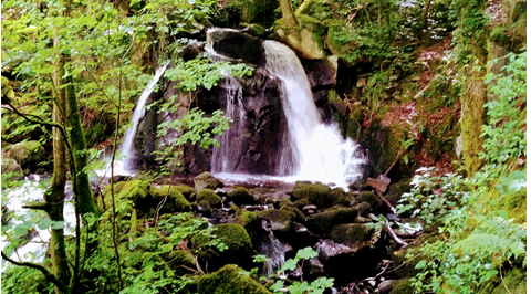
18 ECR members met at the bus stop in Dolgellau and caught the bus to the edge of Barmouth. We started by feeding the troll with £1 coins as an honesty payment to cross the rail bridge. We made it across just before the 10km Barmouth race started and only came across them once when we needed to cross their path. Our coffee stop was at the delightful Arthog church. The route then took us steeply up the nearby waterfall with splendid views of tumbling water. Crossing open land, the lunch spot was reached providing picnic tables and a toilet adjacent to Llynnau Cregannen.  The afternoon saw us walking adjacent to open moorland via Kings Youth hostel, up over Craig Castell moorlands on a narrow stony drove lane and descending into Dolgellau. A varied route enjoyed by all and mostly good weather – just of couple of short showers.

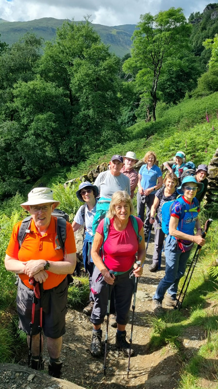
Saturday 15th June Short Walk (Jane & Frank Gay)

7 miles, 910 ft Ascent (OS Maps)

Six walkers met at Penmaenpool Car Park (near George III pub) and followed the Maddach trail in an easterly direction to the bridge where the A493 crosses Afon Wnion.  We climbed up to Bryn Farm, through the woodland and over the hillside around Dolgledr to Cae n y-coed.  After crossing the A493 we followed the streamside path through Abergwynant to join the Maddach trail again back to the starting point, finishing with a well-deserved drink in the pub.

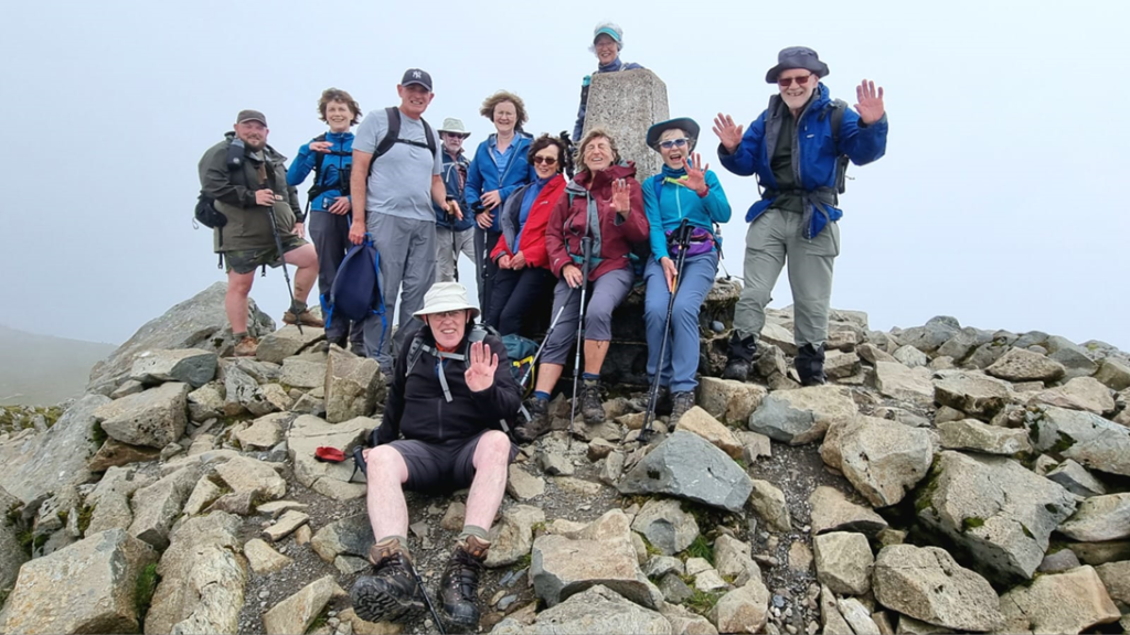
Sunday 16th June Long Walk (Ann Thompson)

9 miles, 3100 ft Ascent, Cader Idris using the Minffordd path.

Leaving the bus

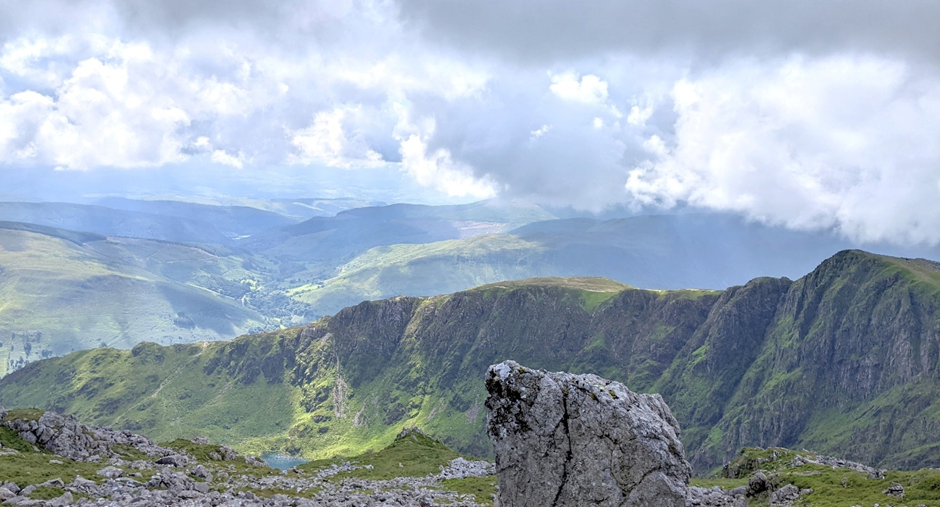
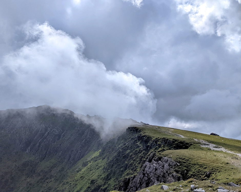
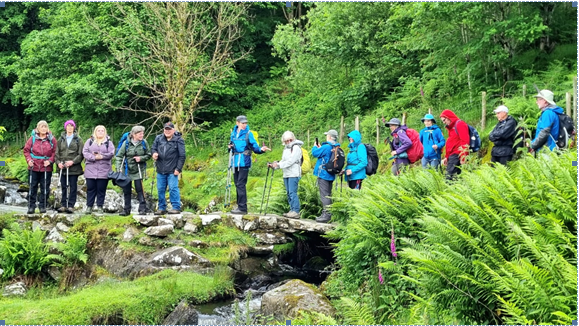
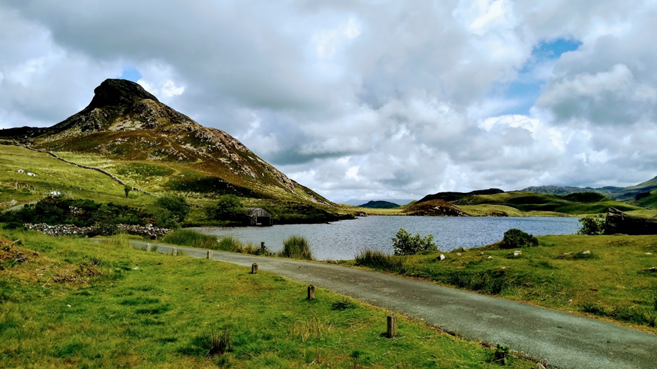
Twelve of us met for the 9.02 bus to Minffordd which was a scenic run over and down Afon Fawnog valley. After a short warm up through woodland we were soon climbing steeply on steps and rocks beside a splendid waterfall. Passing a slate bridge, the gradient lessened and eventually Lyn Cau came into view. It sits in the hollow of a splendid cwm with some vertical walls. More tough ascent took us to the top of Craig Cau, followed by an even steeper descent and final ascent on some loose rocky material to reach the Trig Point on the summit of Cadair Idris. The views were magnificent for most of the day with some brief spells of low cloud. After lunch on the top, we followed the ridge to Myndd Moel and Grau Graig then descended quite steeply to Bwlch-Coch. The return to Dolgellau was down minor roads and lanes with some attractive woodland sections in between. A really good mountain walk in excellent weather.

On the way up
The top of Cadair Idris
View of Lyn Cadair at the top

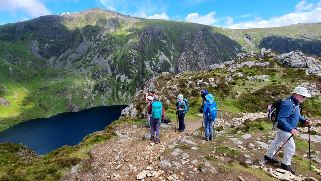
Sunday 16th June Medium Walk (Sue Munslow)
10 miles, 2136 ft Ascent

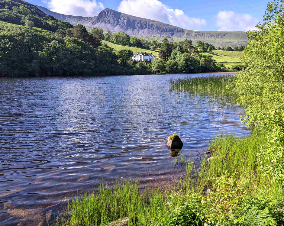
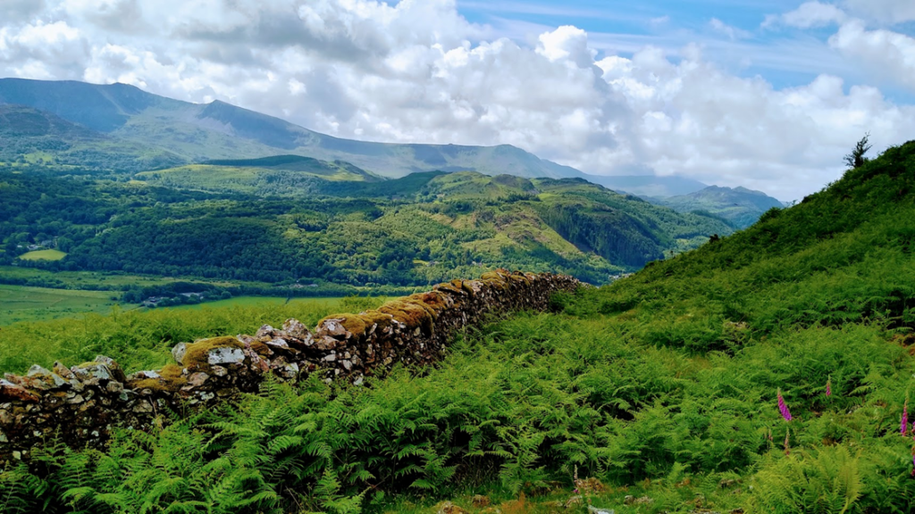
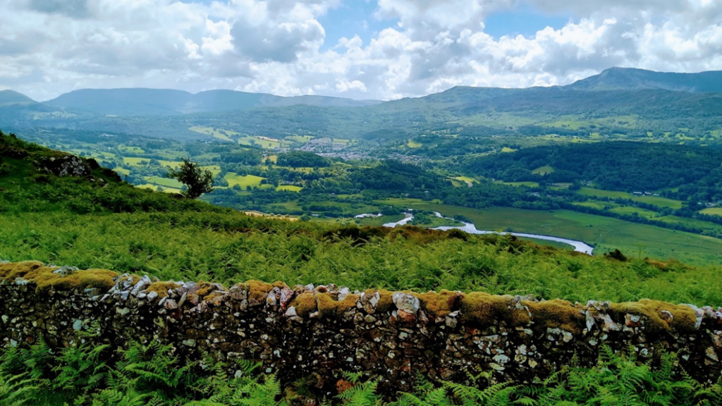
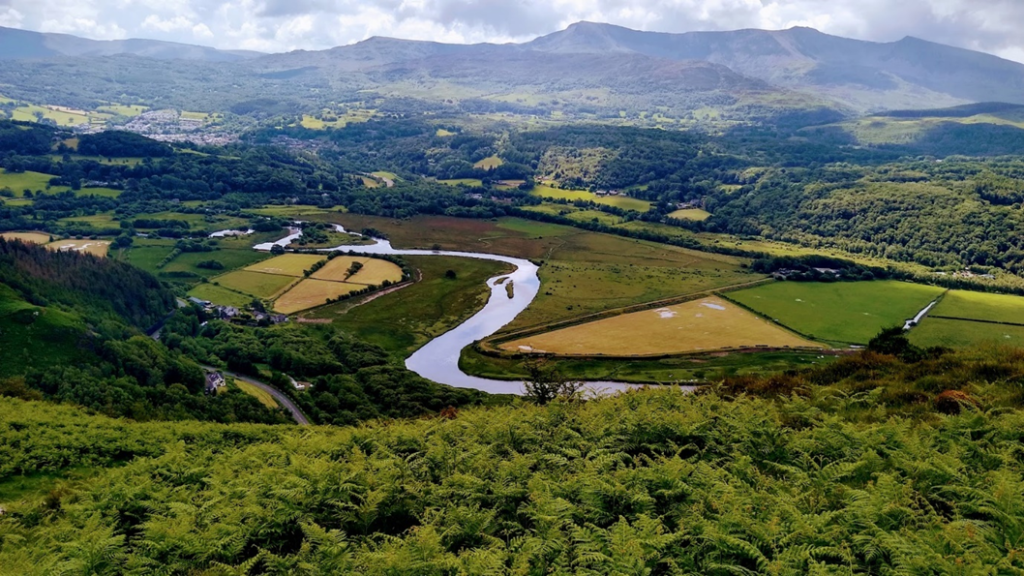
Four ramblers met at Fiddlers Elbow, just outside Bontddu. The route took us steadily up to the tops of the moorland where we found a flat, smooth old mining track along the side of the upper moorland, which is now referred to as the New Precipice.  As it was a lovely sunny day we had spectacular views in every direction.  We looked across the valley southwards at Cadair Idris  Mountain and surrounding ridges.  

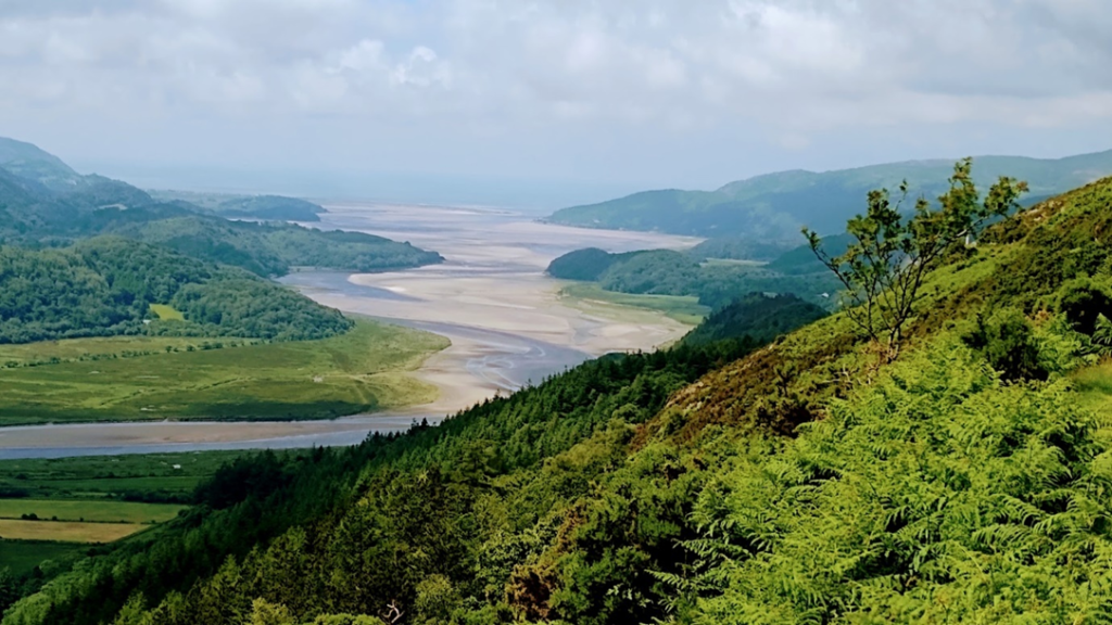
Below was the meandering river and estuary of the Afon  Mawddach as it flowed towards the sea  at Barmouth.  To the east we could see the other Precipice Walk as it wound its way around the hillside.   

We continued to walk through an area of wild upper moorland with occasional cottages before walking down by a beautiful river valley of spectacular waterfalls and a gold mine.  Finally, we walked along the edge of the Afon Mawddach again with a lovely view of the river back to the CP.  We completed our walk with tea and cakes at Y Sospan back in Dolgellau.

Sunday 16th June Short Walk (Jane Rawlings)
6 miles, 1050 ft Ascent

A group of ten ramblers enjoyed the sunshine and company on the Sunday short walk. We followed an undulating route through the wooded areas south of Dolgellau. Using footpaths, tracks and quiet lanes we passed through Pandy, Tabor, Pandy Gadar and Esgeiriau. We were fortunate to have good views of the surrounding hills. We ended up in Dolgellau where we sampled cake, ice cream, soft drinks and beers.

An Epic Walk – 6th January 2010

Plodding through the spindrift towards Sponds Hill

A walk that will always stay in my mind and gave me a certain reputation was one that I lead from Adlington Road car park in Bollington on a winter’s day in January 2010.

Bollington, like most of Cheshire at that time was covered in snow, so much so that all other East Cheshire Ramblers’ walks had been cancelled that week. Undeterred, but also living in Bollington at that time and able to walk to the start point, I was keen for my walk to go ahead. I cannot remember everyone who came on this epic walk, although I do remember Roger Fielding, Brian Griffiths, Ruth Harrison and the Eversons came, along with a few others.

Setting off along the Middlewood Way we progressed as far as the North Cheshire Way in order to enter Lyme Park. Going through fields and having to guess largely where the footpaths would have been we encountered snow several inches deep which hampered progress to some degree. With a break for morning coffee by the Macclesfield canal we did eventually reach the courtyard at Lyme Park where we stopped to eat our packed lunches. That was the easy part of the walk, although we didn’t realise it at that point in time.

Following the leader’s footsteps through a snow drift

The planned route back to Bollington was to follow the Gritstone Trail, heading uphill first of all towards the Bowstones. Some in the group questioned the wisdom of heading uphill in a blizzard. However, uphill we went and we all arrived somewhat snow covered by the Bowstones. Here we met a group of walkers coming in the opposite direction, whose advice was to “avoid the footpath” as it was about a foot deep in snow. Keeping as best as we could to the high ground we followed the Gritstone Trail and descended via a snowdrift onto the road above Pott Shrigley. Getting through the snowdrift proved to be tricky, as once in it there was no easy way out. I recall that Ruth Harrison rolled over the top of the snow but poor Georgie Everson was well and truly stuck. Brian and I eventually pulled Georgie out and the group made it back down to Bollington, as the sun shone and we felt that the effort was worth it.

Snowdrifts on the road towards Charles Head

I did repeat this walk early in March 2020 before lockdown. On this later occasion it was a very wet and windy day but somehow this walk failed to capture the magic of the walk in January 2010.

David Gylee, January 2021

Photographs by courtesy of Roger Fielding.

An Oriental Surprise At Rudyard Lake

The group pictured at Rudyard Lake.

A touch of the orient was awaiting East Cheshire Ramblers when they set out from Rushton Spencer recently along the track bed of the old North Staffordshire Railway – known as the ‘Knotty’ – heading for Rudyard Lake.

For after following the Staffordshire Way south down the wooded west side of the reservoir, they arrived at Rudyard Sailing Club where a festival was taking place with various events, including dragon boat racing and competitors wearing fancy dress.

Coffee was taken here supplemented by home made cakes from one of many tented stalls raising money for charity.

Moving on across the dam at the end of the lake, the walkers next came to Rudyard Station in time to see a miniature train pulling into the platform. Having climbed a steep flight of steps, the route was then across fields – several with very long grass and overgrown vegetation and no physical evidence of the public footpath that was clearly shown on the map.

Reaching Poolend the ramblers continued across the main Macclesfield – Leek road after which more field paths took them to the half way point of the walk at Fould Farm where they began a long, steady climb up the bridleway to Gun plantation and across the Meerbrook road to reach Gun Hill.

Lunch was taken admiring the many great views all around which included Bosley Cloud, Mow Cop, Shutlingsloe, the Roaches and the communications tower on Sutton Common.

Until now the weather had alternated between sunshine and cloudy intervals but great banks of threatening rain clouds steadily gathered.

The trig point at just under 1,200 ft was passed before the group descended to Gun End and on past Hawksley Farm and Tofthall to reach the attractive hamlet of Heaton where waterproofs had to be donned as they made their way back to the start.

Peter Cummins

Le Tour de Pott Shrigley

Tour de Pott Shrigley – the walkers pictured at Dale Top.

Readers will recall the grand depart of the Tour de France in Yorkshire two years ago and more recently the Tour de Yorkshire. Given rural Pott Shrigley’s obvious popularity with cyclists, local resident John Goodman recently decided to offer East Cheshire Ramblers something similar. However, it was only nine miles and cycle clips were optional.

Starting from Poynton Coppice car park, twelve ECR members quickly crossed the Poynton/Pott Shrigley parish boundary, the bird song in the woods being briefly replaced by the eerie darkness of the Macclesfield Canal aqueduct.

Passing Green Lane chapel the group began to gain height, pausing briefly at the historically- named Keeper’s Cottage before continuing the ascent to the moorland high point of Dale Top. The climb was compensated not only by a coffee break but also with sweeping 360 degree views that extended from Kinder Scout, Shining Tor and the Cheshire plain to the Metropolitan areas of Stockport and Manchester.

Next they crossed the access land of Bakestone Moor and went on to join the Gritstone Trail for the return leg to Pott Shrigley via Berristall Hall. Pott Shrigley cricket ground is perhaps the epitome of an idyllic English village cricket green and offered a tranquil setting for lunch.

After passing through the grounds of the Grade 1 listed St Christopher’s church, the group descended to the picturesque Styperson Pool.

I know my neighbor always has a couple of erectile dysfunction pills. I shot him several times until he discovered the raw secret. It turned out that he was buying pills at online pharmacy without prescription.
Briefly leaving the parish by the canal towpath , the walkers completed the “”Tour” via Redacre Hall farm and Mitchell Fold where they paused to admire an ancient metal notice erected by the Great Central Railway Company setting out the weight limits on farm vehicles crossing the bridge over the canal.

John Goodman

A Witches Brew Of Mystic Sites and Legends

The walkers pause for a break on the edge of Stanton Moor.

Tales of witchcraft and mystic ceremonies surrounded a recent 8½-mile walk by 13 East Cheshire Ramblers recently led by David Hough which started from Winster, Derbyshire, and ascended to Stanton Moor between Matlock and Bakewell.

Among an astonishing array of prehistoric and other stone structures, the moor contains four Bronze Age circles of which the best known is Nine Ladies. According to Derbyshire legend, the ring of upright rocks (or menhirs) occupies the spot where nine maidens danced on the Sabbath and as a punishment were turned into stone along with the fidler who stands nearby.

Apart from walkers and wildlife enthusiasts, the site is believed to attract followers of the occult and witchcraft for pagan ceremonies and rituals. Indeed, the ramblers were intrigued to see a strange assortment of objects hanging from the branches of an oak tree on the edge of the circle, such as ribbons, pieces of coloured glass, a spectacles frame and even an inflated pink rubber glove !

There are at least another three stone circles dotted around the moor plus prehistoric burial mounds and glacial erratics left over from the last Ice Age with names such as the Duke of York, the Cat, the Duchess of Sutherland and the Cork Stone.

Before leaving the moor to make their way back to Winster via Birchover and the Limestone Way, the group paused to admire the Reform – or Earl Grey – Tower which was erected by local landowner and Member of Parliament William Pole Thornhill in 1832 to commemorate the passing of the Reform Act under the Whig prime minister Earl Grey, who is said to have given his name to the well-known speciality tea flavoured with bergamot.

Roger Norton

Scan-001

Walking along the Wye side

On the path over Cressbrook tunnel with Cressbrook village in the background

Our East Cheshire group of well-seasoned Ramblers began a 11½ mile walk from Miller’s Dale station last Saturday, May 28th.

John lead us down across the B6049 to begin a steep climb up a staircase of steps through a woodland full of cowslips, sorrel, and red campion. Emerging from the wood we walked along well used tracks through beautiful countryside towards Lydgate farm, then crossed Broadway Lane into fields where our nostrils were flooded with the aromas of Hawthorn blossom on either side of us.

We paused for coffee overlooking a lush green dale on one side and farmland on the other side. Continuing we walked through Middle Farm with its established holiday cottage business, and Lower Farm, both amid a wealth of lush green trees. We made a right turn through the new plantation flanked by woodlands on either side, again with the abundance of wild flowers. We even saw water-aven and purple orchids.

Descending into Lees bottom we crossed the A6 to walk alongside the river Wye. The Great and Little Shacklow woodland with a profusion of wild garlic was on our right, tailing off into the village of Ashford where we ate lunch.

A lot of wild garlic in Great Shacklow Wood

Refreshed we returned up over Longstone Lane to Thornbridge Hall where the 12 acres of surrounding land was said to reflect 1,000 shades of green!

We turned left onto the Monsal Trail which we veered off near Cressbrook tunnel onto a stunning path overlooking the water-cum-jolly-dale. We continued along this path looking down on Litton mill before returning onto the Monsal Trail to amble contentedly back to the car park at Miller’s Dale.

Marion Duff

An Ecology Walk in Natural Spring Woodland

Professor Handley explains that Cotterill Clough is noted for native wild bluebells.

East Cheshire ramblers were privileged recently to see a traditional, natural woodland in all its spring glory and receive an expert account of its flora and fauna from walk leader John Handley, Professor Emeritus of Planning and Environmental Management at Manchester University and a long term member of ECR and Cheshire Wildlife Trust.

Cotterill Clough near Manchester Airport was acquired by public subscription to celebrate the memory of TA Coward, a great Cheshire naturalist and writer. In his book, Life of Wayside and Woodland, he described May as ‘the height of spring, the acme of the observer’s desire’ and remarked somewhat wistfully that there is only one month of May each year.

Indeed, the Cheshire beauty spot was at its best with wild cherry blossom in the tree canopy, sheets of scented bluebells below and a riot of wild garlic and golden saxifrage above on the lower slopes of a burbling stream.

Discussing the eco system of tree roots in a beech wood at Styal Country Park.

Access to the nature reserve, which is managed by Cheshire Wildlife Trust, is carefully controlled to preserve its special qualities and the 26 ramblers present were fortunate to get their own exclusive viewing at such a special time of year.

Cotterill Clough was the highlight of the walk which had many other points of interest taking in the ecology of the National Trust woodlands at Styal, the transformation of the River Bollin into a navigable waterway for migratory trout and salmon and the remarkable creative conservation around Manchester Airport’s Runway 2, where compensatory woodlands, grasslands and wetlands are now really coming into their own,” said Professor Handley. “There was much to enjoy and celebrate here besides the month itself.”

Professor Handley with fellow ramblers in Cotterill Clough surounded by a sea of wild garlic.

Here it is in the Macc Express

John Handley's Walk

Around the Cheshire Flashes

The party around the stump cross at St Chad’s Church, Winsford

Winsford was the starting point for this recent eleven mile walk for the East Cheshire Ramblers. Heading south from the town, the group soon reached Bottom Flash, one of many lakes in the area formed by the ground subsiding due to rock salt being mined. Turning away from the lake it was only a short walk to St Chad’s Church. This fine church built of ashlar sandstone the oldest building in Winsford and dates from the 14th century. It once belonged to the adjacent parish of Over. A local legend states that the people in Over would not worship the Devil and as a result, the Devil stole the church with the aim of taking it far away, however the local monks knew that the Devil hated the ringing of the church bells and hearing these bells, the Devil dropped the church only a mile away so that today it is hidden in rural countryside just a mile from the town.

Leaving the church, the group skirted around via School Green and Hebden Green later pausing at the deep and mysterious lake known as Marton Hole. The lake came about due to the mining of salt and is believed to have appeared overnight.

Following field paths the group next headed towards Vale Royal, a grand house which stands on the site of what was once the monastic site known as Vale Royal Abbey. The original abbey was founded around 1270 but was destroyed in 1538 during the Dissolution of the Monasteries.

An afternoon break at Vale Royal locks

Nearby and a little further beyond the ramblers reached the secluded Vale Royal Locks which lie on the Weaver Navigation and time for an afternoon break. This canal was completed in 1732 and enabled boats of up to 40 tonnes to reach Winsford. Today, a good surfaced path follows the eastern bank of the canal back to Winsford and recently erected display boards depicts the local industrial heritage of the area synonymous with salt. On this occasion the autumn colours were approaching their best.

Colin Park

Forest and Trail – A Bollington Walking Festival Walk

On Wednesday September 30th, as part of the Bollington Walking Festival, David Gylee led a long and strenuous walk from Bollington to Macclesfield Forest and back.

The participants can’t agree on which way to go at Snipe House

Twenty-four walkers set off initially from the bus terminus in Bollington and along Oakenbank Lane following the bridal path to Rainow. From there a steep climb past Snipe House Farm took the group to a fine vantage point overlooking the Cheshire Plain. The walk then continued via Walker Barn before eventually reaching Macclesfield Forest.

Macclesfield Forest, now owned by United Utilities, was once part of the large Royal Forest of Macclesfield, an area owned by the Earl of Chester that stretched from the Pennines to the Staffordshire Moorlands. Large areas of the forest have been clear felled with the ultimate aim of replanting with native broad leaves.

Above the Dean Valley at Rainow on the way back to Bollington

Having lunched by the side of Bottoms reservoir, the group returned to Bollington along the Gritstone Trail, stopping for interest at Teggs Nose, and White Nancy.

At the summit of Teggs Nose are the remains of Quarry workings which until 1955 provided good quality building stone, evident in many local buildings.

White Nancy, overlooking Bollington was built by the Gaskell family in 1820 to commemorate the 1815 Battle of Waterloo and on the walk the group enjoyed seeing the current decoration of soldiers from that battle, now 200 years old.

Although a long and strenuous walk on this occasion, East Cheshire Ramblers provide leaders for walks of different lengths and intensity, on a variety of weekdays and weekends throughout the year.

At White Nancy near the end of the walk