Group walk report 26th August 2019

Wainhouse Tower which claims to be the ‘Worlds tallest Folly’.

It was a fine summer’s day for this walk starting out from Ripponden and led by Steve Hull. A small group of East Cheshire Ramblers set out by crossing the River Ryburn and making a steady ascent up onto Norland Moor which afforded some fine views over the surrounding countryside including to the objective of today’s walk, a visit to Wainhouse Tower.
The northern slopes of Norland Moor are one of best locations of a feature almost unique to Lancashire and upland Yorkshire. Lines of upright stones along some field boundaries are known in these parts as vaccary walls. In the thirteenth century numbers of vaccaries were carved out of the old private hunting chases of the nobility, who created them in an attempt to get some revenue back from their holdings. Vaccaries were small-scale commercial cattle farms – in places, as around Pendle (more famous for its witches) you can still see the big stone-slab walls that kept the cattle enclosed. The word comes from the medieval Latin vaccaria, derived from vacca, a cow. Vaccinate is closely linked, since that derives from the Latin vaccinus, of or from a cow, as cow-pox serum was used to protect people against smallpox.
Our walk continued via lanes and paths descending then ascending over the Calder Valley and the Calder & Hebble Navigation. After a stiff ascent we reached the Wainhouse Tower which today was open to the public. This building has the claim of being the world’s tallest folly at 275 feet tall and was built between 1871 and 1875. There are 369 steps to the lower of two viewing platforms. One driving force behind the erection of the viewing platforms was a long-standing feud between landowning neighbours John Edward Wainhouse (1817–1883) and Sir Henry Edwards (1812–1886). Edwards had boasted that he had the most private estate in Halifax, into which no one could see. As the estate was on land adjacent to the chimney’s site, following the opening of the viewing platforms, Edwards could never claim privacy again.
After stopping for lunch nearby, the return walk was along the canal towpath through Sowerby Bridge before following the former railway track bed of the Ripponden Branch Line which is now a footpath along the wooded valley of the River Ryburn to reach Ripponden.

A medieval Vaccary wall on Norland Moor.

A view from the top of Wainhouse Tower towards Sowerby Bridge.

At the top of Wainhouse tower with a view across Norland Moor.

A view below, from the top of Wainhouse Tower.

Ireland’s Table Mountain

View towards Ben Bulbin from near Rathhugh (taken in 2016)

The eastern third of County Sligo is occupied by The Dartry Mountain’s of which the most famous mountain is probably Ben Bulbin. It’s not the height by any means, it purely its shape which is a landmark for many miles around. I have passed it many times on my travels but have never got around to climbing it, that is until this summer. One reason for this is that walkers aren’t necessarily welcomed to this area and so this walk may throw up a few issues.

From my base in Strandhill it is only a short drive to Ben Bulbin, and quite wisely I park up at the official car park at Gortarowey which lies at the end of a cul-de-sac where some signed forest trails lead off. It is a fine morning as I set off for this walk to climb Ben Bulbin but there is no direct access from this area as the mountain is lined with cliffs.

I start out by walking away from the mountain down the cul de sac lane which I have just driven up before turning left via a long straight road with views northwest towards Sligo Bay. Eventually at a T-junction I turn left to be met by signs stating to park here would be an offence and walkers are not welcome. Ironically, this is a spot indicated in older guidebooks on where to park. A track soon leads uphill and notices make it quite clear that to proceed further will mean that you will be trespassing. With no one around I take a chance. The track is enclosed with good hedges and I will be soon out of sight, or will I? Ironically before I am out from view I can see a lone figure some distance behind me. Is this another walker or an irate farmer? I press on and I am soon well hidden and ascending the enclosed track to reach another gate crowned with an array of wire together with another trespass notice and making it impossible to proceed and further. It is fortunate that a couple of parallel rungs on the gate have been prized apart and removing my rucksack I am able to squeeze through. So far, so good!

Track leading up to Ben Bulbin at Cartronwilliamoge which gives me enough cover not to be seen from below.

The hillside is more open but thankfully I am quite camouflage with my beige jacket and beige trousers so I am expecting not to be noticed. Every time I stop I do so where I can’t be seen from the farms below. I zigzag my way up on the track which thankfully although open gives me fairly good cover. The other person that I had spotted earlier is indeed a walker but he making his way up the hillside further northwest of me. The terrain later became rougher and as the slope eases off I can for awhile be probably seen on the skyline. In many respects I am glad to be out of sight of the farms which lined the valley far below.

The plateau on Ben Bulbin leading out to ‘the prow’.

On ‘the prow’ which feels as if you are in an aeroplane.

The view east along the cliffs towards distant Benwiskin.

The view west along the cliffs across county sligo to the blue Atlantic beyond.

Ahead lies a flattish area of boggy moorland with a few spots fenced off with water filled swallet holes which look to be bottomless. I keep well away and make my way out to Barnarobin, the nose or prow of the mountain that faces west from Ben Bulbin. The other walker isn’t far away now but had reached the nose some ten minutes before me. The view is impressive here with a wide view out over an array of little green fields to the blue Atlantic beyond. A few showers are around but for now I mostly have the sunshine to enjoy. It feels almost as if you are in an aeroplane at this location. After taking a few photographs I opt to follow the cliff top north eastwards and passing the other walker on the way. He is German and we manage to have a brief conversation with his broken English, and he asks me to use his camera to take his photograph. We go our separate ways but the way along the cliff top isn’t that straightforward as I have to cross numerous rivulets which drain from the wet and boggy summit.

The trig point on Ben Bulbin 526 metres lies at a slight rise on the peaty moorland.

My route down on the eastern side of Ben Bulbin. The path can be seen running diagonally from top right to bottom left.

Veering away from the cliffs I go to visit the trig point which is located on a slight rise at 526 metres. The landscape is very peaty but from here on there is a path albeit a peaty one. With shower clouds becoming more apparent I head southeast over a secondary summit to reach a col. I have spotted a path which leaves the plateau and runs northeast parallel with a stream. Descending this is the easiest way which eventually takes me onto a bog track and later a minor lane. Showers come and go giving brief spells of heavy rain but with the stiff breeze the sun soon came out again and I quickly dry out.

My route back via Luke’s Bridge among banks of rhododendrons.

Easier walking along the top edge of the forestry plantation and a signed path.

I now descend via Luke’s Bridge and head west along this minor lane through the rough moorland with copious amounts of flowering rhododendrons either side. I now want to join the Ben Bulbin Loop Path (a signed trail) which will lead me back to the car park but getting to it is another matter. It might be only two hundred yards away but this means climbing two fences and crossing watery ditches and negotiating an area of tussocky grass pitted with holes. It takes awhile but I manage it without getting wet feet. Once on the Ben Bulbin Path I am now on a good surface for the last mile walk back to the car. This path runs along the top edge of a forestry plantation with good views up to the serrated cliffs of Ben Bulbin.

The view back up to Ben Bulbin towards the end of my walk.

Group walk report 24th August

On the ascent to Win Hill

By Sue Thersby

From the top of Winnat’s Pass there was cold air inversion en route to this walk with Mam Tor bathing in early morning sunshine whilst the valley below was engulfed in thick mist. The drive through Castleton felt eerie but as we arrived at Hope, the start point of our walk, the sun was out giving the prospect of a lovely summer’s day. The village of Hope is situated where the River Noe and Peakshole Water meet. It was mentioned in the Doomsday Book as having both a priest and a church and the present church, dedicated to St Peter dates from around the 13th century and is famous for its gargoyles, a Norman font and the stump of a Saxon Cross in the churchyard. There were only a small number of walkers setting out on this trek Our first objective was Win Hill, which was reached via Aston and Thornhill Carrs. Lose Hill lies about two miles to the west. In relatively recent times, the two hills’ names have prompted a fanciful tale concerning the outcome of an imagined battle. There is no historical basis for the tale whatsoever, and no evidence of any battle ever being fought here. We had our morning break at the trig point on Win Hill, enjoying spectacular views of Ladybower Reservoir. From here we went along the ridge to Hope Cross, which is 7 feet high with a square capstone bearing the names of Edale, Glossop, Hope and Sheffield on its faces. Then we descended a rocky path to reach the shores of the Ladybower Reservoir we had seen earlier. It is a large Y-shaped reservoir in the Upper Derwent Valley. It was built between 1935 and 1943, and was opened by King George VI on 24th September 1945. During construction, the villages of Derwent and Ashopton were flooded. The inhabitants of the two villages were relocated to Yorkshire Bridge estate, just downstream of the dam. After walking along the banks of the reservoir beyond the dam, we took a south-easterly path through woods and fields back to Hope, passing Ryecroft, Hallum Barn and Hope Station on the way. We indulged in refreshments in Hope before making our way home.

Heather on Win Hill summit

Morning break on Win Hill

View from Win Hill to Ladybower Reservoir

Roger leading off from Win Hill

Hope Cross

Lunch by Ladybower Reservoir

A cup of tea after the walk

Frequently Asked Questions

Frequently Asked Questions for New Walk Leaders

The following Questions and Answers supplements the information provided for Walk Leaders published by the Ramblers Association. Walk Leaders Check List

1. I would like to find out more about leading a walk. Who do I contact?
ECR has a named coordinator for all the following programmes: Short Midweek Walks, Medium Midweek Walks, Weekend Short Walks, Weekend Medium Walks, Weekend Long Walks, Midweek Long Walks, Stroller Walks and Evening Walks. Each coordinator welcomes contacts from walkers who are willing to organise a walk. If you contact the Chair she will put you in touch with the organiser.
2. Will anyone help me with my first walk?
ECR have a number of volunteers who would be happy to work with you on your first walk. Please contact the Chair, Jane Gay, and she will put you in touch.
3. Do I need to be able to read maps?
Being able to read a map is useful but not essential. There are lots of walks which provide pictures and descriptions of walks which are a really useful source for walk leaders. The Ramblers do provide Map Reading training if you wish to attend. This is advertised on the website and via email.
4. Where can I find a walk?
The Cheshire East Ramblers website under the Walks Planner Tab Walks Planner provides a number of ideas for walks. There are also a range of books and other websites which are also a useful source.
5. Where do I find grid references and post codes for the start of my walk?
You can find this information on the ECR website under the Start Point tab. You can also look them up on the internet.
6. Do I need to recce my walk?
Yes this is essential. It’s a good idea to ask a buddy to go with you. It gives you the opportunity to check parking availability, the accuracy of the walk description, spot any potential hazards, timings and distance.
7. Can I ask people to use public transport for my walk?
Yes. Walks can involve trains, buses and or trams. Include the information in your walk description and suggest that walkers bring money, bus passes, and railcards.
8. How do I advertise my walk and what information do I include?
You post details of your walk on the ECR website at LEAST TWO WEEKS before your walk. You click on the Notice Board Tab and click to post details of your walk. It is an easy programme to use. You need to include: the date, the length, the level of difficulty (easy, moderate, strenuous) the starting point including the post code and grid reference,

parking costs if any, toilets if any, a brief description of the route and any specific points about gradient, mud, etc. It’s helpful to look at others descriptions before you write yours.

9. How do I grade my walk?

Walk leaders are asked to provide sufficient detail about their walk when they post it on the Notice Board so that potential walkers are aware of the level difficulty of the walk. For example; height gain, conditions underfoot or any potentially challenging terrain.

Walks are graded as follows:

Length:

Short: approx. 5 – 7 miles

Medium: 7+ – 10 miles

Long: 10+

Degree of difficulty:

  • Easy – mostly flat walking on good paths
  • Moderate – this covers the majority of walks; there might well be a steep hill or two but it will generally be on good paths in undulating terrain
  • Strenuous – expect a fair bit of uphill walking, maybe even some mild scrambling. We might leave paths for open country but not invariably

Stroller Walks:

These walks are:

3 – 4 miles on even ground with very limited ascents or descents and very few stiles

10. Can people take dogs on the walk?
It is the decision of the walk leader. If you feel that it is safe for people to do so, no live stock on the walk, then indicate this in your information. If you feel it would be a risk then state this clearly when you post your walk on the notice board.
11. Do I need a backmarker?
Yes you do need someone to walk at the back of the walkers to make sure the group doesn’t get lost. It’s a good idea to share phone numbers if you can. When you’re walking you need to keep the backmarker in sight. You may need to stop until they come into view. It’s essential to make sure the backmarker knows when you turn off the path or cross roads. If you have a large group 30+ it’s a good idea to have a middle marker too.
12. Who do I ask to be a backmarker?
If the person who recced the walk with you is walking they are an ideal backmarker. If not then ask at the start of your walk. Someone will always volunteer.
13. What equipment should I take on my walk?
Take a first aid kit, whistle, water, phone, map, walk instructions, plastic bag, emergency services contact numbers, the contact number for the Ramblers Association +44 (0)20 3961 3300.
14. What happens at the beginning of the walk?
Walks usually start at 10am. It’s a good idea to get there early. Walkers generally gather well before the start time. Gather walkers together at 9.50ish and introduce yourself. Give a brief verbal description of where you’re going. Ask for someone to be a backmarker. Count the group before you set off!
15. Should I have emergency contact numbers for all the walkers?
Walkers are encouraged to complete an In Case of an Emergency (ICE) card and carry it with them on their walks. You can have a set of these cards to give out at the beginning
of your walks.
16. What do I do if someone turns up who hasn’t walked with ECR before?
It’s always helpful to ask at the beginning of the walk if there are any walkers new to ECR. Please ask them to introduce themselves to the group and give them a warm welcome. It’s worth checking in with them when you stop at any point. At the end of the walk ask them how they are and that you hope they manage to come on more walks.
17. What happens if no one turns up?
You can go home. Let the walk organiser for the walks know.
18. What happens if one or two people turn up?
You do the walk unless everyone else wants to go home.
19. Do walkers need to be members?
We don’t check membership cards. Members may bring a friend to try a walk or they can bring a visitor. The general rule of thumb is new walkers can try three walks before they join.
20. Do people take refreshments on a walk?
Leaders usually stop for coffee for 15 mins an hour after the start of the walk. Long and medium walkers take a packed lunch. Build in a stop at a suitable place for each when you recce your walk.
21. Do I have to organise lunch for walkers?
Medium and long walkers take a packed lunch. Traditionally, the midweek short walkers like to go for a pub lunch after their walk. If you can identify a pub as a starting point that’s ideal. Contact the pub to let them know you will be bringing a party in at lunchtime. Check either at the beginning of your walk or at coffee time who would like lunch and phone the pub with the numbers.
22. What happens if someone needs a comfort break?
If a walker needs a comfort break they need to let the backmarker or leader know when they step off the walk and return to the walk.
23. What happens if someone is ill on the walk?
If the person feels able to walk back to the beginning ask another member of the group to go with them and ask them to call you when they get back to the car. If someone is seriously ill contact the emergency services and report back to the walk co-ordinator.
24. What happens if I am ill on the walk?
You will have many experienced walkers on your walk who would be willing to lead the rest of the walk for you if they have your map and or written directions. It would be a good idea if someone walked back with you to the car or, in the event of a serious illness, calls the emergency services.
25. What happens if I have to cancel the walk on the day?
Log on to the ECR website – Notice Board Tab – click on the date and post cancelled.
26. What happens if I have to cancel the walk well ahead of the date?
Contact the walk organiser for the walk programme and they will try to find someone else to lead a walk.
27. What happens if I have to change the walk?
It may be necessary to change the details of an already posted walk, maybe due to snowfall making road travel risky or because the leader is ill. In this case a new
message should be posted on the notice board making it clear that it replaces the original posting for that walk. The programme coordinator will get an automatic email notification of the new posting and he will then liaise with the webmaster to alter the programme on the web site to indicate that the walk is either cancelled or changed and include the new details.

If midweek walk is involved the new details should also be emailed to appropriate walks coordinator, short, medium or long, so that they can circulate the message to their address lists.

28. What happens if someone has an accident on my walk?
Notify the ECR Secretary as soon as possible and complete an incident form within a maximum of 10 days. The form is sent to the ECR Secretary and they send the form to the Ramblers Association.
29. What do I do if someone leaves the walk?
Occasionally walkers may wish to leave the walk. They must let the walk leader know. If they walk on ahead of the leader they may also be deemed to have left the walk.
30. Who is insured on the walk?
For detailed information about insurance please visit the Ramblers Association website Insurance Toolkit
31. What do I do if I lose someone?
It is very rare to lose someone on a walk. The requirement to have a backmarker, and middle marker for a large group, should ensure that no one gets lost. If you do lose a member of your group you could ask for volunteers to walk back to the start to try to find the individual while you stay with the main party and continue with the walk. Ensure you have shared mobile numbers with the individuals who have agreed to walk back.
32. What do I do at the end of my walk?
Ensure everyone gets to the end and thank people for coming. Text/email the walk organiser the number of people who attended your walk.
33. Can I share my experience with anyone?

ECR encourages walk leaders to do a ‘write up’ for the local press and the website. Colin Park manages this process and his email is available from one of the committee members. The article needs to be 250-350 words with a photograph taken on the walk in a JPEG format. If you are unable to attach a photograph or if no photographs were taken Colin Park can add one from my library of pictures.

34. How do I access training and what is available?
Training events are provided by ECR and the Ramblers Association. The events are advertised on the website and circulated via email.
35. Can I take photographs of my fellow walkers?
It is polite to ask walkers before you photograph them whether they wish to be included in your photo. If you intend to use your photo for publicity, or on social media, you should let the walkers in your group know BEFORE you take the photo.
36. Safeguarding
The Ramblers Association has a Safeguarding Young People and Adults Policy which can be accessed here Safeguarding

Group visits to The Blackden Trust

The Old Medicine House at Goostrey

During a walk I led through the Goostrey area early in 2019 we ‘stumbled’ upon some signs pointing to ‘The Blackden Trust’. On closer inspection, the track led up to an attractive old half timbered building.
Some research afterwards found this to be a local ‘hidden gem’, a re-located Tudor House tucked away in the Cheshire countryside on land which had been inhabited for ten thousand years.
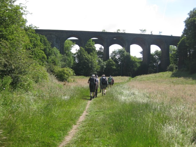
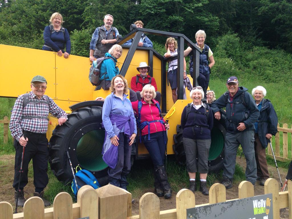
After some enquiries ,Brain Griffiths and I decided toorganise a visit to this house during the summer months, which as it turned out proved so popular that in the end we organised three trips which included a short morning walk locally followed by a visit and conducted tour on what is called The Old Medicine House and the surrounding gardens followed by afternoon refreshments. Thankfully, the weather was fine for all three visits.
The Old Medicine House belongs to The Blackden Trust, a registered charitable trust, founded by Alan and Griselda Garner and their friend, Patsy Roynon.
Our visit was to The Old Medicine House and its gardens. The building which was originally at Wrinehill, southeast of Crewe was due for demolition back in 1970 despite it being a Grade II building. The building was rescued by Alan Garner who bought the house for £1. It was dismantled and rebuilt adjacent to the historic half timbered Toad Hall, where the Garner family has lived since 1957.
The building is a three bay timber-frame structure and dates from around the early 16th century. Our tour started with a short slide show depicting the construction and history of the house before we were split into smaller groups where volunteer guides showed us around the rooms giving us a detailed insight into the history of each room including items which have been discovered in the re-building of the house and these included mason marks and marks made in the woodwork to protect the house.
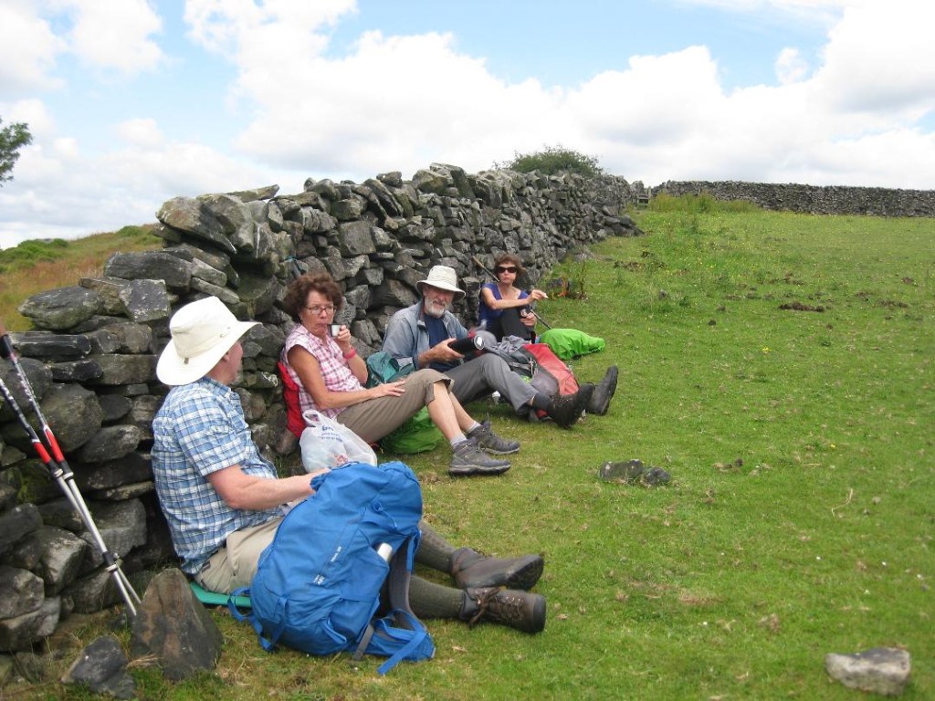
In one room there was a display of items found on the surrounding land which indicated that area has had human occupation for ten thousand years. After the tour, the group enjoyed afternoon tea and coffee with locally made cakes in the marquee in the garden to round off a very interesting day.
May I also thank Tony Littler who kindly organised the third tour and led the walk prior. In all we had sixty members of the group that visited The Blackden Trust during the three visits. If you missed out and would like to go on a tour then go to their website where there are occasional tours for the general public.
For details of this fascinating local ‘hidden gem’ go to www.theblackdentrust.org.uk

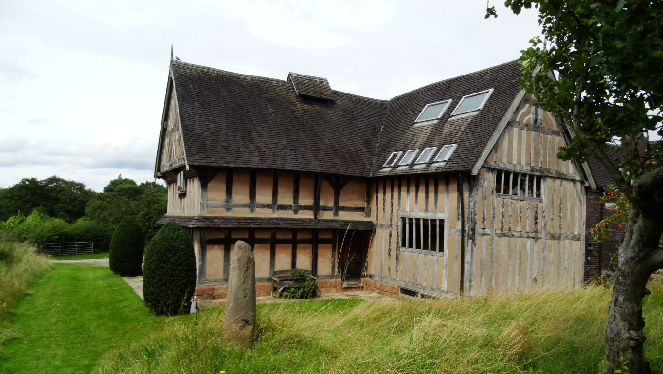
Rear of The Old Medicine House & rescued Saxon cross shaft.

Afternoon refreshments being enjoyed in the garden at The Old Medicine House.

Another Land’s End

The Martello Tower at Fort Grey is now a local Shipwreck Museum.

Coastal walking has a great appeal to everyone and I have walked the coast of Guernsey a couple of times. A few years ago, my son and I opted to spend a week on the island exploring the coast and its array of war time bunkers and defences.
Guernsey is shaped like a wedge of cheese with the highest cliffs along the south coast tapering northwards to a series of sweeping bays along its northern coast.

Hanois Lighthouse lies off the south western tip of Guernsey.

You can follow the coast all around the island on foot and to do the forty miles will take you around four days at a leisurely pace. If you are based in the capitol, St Peter Port you can use buses to pick up at a point where you left off the previous day and so you don’t need to take a car. The island is well served with buses and timetable book is available at a number of locations. The walking is so varied from the rugged cliffs along the south coast to the long sweeping beaches along the northern coast and there is so much of interest from ancient burial mounds to war time structures. If you prefer an ‘inland’ walk, there is a maze of quiet lanes which see very little traffic and again you can plan a linear walk from village to village using buses for the outward and return journeys.

Fort Pezeries but used by the Germans during both World Wars but is a much older fort.

For this walk, my son and I are covering a ten mile section of the coast from Fort Grey on the west coast of the island to Mouilpieds in the parish of St Martin’s.

Pleinmont German Observation Tower at Tortival.

Restored WWII German gun at Torteval.

German Observation Tower at Gull Rock Torteval, one of several such towers along this stretch of coast.

A typical view along the south coast of Guernsey with many miles of first class coastal walking. This view is above Belle Elizabeth. In the distance is the spire of Torteval Cchurch.

Miles of good coastal path like this along the south coast of Guernsey. This is near Les Tielles.

It’s a cold Spring morning with squally overnight showers clearing away and a fine sunny day is prospect. We catch the number seven bus from St Peter Port to Fort Grey timing it with opening time at 10am. We are the first visitors of the day to this small museum on Guernsey Shipwrecks, which is housed in a Martello Tower. Leaving the museum, we follow the shore along Route de la Lague before taking a private road along to Fort Pezeries. This is the first of several German bunkers we will explore today. To the west of us on a treacherous offshore reef is the fine rock lighthouse at Le Hanois, standing a mile or so from our location. It was constructed between 1860 and 1862 and designed by the engineer James Douglass. Prior to the lighthouse there were a great number of shipwrecks in this area. Far beyond we can make out The Casquets, another rock with a lighthouse some ten miles away.

We now follow the coastal path along the south shore of Guernsey on a good path with steps. This area is the ‘Land’s End’ of Guernsey. A small diversion is taken inland to explore Pleinmont Tower, a prominent war time defence and is probably the best known German Bunker. We discover that this will be open later in the afternoon but by then we will be some distance east on our walk. Back on the coast we continue on the good path, taking our time as there was so much to see. If you are into history of the world wars then this is the place to come. My son speeds on ahead to explore the next German bunker whilst I take it at a leisurely pace taking several photographs on the way. Inland the skyline is dominated by the spire of Torteval Church. The current church was built in 1818 and stands on the site of a much earlier church. Its spire is the tallest on Guernsey and prior to the Hanois Lighthouse it was used as a sea mark.

On the coast path we soon come across a large German Gun and a network of tunnels and trenches have been restored much to my sons’ delight. East of Le Creux Maine we find a seat out of the brisk wind to have lunch. Until now, we have had the coastal path mostly to ourselves but a few walkers now pass us heading west.

For the afternoon we stay with the coast and later at a point where the path goes slightly inland we find a café selling ice creams at La Gouffre. Back on the coast we pass a party of French ramblers. We finally leave the coast at Petit Bot Bay but not before a wander down to the beach. I had originally intended catching the bus from Le Bourg but due to a road closure noted in the morning, I decide that it would be better to head further east. A road is followed inland from Petit Bot Bay then a path to join a lane up to the main road. Our timing means that it will be a long wait for the next bus on a busy road so we opt toextend our walk by turning right then left to follow a quieter lane to Mouilpieds which just happens to be under the flight path to Guernsey Airport. At Moulipieds we wait for the bus along with another group of people. It isn’t the best place to stand on such a busy road with no pavements. When the bus does arrive, it is full including the group of French ramblers we saw earlier so its standing room only for much of the way.

Cramming in three Munro’s in one afternoon.

Ascending Stob Creag an Fhithich with the view towards Ben Oss and Beinn Dubhchaig.

It’s June 2015 and the weather has been quite appalling over recent days and I am setting off on a ten day trip to bag a few more Munro’s.

With an early start from Macclesfield, I head north to Scotland with very much an open mind with thoughts even of doing something low level today. From fleeting showers over Northern England and the Southern Uplands to heavier showers north of Glasgow prospects don’t seem too good but I continue north, stopping in a lay-by opposite the turning to Derrydaroch Farm just short of Crianlarich. Will it be possible to bag my last three Munro’s in this area is the question on my mind? The weather looks to be clearing up and the cloud appears to be lifting off the hills.

I’m deciding to go for it and donning full waterproof gear I set off crossing the bridge over the River Falloch then head south a short distance following the West Highland Way. A few walkers are trekking north along this path but it seems that no one is venturing up into the hills. After crossing the Allt a’ Chuilinn I’m leaving the West Highland Way and strike off south towards the spur called Stob Creag an Fhithich. The going is slow and quite squelchy and with a biting wind it’s not all that pleasant. A succession of showers pass just to the south of me and for now I stay dry. What seems like an endless ascent I eventually reach the summit of Stob Creag an Fhithich where I bump into a couple of young women from Glasgow with their dog who are slightly lost. I put them on the right track. What is now disheartening is the big descent which lies ahead of me along this very undulating and hummocky ridge. Progress will indeed be slow along this ridge leading up to Beinn Chabhair, my first of three Munro’s. It is often the case of any height gained is soon lost as I come across deep little valleys.

The route looking southeast towards the summit of Beinn Chabhair.

The summit cairn at Beinn Chabhair.

At a sheltered spot I stop for a quick but late lunch before making it to the 933 metre summit. At least I have a view but the biting wind means it is a fleeting visit and not a place to hang around despite it being June. I have two more Munro’s on the cards today but by now I am losing time in this rugged terrain. Heading east I descend to a col before climbing diagonally to Bealach Buidhe across pathless terrain. Beinn a’ Chroin my second Munro seems to be surrounded by cliffs with few chinks in its armour although I do spot a possible way up. Having found a path, I decide to follow this which ascends around the southern side of the cliffs with an increasing steep drop to my right. I am expecting an easy way up but I am eventually confronted by a rock step about head height and no easy way up and with no easy hand holds. It isn’t the place to have a fall. I ponder the possibility as it is likely that I will have to return this way. Placing my walking pole on the ledge above I carefully lever my way up the step and soon meet a party of walkers coming down which I will join up with towards the end of the walk. Once on the summit plateau I make for the highest point via some false summits. I am satisfied that I had reached the 942 metre summit and again don’t hang around. My main concern is that dreaded rock step on the way down. Remembering the possible alternative gap in the ring of cliffs I opt to head there but from above it isn’t easy to find. Dropping too low too early will be a big mistake. Skirting around the western spur of the mountain it is with relief to see the easy way down but this too proves quite steep but at least there is no rock step. It is then a straight forward walk across to Bealach Buidhe.

The last peak of the day is An Caisteal and the highest, topping out at 995 metres. It is now a 200 metre ascent up the rocky spur. The party that I had seen earlier are almost at the top. In a bitterly cold wind I toiled up to the top, and again I have no appetite to linger on the summit so it is just a quick photograph stop to prove that I had bagged yet another summit.

With time pressing, I am now well behind schedule. The easiest descent now is via Twistin Hill which indeed has one or two surprises up its sleeve with a gash in the ridge to cross and on its eastern side snow has drifted to around thirty feet. The other party are some half mile ahead of me and by now crossing the spur at Sron Gharbh. I follow on down the ridge with a head wind which makes my eyes water. It is even cold enough for gloves and yet this is June but it feels more like mid winter. At Sron Gharbh I decide to head directly off the ridge to a point where work is being carried out to harness the water on the Allt Andoran. Beyond that point a track has been constructed. It is a quick descent and I am pleased that the wind has dropped at lower levels. The other party has takebn a longer route for the descent and I have now almost caught them up. Crossing the Allt Andoran proves another matter and thankfully I have seen where the other party has crossed. The stream is running high and many rocks are submerged. It certainly isn’t the place to take a paddle. Safely across I soon catch up the other party who consist of a father and two adult sons. The father is tiring after doing a similar walk to the one I have done. One of the other son’s I get chatting to for the remainder of the walk. Since leaving the army, he was out on a challenge for charity to climb all the Munro’s before September but he had only just started this quest and the previous week he had been out in some atrocious weather and reading between the lines I just thought that he was being a bit too ambitious.

Well three Munro’s had been bagged after an early start from home and a three hundred mile drive I was now ready for a good rest.

Looking back along Twistin Hill towards An Caisteal, my last Munro of the day.

Group long walk report 6th July

By Sue Thersby

Eleven East Cheshire Ramblers boarded the train at New Mills Central Station for the short journey to the start point of our linear walk in Edale. Leaving the train we followed the procession of other walkers, who were starting along the Pennine Way. There was no need for a map at this point as it was just a case of follow my leader. We all went up Jacob’s Ladder, which was named after Jacob Marshall, who created the original stepped path on the pack-horse route during the 18th century. From the cairn at the top of the steps, there was still quite a steep climb up to a division of paths. Then, the hordes went northwards, whereas we continued southwards using the “yellow-brick” road of paving stones, which line this path along the edge of Brown Knoll. This path gave us lovely views of Kinder and the valley beneath us. Reaching South Head, we joined the Pennine Bridleway for a short time, before turning to the south-west, crossing the Hayfield Road and taking the path passing Peep O’Day. Allegedly this interesting name comes from the position of the small window above the porch of the house. In the early morning sun shines through this window onto and down the stairs. From here, we climbed up passing Hills Farm and onto the moors. Descending towards Hayfield, we caught our first view of Kinder Reservoir in the distance. Our route then veered south-westward, past the radio mast and over Ollersett Moor, before going via Shedyard Clough, down to the River Goyt and eventually joining the Mid-Shires Way. From there, our route was flat along the riverside and over the Millennium Walkway. About half of its 125 yards length this walkway hugs a tall retaining wall, before running along pillars rising from the river bed. It was then just a short, steep climb back to our starting point at the station.

Ascending Jacob’s Ladder onto Kinder Scout.


Crossing from Jacob’s Ladder towards South Head.


Afternoon break after crossing Ollersett Moor.


Going through long grass towards the end of the walk.

Long walkers weekend report 2nd-4th August at Kirkby Stephen

The group gathered by a rare AA village sign in Little Musgrave (Sunday walk).

Written by Colin Park & Graham Bothwell

The ‘long walkers’ of the East Cheshire Ramblers recently journeyed north to the Howgill Fells and the westernmost part of the Yorkshire Dales for three days of walking.

On the Friday, the group ventured up onto the Howgill Fells and set out from Sedbergh to make the steady ascent over Arant Haw and Calders to reach The Calf which at 676 metres is the highest point in this group of hills. The return was made over White Fell Head and quiet country lanes.
For the Saturday, Graham Bothwell led a linear moorland walk starting out from the small village of Keld in Upper Swaledale and the group followed a paved path heading towards Kisdon Force and used a wooden bridge to cross the River Swale, before continuing above Cotterby Scar and on towards Ravenseat Farm. On leaving the farm using an old stone bridge, we followed a minor road, track and then paddled across a shallow ford to use a right of way alongside Ney Beck. After passing a shooting hut the group left the footpath, headed across rough ground towards a prominent pillar of stones, then a ruined shelter before approaching a boggy section of the route. On negotiating this we headed towards White Mossy Hill and headed to highest point of the day at Nine Standards Rigg (662 metres). This summit is crowned with nine large cairns which once stood up to four metres high. Their origin is uncertain but they are marked on old maps dating back to 1738 and it is thought that they are much older. One theory is that they marked the boundary between Westmorland and Swaledale. From the summit, a gradual descent was made towards Hartley and before reaching the village we left the Coast to Coast route to walk along a disused railway over the substantial Merrygill and Podgill Viaducts. Leaving the old railway the group walked via fields and alongside the River Eden to return to Kirkby Stephen.
With a met office weather warning in place for the Sunday, the decision was made to do a low level walk rather than heading up onto Wild Boar Fell and Swarth Fell, an area of high exposed moorland with no shelter. Colin Park led a walk north from Kirkby Stephen on a fine sunny morning and followed a series of field paths passing through the quiet village of Winton and passing close to Kaber and Brough Sowerby to reach Church Brough. A break was taken here to visit the ruinous Brough Castle which is in the care of English Heritage. The castle was built by William Rufus around 1092 and stands on the site of the old Roman Fort called Verterae, one of a chain of forts between York and Carlisle. After a wander around the ruins the group paused for refreshments and ice creams.
Continuing west, we now headed for the village of Great Musgrave for lunch in the peaceful churchyard overlooking the River Eden. The return was via lanes and field paths passing through the villages of Little Musgrave and Soulby with shower clouds beginning to threaten as we entered Kirkby Stephen.

The rolling Howgill Fells. The group followed this ridge on the Friday walk and this view looks south from Calders.

Heading towards Nine Standards Rigg on the Saturday walk.

A place to pause at one of the nine cairns at Nine Standards Rigg. (Saturday’s walk).

Resting at one of the recently re-constructed cairns on the Nine Standards Rigg (Saturday’s walk).

Kirkby Stephen Parish Church near the start of Sunday’s walk. It’s hard to believe that there is a weather warning in force for thunderstorms.

A old fingerpost in Kirkby Stpehen giving distances in miles and furlongs. (Sunday’s walk).

Walking by the River Belah, north of Kirkby Stephen. (Sunday’s walk).

Brough Castle – a stopping point for tea/coffee and a vast range of locally made ice creams. (Sunday’s walk).

Anne tries out the stepping stones on Scandal Beck, just east of Soulby. (Sunday’s walk).

Group walk report 3rd July

Stopping for a brief refreshment break on the ascent to Chinley Churn.

By Sue Thersby

Chinley was the start point for a recent walk by the East Cheshire Ramblers. Ten walkers set off under sunny skies with a promise of warm weather. Chinley is a large, busy village on the western edge of the Peak District National Park. Originally it was part of the Royal Forest of the Peak and consisted of little but a few isolated farms until the 17th century. The industrial revolution significantly altered the village with the construction of three mills along the Black Brook, which runs through the village, followed by the Peak Forest Tramway completed in 1806 (a crude railway which used horse-drawn wagons to carry stone). We descended to the tramway to begin our walk and went along it as far as Chapel Milton. Having crossed the Chapel en le Frith road, we made our way to Wash via field paths and then on to Bowden Hall. The history of the hall is obscure but there was a building there as early as 1477. Later in its history it was the home of a Wormhill quarry owner. It has lovely views to the west. From here we crossed the Sheffield Road before having a morning break. The route then continued to Bagshaw and from here we climbed quite steeply to Stonyford. Having struggled to find a route along field paths during the reconnoitre we opted to take the road to join a track which runs parallel to the aforementioned Sheffield Road before crossing it again and joining the Pennine Bridleway at the bottom of Rushup Edge. We followed this for about two and a half miles to the bottom of South Head (1621 feet), taking advantage of some excellent views to have our lunch break on the way. Because of the hot weather and further climbing to be done, we contoured round the base of South Head. A little further on, we left the Pennine Bridleway to cross the Hayfield Road and resume our walk in a westerly direction, passing Peep o’Day. Allegedly this interesting name comes from the position of the small window above the porch of the house. In the early morning sun shines through this window onto and down the stairs. From here, we climbed Chinley Churn and, after enjoying the views from our vantage point, we descended back to the village of Chinley, finding refreshments at a local café.

Approaching the double railway viaduct at Chapel Milton.

Mike Harding crossing footbridge at Charley Lane.

John finds a sunny spot for a tea break.

Descending towards Chinley from Chinley Churn towards the end of the walk.