

The group gathered by a rare AA village sign in Little Musgrave (Sunday walk).
Written by Colin Park & Graham Bothwell
The ‘long walkers’ of the East Cheshire Ramblers recently journeyed north to the Howgill Fells and the westernmost part of the Yorkshire Dales for three days of walking.
On the Friday, the group ventured up onto the Howgill Fells and set out from Sedbergh to make the steady ascent over Arant Haw and Calders to reach The Calf which at 676 metres is the highest point in this group of hills. The return was made over White Fell Head and quiet country lanes.
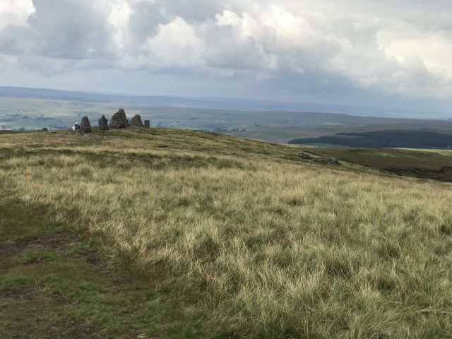
For the Saturday, Graham Bothwell led a linear moorland walk starting out from the small village of Keld in Upper Swaledale and the group followed a paved path heading towards Kisdon Force and used a wooden bridge to cross the River Swale, before continuing above Cotterby Scar and on towards Ravenseat Farm. On leaving the farm using an old stone bridge, we followed a minor road, track and then paddled across a shallow ford to use a right of way alongside Ney Beck. After passing a shooting hut the group left the footpath, headed across rough ground towards a prominent pillar of stones, then a ruined shelter before approaching a boggy section of the route. On negotiating this we headed towards White Mossy Hill and headed to highest point of the day at Nine Standards Rigg (662 metres). This summit is crowned with nine large cairns which once stood up to four metres high. Their origin is uncertain but they are marked on old maps dating back to 1738 and it is thought that they are much older. One theory is that they marked the boundary between Westmorland and Swaledale. From the summit, a gradual descent was made towards Hartley and before reaching the village we left the Coast to Coast route to walk along a disused railway over the substantial Merrygill and Podgill Viaducts. Leaving the old railway the group walked via fields and alongside the River Eden to return to Kirkby Stephen.
With a met office weather warning in place for the Sunday, the decision was made to do a low level walk rather than heading up onto Wild Boar Fell and Swarth Fell, an area of high exposed moorland with no shelter. Colin Park led a walk north from Kirkby Stephen on a fine sunny morning and followed a series of field paths passing through the quiet village of Winton and passing close to Kaber and Brough Sowerby to reach Church Brough. A break was taken here to visit the ruinous Brough Castle which is in the care of English Heritage. The castle was built by William Rufus around 1092 and stands on the site of the old Roman Fort called Verterae, one of a chain of forts between York and Carlisle. After a wander around the ruins the group paused for refreshments and ice creams.
Continuing west, we now headed for the village of Great Musgrave for lunch in the peaceful churchyard overlooking the River Eden. The return was via lanes and field paths passing through the villages of Little Musgrave and Soulby with shower clouds beginning to threaten as we entered Kirkby Stephen.
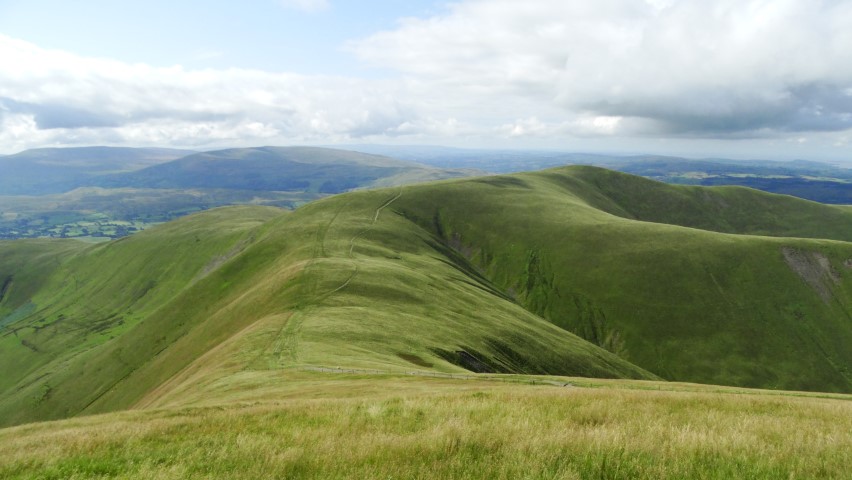
The rolling Howgill Fells. The group followed this ridge on the Friday walk and this view looks south from Calders.
Heading towards Nine Standards Rigg on the Saturday walk.

A place to pause at one of the nine cairns at Nine Standards Rigg. (Saturday’s walk).

Resting at one of the recently re-constructed cairns on the Nine Standards Rigg (Saturday’s walk).

Kirkby Stephen Parish Church near the start of Sunday’s walk. It’s hard to believe that there is a weather warning in force for thunderstorms.

A old fingerpost in Kirkby Stpehen giving distances in miles and furlongs. (Sunday’s walk).
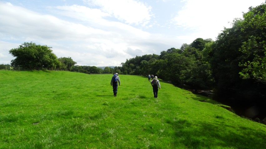
Walking by the River Belah, north of Kirkby Stephen. (Sunday’s walk).
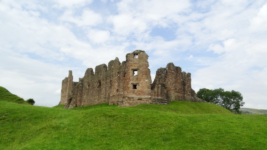
Brough Castle – a stopping point for tea/coffee and a vast range of locally made ice creams. (Sunday’s walk).

Anne tries out the stepping stones on Scandal Beck, just east of Soulby. (Sunday’s walk).