Group walk 13th February

By Paul Simms

A small but intrepid group of East Cheshire Ramblers recently walked a section of the Peak Pilgrimage route squeezed between storms Ciara and Dennis. The Peak Pilgrimage is a 39 mile long-distance footpath from the Church of the Holy Cross in Ilam to St Lawrence’s Church in the plague village of Eyam taking in ten other churches on the way. East Cheshire Ramblers have been following this path by a series of circular walks over the last few months.
This section started from Baslow taking in St Anne’s Church with its clock face celebrating Queen Victoria’s Diamond Jubilee and then northward following part of the Derwent Valley Way. At Calver we paused for coffee at All Saints Church then on past Calver Mill where cotton was spun by water power until the 1920’s. A kilometre north of the mill is the weir which holds back the waters of the Derwent in order to feed the mill race which once powered the mill. The present weir, the third on the site, is a Grade 2 listed structure, was built in the 1840’s and restoration completed in 2010. It holds back a head of 3.5 metres and these high water levels help to sustain wetland habitats collectively known as Calver Marshes. We walked through this rare Peak District wetland and on to Froggatt Bridge and Grindleford.
Our walk was fairly gentle with only 1000 feet of climb in the 10 miles but all of it now came at once with a steep accent through Hay Wood to reach the top of the gritstone outcrop of Froggatt Edge. We were very fortunate with the weather given the storms just before and after our walk. Although it was a little wet and boggy underfoot in places we had no rain and indeed quite a lot of sunshine and only a very gentle breeze. The sun came out now as we walked along the gritstone edges with wonderful views into the Derwent valley below from snow-clad Lose Hill and Kinder in the north to the stately Chatsworth House and beyond in the south; the English countryside in its glorious best even in February.
We returned to our starting point via the Eagle Stone and Baslow Bar.
For more details of the Peak Pilgrimage go to peakpilgrimage.org.uk

St Anne’s Church at Baslow.

The group on Froggatt Edge.

Fly & walk (3)

On the approach to Inishmore Airstrip which is situated between two bays.

It was just a thought that I didn’t really think would come to fruition. I was visiting Galway in the west of Ireland and decided to visit the Tourist Information Office. Now was it feasible to visit Irishmore, the largest of the Aran Islands the following day? The weather forecast was set for a fine day. My plan was to go by boat from Rossaveel, but this would leave precious short time to explore the island and in any case would mean that I wouldn’t get to the three places I really wanted to see – the ancient forts at Dun Eochla, the famous Dun Aonghasa which stands right on the edge of a vertical sea cliff and Dun Duchathair. These fine forts date back to around 1100BC. The Tourist Office suggested that if my time was limited then I could possibly fly out an back but this meant seeing if there were any spare spaces available. It transpired that there was a spare seat available for the outward and return flight but would I mind sitting up with the pilot. This was music to my ears and with no hesitation I booked the flight then and there.

It was a glorious sunny morning as I drove west from Galway to the tiny Connemara Airport and checked in for the 10am flight. We set off on the second of two Islander planes for the ten minute flight to Inishmore. It was just fantastic with a panoramic view of tiny islands all around me. At the islands’ airport a minibus was waiting to take our little group into Kilronan. This saved a one and a half mile walk. I had done calculations that if I wanted to see the three main forts on the island it would mean walking at least thirteen miles and that timing would be very fine. The minibus driver arranged to pick me up at 4.15pm at Kilronan so off I set at a brisk pace westwards along the main island road. Most people were wandering around Kilronan, the main village, visiting the variety of woollen shops whilst others were taking a ride by minibus or jaunting car to Dun Aonghasa. I wanted to walk and take in Dun Eochla, my first ancient fort. Standing at about the highest point of the island I had to take a small detour up to the old lighthouse then double back across several small fields to gain the fort. I had it to myself and it was a very impressive site. I couldn’t stop to long as I had a time schedule to keep to. I continued west along the main island road passing the occasional jaunting car before dropping down on a track to the northern coast. It seemed that I had been transported back a century in a landscape where the horse and cart seemed to be the main form of transport but there were many cyclists. Seals were out basking in the bay to the north. After a mile and a half of brisk walking I arrived at the sandy beach of Port Mhuirbhigh. My route now lay towards Dun Aonghasa. It seemed everybody was heading there and I soon passed the terminus for the jaunting cars. At the gift shop and information centre I bought a ticket then followed the enclosed stony path up hill along with everyone else. Dun Aonghasa lived up to its reputation. It was most spectacular, perched on the edge of a sheer 300 foot high cliff. This dry stone fort, rising to twenty feet in places was unbelievable and I was here in perfect weather. However, I did have to share it with almost every other nationality in the world. I was snap happy with the camera as everywhere you looked was worthy of a photograph. Despite the crowds, it was worth staying as long as possible to have my picnic lunch. An aircraft flew low over the fort which must have been truly spectacular from the air. Reluctantly I had to set off. I had one more fort that I wanted to see that of Dun Duchathair (The Black Fort). It was a good five miles away and I decided to walk via the road and track which crosses the southern side of the island. Away from the crowds one sees the true Aran, with men with scythes turning the hay and hay laid out in ‘stone’ fields to dry. On my route I was fascinated by the stone walling and the vast number of small fields some of which had hardly a blade of grass in. It was mile after mile of limestone pavement and one can imagine the hardship of working this landscape. I joined the road briefly south of Kilronan before taking a stony track to the south coast again. The coast was so spectacular, with massive curved overhanging cliffs, caves and arches. The fort at Dun Duchathair although not as complete as that at Dun Aonghasa was situated in a most spectacular location. I sat on the seaward side of it. The view was so spectacular that I didn’t want to leave. I attempted to return a similar way to Kilronan but went slightly astray in the maze of stone fields before I got back on course. My timing for the minibus was going to be fine. With a few minutes to spare I waited for the minibus in Kilronan, entertained by some young children busking by the war memorial. Waiting I did, with the precious minutes ticking by. As for the mini bus, it was nowhere to be seen and so in the end I just had to set off towards the airfield. There was no way was I going to get to the airfield on foot in time so I would need to hitch a lift from the first vehicle that came along. After a half mile I heard the minibus coming from behind. I stopped it and was relayed back to the airfield. It was a front seat again up with the pilot for the return journey to complete a most memorable day.

Kilronan is the main settlement on Inishmore which is famed for its Aran Sweaters.
Where time stands still. A typical scene on the road west from Kilronan.
Dun Eochla – The first of three ancient forts I visited on Inishmore.
The sandy beach at Cill Mhuirbhigh.
Heading towards Dun Aonghasa – the most spectacular fort on Inishmore.
Much of the southwest side of Inishmore consists of three hundred foot high sheer cliffs. Dun Aonghasa stands right on the cliff edge.
Fascinating stonework in the construction at Dun Aonghasa. A close up view.
One feature of the cliffs along the southwestern side of Inishmore is the spectacular under cutting of the cliffs. This photograph was taken at Dun Duchathair, – the last of the three ancient forts I visited.

Group walk 8th February

The group at the infant Kinder River crossing

By Martin Cave

With warnings of extreme weather for the Sunday I decided that a relatively low level walk around Hayfield would be a good option. This would provide excellent views and options to cut the walk short if the bad weather arrived earlier than forecast. As it turned, out ten of us enjoyed a lovely walk with plenty of sunshine.
Starting from Hayfield bus station we set off along the Calico Trail, passing above Clough Mill but well below Lantern Pike, to Matley Moor where we took a brief coffee stop. Crossing the Hayfield / Glossop road we then headed down to Carr Meadow which at the bottom of Hollingworth Clough is a wonderful walk leading to a distant small waterfall in August when the heather is in bloom. However, Hollingworth Clough is quite a challenge and not for us today. We then took the track to the shooting cabin above the Kinder Reservoir then down to the bottom of William Clough where we joined the path round to where the Kinder River joins the reservoir. Here we had our lunch, sheltered from the slight breeze and with good views of the Downfall far above us. Walking past Upper House we headed for the bottom of Broad Clough where our short but quite steep climb took us up to the bottom of Kinderlow End. After a short boggy section we joined Coldwell Clough, a bridle way joining Hayfield with Edale. Leaving Coldwell Clough we took little used field paths down to South Head Farm returning to Hayfield via the Pennine Bridleway and Elle Bank. Most of us ended the day with coffee and cake at Millies Tea Room and Chocolatier.

Hollingsworth Clough

At Blackshaws above Kinder Reservoir.
Above Coldwell Clough

A New Way To Find Our Walks

You may have noticed that a lot of random words have appeared on the walks programme on our home page. It’s not a mistake but a new, additional, way of locating the places where our walks start.

It is called what3words. Each 3 metre square in the world has been assigned a different combination of three words by What3words Ltd and they supply a smartphone app which converts the three words into a location and can then guide you to that place. The idea is that what3words is more accurate than a post code and easier to remember than latitude and longitude or a grid reference. At the moment you need the app to make use of the words but in the future it is likely that satnavs will accept them.

What3words won’t be replacing anything on our web site – it is just another way to guide you to our walks.

Ten years on

The ECR at the White Nancy Monument above Bollington

We haven’t seen much snow this winter if any, but ten years ago today the weather was quite different. I have gone back and shifted out some photographs of the weekend of January 30th and 31st 2010.
I led a walk on the Saturday from Bollington for the group with a healthy attendance. We had bright blue winter skies but I recall it was quite icy underfoot. See if you are on the first or third photographs.
We woke up the following day to a winter wonderland with a good covering of snow. A good day to get out on a local hike from Macclesfield which included a trek up to the icy heights of Shutlingsloe and Wildboarclough.

View towards Shining Tor – A sunny winter day but a biting icy wind.
ECR by Harrop Fold Farm.
Not quite the Antartic but this is the ice coated rocks at the summit of Shutlingsloe on January 31st 2010.
A snowy path at Wildboarclough. (31st January 2010)
Tongue Sharp Wood at Wildboarclough (31st January 2010).

Group walk 22nd January

Sandbach Market Place and the Olde Black Beare Inn

(all photographs were taken on the reconnoitre)

The Market Square was the starting point for this eight mile walk from the historic and fascinating town of Sandbach. Being such a miserable and foggy day the minutes ticked away towards 10am, so I was expecting a nil turn out. But almost on the stroke of ten, three EC ramblers emerged from the morning gloom. We started off with a brief historical tour of this interesting town centre starting with the Saxon Crosses. The two crosses are believed to date from the 9th century and are said to be among the finest Saxon crosses in the country. The carvings depict scenes from the Bible. The crosses were destroyed and broken up during Puritan times and the stone ended up in different parts of Cheshire but were brought together and re-erected in 1816.

Many buildings around the Market Square are grade 2 listed and most striking is the “Ye Olde Black Beare Inn” which was formerly owned by Lord Crewe, and is a timbered black and white building and the only building still to boast a thatched roof in the town. The date of its construction over the door is 1634 AD. It is conjectured that Dick Turpin stayed here on more than one occasion, and it was certainly here that bear-baiting took place.
We next made a short diversion to the Town Hall which is a fine steep-roofed building with a bell tower. Over the main entrance are two statues: one is of Bigot, the first Norman to hold the Manor of Sandbach and nephew of William the Conqueror, and the other is of Sir Randolph Crewe who was ancestor of the Right Honourable Hungerford, Lord Crewe, whose coat of arms also appears over the door.

Returning back along the High Street we passed the George Hotel, one of Sandbach’s original coaching inns. It is certainly over 300 years old and was the calling point for stage coaches plying the route between London and Manchester.
One of the most fascinating buildings in Sandbach is the Old Hall, which is now a hotel and was built in 1656 and is Grade 1 listed. The oak for the timber frame is thought to have come from the Saxe-mondron forest near Nantwich. Inside are some original fireplaces and oak panelling and there also a priest hole.
Crossing over the road we paused to visit St Mary’s Church. There has been a church on the site since around 1200AD and the original building was probably timber framed. Various restorations and changes have been made over the centuries but a major restoration took place between 1847 and 1849 under the direction of Sir George Gilbert Scott. We took a quick look inside to admire the nave and side aisles which have roofs of Cheshire oak richly carved in 1661. Just outside there are several fragments of the Ancient Crosses are under the archway of the tower, these only being found after the crosses were re-erected in 1816. Just behind the church our last building to look at was the Lower Chequer Public House which is claimed to be the oldest building in Sandbach, and dates from 1570.

Leaving Sandbach centre we paused briefly alongside Scotch Common Car Park. It was here that in 1579, Sir John Radclyffe of Ordsall secured the right to hold fairs and markets in Sandbach from Queen Elizabeth I. The Royal Charter also allowed for a fair to be held on the last weekend in September but on the 3rd September 1651, during the Civil War, a skirmish occurred on the town’s Common whilst the September fair was in full swing. Nearly 1000 Scottish troops were retreating from the Battle of Worcester where they had served under David Leslie. They paused to rest but were set upon by locals and market stallholders, who killed or took the soldiers prisoner. The Common is known locally as the “Scotch Common”.

It was now time to get walking and we left the town through Sandbach Park and on through new housing to gain the countryside. At Kingfisher Pool we stopped for a short morning break and beyond we continued on field paths which were now becoming almost impassable due to copious amounts of mud and water logging. We pressed on via farm tracks and minor lanes but the path after crossing Wood Lane was really a nightmare to cross and was so churned up with mud and water filled ruts. After sliding about we did reach Elworth without incident and crossed the A533. We next followed Mill Lane for a short distance before crossing a broken stile (since reported to the council). At least the towpath of the Trent and Mersey Canal provided some good firm walking and we pressed on via Hall Lane and Moston Road then taking an estate path through to join the Wheelock Rail Trail. Along this trail we found a good picnic site in the grounds of Sandbach United FC which was just off the path. We stayed with the trail a little further afterwards then took another muddy path along the valley to reach the former Sandbach Corn Mill. A series of paths between houses and residential roads were followed back into the town. An interesting walk with plenty of history but marred somewhat by some extremely muddy field paths.

St Mary’s Church in Sandbach.
The Trent & Mersey Canal just north of Elton Moss Bridge.

Group walk 23rd January

The flood gate structure has been artistically decorated by local school children at Fletcher Moss.

Exploring Mersey water parks and flood basins by Ann Thompson

Nine East Cheshire ramblers parked near the Golden Days Garden centre in Cheadle and set off along the bank of the River Mersey and up to the Didsbury tram stop. A new experience for some on the tram brought us to Sale Water Park. After coffee at the Tree Tops we set off to explore the Mersey floodplain.
One of the most interesting features of the walk was the variety of uses of the floodplain. The first half of the walk was varied with paths alongside lakes, the Mersey and through nature reserves, visiting both Sale and Chorlton Water Parks. These former gravel pits are now excellent recreation areas, one with water sports and the both with fishing. Sale Water Park was created in the 1970’s when gravel was needed for the M60 embankments. Another extensive use of the land is for golf and we saw parts of five courses although only walked across Withington.
The water parks and golf courses are all part of a food alleviation scheme. If water rises dangerously, weirs or flood gates can be opened with water stored until the floodwaters have passed. A large scheme was seen near Fletcher Moss, Didsbury where the flood gate structure has been artistically decorated by local school children. Fletcher Moss is an interesting garden and wild life area created by Robert Williamson whose wife was instrumental in the formation of the RSPB. It was given to the city by Cllr. Fletcher Moss who bought the property and garden from Williamson.
There was then only a short section of river bank before reaching the road and the garden centre after 9.5miles of flat and not too muddy walking.

Group walk from Nelson Pit 21st January

Morning coffe break just off the Gritstone Trail.

By Sue Thersby

Nelson Pit Visitor Centre was built on the site of a former colliery with the assistance of a Heritage Lottery Fund grant, and opened in spring 1999. It is a popular place to start a walk, as it provides information and toilet facilities for visitors to the Middlewood Way, the Macclesfield Canal, and the surrounding countryside. 13 ECR members left here for our walk today. The weather was dull but dry. We accessed the Macclesfield Canal directly from the car park and walked in a northerly direction before leaving after the second bridge to do a complete U-Turn and walk via Middlecale Farm, Platt Woods Farms and Elmerhurst Cottage and entering Lyme Park. Our stay here would be brief. The estate is managed by the National Trust and consists of a mansion house surrounded by formal gardens, in a deer park in the Peak District National Park. The house is the largest in Cheshire, and is recorded in the National Heritage List for England as a designated Grade I listed building. From here we caught our first view of the Cage, which stands on a small hill with exceptional views over the surrounding countryside. Leaving the park, we continued along Red Lane and then picked up the Gritstone Trail, as we walked along a green lane, before crossing the Disley – Whaley Bridge Road and beginning our climb of Black Rocks, where we had our morning break. After coffee, we descended past the former Moorside Hotel, which is now a school for vulnerable children, on our way to Cornfield Farm and Sweet Hill. At the top of Sweet Hill, we could see Bowstonegate nearby. The Bowstones are a pair of Anglican cross shafts, situated beside the old ridge way between Disley and Macclesfield and are a scheduled monument. Leaving the Bowstones to the North, we continued via Dale Top and Blakestone Moor, passing a trig-point-like monument to the coal industry that was so prevalent here, to Keepers Cottage. At this point we had lost what views we had earlier, as the mist had descended. From here, we went via a small Methodist Chapel to Westpark Gate and then on, via a memorial plaque to Joyce Blanchard (a former ECR member, who died some 8 years ago) to re-join the Macclesfield Canal and made our way back to the cars. Some of the group were able to enjoy tea and cake at the Trading Post near to the car park.

The climb to Black Rocks.
The view from Black Rocks.
The monument to the coal industry on Blakestone Moor.

Fly & walk (2)

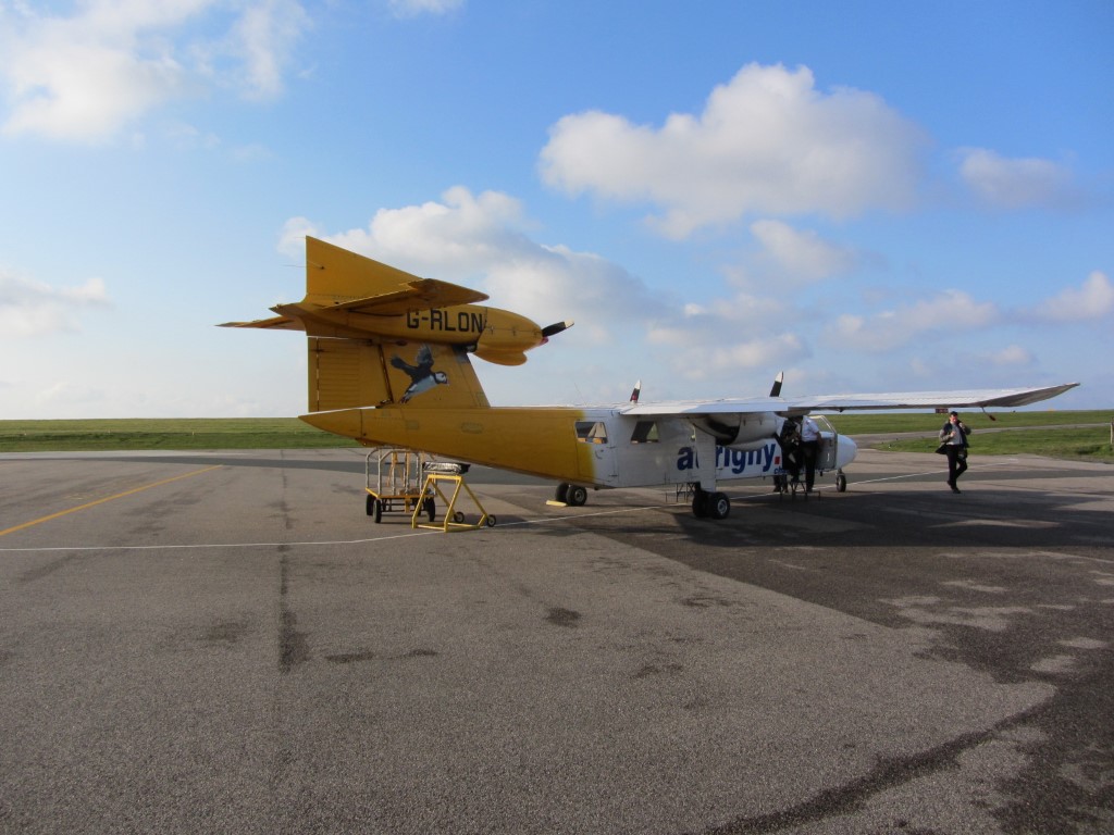
Our flight to Alderney was on this Trislander Plane.

For this second of three walks where I have taken a flight to the start of a walk I am headed south. Rather than setting out with little planning, this flight and walk was pre-planned some time in advance. Taking a week long holiday with my son in Guernsey, we planned to visit the neighbouring island of Alderney but being a bit out of the main tourist season there was no ferry service. The only way we were going to get there was to fly and to make the most of the day we planned to get the first flight out from Guernsey and the last back.

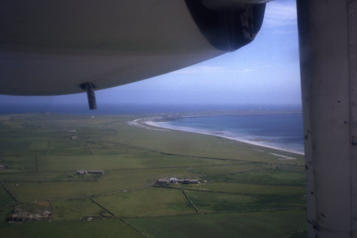
This was going to be an action packed day which would rely heavily on public transport running to time and good weather. Our guest house kindly supplied an early light breakfast left at our room on the previous night and so it was up early to catch the first bus from a deserted St Peter Port to the airport at 06.30am. The flight was on time, if a little early and in no time our small group of six passengers were whisked across the ten miles of sea in our little Trislander plane to arrive slightly early on Alderney.

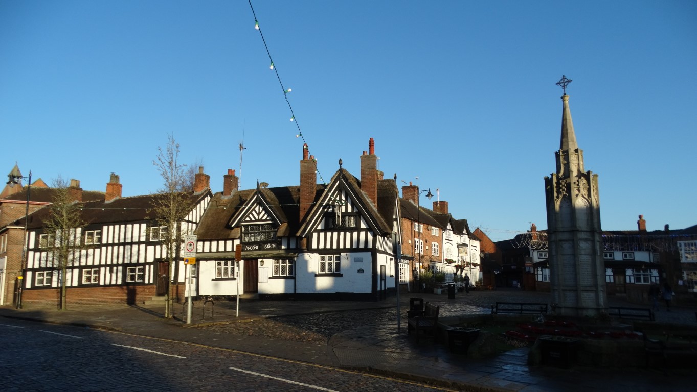
Early morning on the High Street, Alderney.

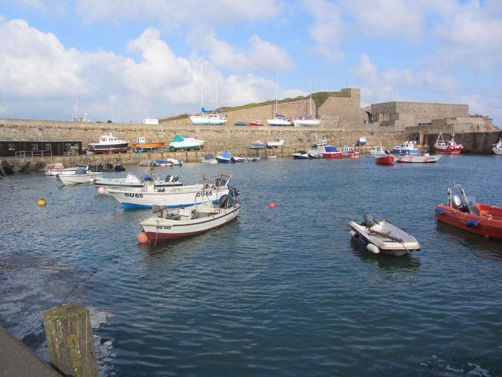
We were walking before 8am from the airport down to the sleepy village of St Anne. First of all we had to fine a shop selling drinks for the day and were surprised to find a well stocked small supermarket. We wandered down through the largely empty cobbled streets towards the harbour where a vessel was being unloaded. The harbour area as such was an untidy place and we had time to venture out to the breakwater but not along it. Occasional waves were sending spray over the breakwater so it wasn’t a good idea to get wet at the start of the day. I spotted a trig point on Fort Grosnez which towers above the harbour but there was no access to it.

Alderney – The Inner Harbour with Fort Grosnez. The trig point on top of the fort looks inaccessible.

We set out anti-clockwise along the coast to Fort Doyle, the first of many forts we would pass today on this fifteen mile long walk then along the sands of Saline Bay where you were warned of a strong tidal undertow. German fortifications were everywhere much to the delight of my son who had a big grin on his face all day. Below Fort Tourgis, my son took the shore road whilst I walked uphill to visit Druid’s Altar Burial Chamber passing on the way the extensive shell of Fort Tourgis. I then took a track down to the shore to meet up with my son again. It had now clouded up for awhile as we wandered along towards the tidal causeway to Fort Clonque. This rocky outpost is now a holiday let and is only accessible at low tide. For now, waves were crashing across the causeway and hence no access. An engineered zigzagged path now led uphill but we missed our intended path to stay with the coast and ended up on the plateau area. The area around Giffoine was honeycombed with German defences but much of the area was covered in gorse.

Fort Clonque lies on a island and is connected to Alderney by a tidal casueway. In the far distance (middle left) can be seen The Casquets Lighthouse.


The rocky islets of Les Etacs at the western end of Alderney is a gannet colony.

Back down on the coast we came across large German gun encampments with bunkers, one of which must have taken a direct war time strike. It was overwhelming how much this area was defended during the war. Offshore were the impressive sea stacks of Les Etacs, a gannet colony. We had to walk inland to avoid Vallee des Trois Vaux before returning to the impressive coast above Telegraph Bay. In bright sunshine we headed east before we were forced inland. A track ran to the south of the airport above the coast but there were few spots to access the coast due to gorse and brambles. We rested awhile on a seat before joining a path. We were now aiming towards Essex Castle and we had a couple of miles of pleasant coastal walking on a good path. The centre of the island was dominated by large pasture fields. Apparently the Germans had ripped out the old small field boundaries. My son often went off to view fortifications whilst I took my time on the path. The only downside in this area was the islands’ rubbish dump, situated in full view of an otherwise attractive section of coast. A little further on at Essex Hill we came across a trig point before joining a road down on the seaward side of Essex Castle. At a sheltered spot above Longis Bay we stopped for lunch out of the cool breeze.

This is typical scenery along the southern coast of Alderney. This photograph is at Les Quatte Vents.


On the path approaching Longis Bay on the south eastern end of the island.


The German ani-tank wall which backs sandy Longis Bay. A nice little suntrap today.


The German Fire Direction Fort – one of several concrete structures on the island.

Setting off we continued along the deserted sandy beach below the German anti-tank wall. Beyond, we joined the road briefly before making a diversion to view the large German structure above Mannez Quarry. Despite it being locked, my son managed to get in through a slit so meanwhile I took a rest for awhile to admire the view. It was then back down to the road before crossing some rough ground and heading down to the shore path. At this point we were the closest people to the French coast and still on British soil. Fort Houmet Herbe on a rocky island offshore was in a ruinous state and in any case by now we were keeping an eye on the time and so didn’t venture out there. Next came Fort Quesnard which was in private hands and Fort les Homeaux Florains beyond, which looked inaccessible on a rocky islet. One place I wanted to look at was the Mannez Lighthouse, standing proud near on the headland with its black and white strips. We headed on around Corblets Bay passing Chateau a L’Etac and down onto the deserted sandy beach at Saye Bay. Bibette Head had more than its fair share of German defences. My son explored these whilst I made my way slowly up to Fort Albert, another prominent fort. By now we wanted to visit the island museum before it closed as so exploring further forts was out of the question. At White Gates we came across the Alderney Railway and after a briefly look, we headed towards Braye Bay before cutting up into St Anne. We found the main shopping street before heading off to visit the island museum. Being out of season we were only the second visitors of the day. After around three quarters of an hour and a brief chat with the curator we spent the rest of the late afternoon exploring St Anne. A detour was made to view the German Water Tower before wandering down to St Anne’s Church, often described as the Cathedral of the Channel Islands. For awhile we sat in the churchyard in the cool spring afternoon sunshine with crows calling in the trees but no other noise. It seemed hard to believe that we had actually made this trip to one of the last places in the British Isles for me to visit. Allowing a bit of time, my son and I wandered back to the airport. There was little or no traffic about despite a large number of vehicles on the island. The flight on time for the short flight back to Guernsey and again we were rewarded by good views. High cloud was filtering in from the west. Back at Guernsey we were just in time to catch a bus back to St Peter Port before the walk back to the guest house. It was quite an achievement to have been on Alderney soil and now back in our guest house in Guernsey in just fifty three minutes!

Mannez Lighthouse which dominates the eastern end of the island.


The Alderney Railway which was built to quarry stone to build the breakwater.


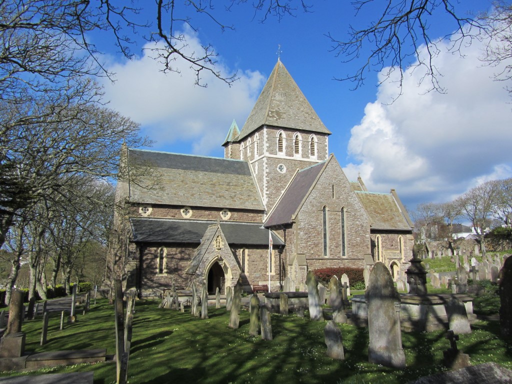
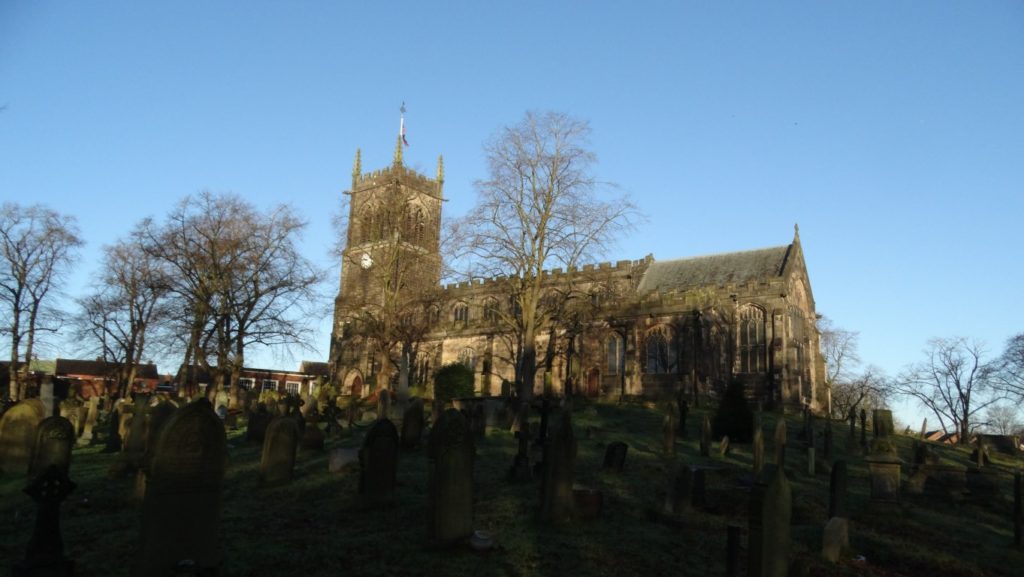
St Anne’s Parish Church has been described as the Cathedral of the Channel Islands.

So summing up, there is so much to say about this island, but we both decided that one day was not enough to explore the island in depth. For those of us interested in military history, World War 2 and forts, it is a paradise. For me, I was fascinated in this fiercely independent island with few connections with the outside world. I think an ‘Island Kingdom’ sums it up and despite the high price to get there and back, the day was certainly worth it. Furthermore, we had been lucky to get there as the following day the flights had been grounded due to rough weather.

Group walk 18th January

Descending from Clarke’s Lane to the Middlewood Way. Many of the group are captured in this photograph.

This medium walk started locally in Macclesfield and attracted 22 walkers and with no long on offer walk today, a large group of walkers had assembled on this fine sunny but frosty morning to be led by Michael Murphy. Setting off from Whalley Hayes Car Park we first headed through West Park where we tried to avoid the worse of the slippery conditions underfoot and pausing briefly at the large 30 ton erratic (boulder) which was brought to this area during the last ice age. Its original location has been traced to near Ravenglass in Cumbria. Our walk then passed through Macclesfield Crematorium before following a short section of path through the Riverside Park then making our way across to the Middlewood Way which was followed north to the wooden footbridge over the Silk Road. A little beyond the far side we stopped for our morning break at Woods Bridge over the Macclesfield Canal before following the muddy towpath north to Clarke Lane Bridge and here we diverted to follow a short section of the Middlewood Way and later descending via Tinker’s Clough to rejoin the Macclesfield Canal Towpath at Greens Bridge.

In the bright sunshine we continued north passing the Adelphi Mill then over the Grimshaw Lane Aqueduct and leaving the towpath to follow a short section of Hawthorn Road to get back onto the Middlewood Way via the Bollington Viaduct which once carried the Macclesfield, Bollington & Marple Railway. It was opened to passenger traffic in 1870 but was a casualty of the Beeching cuts. With the former railway lying dormant it was eventually bought by Macclesfield Borough Council and a program of works over the following years developed it into a recreational trail called the Middlewood Way. There were even plans to demolish the Bollington Viaduct but there was much local opposition.

Our walk headed east now through the Recreation Area then along Water Street and High Street in Bollington before making the biggest ascent of the day up to White Nancy. The majority of the group took the more gradual but longer ascent to the summit via the Millennium Steps whilst a smaller group took the hill direct up the muddy and slippery slopes. White Nancy was our lunch stop by which time a cool breeze had sprung up and there was more cloud around now and the deep blue skies of earlier in the day had turned hazy.

We set off along the Kerridge Ridge where in places a better path surface had been implemented but part of the path was a sea of mud due to heavy footfall. The descent at the southern end was muddy and very slippery and so progress was slow. We joined the B5470 briefly before joining Carlofold Lane then taking a muddy path over the shoulder of Cliff Hill. At the end of this path we turned left uphill on Cliff Lane then along another very muddy path down to the B5470 once more. Heading towards Macclesfield we soon struck out along the Macclesfield Canal towpath to the Buxton Road before heading into the town via Victoria Park.

Ramblers reflected in the waters of the Macclesfield Canal north of the Adelphi Mill at Bollington.
Some of the group at lunch stop by White Nancy. A cool breeze had sprung up and so many more had taken shelter behind White Nancy.