.
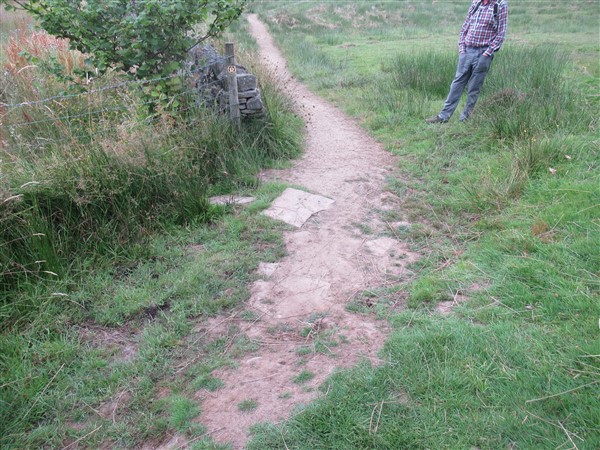
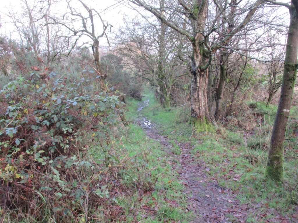
I have walked Pott Shrigley FP 9 several times in all seasons. If the ground is wet, or even just damp, the path is dangerous where it descends into the woodland at Gausie Brow, with very high possibility of injury through slipping and falling onto one’s back with back or head contact with various rocks projecting above the surface, or ripping clothes or skin against barbed wire with arms outstretched to keep or gain balance. The top drystone wall stile existing stone steps had exceptionally large steep drops (400 – 500mm) which were difficult to negotiate by persons with constricted mobility. The rotted handrail was loose and was ‘supplemented’ by barbed wires!


After a brief discussion with CEC’s PROW officer, Nicola Swinnerton, we agreed our Project Team would build a flight of steps to overcome the difficulty of this descent. The plans show access routes to the site for construction of the new flight of steps at Gausie Brow.


Permissions were given to Nicola by very cooperative and understanding landowners to:
- Construct the steps at ‘E’
- Have vehicular access along a private vehicular access from Spuley Lane at ‘F’
- To drive an estate car with heavy tools, timber, and gravel bags through a private electric gate at ‘B’ and the farm’s sheep fields to ‘E’. (One day required for these deliveries).
- Have vehicular access from Bakestonedale Road at ‘A’ along a private drive of Sherrow-Booth dwelling to point ‘C’.
- To park team cars at the top of 20-Acre Field at ‘C’ on several days
- To drive an estate car daily, laden with tools and materials, to park at ‘D’ in 20-Acre Field with several smaller gravel deliveries.
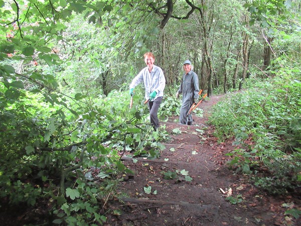
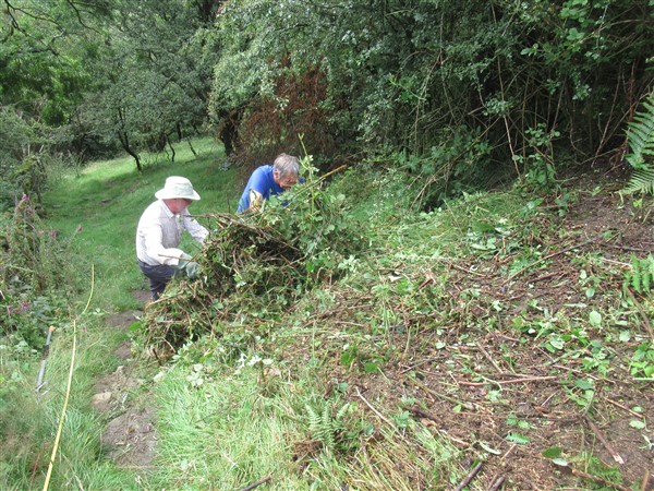
Initially, whilst awaiting permission to be confirmed to allow us to build the steps, two team members cut back tree branches overhanging and obstructing the path between D and E. Way-marker posts were placed, and a wooden stile’s step plank at D was studded with staples for better grip.


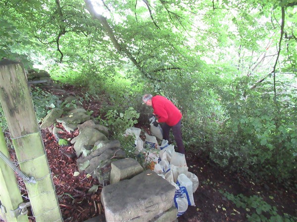
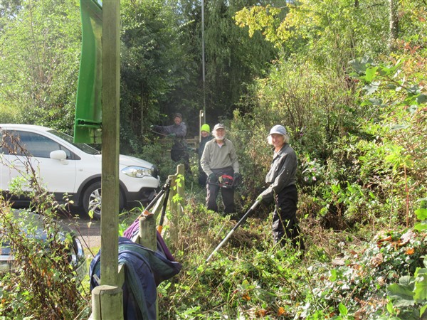
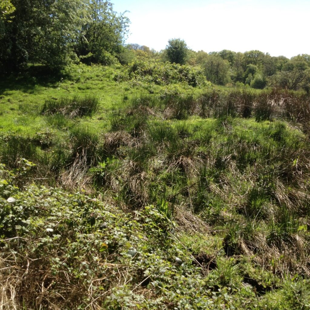
At the proposed steps site, cutting down and removal of some dense vegetation of hawthorn tree, 30mm diameter briar rose, holly bushes and brambles was carried out, enabling a survey of the site to proceed.

The Stile Site from above. 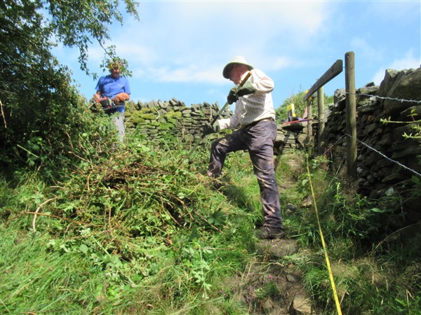
Roger Jubb, Nick Wild 
The hillside’s vertical profile as well as cross sections of the eroded/hollowed-out path were determined. These were plotted on graph paper, and step positions positioned to eliminate the need to remove projecting rocks, whilst maintaining a regular pattern (rhythm) of riser heights and ‘going’ spaces between, and attempting to minimise the quantity of imported 20 mm sized limestone stones required to fill the step spaces. Reference pegs were placed and integrated in the survey for the future work’s setting-out.

Roger Jubb 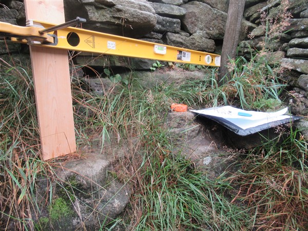
At stone steps of stile 
Roger Fielding
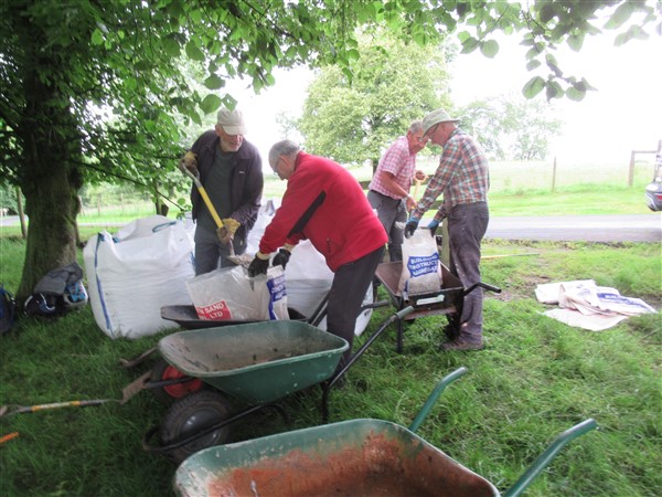
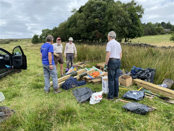
I collected timber materials from CEC PROW’s depot at Winsford for the steps’ construction. Over 1.6 ton of 20 mm size limestone stones was brought from Ingersley Vale, where it had been stacked as surplus to requirements on the refurbishment of Rainow FP 38 project earlier this summer. Of this, approximately 0.6 ton was taken to Hedge Row for use on the Gritstone Trail (See ‘Gritstone Trail’ Article on web site) and the remainder to the top of the steps at E (via F and B). This took place on 11th August ’21. All subsequent deliveries of materials, and daily transportation of tools were taken by wheelbarrow to and from the steps at D (just 200 metres each way), including surplus stones not required and recovered from Hedge Row works on the Gritstone Trail.
Roger Jubb, Steve Osborne, Nick Wild, Alan Wilson. 
Stock at E – top of steps’ site. 
Stone delivered to gate at D to be moved to E
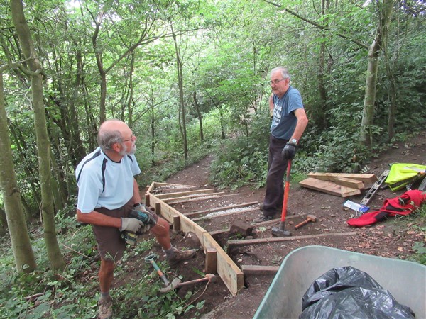
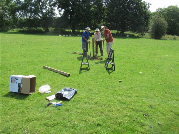
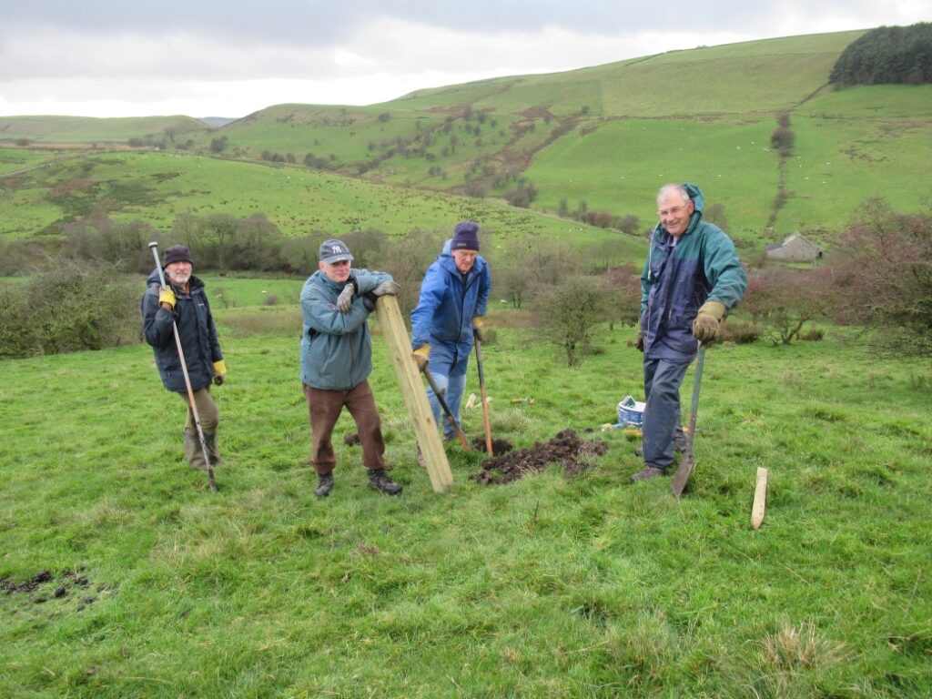
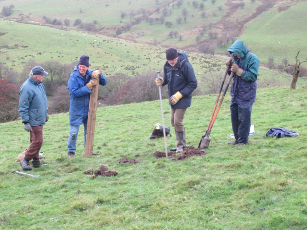
The steps were constructed from the bottom, except for the top three steps. 15 mm diameter steel pins were driven into the rocks to support the wooden risers where pegs could not penetrate. (And used as setting-out spacers).

Nick Wild, Roger Jubb, Steve Osborne 
Roger and Nick 

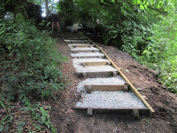
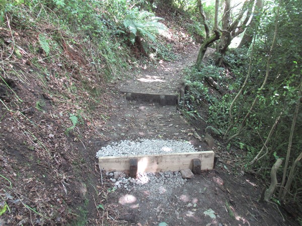
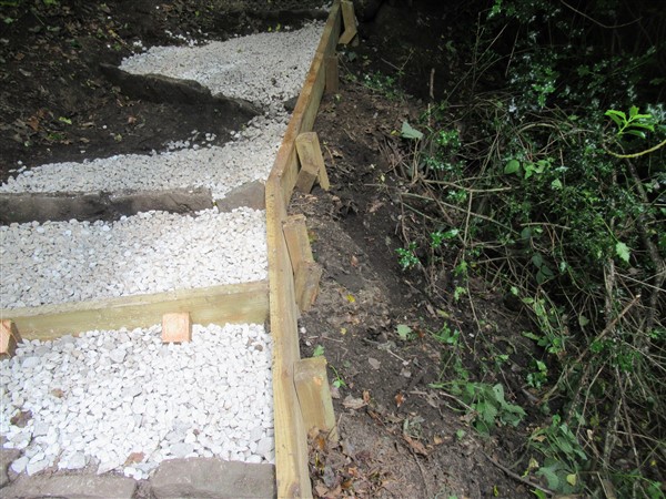
The latter top three steps’ wood risers were built suspended above the ground, supported by posts, and backfilled with rocks and 20mm limestone subsequently. This was necessary to keep step heights climbable whilst reaching the existing topmost stone step. The stone step protrudes from the drystone wall 300mm below the ‘threshold’ step across the wall. All wood steps below this have 200mm maximum rise. The wood step risers were sized 50 x 200 mm and one metre wide.

All posts had to have their holes chiselled through rocks using the background long steel tool (weighing 8 kgm) 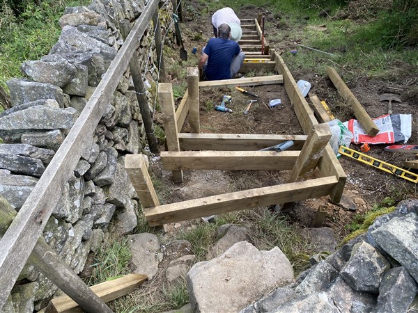
The steps accommodate a change of direction from the stile 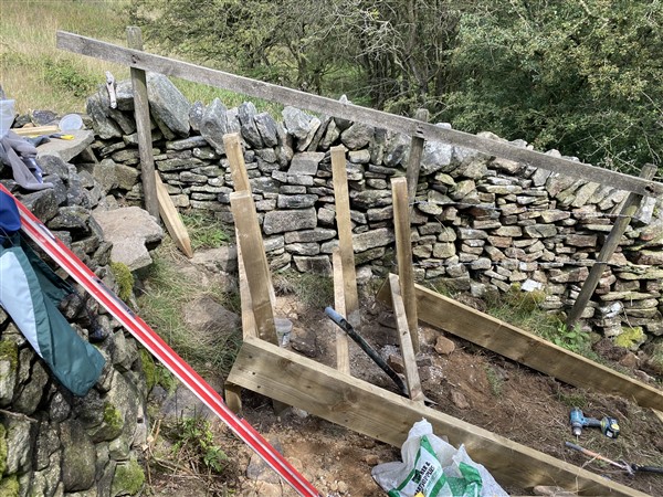

The underspace was filled with rocks and 20mm sized limestones
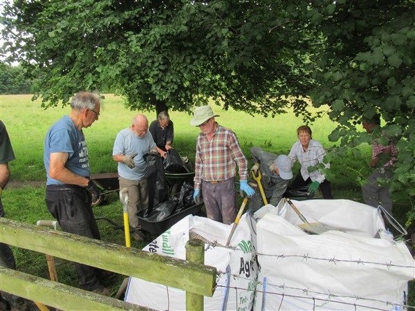
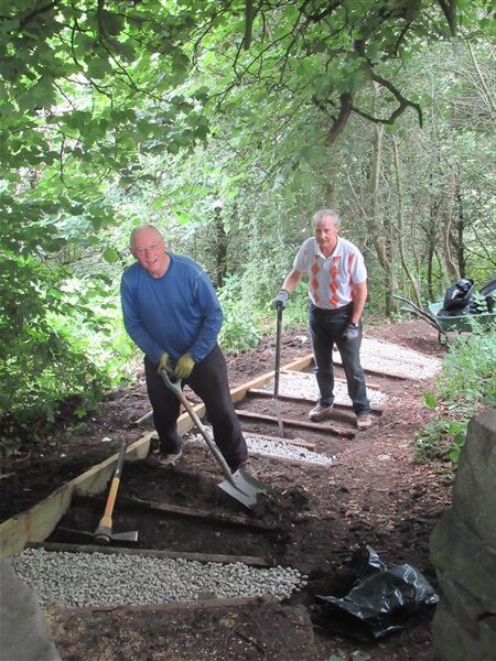
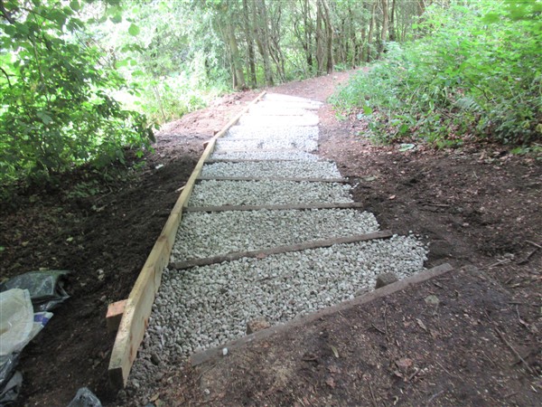
Wood ‘stringers’ (50 x 200 mm cross-section were erected up the slope to support the risers and to contain the 20mm sized limestone infill. The top steps’ side not constrained by a wall was ‘boxed in’ with a raised stringer to contain the deeper fill material. More stone (approximately 0.5 ton) was imported as 10mm sized limestone chippings by estate car, delivered to point D and wheelbarrowed to E. On one occasion, a passing runner stopped to chat, and then very kindly, changed his training mode briefly to fetch two barrowloads of gravel for us! Steps were cleaned to allow sufficient depth for stone surfacing. Vegetation piles were cut up and stacked in undergrowth.

The void was protected overnight with infilled timbers. Riser support posts were not cut back until completion of stone backfilling 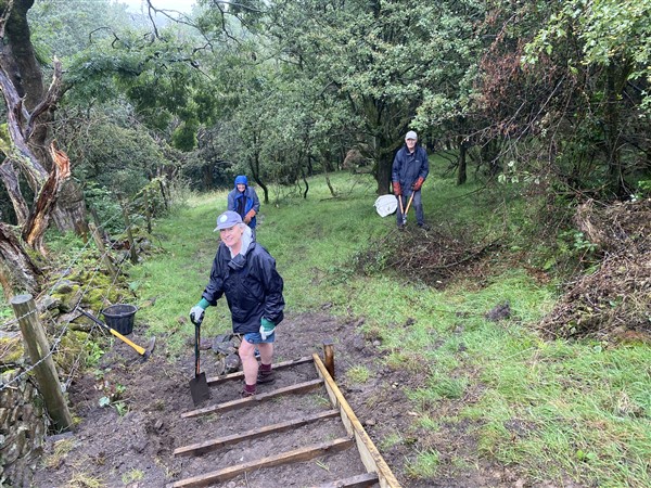
Alan Wilson, Roger Jubb, Ian Wasson 
Stoen fill progressing.
Posts were erected on the wall-side of the steps and supported independent of the stringer. This separation of the step and handrail structures ensures future replacement of steps or handrails will be facilitated. All the handrail posts were wrapped in bitumen/polythene sheeting (heat-welded to the wood) for 100 mm above, and 250mm below ground level. This zone is recognised to be where rotting of the wood occurs. Handrails were affixed to the posts at two heights above the steps, and were planed and sanded along their top side and corners beforehand. The steps were completed on 27th August.

Post Protection 
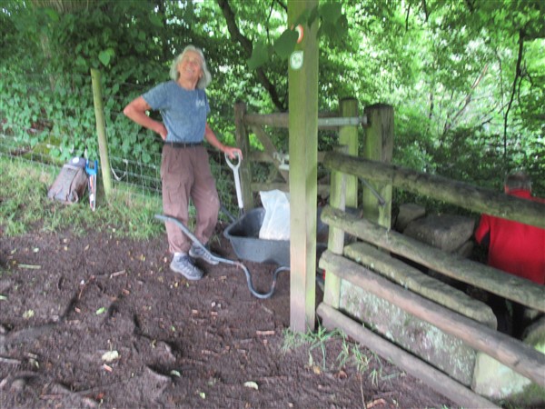
Handrails preparation – Alan Wilson 
Stone Filling – Steve Osborne, Nick Wild 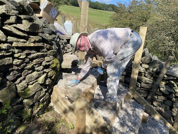
Nick Wild 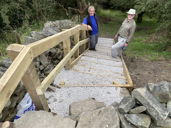
Basking in Success – Roger Jubb, Nick Wild 
Top Handrail Post. Collapsed wall behind restored by Roger Jubb.
Spring water, collected in a field tank, overflows to run from the field above the steps, seeps through the wall at E, and saturates the ground adjacent to the steps. More critically, this run-off saturates and muddies the path below the steps as it crosses the path to reach a naturally formed ‘ditch’ by the wall further down.

The water flow-paths after extended dry weather 
Water flow in wet weather. Note a faint water channel crossing right to left below the path. 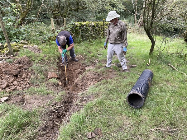
Digging a deep bed for a 225 mm dia. pipe of 2 metres length – Roger Jubb, Nick Wild 
Later return – to add planks and more soil/turf cover to the pipe 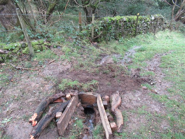
Deep inlet sump with protective deterrent to sheep and cattle.
We cleared a channel alongside the upper field wall which captures surface water flowing through rushes from the tank upstream of the wall. This directed water to a drainage ‘route’ through the wall between its wider spaced founding stones further away from the steps. However, once through the wall, the waters naturally follow the crossfall of the slope back towards the steps. We installed a 225 mm diameter, two metre length of pipe across the path below the steps and channelled the water towards the pipe’s inlet. The pipe outfall fed into the ditch directly, clear of the path. The final task was to cover the pipe with rocks and grass tuffs and protect its intake with 50 x 200 mm planks against sheep and cattle footfalls. This was completed on 5th October.
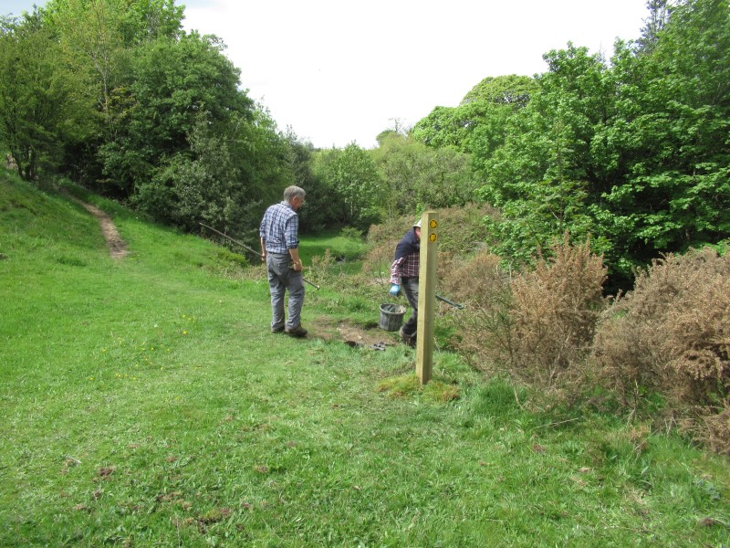
During our works , time was taken to rationalize the path leading up to the steps from the valley. Two waymarker posts were placed strategically and their tops yellow-painted for better intervisibility in the woodland. Disks were fixed to them.
All of the 20 mm sized limestone and timber was supplied by CEC PROW. Additional bags of 10 mm sized chippings, several bags of quick-setting concrete, post protection materials and the pipe were supplied by East Cheshire Ramblers Group.
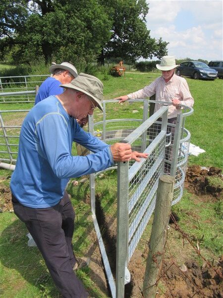
Thanks go to the following Projects Team members for their help and encouragement. Roger Fielding, Roger Jubb, Chris Munslow, Steve Osborne, Brian Richardson, Ian Wasson, Nick Wild and Alan Wilson. Amongst us, eight members attended on 42 person-days, and acheived 236 man-hours work – excluding lunch breaks.
.