

The Aviary which stands above Old Warke Dam in Worsley was built as a hunting and fishing lodge by the 1st Earl of Ellesmere.
In a time when we have had so much rain, and near on seven inches this month in Macclesfield alone, it is becoming increasingly difficult to find somewhere to walk where you are not going to encounter waterlogged paths and fields or thick mud.
This week Steve Hull joined me on a walk where I hoped that we would find less in the way of flood water and hopefully not too much mud and in all but a few places this walk avoided most of these problems but not all.
I don’t think the ECR have ever walked from Blackleach Country Park which perhaps is an unlikely place to have a country park as it is located just off the Bolton Road in Walkden.
It was unfortunate that we arrived during a heavy hail and rain storm and having donned walking boots and waterproofs we spent the next few minutes in the car before the weather showed signs of improving. We set off on decent paths around the southern edge of Blackleach Reservoir and despite it still raining, brighter skies were quickly moving in from the west. It was only a short walk to reach the Rotary Way, – a surfaced path which ran along the former Bridgewater Collieries Railway. We were so glad that we weren’t crossing fields here as many were under water either side of the embankment we were on. After a half mile we left the former railway to follow a watery track then a field path which formed part of the Salford Trail. Gradually, conditions underfoot became quite waterlogged and so progress became quite slow for the walk to reach the Manchester Road. We crossed this road to join another watery path but had to revert back to the main road to pass beneath the M61 and M60 motorways.
Taking a track beyond, we soon entered pine woods and the driveway which led down towards the historic Wardley Hall. The hall is reputed to be one of the most haunted buildings in the country and dates from around 1500 although records show that there has been a moat here since 1292. It is the official residence of the Roman Catholic bishops of Salford. Preserved in a niche at the top of the main staircase is the skull of St Ambrose Barlow, one of the Forty Martyrs of England and Wales. On 10 September 1641 after confessing to being a Catholic priest he was hanged, drawn and quartered at Lancaster Castle. Ambrose was born at Barlow Hall, Chorlton-cum-Hardy in 1585 and the Barlow family had been reluctant converts to the Church of England following the suppression of the Catholic Church, but Ambrose converted back to Roman Catholicism in 1607. Despite being arrested several times during his travels, Ambrose was released without charge but on the 7th March 1641 King Charles I signed a proclamation which decreed that all priests should leave the country within one calendar month or face being arrested and treated as traitors, which would result in imprisonment or death. Ambrose’s parishioners implored him to flee or at least go into hiding but he refused. On Easter Day 1641 Ambrose and his congregation of around 100 people were surrounded at Morleys Hall, Astley by the Vicar of Leigh and his armed congregation of some 400. Father Ambrose surrendered, and his parishioners were released after their names had been recorded. Ambrose was taken to Lancaster Castle where he met his fate.
After crossing the East Lancashire Road we now continued towards Egerton Park and soon taking a muddy field path. We later passed beneath the M60 motorway a couple of times as we continued through Worsley Woods Nature Reserve. Here we found some seats for a morning break. The water level in the lake at Old Warke Dam was much higher than usual but at least by now we had some welcome sunshine. On the north western side of the lake stands The Aviary, a fine mid 19th century black and white house which was built by Frances Egerton, the 1st Earl of Ellesmere as a hunting and fishing lodge. Frances Egerton was a prominent British politician, writer, traveller and patron of the arts. The tenth largest island in the World, Ellesmere Island in northern Canada is named after him. Along with his large estate, the very profitable Bridgewater Canal, and the collieries at Worsley which also served as the headquarters of the canal made him a very wealthy man.

The Bridgewater Canal through Worsley.
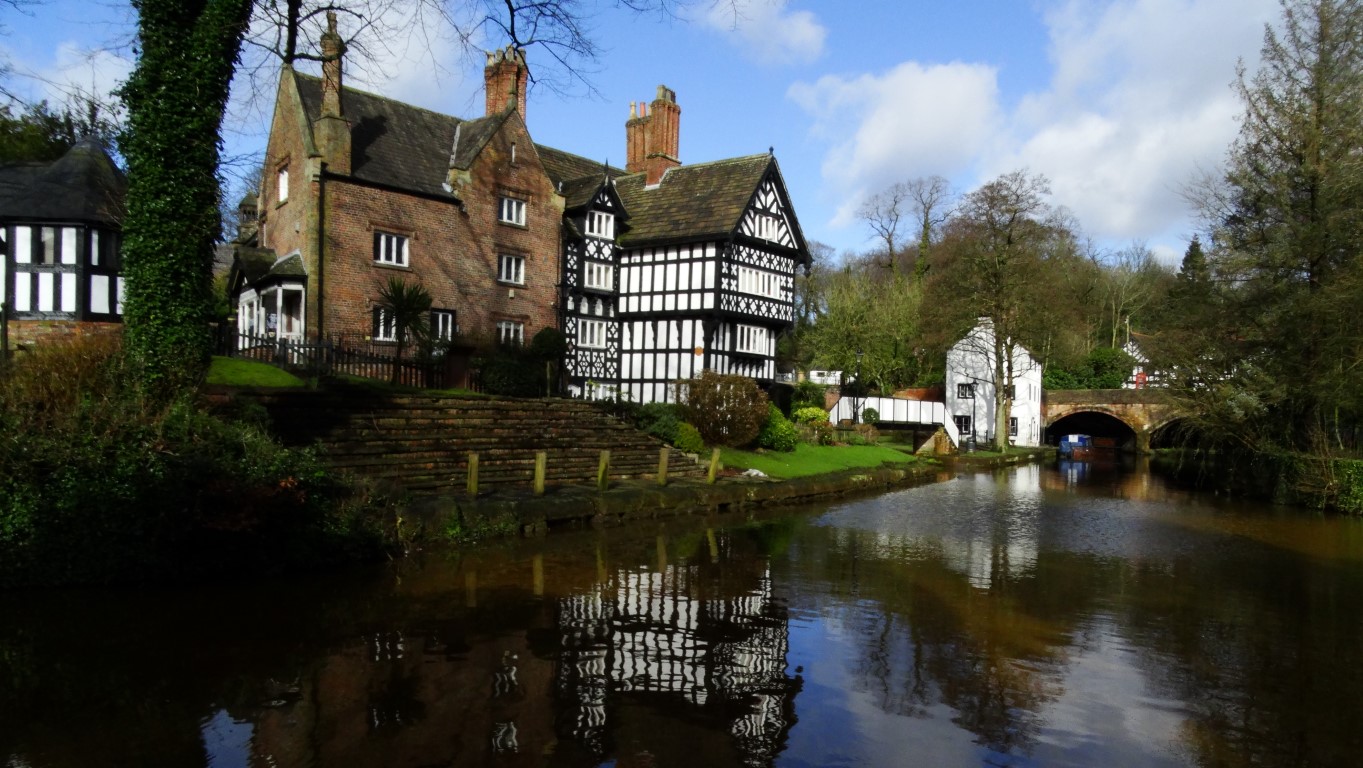
The picturesque Packet House in Worsley.
We now entered the historic part of Worsley much of which is tucked away and out of sight of most passing traffic. The ‘village’ has many fine houses and reminded us very much of nearby Prestbury. The Bridgewater Canal dissects the village and the picturesque Packet House is a fine black and white building overlooking the canal.
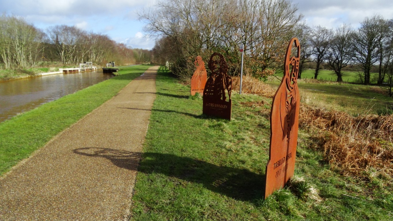
Sculptures to prominant men in the area beside the Bridgewater Canal

Some good and dry walking along the towpath of the Bridgewater Canal west of Worsley.
Heading west, Steve and I struck out on the good surfaced path alongside the Bridgewater canal to reach the Boothstown Marina. En route, and to our right, the new RHS Bridgewater Gardens were taking shape. This will be a major tourist attraction when it opens later this year. The 164 acre site is being transformed into one of the largest new gardening projects in Europe.
We left the canal towpath at Boothstown and now had some walking via residential roads. We searched for a spot to have lunch but only found some seats at a small shopping precinct which was doing little trade.
Once over the East Lancashire Road once more we headed north and were soon back into open countryside and crossing the Busway with its associated ‘car traps’ We soon passed through the small hamlet of New Manchester before crossing some open ground to reach Engine Fold and prior to reaching this community we had to take shelter from a heavy shower of hail.
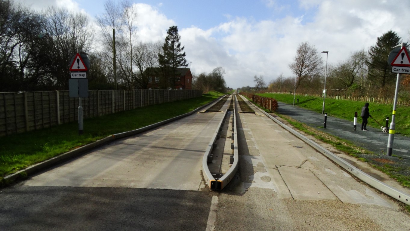
The busway north of Boothstown with it’s ‘car traps’.
We next joined the good path which followed the former Worsley and Bolton Railway Line, and for much of the way, this ran along a cutting. There was a sign where the former Little Hulton Station was once located. There was a station here between 1875 and 1954. Nearing the M61 we veered right to take another good surfaced path which ran back to Blackleach Country Park to complete a walk full of history through a landscape which has radically changed in the past one hundred years.