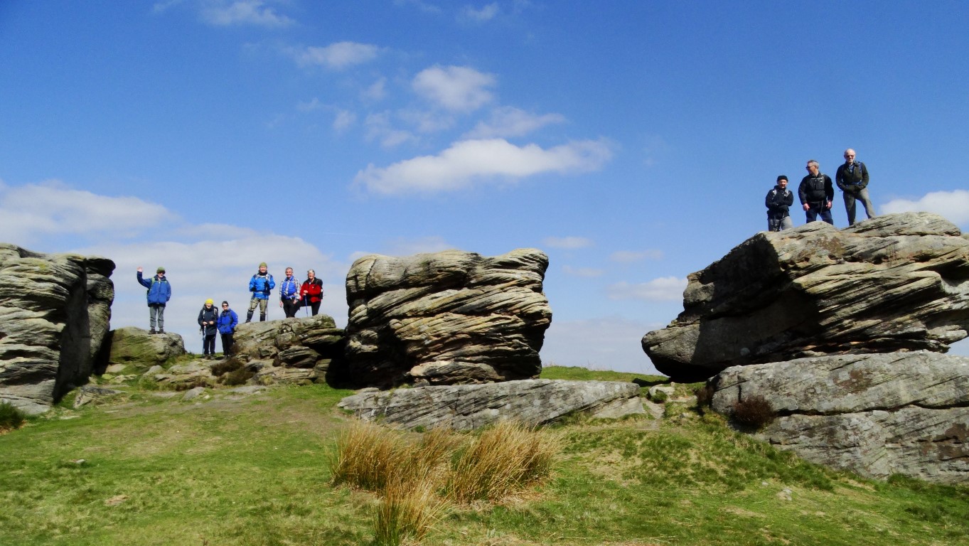
The East Cheshire Ramblers used trains for a recent linear walk between Salford Crescent and Bolton Stations for this thirteen mile ramble along the lower reaches of the Irwell Valley.
Leaving Salford Crescent we were soon in rural countryside and skirted the area which was once the site of Manchester Race Course and was first recorded as being in existence in 1647 and finally closed in 1847. To reach Ringley our route followed closely the wooded banks of the River Irwell on good paths with a stop for a picnic lunch en route. In places there were reminders of the former Manchester, Bolton & Bury Canal including our crossing of the old Clifton Aqueduct which is where the canal crossed the River Irwell.
In Ringley we paused to take a look at the historic Ringley Bridge over the River Irwell. The bridge dates from 1677 and was built to replace an older wooden bridge which was swept away in floods in 1673. Nearby is an interesting clock tower which dates from1625 is now once more in working order.
Crossing the A667 we now followed the canal towpath for the next mile to the Prestolee Aqueduct. This proved to be an interesting section of the canal as it ran along the side of a steep hill side. Directly below was the community of Prestolee complete with church and mill which could have been a similar scene one hundred years ago.
We next crossed the ancient Prestolee Aqueduct which opened in 1793 and spanned the River Irwell and just above it was the Prestolee Canal Staircase. The site had been cleared of vegetation to reveal the extensive stonework. Plans are afoot to restore this flight of locks. What is unusual is the work that has been carried out and several features made out of large scale Meccano have been constructed including a seat, picnic benches and largest of all a Meccano Bridge over the canal. This unique site made a good afternoon tea stop.
The walk towards Bolton continued via Moses Gate Country Park and later over the two former railway viaducts at Darcy Lever and Burnden which have now been converted to a cycleway and walkway. This led us nicely in towards Bolton where we timed it just right for our return train journey.
Author Archives: Colin Park
Group walk report 22nd May
By Steve Hull
East Cheshire Ramblers recently spent a day walking part of the Sheffield Round Walk. The walk does not circumnavigate the whole of the city but is a loop through parkland and countryside south and west of the city. Starting amongst the park runners in Endcliffe Park we soon came to the Shepherd Wheel further up the valley of the Porter Brook which is open to visitors and working on most Saturdays.
The walk rises gradually and becomes wilder as it ascends past Forge Dam up through Porter Clough to the edge of moorland at Ringinglow with its alpaca farm. We then went down through fields and woodland and spent some time looking round Whinfell Quarry Gardens which is being restored by volunteers to its former state as the garden of a large house which is now demolished.
Returning to the route of the round walk we walked through Eccleshall Woods past a miniature railway which was unfortunately not open to reach the one steep climb of the day up the wooded slopes above the Dore and Totley Station. This brought us to Beauchief Abbey. The exact date the Abbey was founded is uncertain but it is thought that it existed prior to 1172AD. During its heyday the Abbey housed around 12 to 15 canons and several lay brothers. Farming and iron smelting was the main occupation and like most other abbeys, it was dissolved in 1537. Today, only the western tower of the abbey is left standing.
Leaving the Abbey some country lanes were followed before passing through woods leading to Graves Park where we enjoyed tea in the café.
The final part of our route took us down the Gleadless valley to the Bishops’ House, which was just closing as we reached it. After seeing some panoramic views of Sheffield from Meersbrook Park, we caught buses back to our starting point.
Group walk report 26th April (Stroller walk)
By Melanie Davy
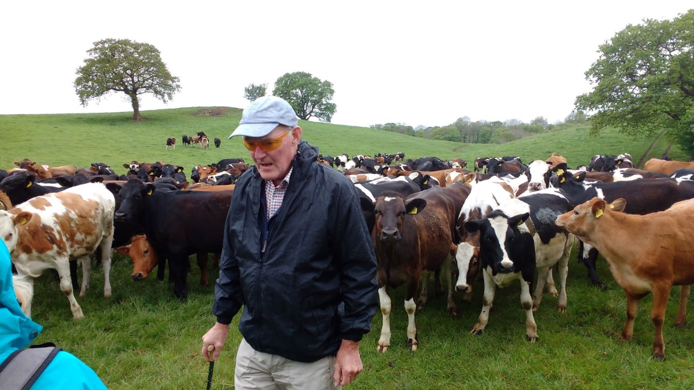
This was a gentle 4 mile stroller walk with a mixture of quiet country roads, woodland paths and fields. Fourteen people set off from Alderley Edge National Trust Car Park, crossed Macclesfield Road, and headed for the fields via Bradford Lane and Finlow Hill Lane. Despite being so close to civilisation, the views from the fields give you the impression that you are miles from anywhere. At Slade Lane, we turned right along the lane edged with bluebells and red campion. At Hocker Lane we turned left and very shortly saw a huge wood full of English bluebells in full flower. We crossed a stile and walked down the hidden path next to the bluebells. It is a very extensive bluebell wood and looked stunning in the dappled light.The next field was full of inquisitive young cattle. No doubt expecting food, they rather alarmingly rushed across to greet us, but ground to a halt when they realised it wasn’t feeding time.We turned right on Birtles Lane and walked to St Catherine’s Church, Birtles, where we stopped for a break in the peaceful churchyard.
St Catherine’s is listed as one of England’s Thousand Best Churches and is a Grade II listed building.It was originally a private chapel for the Hibbert family but is now a parish church. Its unusual octagonal tower contains eight bells and the stained glass and furnishings were collected by the Hibbert family from Germany and the Netherlands and date from the late 16th and early 17th centuries. They include a pulpit dated 1686, a medieval eagle lectern and two large brass chandeliers which are copies of those in Milan Cathedral.
We re-traced our steps for a few metres and took the path to Higher Park Farm. This took us back to Hocker Lane where we turned left and walked along a quiet country lane as far as Hayman’s Farm. Taking the footpath up Finlow Hill, we turned left and returned to the car park. A very pretty walk, which would also be perfect for a summer’s evening.
Long walkers weekend Thirsk – Group report 27/28th April
Thirsk in North Yorkshire was the base for two long walks by the East Cheshire Ramblers recently. Despite some unseasonable weather, the large group managed an eleven mile walk along the Cleveland Way on the Saturday. Starting with a car shuttle, twenty one walkers set off from below the large chalk figure known as the Kilburn White Horse.
The White Horse is the largest hill figure in the country measuring 318 feet in length and is 220 feet high and is said to be visible from around 45 miles away. The figure was created in 1857 by school master John Hodgson and his pupils together with several volunteers. During World War II it was covered up as it was a navigational landmark for enemy bombers.
Ascending steeply to the escarpment with limited views across the rainy Vale of York, the group first headed via the Sutton Bank Visitor Centre before heading east via the upland village of Cold Kirby to Flassen Dale where we stopped for lunch at some convenient picnic benches in the sheltered valley.
A short diversion was made during the afternoon to visit Rievaulx Abbey. The abbey was the first Cistercian monastery in the north of England and was founded in 1132. In this secluded corner of North Yorkshire the abbey prospered and in its heyday had around 140 monks and 500 lay brothers. Over time the abbey became one of the wealthiest in England and farmed over 24 square kilometres and had lead and iron mines. By the end of the 13th century the abbey’s fortunes waned due to an epidemic of sheep scab and suffered from raiding parties from Scotland. The Black Death in the mid 14th century meant that there was a labour shortage and the abbey was forced to lease much of its land. The final blow came with the Dissolution of the Monasteries in 1538. Our walk continued to finish in the attractive little town of Helmsley.
The weather was better for the Sunday with a ten and a half mile long circular walk on the western edge of the North York Moors following field paths and taking in the attractive villages of Boltby, Kirby Knowle and Cowesby. In the latter we stopped for lunch before ascending back onto the moors and visiting tea rooms at an isolated farm shortly before the end of the walk.

Saturday’s lunch stop in Flassen Dale with a choice of places to eat lunch – picnic benches in the rain or in the cabin in the dry.
Group walk report 21st April
Despite a fine and sunny Sunday it was a fairly small attendance for this walk from Hope in Derbyshire.
Setting off from the village we headed north on a path between houses before making the long ascent to the summit of the 462 metre Win Hill which today was very busy with walkers enjoying the fine weather.
After a break on the summit we descended north on a much quieter path and later passing through pine woods to reach the path that runs around the southern shore of Ladybower Reservoir. This very popular path was followed around to the dam at Ladybower Reservoir.
The reservoir is the largest of the three lakes in the Derwent Valley and was built between 1935 and 1943 but work was slow owing to the outbreak of World War II which resulted in a shortage of labour. The dam is 500 feet wide and is mostly constructed of a clay-cored earth embankment. Deep beneath the water nowadays is the former village of Ashopton and roads along the valley had to be diverted and now run over the Ashopton and Ladybower Viaducts.
After crossing the dam we next descended to Yorkshire Bridge before ascending to the Thornhill Trail. The trail runs along the course of a former narrow gauge railway, specially built to transport materials to build the Ladybower Reservoir. A large bench here was our lunch stop.
Our walk over to the small and attractive village of Aston was on a pleasant hill path. Aston has many interesting and picturesque cottages and the historic Aston Hall dates from 1578.
Descending across pastures towards Hope we rounded off the walk with a visit to a tea room.
Group walk report 17th April
Brian Griffiths recently led the East Cheshire ramblers on a walk exploring the industrial past around Monyash and Sheldon. Starting out from Monyash the group headed north on field path passing Hard Rake a nature reserve which has some rare limestone loving plants in season.
After crossing a road we made a descent through Deep Dale where there were many cowslips and at the foot we stopped for our morning break.
To get to Sheldon it meant a steep ascent up a wooded valley before crossing more fields to reach this former mining village.
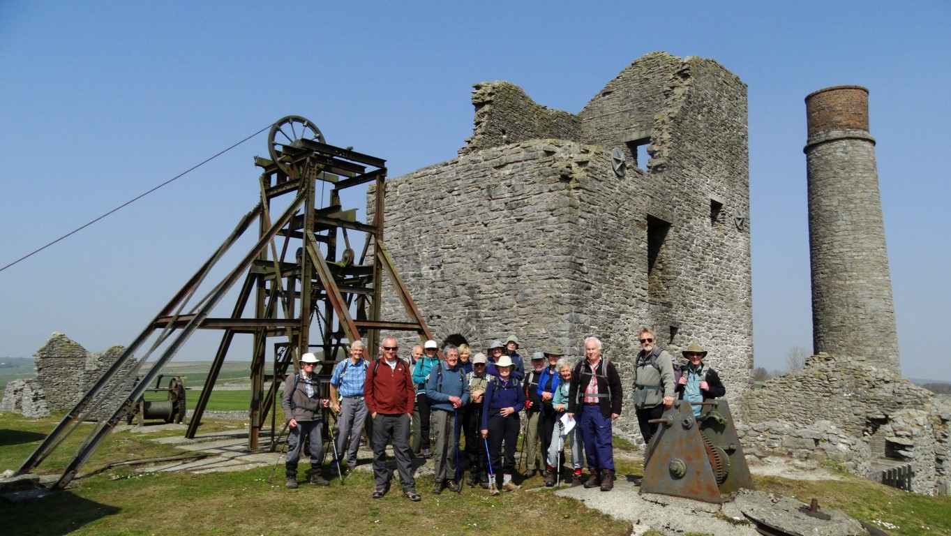
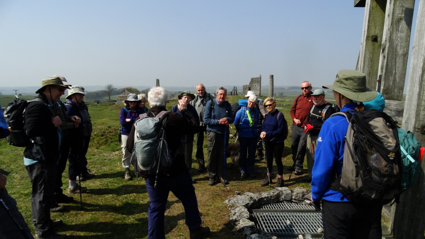
From Sheldon it was just a short walk to reach the Magpie Mine which was our stopping point for lunch. Afterwards Brian gave us a potted history of the mine. The Magpie Mine commenced operation in 1740 and was one of several mines in the area. Right from the start there was an issue with stopping the mine from flooding and by 1824 a Newcomen type engine was installed to keep the main shaft free of water. In 1827, 800 tons of lead was extracted, a record which stood until 1871 but the mine was always dogged with disputes with other nearby mines and sometimes fires were lit underground to smoke rival miners out, but this resulted in three miners being suffocated by fumes in 1839. In 1839 the famous Cornish mine engineer John Taylor was brought in to re-open the Magpie Mine and introduce a number of improvements and deepened the main shaft to 208 metres. New pumping engines were installed but water seepage remained a major problem. In 1873 a drainage channel was cut through the rock to take water away to the River Wye some two kilometres away but this proved very time consuming and costly.
For the afternoon we headed south via field paths and lanes and later descended to Lathkill Dale. Turning right, we headed upstream beside the crystal clear water which further up the valley was emerging from a cave system. En-route we stopped for an afternoon break and afterwards the group made our way back to Monyash stopping for afternoon tea in the village.
ECR Coach Trip to Arnside
A coach load of ECR members enjoyed a coach trip to the Arnside area on Morecambe Bay on a rainy day in June. Despite a dire forecast the rain never amounted to much more than a heavy drizzle and had almost stopped by the time we set off back home.
The day got off to an unusual start when we stopped to pick up one of our members in Macclesfield and had to repel boarders who had mistaken our coach for theirs and were insistently trying to join us. We shall never know if they would have enjoyed a day walking in Cumbria.
All three of our walks ended by walking over Arnside Knott and down into Arnside village. There were surprisingly good views of the Kent Estuary and the southern Lake District from the top. One disappointment was that the promised stop for ice cream before the ascent was not possible because the tea shop was closed: perhaps the weather was too bad for even hardy Cumbrian farmers.
The short walk was led by Ruth Harrison and started a mile or so along the coast from Arnside at Sandside heading inland through the village streets and over fields to the peel (or pele?) tower at Hazelslack. The route then took us round Silverdale Moss across surprisingly dry fields to a pleasant walk through woodland to the ruin of Arnside Tower and its closed café. This led to the only serious ascent of the day through the woods surrounding the Knott. The Knott has superb views over the estuary, the Lakeland hills and back towards the Tower. The walk finished with a descent to Arnside and its welcoming cafés, most of which were actually open.
Short walkers on Arnside Knott
Hazelslack Tower
Arnside Tower
The medium walk was led by Steve Hull and started near the fire station in Milnthorpe walking across a playing field by the River Bela to avoid the narrow village streets. We made a sharp turn to cross the river near to Dallam Tower (another peel tower) and then walked across the deer park with its many deer calves. After passing a deer shelter and two mills – one for making specialised paper and one an ancient corn mill – we took a path overgrown cow parsley which proved to be the wettest part of the day. The route then went up through woods to the Fairy Steps. None of our party took up the challenge of descending the steps. The descent to Hazelslack was taken slowly across slippery limestone where we joined the route of the short walk. We followed that route until Arnside Knott, from where we descended to walk along the coast for the last half mile into Arnside. On top of the Knott we heard the siren warning of the approaching bore across Morecambe Bay which can be very dangerous for the unwary.
Medium walkers on Arnside Knott with Arnside Tower in the background
Arnside Viaduct from the Knott
The long walk, led by Colin Park,started close to Carnforth station where the 1945 film ‘Brief Encounter’ was filmed and then proceeded via Warton village with its ruined old rectory to Warton Crag which with its wooded limestone country required some complicated navigation. From the crag the walk continued through Leighton Moss Nature Reserve down to the coast at Crag Foot and then along the coast via Jenny Brown’s Point and Jack Scout to the west of Silverdale. After taking the coast route round Arnside Park the party ascended Arnside Knott and so back to the coach at Arnside.
Near Jenny Brown’s Point on the long walk (Warduck’s Wall)
Coastal viewSilverdale Cove
Text: Steve Hull
Photos: Jenny Bordoli, Maggie Swindells, Sylvia Hill
Four days on the Black Cuillin
So what is the Black Cuillin? It might be only seven miles long but this formidable chain of jagged peaks on the Isle of Skye is like no other in the British Isles and contains eleven Munro summits. The rocky summits tower skywards above sheer rock faces and consist of a complicated mix of the volcanic rock known as gabbro intruded with basalt dykes and several other rarer rocks including the very metallic peridotite which play havoc with your compass bearing. Knocking two pieces of peridotite together gives very much a metallic chink. The gabbro is very coarse and gives a good grip but the basalt becomes slippery when wet so it is idea to distinguish what you are walking on.
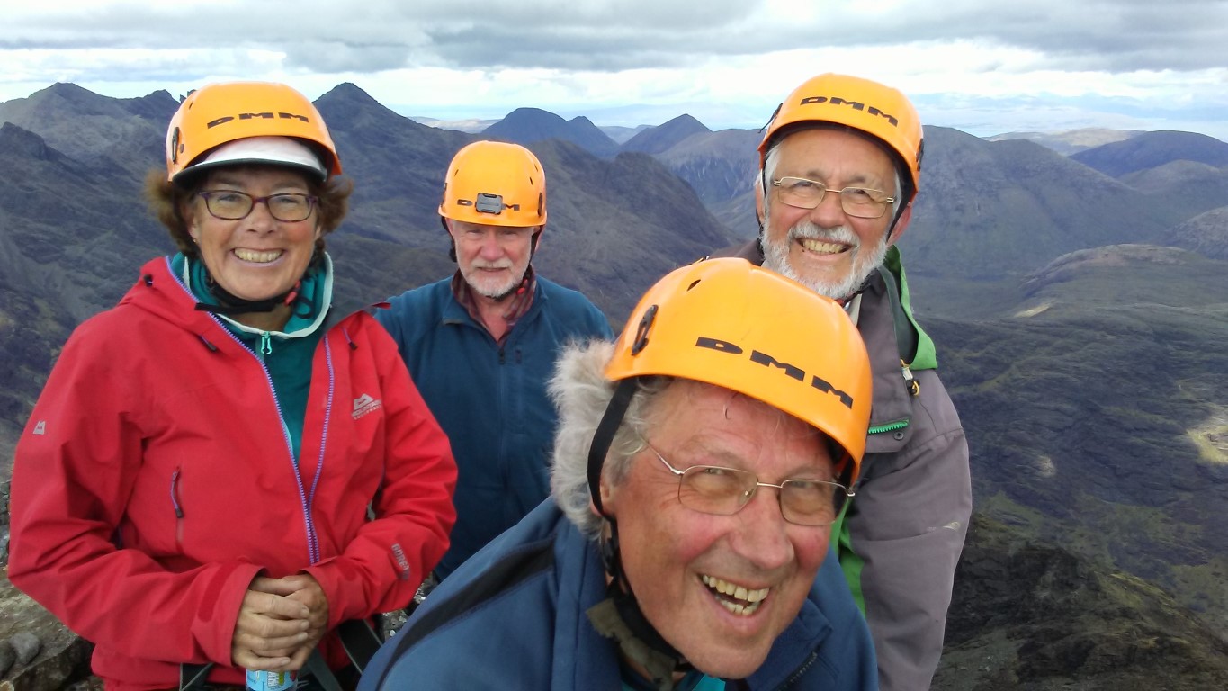
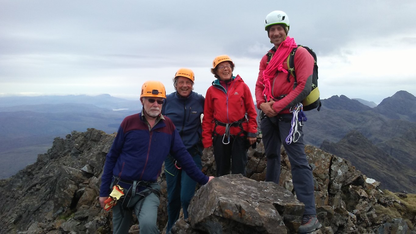
So here we are, four members of the East Cheshire Ramblers about to embark on quite an adventure. Due to the nature of the Cuillin’s we have hired a guide not only lead us up and down through the maze of crags but also to lead us roped up through trickier areas and to oversee and help us down anything we need to abseil.
For myself, I had only been up one of the Munro’s on Skye and that was the outlier of Blaven many years ago but for all of us, this was a new area to us all.
It’s a Saturday in May and the fine weather of the past week is at an end. Gathering at The Sligachan Hotel which everyone calls ‘The Slig’ we meet our guide for the next four days Tom who works for West Coast Mountain Guides. Like every day, it’s going to be an early start.
The weather forecast which as we find out is not always that accurate suggests that today will be the worst day of the next four so we opt to do the easiest walk of the four days to ease our way in and get a feel to the area. With Tom on board, we travel in one car to the start and today’s walk will be to scale two Munro’s – Sgurr a’ Ghreadaidh 973 metres then Sgurr a’ Mhadaidh 918 metres.
Setting off from Glen Brittle Youth Hostel our rucksacks are filled of not the usual items. This time we have to stuff in a hard hat, and harness together with an array of carabiners. Out goes my heavy camera – I will have to make do with my phone camera and hence the quality of my photographs won’t be quite as good. I don’t even need a map. For myself, it feels a bit strange going into a mountainous area without a map but we have full confidence in Tom.
At a steady pace we trek uphill beside the Allt a’ Choire Ghreadaidh with Tom leading our little group and after a good hour and a half we are well up into Coire An Dorus. Ahead lies a narrowing stone shoot leading up to the narrow gully leading to the An Dorus Gap which will ultimately lead up to both Munro’s. After a brief break it’s time to put on our yellow hard hat and get kitted up with our harnesses. Tom produces a rope and links us all up to give us practice of walking with a rope as a group. The rope needs to be kept taut. For now the yellow hard hat will give us some protection from any loose rock from falling from above. As we gain height so the stone shoot narrows and we have some easy scrambling up over some bigger rock steps. The crest of the ridge comes very suddenly with a steep drop going down the far side over rocky crags towards Loch Coruisk. It’s here that we are going to leave our rucksacks to tackle Sgurr a’ Ghreadaidh.
From An Dorus Gap there is a rock wall on either side. Tom leads out to belay some fifty feet about and shouts down for us to start climbing. Roped together means progress is slow. The key is remembering how Tom tackled this first bit and where do you put your feet. One by one we work our way up this first bit of somewhat awkward rock face. Beyond, the steep ascent continues but for much of the way is just a scramble except for a couple of awkward steps. It’s our first experience of being somewhere with a big drop below. A large rocky tower, known locally as ‘The Wart’ is skirted around on the western side to gain the tiny summit. It’s one summit down and ten to go. And yes we have got a view despite the grey overcast day.

The route taken up and down Sgurr a’ Ghreadaidh. Note the party making the ascent as we did a hour or so earlier.
Our route back is as our upward route except this will involve what is known as ‘down climbing’. With me roped up at the rear of the group on the way up it now my turn to lead and remember our upward route on the way down. It’s not as easy as you think as you are often climbing down semi blind feeling for good rock steps to ease your way down. It helps to lean out and to look down to get an idea where you are going. For everyone else you can guide them down, sometimes by catching hold of an ankle above you and guiding a foot onto a rock step. Meanwhile Tom at the top has secured the rope before climbing down himself.
Climbing out of the gap on the other side, this time with rucksacks also involves a short climb but we are soon on ‘easier’ ground if you can call it easier where we stop for a short lunch break. Coming to lunch breaks – stops were always very short and time only to grab a sandwich and a quick drink before we are off again.
Sgurr a’ Mhadaidh, our second Munro of the day proves more of a straightforward ascent. We were no longer roped up which made progress is much quicker. Dumping our rucksacks once more we scrambled up among the crags and were soon on this second airy summit. Again we are fortunate enough to get good views. The promised rain is nowhere to be seen.
Retracing our steps we were soon reunited with our rucksacks and time for another quick snack. Tom now searches out a easier route down to the An Dorus Stone Shoot where we descend as per our outward route.
We reached Glen Brittle Youth Hostel by mid afternoon and Tom has been pleased at our progress.
It’s day two and after the first successful day on the Black Cuillin, the weather has taken a turn for the worst. The weather forecast suggests that it will improve as the day goes on and fingers crossed the low cloud will lift off the mountains. As usual it’s a early start and we meet up with Tom at ‘The Slig’. Putting off the infamous ‘In Pinn’ for a better day we opt to do the three northernmost Munro’s – Bruach na Frithe, 958 metres, Am Basteir 935 metres and Sgurr nan Gillean 965 metres.
From the word go, the weather doesn’t look good with steady fine rain and the mist and murk well down on the mountains. It’s a case of donning wet weather gear even when we start.
It’s a long walk in but it’s a good path to follow and it seems that we are the only ones setting out this morning. It’s such a pity that we have no views as the landscape ahead is quite spectacular with the pinnacle ridge of Sgurr nan Gillean towering ahead and to our left. As we gain height so that landscape gradually mists away. Reaching the western side of the Bhasteir Gorge we now need to clamber up to our right. There are several rock terraces and it’s very easy to take the wrong one. Tom scouts on to check that the route ahead the correct one. Once over this area we enter the hanging valley of Coire a Bhasteir but little can be seen. The whole place is choked withthick mist. Tom leads us up among scree slopes and crags towards the northern precipitous face of Am Basteir with a brief stop to put on hard hats. Conditions are certainly not improving and the fine rain at the foot of the mountain has turned to steady rain.
The decision is made to get to the top of Bruach na Frithe first which is the easiest of the three Munro’s planned for today. Dumping rucksacks, we toil up the steep scree slope below the overhanging northern face of Am Basteir and the cliffs are giving some shelter. The Bhasteir Tooth rises skyward into the mist but we do get an misty outline of this in the thick mist. Beyond, we round a craggy top before scrambling along to the summit of Bruach na Frithe. Crowned with a trig point it is the only summit with a trig point in this group of eleven Munro’s. It’s just unfortunate that the view is simply nil today.

The summit of Bruach na Frithe. The only summit in the Black Cuillin with a trig point but today there was simply no view.
We pick our way back along the ridge and down to our rucksacks for our lunch stop in the rain. The rocks are all running with water and in a discussion over lunch we opt to abandon any attempt on scaling anymore Munro’s today. It does mean now that we will not achieve our target of doing all eleven Munro’s on this trip but having said that, few groups are successful in completing all these Munro’s on one trip. The weather needs to be on your side and secondly the party needs to be very fit.
Disappointed we head back downhill crossing a stream that has swollen in the past three hours. We are all quite damp and glad to get back for a decent shower and freshen up. So we are half way through our course but only three Munro’s climbed.
It’s the penultimate day and despite not a very promising start weather wise we opt for the longest walk of the four days. It’s just three of us today plus our guide as Monica has been attracted to the bright lights of Portree. Again we collect Tom from ‘The Slig’ and travel down to the camp side above Glen Brittle Beach.
It’s a early start with three Munro’s ahead of us with Sgurr nan Eag 924 metres on the cards first, followed by Sgurr Dubh Mor 944 metres and a ascent of Sgurr Alasdair 993 metres to finish with.
It’s a long walk in over relatively easy ground and slowly ascending with increasingly good views out to sea to Rum, Eigg and Tiree with the Outer Hebrides on the far horizon. To the west it is quite sunny but showers are building up already with a few shafts of rain falling here and there. After a good two miles we start to head up into Coire Ghrunnda and the terrain soon becomes steep with a jumble of house size boulders to negotiate. Tom has a good balance and is able to walk from boulder to boulder with confidence but the rest of us take on this part a bit more caution. A further steep rocky ascent which requires a bit of knowhow on way finding climbs up to a second hanging corrie and Loch Coir a Ghrunnda. It’s time for a short morning break before skirting the loch and pressing up the scree and crag slope over increasingly difficult ground. Nearing the crest of the ridge it’s time to dump rucksacks before picking our way along the airy ridge to Sgurr nan Eag where we get a excellent view. The hill cloud of earlier is lifting off the tops. It’s now a case of returning to our rucksacks.
With a quick bite to eat we are off again bound for Sgurr Dubh Mor and this section of the walk proves quite tricky. Although we do manage to bypass the rock stack called Caisteal a Garbh-choire. The route chosen is called the ‘Runners traverse’ which skirts along the eastern side of several crags and this proves a little used route and involved a fair bit of scrambling.
On the ridge west of Sgurr Dubh Mor the rucksacks are left again before making quite a difficult ascent to this summit which involves a few awkward moves and working your way up a chimney. This summit lies off the main Cuillin ridge and it proves time consuming to reach. Roped up, Rob leads us down towards our rucksacks but takes us out onto an airy ledge which we decide to call Rob’s Traverse – an airy little walk with a big drop but good hand holds. It is like standing on the window sill of a three story building!
Re-united with our rucksacks, it is time to bag the last summit of the day and the highest in the Cuillins. To get to the summit of Sgurr Alasdair meant skirting along the southern flank below sheer cliffs on a steep scree covered slope to gain the south western ridge via a ‘chimney’ not far from the summit. The chimney proves a hard climb and in places we have to use our feet on one side and our back on the other to work your way up. As usual Tom was always above with the rope secured. The last little bit is an airy scramble to the tiny summit with the ground falling away either side into the abyss.
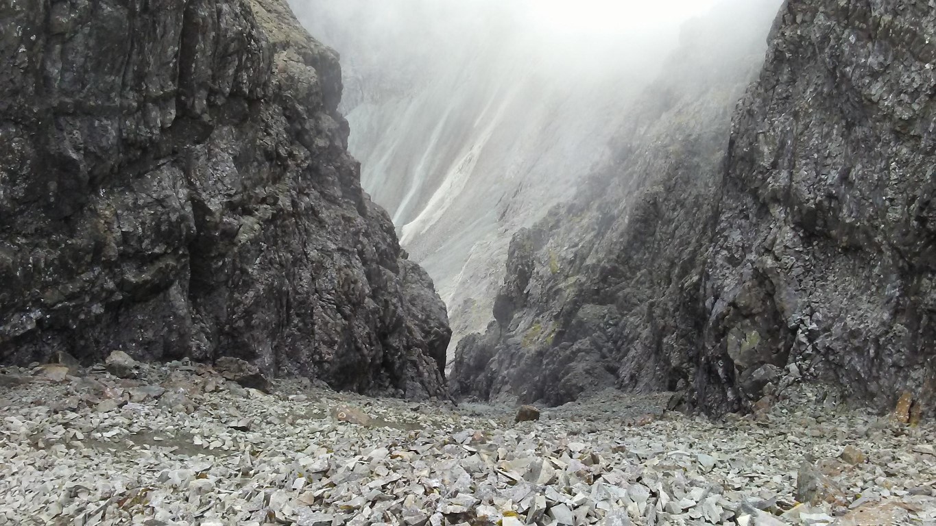
For a few minutes we were the highest people in the Hebrides. Now for the descent which means working our way along a narrow rocky ridge down to the top of the Great Stone Shoot where we stopped for a break. Hemmed in by the rock walls of Sgurr Alasdair on one side and Sgurr Thearlaich on the other, The Great Stone Shoot is the longest scree slope in Britain but the angular stones come in all shapes and sizes, with the stones at the bottom generally smaller. The descent is incredibly steep and once in motion it is difficult to stop. This is where our builder gloves come in handy as virtually no one descends this steep slope without sliding down on their backside.
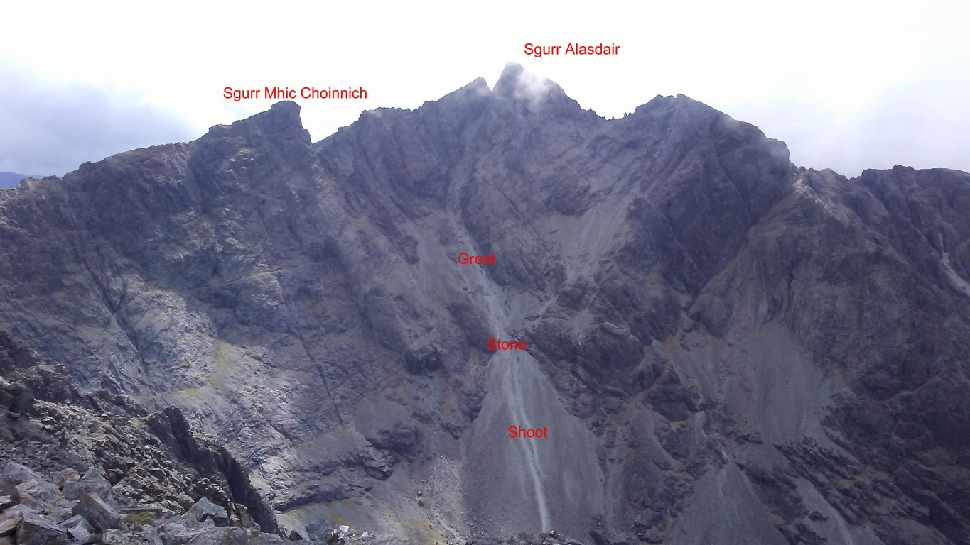
The view of the Great Stone Shoot taken on the following day. We descended this route from Sgurr Alasdair. At nearly 2000 feet it is the longest scree slope in Britain as is incredibly steep.
Some of us were quicker than others and others (not in our party) spent more time on their rear coming down. The hard hats are essential and it was well advised to keep well apart from anyone else due to the amount of loose stone. Safely at the bottom we are reunited for the walk back to the car and a later than usual finish and our tally on the Cuillin Munro’s now totalled six.
Monica has rejoined us for the last day and we are now faced with our greatest challenge. The ascent of the Inaccessible Pinnacle 986 metres and Sgurr Mhic Choinnich 948 metres rated as first and second hardest Munro’s to climb.
From the start we have ruled out climbing Sgurr na Banachdich, – a Munro but a much easier one which can be reached without a guide. The decision is taken to climb directly from the Glen Brittle Memorial Hut up the western ridge of Sgurr Dearg and going via this route we gain height quickly. The ascent is fairly straightforward with just a little easy scrambling among the crags higher up. Other groups have set out before us and so are expecting a queue to climb the In Pinn. At least today, the visibility is excellent and away from the mountainous areas it is quite sunny.
We reach the top of Sgurr Dearg before noon and made the down climb of steep sloping rock with loose scree to the base of the In Pinn. In the silence of the late morning some thousand feet below us comes the sound of crashing rock and as we find out later, several hundred tonnes of rock had come away from the mountain side and has scattered down the steep slope. The biggest pieces are the size of a bus so we were just glad we were not in that area at the time. With Monica and myself reaching the point where we have to make the climb of the In Pinn first, Tom decides to lead us first as there is no queue. Meanwhile Nick and Rob will have lunch and await for our return. The Matterhorn and most Alpine peaks were conquered before the In Pinn and it wasn’t until 1880 that the In Pinn was finally climbed by Charles and Lawrence Pilkington. They were guided to the foot of the climb from Sligachan via Coruisk and Bealach Coire na Banachdich by a local shepherd called John Mackenzie.
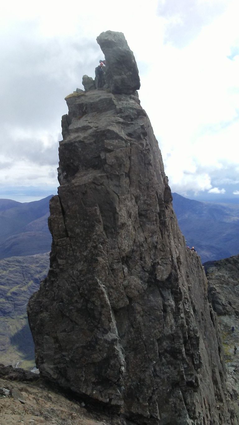
Our first view of the ‘In Pinn’. Note the climber on top. We will abseil off this side later. We will ascend via the ‘easier’ far side.

The side we ascended The ‘In Pinn’. monica can be seen in the stone shelter, bottom left. the ascent is very exposed on either side so best not attempted in wet and or windy weather.

Nick followed by Rob on the first pitch of the ‘In Pinn’. The guide only takes two of us up at any one time. Tom our guide is out of sight just over the pinnacle.

The view on top of the ‘In Pinn’ looking southeast. Being roped up and constantly on the move there are few precious moments to get photographs.
Tom sets off up the knife edge ridge to secure the rope for the first pitch and we watch carefully where Tom is placing his feet. Monica and I are attached on the rope at the bottom with Monica taking the lead. I follow on behind at the end of the rope. The first thirty feet is fairly straightforward but then you have to get onto the knife edge ridge with hand and footholds quite smooth over time. Re-united briefly with Tom he then climbs the second pitch whilst Monica and I cling on the narrow ledge above the abyss. Tom shouts down to start climbing. It is getting airy with an overhanging and infinite drop on one side, and a drop on the other side even steeper and longer. Now concentrating on what I am doing and planning each step is paramount. Now I know that climbing shoes are better than walking boots in this type of terrain. The footholds are so small that below the soles of my boots are hundreds of feet of air! I cling on trusting that my hands will hold as the knife edge steepens and daring not to look down. Thankfully the ridge eases but at the same time gets much narrower as we make our way to the airy summit with much relief.
It is now time to abseil down the steep side, an eighteen metre sheer rock face. Tom is going to do a stacked abseil meaning we would all go down the same rope. The massive rock on the summit has a fixed chain around it with carabiners which you can attach the rope. Now I am thankful that I had abseiled before and I am more confident for the descent. Tom descends first with me following and remembering what I had learnt on Tegg’s Nose a few weeks earlier. Lean well back, feet apart and let the rope feed through your hands as you walk backward down the rock face. It is all over in a moment with feet firmly on terra firma. Monica follows confidently and at speed and the three of us make our way back to Nick and Rob.
It is now their turn and again Tom leads on up the rock face before Nick and Rob start out on their ascent. Meanwhile Monica and I settle down to lunch in the shelter of a dry stone wall but it seems a long time before the three of them return and we are beginning to get cold.
We are glad to set off and made our way slowly down to the col above An Stac screes. On the way we pass the massive rock fall from a couple of hours earlier which lay right on our path and it seems that more rock is ready to fall, hence we don’t hang about here.
Dumping rucksacks we will now attempt the climb of Sgurr Mhic Choinnich which is said to be the second hardest Munro in the Black Cuillin. there are certainly some very airy drops as you work your way along the ridge.

On the summit of Sgurr a’ Ghreadaidh with the view towards Sgurr Thearlaich and Sgurr Alasdair. note the climber at the summit.
Near the col we pause awhile and leave the rucksacks weighted down with a few rocks before making the ascent on the complicated Sgurr Mhic Choinnich. The summit is said to be the second hardest Munro to climb in the country and route finding proves not easy. For much of the way we are roped together and Tom opts to keep us right on the crest which in places has an almost sheer drop of several hundred feet on the western side. The summit is narrow with smooth steep slopes on either side almost as if you were on the apex of a rouse with steeply sloping roofs.

The red arrows show the route taken from Sgurr Dearg and The In Pinn to the top of the An Stac screes. there had been a rock fall of several hundred tonnes a couple of hours prior to this photograph being taken.
For the return, I lead the way, picking my way along the crest and all the time we are roped up. I find a ‘chimney’ which seems an easier route and once in it we are committed until we can gain the ridge again. Back with our rucksacks after what seems to be quite a long time we take a break before descending the An Stac screes which although much shorter than the Great Stone Shoot we still end up with us well spaced out. The walk out was from Loch Coire Lagan is noted for its smooth rock gouged out by glaciers.
 Smooth rock gouged out by glaciers make these features look a bit out of place. This rock looked like a stranded whale. This photograph was taken in Coire Lagan on our last day in the Black Cuillins. The Cioch is shown up by the shadow it is casting on the rock face.
High to our left we spot two climbers high up on the rock face called The Cioch. This is a massive piece of rock which almost defies gravity and sticks out of the rock face. In 1986 it featured as the setting for a sword-fight in the movie ‘Highlander’. Our pace now quickens as we gain easier ground and in afternoon sunshine make our way back to the Glen Brittle Memorial Hut.
Overall we had bagged eight of the eleven Munro’s we had set out to do and the weather has been kind to us on three of the four days. I understand that you could go to the Cuillins and bag no Munro’s if the weather was bad and so overall we haven’t done too bad. Having said that, we are all very grateful to our guide, Tom Sylvester which without him, this adventure would not have been possible.
Group walk report 10th April
With the promise of a reasonable day it was somewhat of a shock as arriving at Curbar Gap Car Park we were greeted by a biting and raw easterly wind.
We set out by heading north on what was to be a walk along ‘five edges’ and first of all we followed Curbar Edge for nearly a mile before descending and doubling back below the cliff face. At Warren Lodge we took the lane downhill for a short distance then took paths around the southern side of Curbar village passing on the way the converted ‘lock-up’ which dates from 1780 and was used as a local gaol.
After stopping for a morning break we continued via Gorsebank Lane to reach Baslow where we took a path down to cross the busy A619 close to the Cavendish Hotel. We were soon in Chatsworth Park entering via the unusual Cannon Kissing Gate. We ascended across the park entering woodlands at Dobb Edge. At the top we turned sharp left to follow the concessionary path along the ridge and later at a sheltered spot behind a high wall we stopped for our lunch out of the wind.
For the afternoon leg of the walk in which the sun made more of an appearance, we continued on the concessionary path to the A619 and crossed to the Robin Hood Public House before making our way up onto Birchen Edge. We paused briefly by the ‘Three Ships’ – three rock outcrops where the names of ships that Horatio Nelson served on are engraved into the rock face. The three names are Soverin, Defiance and Victory. Nearby is Nelson’s Monument which was originally erected in 1810 by John Brightman, a Baslow man. Reaching the trig point we took a un-defined path to the less known Gardom’s Edge. From here we headed northeast to reach the crossroads of the A621 and Clodhall Lane.
Heading west next we made for the Wellington Monument which was erected by a local man called Doctor Wrench who felt the need to counterbalance the memorial dedicated to Admiral Nelson on nearby Birchen Edge. Heading back towards the cars we took the path north soon passing the gritstone outcrop known as Eagle Stone rather than follow the edge itself. This lone boulder is quite a landmark and historically, an ascent of the stone was a rite of passage for the young men of Baslow who were suppose to climb the stone before proposing marriage to a local maiden. The day finished with a visit to the tea room at the Derbyshire Craft Centre.
Group walk report 2nd April
By Sue Thersby
A recent East Cheshire Rambler’s circular walk started from Hayfield in Derbyshire. There were eleven of us, in spite of the rain. The first written record of Hayfield is to be found in the Doomsday Book when it was called ‘Hedfeld’ and was a natural clearing in the vast forest at the foot of the Kinder Scout, the highest point in the Peak District (2088ft) and the southernmost point of the Pennine Chain. It became a mill village from the 17th century onwards and is famous as the birth place and childhood home of Arthur Lowe (Captain Mainwaring in Classic ‘Dad’s Army’) whose home is marked by a blue plaque, which we passed on our way towards Kinder Reservoir.
We climbed up the cobbled path to the west of the reservoir before turning westwards to arrive at the shooting cabin, where we had our morning break. After crossing Middle Moor, our route took us northwards, parallel to the Glossop Road before we crossed it, just before the now closed Grouse Inn. We then passed through a couple of farms before joining the Pennine Bridleway for a short distance. Continuing our way past Higher Plainsteads and Rocks Farms, we climbed gradually up to Cown Edge, from where we had 360-degree views over the surrounding countryside with Glossop to the east and Charlesworth to the north. We walked along the whole of the ridge in a generally southerly direction until we descended to Rowarth, a small village, which is locally famous for the Little Mill Inn, a pub and restaurant in a former candlewick mill, with a waterwheel in the adjacent stream. The Little Mill has a retired Brighton Belle Pullman railway coach which is used as guest accommodation.
Changing our orientation to south-easterly we passed Laneside Farm before climbing up a bridleway which eventually took us to the Pennine Bridleway again and Lantern Pike. Here our party split up and the more energetic climbed up the Pike, which boasts an orientation table and has magnificent views, whilst the others contoured round it. Finally, we gradually descended back into Hayfield via Upper Cliffe Farm. We were lucky enough to find the local chocolatier open at the end of the walk for our usual refreshments.


