
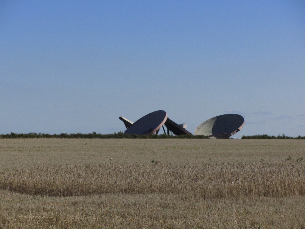
Abandoned tropospheric scatter dishes at the former RAF Stenigot are a landmark for many miles around.
Lincolnshire is not all flat. Much of the county is gently undulating with the highest ground rising to around 550 feet above sea level on the Lincolnshire Wolds. The Wolds have been designated an area of outstanding natural beauty and this area of Eastern England has the highest land between East Yorkshire and Kent.
For this walk the weather couldn’t have been better with deep blue skies and strong September sunshine greeted my wife and me as we drove from our base in Lincoln across the Wolds to start our walk from the attractive village of Donington on Bain. We found parking in a cul de sac road south of the church and by mid morning we set off passing the small village church to join the Viking Way southwards. The Viking Way is a pleasant way marked 147 mile long trail running from Barton upon Humber to Oakham in Rutland which over the years I have walked in its entirety.
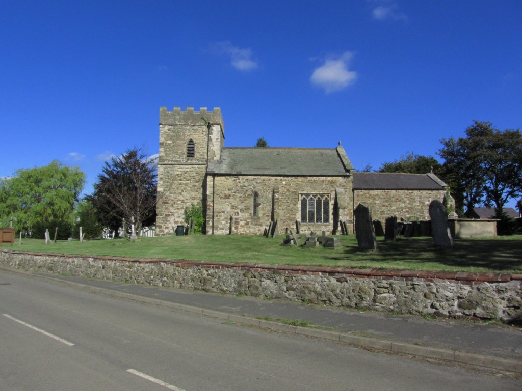
St Andrew’s Church at Donington on Bain dates from the 12th century.
The path south from the village was good and well defined as we followed field boundaries later joining a lane through Fox Covert. A left turn took us onto the aptly name Sandy Lane. At the end we turned right to follow a quiet road to reach the small isolated church at Stenigot, a grade II listed building. It was a left turn here to make a long ascent for Lincolnshire standards up through the hamlet of Stenigot.

The isolated church at Stenigot lies well away from the village.
At the top of the hill I went in search of a trig point which being at a road junction I thought would be an ‘easy bag’. It was anything but as I had to crawl under a hedge, over a fence into a field and back over the same fence to reach the well hidden trig point. With a few scratches to boot I had to return the same way. I had told my wife to wander on which she did and she was well down the lane by the time I emerged from my little adventure.

The 360 foot high former radar tower at RAF Stenigot is one of a few left that formed a vital link in Britains defence during WW2.
We had hoped to cut the corner by walking via the track passing Cold Harbour Farm but this was private and so we had to walk around via the roads to join our intended track leading to the ex RAF Base at Stenigot. The site is dominated by the disused 360 foot tall Stenigot Tower, now a grade two listed structure and was once one of a chain of radar towers used to detect incoming German aircraft during WWII. We stopped for a picnic in a field nearby with a view southwest across Lincolnshire. We spoke briefly to some residents living directly below the tower who surprisingly didn’t really know what the tower was for.
Taking the lane west, we soon turned right on a track north and soon made a diversion to visit some disused tropospheric scatter dishes, dumped in a corner of a field. Again these were a landmark for miles around and I was able to explore the dishes at close quarters. Back on the track north, my wife decided to head back to the car as we were quite close to our start point so I gave her instructions which way to go.
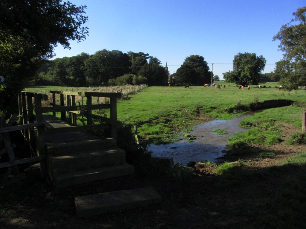
A peaceful September afternoon on the Viking Way at Biscathorpe. This is where the trail crosses the infant River Bain.
I for one wanted to explore Biscathorpe, a medieval deserted village a little further north and in any case it was too early in the afternoon to finish the walk. Going our separate ways I started meeting many other walkers and got chatting with one man when I crossed the next lane. The track ahead was most pleasant with wide views under a deep blue sky and it was just good to be out. Skirting around to the west I joined a lane down to Biscathorpe, a parish which today has only three buildings. A few people were out walking here. The lane ran west across a common area passing through a couple of fords with cows grazing in the area. I didn’t really have time to go to explore the mounds forming the medieval village but instead made a small diversion to visit the little church nearby. There are many deserted villages in the Lincolnshire Wolds but these villages didn’t disappear during the Black Death, but apparently it was due to the changes in agriculture practises as during the fifteen hundreds, sheep farming became more profitable over agriculture and was much less labour intensive resulting in many labourers moving away. My return to Donington on Bain was along the Viking Way which followed fairly closely to the infant River Bain and later along the road back to the car.
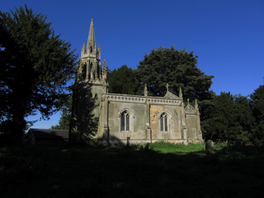
St Helen’s Church at Bicscathrope – one of only three buildings in this deserted medieval village