

The bulk of Nephin rises above the Plains of Mayo.
Nephin is a mountain few of us have heard of but rising above the Plains of County Mayo in the north west of Ireland, this hulk of a mountain is quite a feature in the surrounding area. With a prominence of 768 metres it is the highest standalone mountain in Ireland and yet it’s not even a ‘county top’ with that claim going to Mwellrea which is just eight metres higher.
Conical Nephin rises from the surrounding plain to 806 metres or 2646 feet in old money and its name translated means either ‘heavenly’ ‘sanctuary’ or ‘Finn’s Heaven’.
If the mountain was ‘plonked’ down in southeast England then it would probably have a cafe on the summit and a chairlift but here in Ireland only a sketchy path leads to the top.

‘A stile’ This looks promising. A sketchy path does go part way up the south western ridge. I had to negotiate getting through the forest below to get to this point.
Nephin has always been a mountain that I wanted to climb and being isolated from any other peak it would be idea for a half day walk. The only feasible way of climbing was to ascend and descend the same way. One big problem is that on most sides the mountain it is surrounded by farmland and so access is limited to a few points. I had done my research and found that the easiest way to climb the mountain was from a forestry track to the southwest.
Arriving fairly early, I parked in the secluded entrance to the forest track and after scaling a gate was soon heading up the easy forest track which abruptly ended at a clearing. I now had the hardest part of the walk by pushing my way through around two hundred yards of forest undergrowth and removing my rucksack to squeeze under tree branches. Having crossed a bard wire fence I was now on uneasy tussocky grass before negotiating a bank covered in bracken to gain the southwest ridge. I soon came across a fence and was pleased to see a stile so at least I was in the right area to climb the long southwest ridge. For now there wasn’t a path and any such sheep path tended to veer off along the southern side of the mountain. I toiled upward but at least the terrain was becoming easier. I did eventually find a path which petered out as I reached stonier ground. Despite no path from here onwards, the ridge was dotted with cairns. The early sunshine was disappearing and patches of cloud occasionally brushed the summit but thankfully this wasn’t an issue. One hour and forty five minutes I was on the 806 metre summit but timed it as cloud obscured the top briefly. I had donned my waterproof coat earlier as it was quite cold at this altitude, and I was even wishing I had brought gloves with me despite it being May.

The fine walk up the south western ridge does have a sketchy path and the views are opening out nicely.
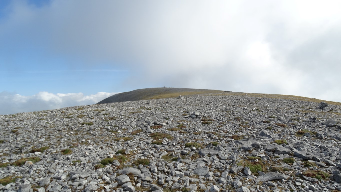
Almost there as the terrain becomes stonier as I near the summit.

Clouds begin to brush the summit as I make the last few steps towards the trig point.
At the trig point I stopped for my morning break and surveyed the view but due to the cloud base being only just above the summit it was a bit limited and furthermore it wasn’t a place to while away the day as it was quite cold. Having taken a few photographs I set off down the way I had come. The weather was improving and cloud base lifting to reveal a most pleasant but cool day. I stayed with the path on the way down which became rather sketchy and decided to enter the forestry at a different point. This was not a wise move and I had to skirt around to my original upward route. I had expected to have seen other walkers on this fine Saturday but I reached the car without meeting anyone. It was still only 11.30am and I had been up and down inside 3 hours.

The view from the top and almost into the cloud.