
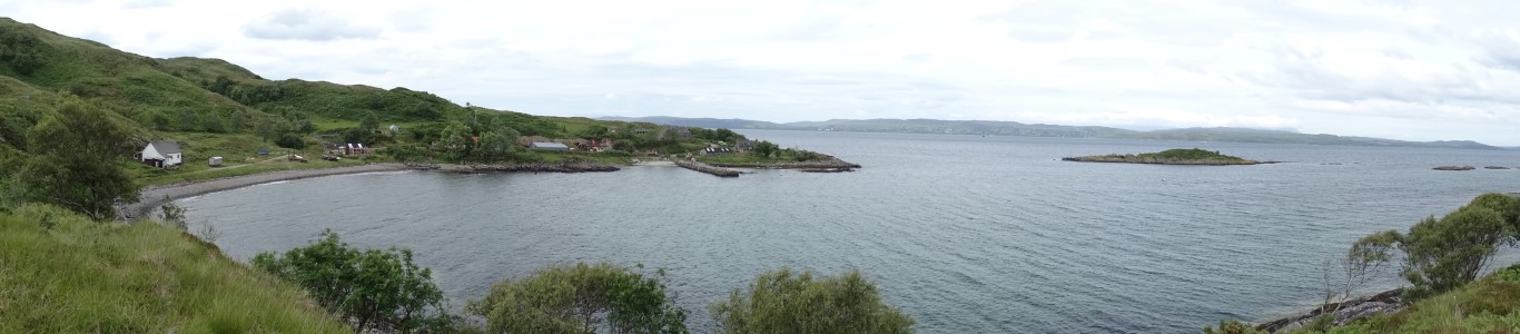
A panoramic view of Airor. Probably one of the remotest settlements on the British mainland.
Its day two of my three day stay on Knoydart and the weather forecast isn’t that good with rain forecast to spread in during the afternoon. Rather than get caught out on the mountains in bad weather I’m opting to walk low level today and head out to see what the hamlet of Airor has to offer. Staying at the Foundation Bunkhouse in Inverie I am the only person in my eight bed dormitory and even in the kitchen there is hardly anyone around.
Setting off by 8.30am I’m going to get the hardest bit of the walk out of the way first before it rains. At least the walk back from Airor is on a road and hence no problem with tall vegetation to wade through. One line of thought is to follow the good track all the way to Inverguseran then ford the Abhainn Inbhir Ghuiserein near its mouth as some maps mark ‘stepping stones’ but my timing will coincide with the high tide. A wiser and safer choice is to stay on the southwest side of the river and work my way the down to the coast despite no path shown on the map and this may mean a walk of two miles over difficult terrain.
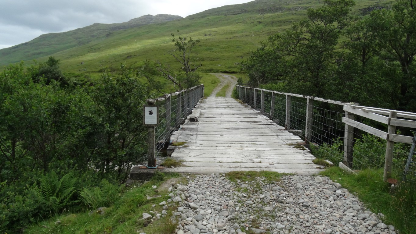
To cross or not to cross, that is the question. Crossing the bridge and staying with the good track will mean fording the river at its mouth.
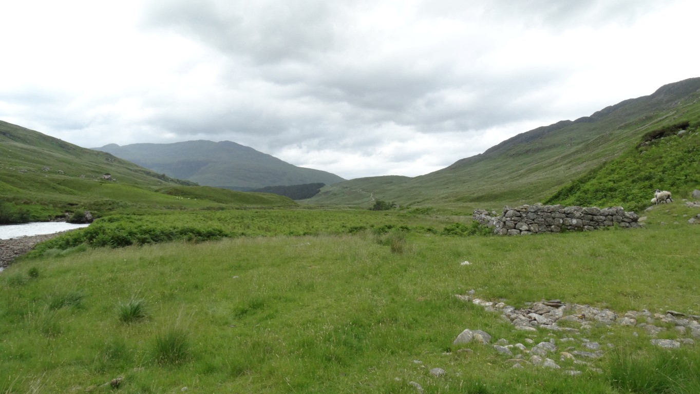
The view back towards Mam Uidhe from the ruin at Cluainairighe. I had crossed the moors on a good track (just visible in the distance) and was following the riverside down to the coast. No path was shown on the map but for now the terrain was easy going.
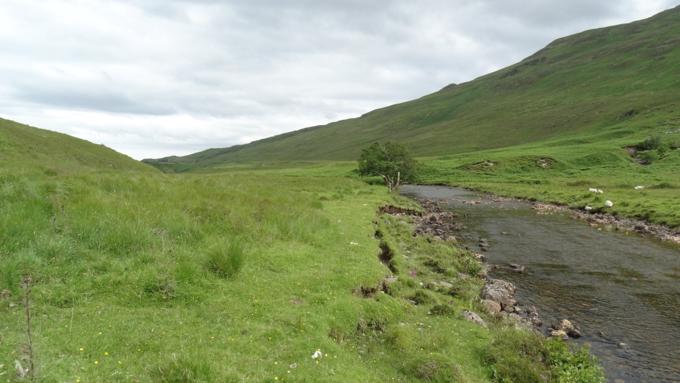
Following the river bank of the Abhainn Inbhir Ghuiserein towards the sea. There is a good track on the far side but using it would have meant fording the river at its mouth. for now the terrain was better than expected.
Inverie is again deserted on this cloudy morning and I set a good pace out of the village on the track I had followed the previous evening. The cloud base is down on the mountains but not that low. I cross Mam Uidhe on a good moorland track before dropping down to the bridge over the Abhainn Inbhir Ghuiserein some two miles upstream from the point where it enters the sea. The river is running fairly high and quite wisely I opt to stay on the south western bank where I spot a quad bike track alongside the river. Surprisingly a path of sorts runs along the river bank down to the ruinous building at Cluainairighe. Beyond this spot the path becomes a bit more intermittent and further down near a sharp bend in the river I have to climb a high deer fence and cross tussocky terrain to easier and higher ground. Here I find another path which soon leads to a gate before crossing rough pasture down to the coast at Inverguseran. My decision had been right not to cross the river as despite a scattering of rocks in the river and a rough but wide ford I would have been up to my knees in water. Satisfied, I continue around to a spot overlooking the Sound of Sleat to stop for my morning break at a deserted pebble beach and the sound of silence. A large piece of cut timber from an old ship is a good place to sit with a view out to Skye. I have made good progress and a couple of miles down the coast I will be on a lane for the rest of the day.
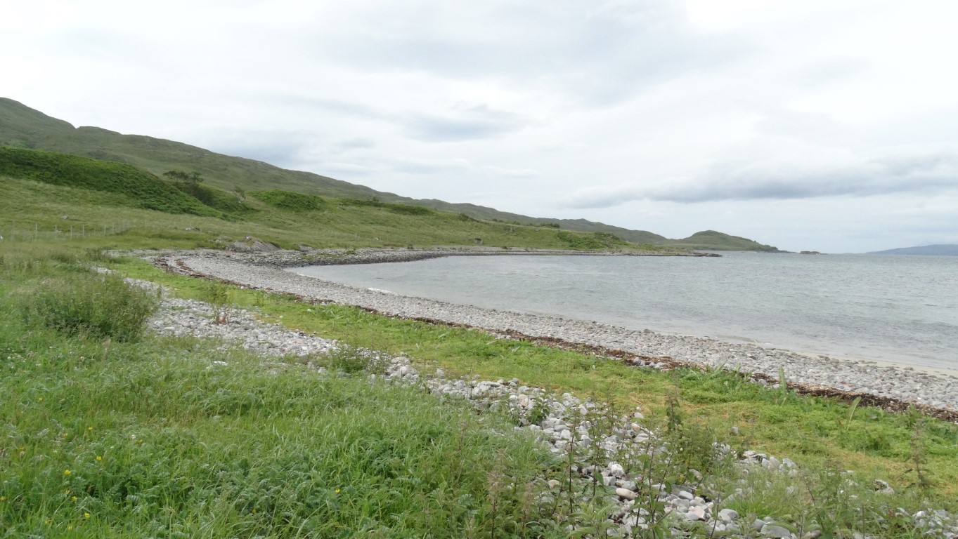
Morning break overlooking the Sound of Sleat southwest of Inverguseran. Pure silence.
A mile or so after setting off again I see a large party of walkers coming towards me. I half expected to bump in the ‘Wilderness Scotland’ group as I had met up with them on Eigg three days earlier and they were staying at Doune on Knoydart for the week. We have a long conversation and it turns out that they are walking to Inverie via the route I had just come and suggest that I meet up with them at ‘The Old Forge’ at the end of our walks. They also mentions that a Jack Russell dog had followed them from Airor and they had to take it to the isolated house at Samadalan which I would pass shortly.
Going our separate ways I went in search of a ruinous chapel marked on the map but I think this was well hidden somewhere in the bracken. Shortly afterwards I passed the isolated house at Samadalan then met the owner of the Jack Russell coming towards me to reclaim her dog.
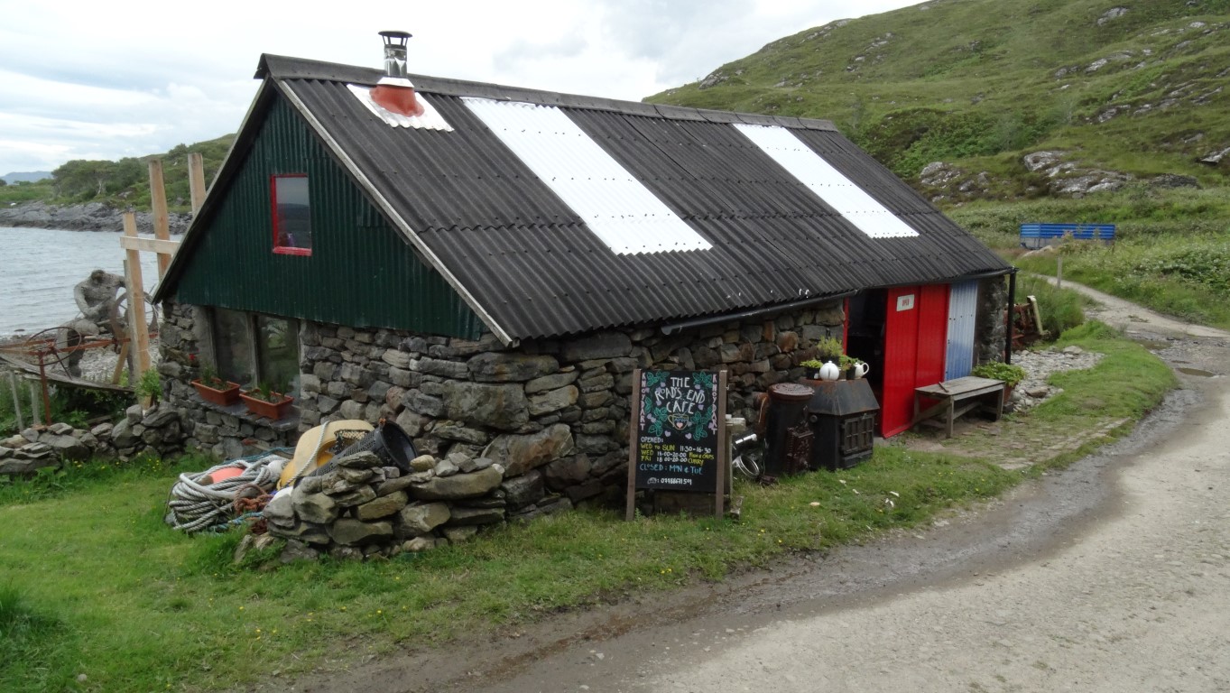
Is this the British mainland remotest cafe? I stopped here for a beef chilli half way through my fifteen mile walk. The place is not even on a road.
I am at Airor by noon and head into this remote village and come across the ‘Roads End Cafe’ which must be a contender as the remotest cafe on the British mainland. Its not even on a road and it’s a good opportunity to get a hot meal to save me cooking in the evening. The place is little more than a shed with a tin roof and venturing inside I take a bench seat at one or two long tables with a view looking out over the Sound of Sleat. A beef chilli is cooked whilst I wait and I get into conversation with another couple of walkers who advise me that there is a path over the two Munro’s I intend walking the following day. Another couple of walkers arrive for lunch whilst I am there and time for another long conversation. An hour had slipped by quickly and I set off again soon passing the village jetty to join the long lane back to Inverie. Crossing the lonely moors, the earlier brightness of the skies is now turning more grey and gloomy and I feel that the rain isn’t too far away. I stop and chat with another walker who is doing the same walk as me but in reverse.
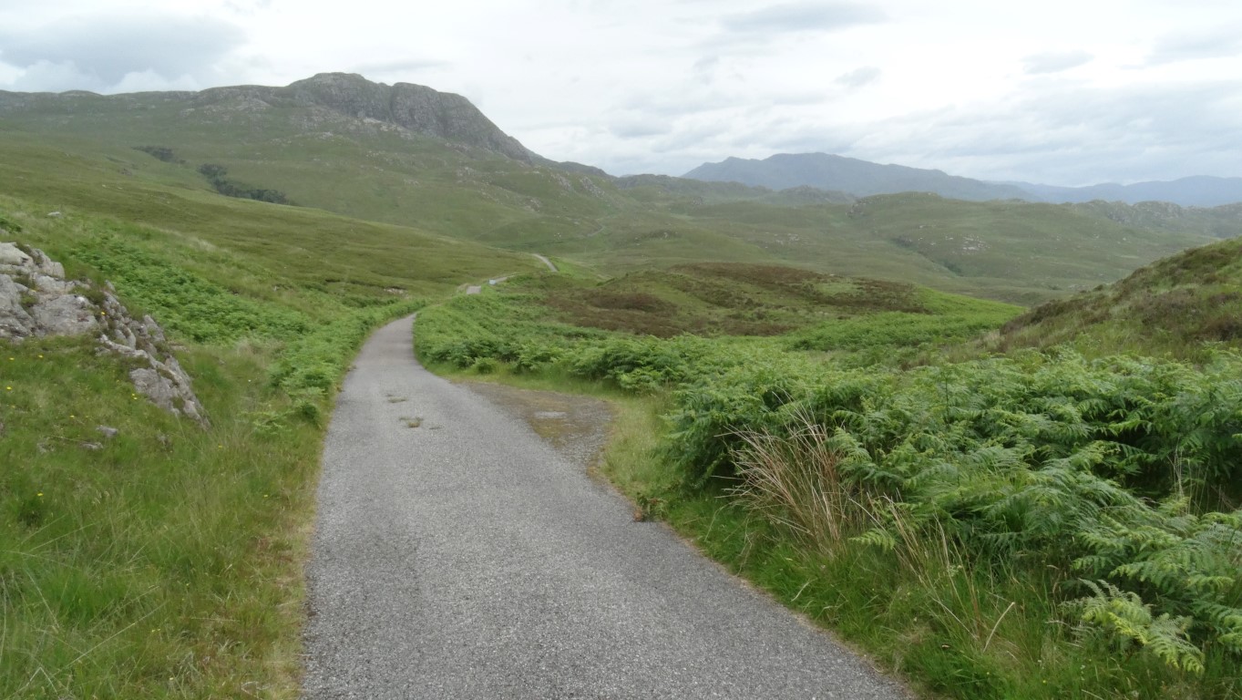
A long lonely lane crosses the seven miles of moorland between Airor and Inverie and doesn’t connect anywhere else. Only one vehicle passed me over the seven miles so it wasn’t exactly busy.
Pressing on at a steady pace and beyond the turning to isolated house at Sandaig a battered four by four vehicle draws up behind me. The person is the owner of the cafe who had lost one of her dogs and had I seen it. It was still lying there in the entrance of the cafe when I left and I think I would have seen it if it had come my way. I continue on with views later towards Loch Nevis. The mountains inland are now engulfed in cloud and rain and so as expected it isn’t long before the rain gradually sets in. I plod on along the lane towards Inverie with umbrella up on this most gloomy afternoon. In the village the ‘Wilderness Scotland’ group are already in the pub and on seeing me I am invited to join them where I spend the next two hours supping a Guinness and deep in conversation about our travelling experiences. When their minibus came to take them back to Doune I set off alone to the almost empty bunkhouse in the opposite direction. It seems like a lonely wet evening is in the offing with tea by myself but I do find a good book to read on the history of Knoydart which does occupy a couple of hours on this wet evening. It’s still daylight outside as I turn in around 10.30pm.