
Few of us will know that today, the 18th of April is the eightieth anniversary of the birth of the trig point we recognise today. During the late 1930’s and during the 1940’s some 6500 trig points were constructed across the length and breadth of Great Britain in an effort by Ordnance Survey to map Britain far more accurately. Prior to that, maps were a bit sketchy but on the 18th of April 1936 the first detailed measurements were taken at Cold Ashby trig point in Northamptonshire at a start of a task which would take twenty six years to complete. The end result was that over the entire length of Britain the new Ordnance Survey mapping was accurate to within twenty metres.
We are all familiar with the concrete pillar which graces many a hill top and these pillars have taken many man hours to construct insomuch that materials had to be carried to the site to make up three quarters of a ton of concrete part of which was buried below ground to ensure firm foundations. In some remoter parts of the country such as mountain tops local material was used such as nearby stone as a means of construction and in some remote parts of Scotland some trig points were built as a concrete column and these were called ‘Vanessas’, which is a corruption of the company ‘Venesta’ that built them. These trig points used far less concrete in their construction but are the same height as the trig points that most of us are familiar with.
At the time of construction, at least two other trig points would have been visible in clear weather but over the years vegetation has obscured the view of many trig points. On the top of the trig point you will find a brass plate with three arms which was used to mount the theodolite from which accurate measurements and angles to neighbouring trig points could be made. On one side there is a indentation with a metal plate and here is found the benchmark giving the unique reference number of the pillar and the accurate height above mean sea level.
Today almost all trig points are redundant as aerial photography and digital mapping using lasers and GPS are far more accurate with a error margin of only a few millimetres across the length and breadth of Great Britain.
Like me and many other walkers, a visit to a trig point on a walk is the icing on the cake. Today thousands of walkers record their visit on a website especially set up listing every trig point in the country. On the website ‘trigpointingUK’ you can join up free and use a pseudonym to record your visit and read other peoples’ experiences. As for myself, I have been a member of this site since 2004 and have to date visited and recorded 681 trig points and this is just a fraction of the trig points out there awaiting a visit. Many people spend all their spare time hunting these concrete pillars down and for one man it has been a challenge to visit every signal trig point in the country. But here is a word of caution, many trig points lie on private land and a visit to a nearby farm to ask permission is often a good idea. A few trig points lie within military establishments and it can be quite a rigmarole gaining access and then in some cases with an armed guard! The website makes interesting reading.
Why not take a look at the site and perhaps start off a new hobby for 2016. – and remember if you visit a trig point today – wish it a happy birthday!
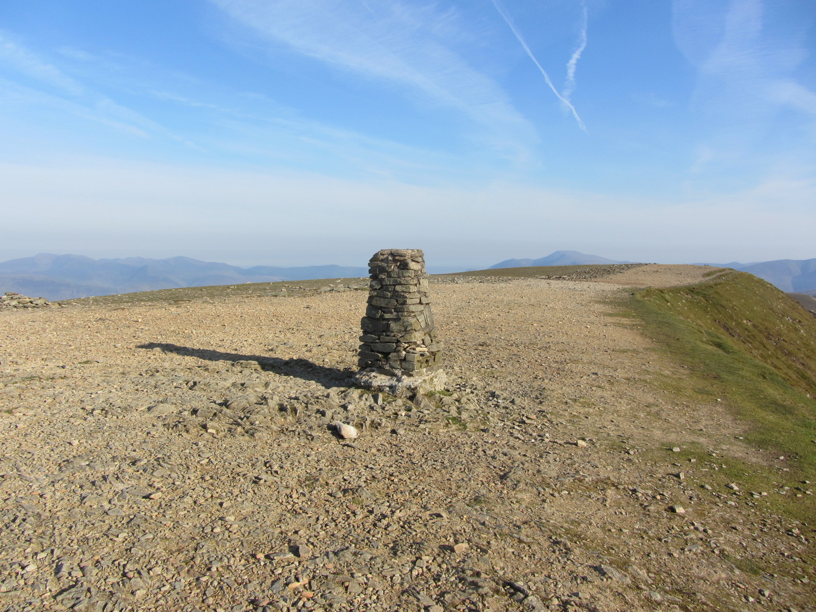
The trig point on the summit of Helvellyn constructed of local stone, but where is everyone on this fine sunny morning. The answer is that I set out at 5.30am to reach the summit for breakfast at 7am.
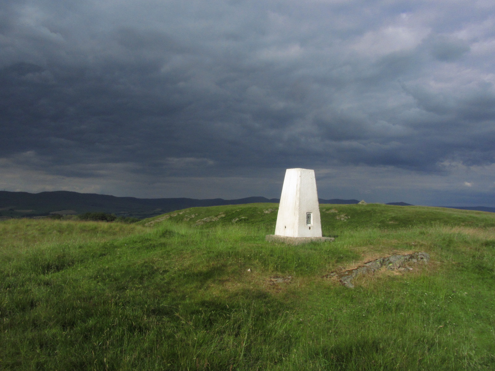
The trig point on Benson Knott near Kendal and the commonest type that we are all familiar with.
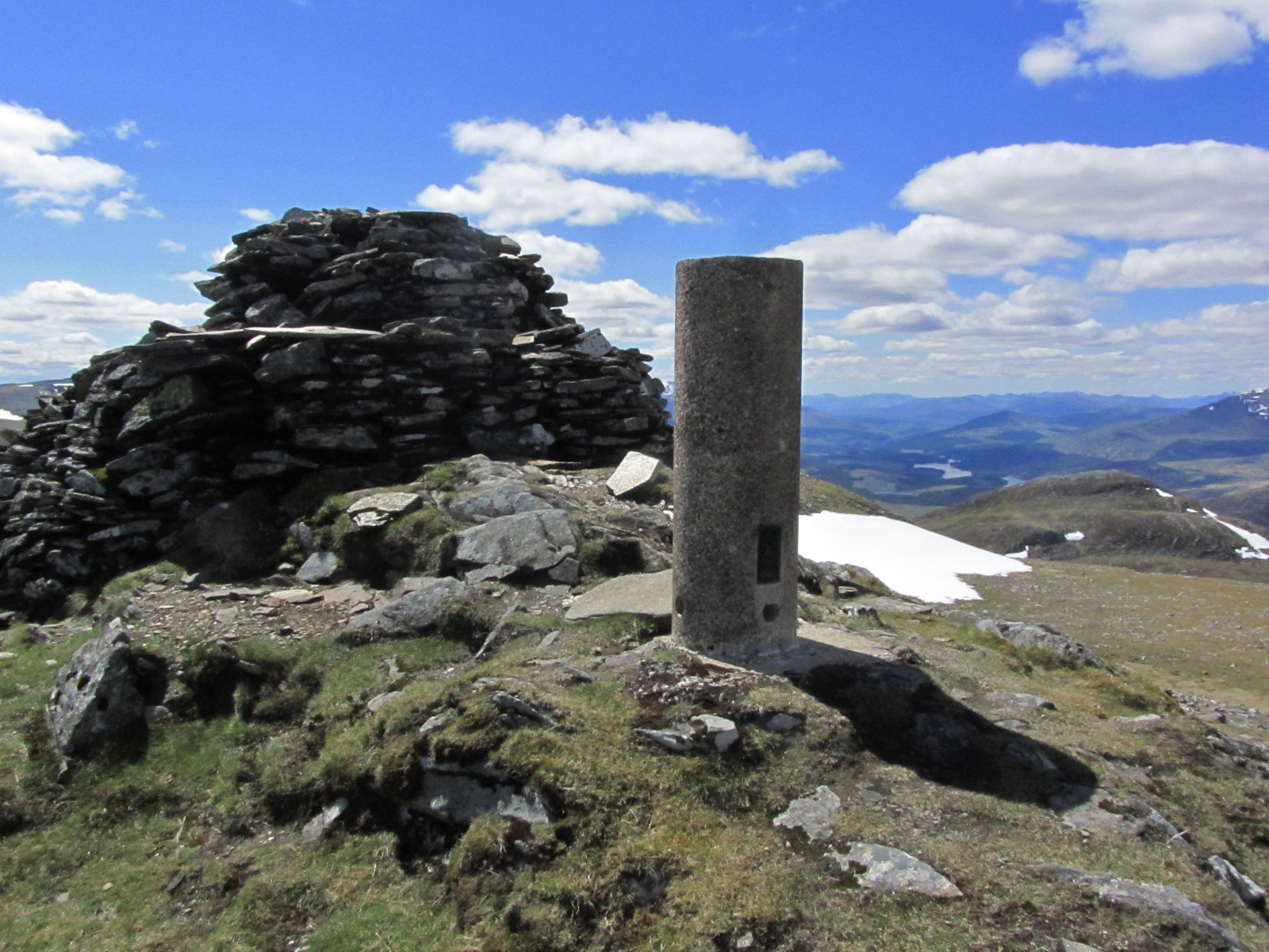
A rare’ Vanessa’ type trig point on remote Geal Charn near Loch Laggan in the Scottish Highlands.
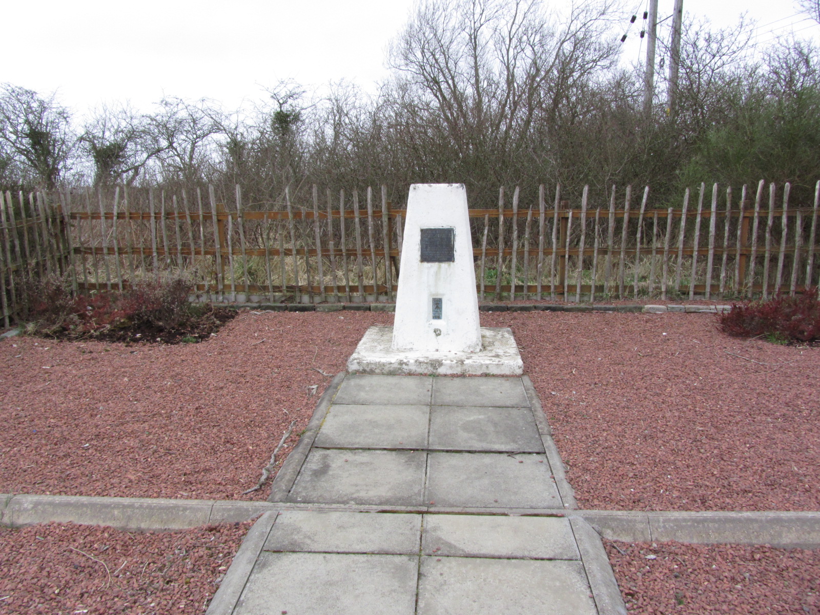
Trig point the site of General Roy’s birthplace near Carluke in South Lanarkshire. Complete with garden and paths it was Roy’s advocacy and leadership that led to the creation of the Ordnance Survey in 1791.