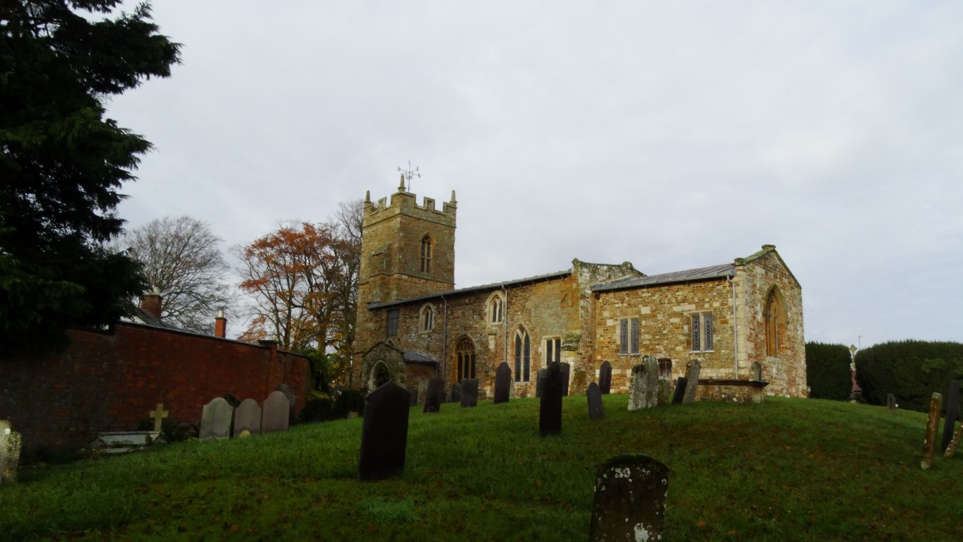
The bleak and lonely Woodhead Chapel which has a history extending over 500 years.
Nick Wild led this small group of East Cheshire Ramblers taking in a high level route above the Longdendale Valley for the outward leg and returning along the Longdendale Trail. Setting off from Padfield on this cold winter’s morning we headed off down through the village to the southern shore of Bottoms Reservoir before crossing the dam and heading up through Tintwistle to gain Arnfield Lane. Along this lane we turned right onto a good hill track but in doing so got caught in a brief hail and snow squall. After a short coffee stop we continued along the rim via Black Gutter to Millstone Rocks following a rather indistinct path in places with plenty of boggy sections. Later we descended on a path down to the relative shelter of Crowden for our lunch stop. As discovered on the reconnoitre the permissive path around the eastern end of Torside Reservoir was closed but a suitable alternative was available which was followed to the isolated and lonely Woodhead Chapel which today felt very bleak.
This remote chapel has quite a long history and today lies at the end of a short cul-de-sac above the very busy A628. The building is semi abandoned and graveyard is overgrown. There has been a church on this site for 500 years and the graveyard was used to bury the navvies who died whilst building the Woodhead Tunnel. It is rumoured that the unconsecrated field behind was used to bury those navvies who were non Anglican and the same field was used to bury victims of cholera that swept the valley.
We had no alternative but to follow a very short section of the A628 before following the embankment across to link up with the Longdendale Trail which we would stay with for the easy and level walk back to the cars.
The Longdendale Trail was opened as a combined foot and cycle way in 1992. The path was formerly part of the Woodhead Railway which ran between Manchester and Sheffield which closed to rail traffic in 1981.
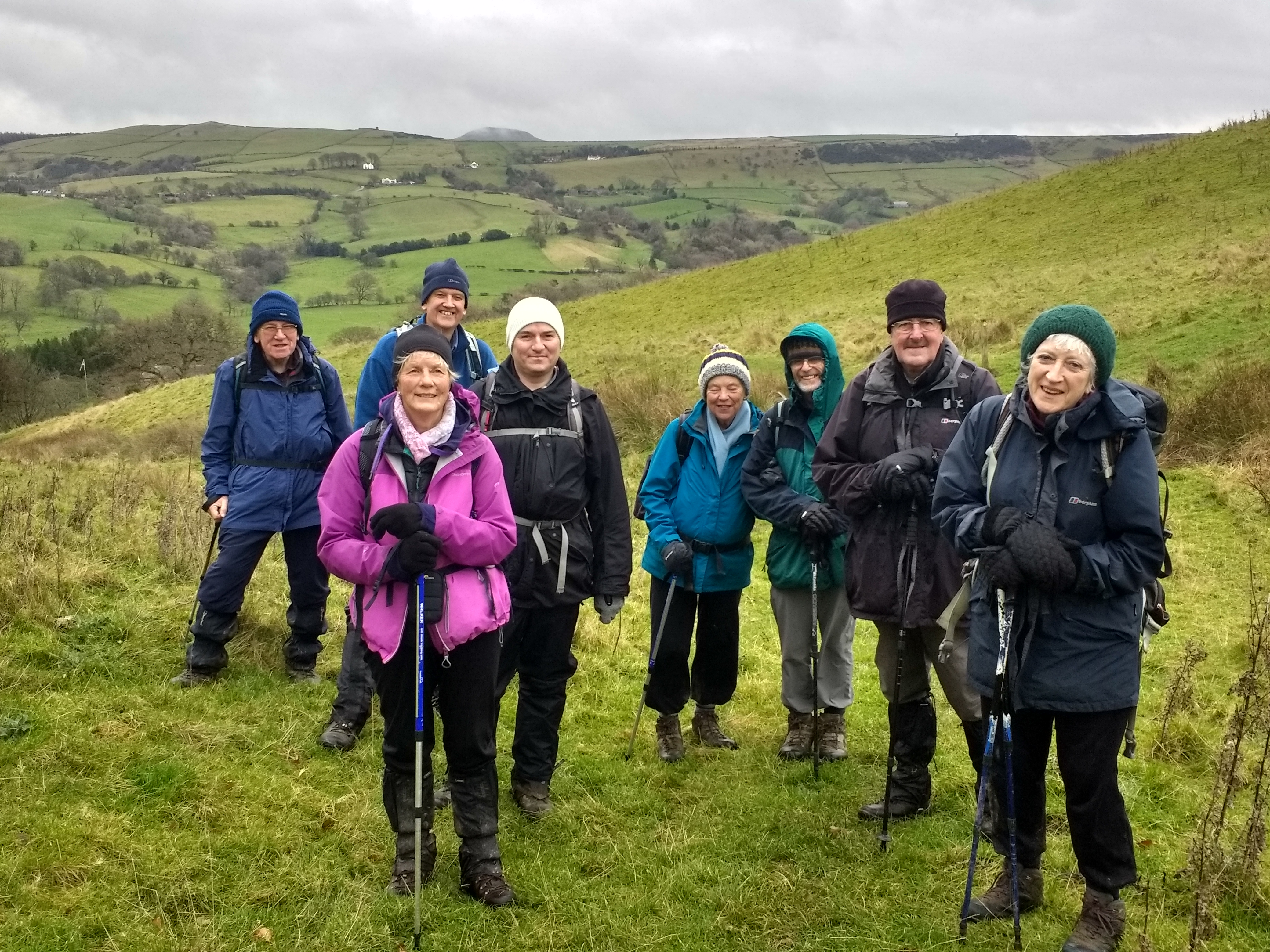
There were ten East Cheshire Ramblers setting out at 10 am on this walk from Taxal lay-by car park on the A5004, led by Anton Woolford, who has been leading walks for us for a number of years now. The weather was cold but sunny and we crossed the Goyt to the village of Taxal from where we took a field path up towards Taxal Edge. At the top we got good views of the Todd Brook valley. We continued south and later turned west to reach Windgather Rocks where we had a morning break. The views from here were even better, looking south to Shining Tor and Shutlingsloe, and west to the Cheshire Plain. We restarted after the break continuing south to Pym’s Chair and then onto the ridge of Cat’s Tor and finally to Shining Tor itself which at 559 metres is the highest point in Cheshire. After enjoying the excellent views from here, we turned southwest to Stakeside, then down the hill to have lunch near Errwood Reservoir. After lunch, walking along the side of the reservoir, we were rewarded by superb autumn colours reflected in the waters of the reservoir. After Errwood we followed Fernilee Reservoir for a time then turned up Deep Clough for a short but sharp climb to a higher path (the sting in the tail!). At the Fernilee Dam we crossed over to follow the River Goyt back to the car park. A great time was had by all!
Setting out above Taxal Church with a view towards Eccles Pike.
A Christmas Carol Ramble – Written by Jenny Bordoli
The group outside Nether Alderley Church.
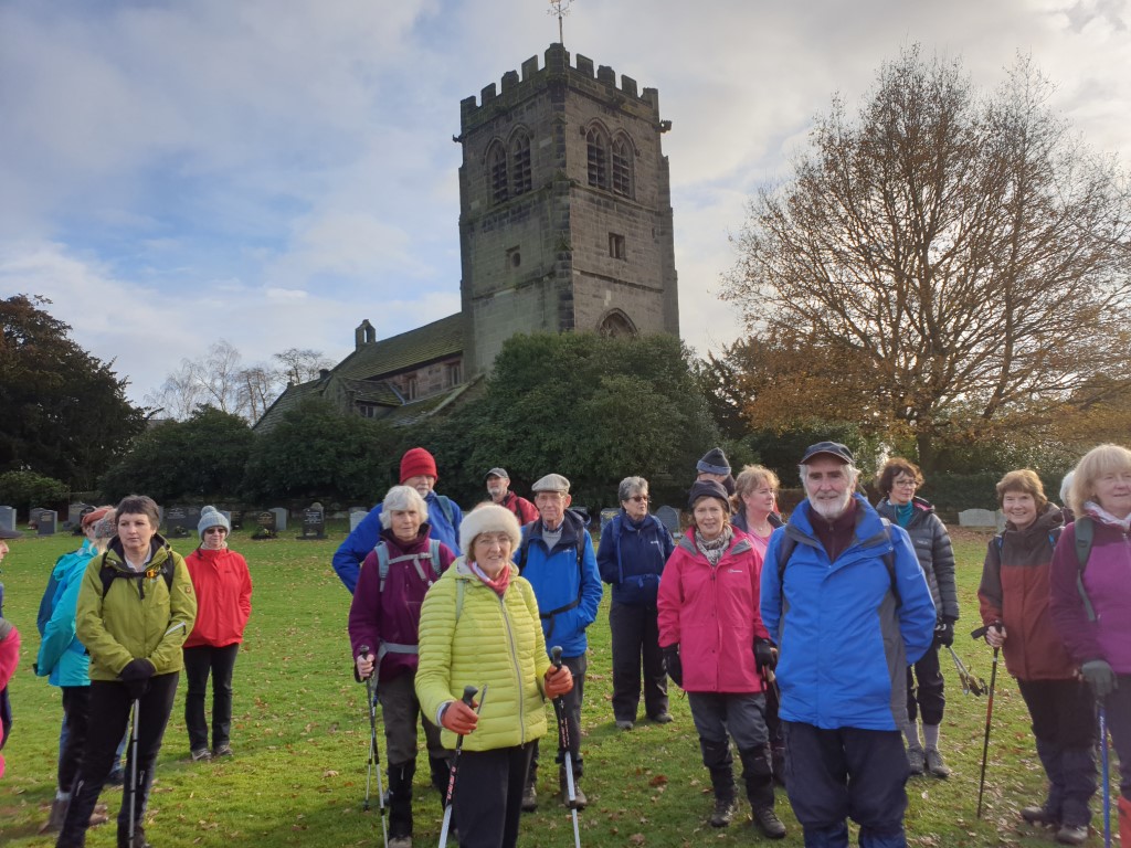
On Saturday 7th December, an enthusiastic group from East Cheshire Ramblers met at the National Trust Car Park at Alderley Edge for a 5 mile walk with a seasonal flavour.Thirty two of us set off down Bradford Lane to St Mary’s Church at Nether Alderley where we enjoyed the Christmas carols sung by the excellent Barnby Choir. We were delighted to be greeted by our very own welcome sign, created especially for us by John Edwards and Marion Duff, who are ramblers and also sing with The Barnby Choir. We were encouraged to join in the singing where appropriate and were soon feeling in the festive mood. The current church is very attractive and dates from the 1300s. It is built from local stone quarried at The Edge and slate from Kerridge. The Old Saxon preaching cross and the 1200 year old yew tree in the church yard indicate this may have been a very early place of worship. After about half an hour, at the end of the first session of carols, we continued on our walk. Everyone was feeling cheerful as we made our way down Hocker Lane in the winter sunshine. We then continued to Finlow Hill where some members, who were a bit short of time, made their way directly back to Bradford Lane and then to the car park that we started from. The rest of us continued on to cross the B5087 and returned to start via Hill Top. We all agreed that our Christmas Carol Walk had been a great success and that we should make it an annual event. I am looking forward to the next one already.
Some of the group gathered outside Nether Alderley Church.
Imagine a hill side carpeted in this rich combination of heather and gorse.
Over the past couple of years I have been nibbling away at walking the Somerset Coast Path between Bristol and Lynton and now I am nearing the end of this trail. Looking back, it seems a long time ago that I set out on a very warm summer’s day this year to walk the section west of Minehead.
My original plan had been to walk west from near Quantock’s Head to walk the section to Watchet then return over the Quantock Hills but this meant some beach walking and only accessible at low tide and todays timings meant that this wouldn’t be feasible. Another section from Watchet to Minehead I had reserved for a winter’s day as it was low and flat.
Walking west from Minehead towards Selworthy on a very warm day.
Another section of the coast appealed to me was to do a circular walk west of Minehead over Selworthy Beacon and this is what I opted to do.
From a glorious warm and cloudless morning, the coastal fog was hugging the coast as I neared Dunster. It was the only area for many miles around where there was cloud and this was just the area where I intended walking. I drove into Minehead and was just into the murky area. Parking up in Alexandra Road I opted to walk the inland part first which looked much brighter. Setting off through Minehead it was a road walk via Irnham Road, Friday Street and The Parks by which time the sun was braking through. I was glad to get off the roads as the latter had no pavements and I found a good path to follow south of Woodcombe. I found a seat in the shade for my morning break before setting off again. The path towards Bratton seemed a good option and was well defined and shady, and for much of the way ran through woodland. The sun was already hot by the time I’d reached Bratton. Here I joined a lane running north then west passing historic Bratton Court which dates from the 14th century. I next continued on a field path which later ran along the northern side of Little Headon Plantation – a very pleasant route with views to Selworthy Beacon and the woodland also gave me a bit of welcome shade. To reach Selworthy I joined an exceedingly narrow lane and despite being marked as ‘yellow’ on the Ordnance Survey Map a sign at the end of the lane stated that it was unsuitable for motor traffic and I could see why. It was a pleasant lane to walk and ahead of me, the coastal fog still hung to the hillside above Porlock Weir. Selworthy Church which mostly dates from the 15th century was gleaming white in the bright sunshine but I didn’t stop to go in today but continued on to the National Trust village. The ‘chocolate box’ cottages made for some good photographs in this very picturesque location and there was hardly anyone around and the whole place seemed almost deserted. I wandered down through the village which was originally re-built as a model village to provide housing for the aged and infirm of the Holincote Estate.
This narrow lane leads down into Selworthy and I am just glad that there is no traffic. Note the last of the coastal fog clearing from the hill west of Porlock.
The historic Selworthy Church gleaming white in the strong sunshine.
The picturesque village of Selworthy minus its tourists on this fine sunny morning.
The Packhorse Bridge at Allerford. – A picture often seen on calanders and boxes of chocolates.
To reach picturesque Allerford I followed an enclosed track and paused at the medieval bridge which spans the stream in the village. This bridge together with the attractive house behind appears on many calendars. Just west of Allerford I branched off to join a woodland path through the bottom of Allerford Plantation before walking down through West Lynch then along the lane into Bossington, another very attractive village. En route, I passed the Lynch Chapel of Ease which dates from 1530 and was used by monks from Athelney Abbey.
Another pictureaque village as I wander through Bossington.
From Bossington, I now headed out towards the coast and Hurlstone Point following a woodland path at first. I was glad of any breeze as I neared the headland. I now skirted around on a coastal path before ascending steeply to the ridge on the northeast side of Hurlstone Combe. What was of note was the fine display of purple heather and yellow gorse and what a colourful and somewhat unreal combination. At a high point on some rocks I stopped for lunch with a glorious view along the Somerset coast. The coastal fog had all gone and there was a real thundery heat in the sun.
This was my lunch stop on this very colourful hillside with a view west along the Somerset coast.
The Rugged Coast Path – a quieter route along the northern edge of Selworthy Beacon but a hot one today. Over three miles i saw only one other couple.
Rather than following the South West Coast Path eastwards over Selworthy Beacon I decided to take the path along the northern slope of the hill. It was called the Rugged Coast Path with
no escape for three miles. It was a delightful path to walk crossing the upper end of East Combe and Henners Combe on this remote section of coast but today it was perhaps a little hot with all the ascents and descents. The valleys were real sun traps and I was glad of any breeze when I reached the headlands. Over three miles I met only one couple coming the opposite way. Later I had to cross Grexy Combe and the ascent on the far side proved rather hot. On North Hill there was a choice of paths and my intention was to follow the South West Coast Path into Minehead. The route wasn’t clear and I ended up much too high but at least the path was through pleasant woodlands. Later, a zigzag path led down to the town just southeast of the harbour. The town was full of tourists and several people were in the sea despite the tide being well out. Near the West Somerset Railway Terminus I found a cafe selling ice creams so it was time for a short break. It was then just a short walk via roads back to the car after an excellent walk.
Now what’s this!. The view towards Butlin’s as you descend from the woods into Minehead towards the end of my walk.
Nine East Cheshire Ramblers set out from just above the Ship Inn, Wincle for a circular walk taking in Croker Hill and Wincle Minn. The weather, whilst dry with reasonable visibility, lacked sunshine but it was certainly a bonus not to have rain and we were determined to make the most of the day. We also hoped that by climbing up into the hills we might avoid some of the mud resulting from what seemed like weeks of continuous rain. In the main this was achieved but we still encountered terrifically muddy stretches.
We walked up through the donkeys’ field opposite where the cars were parked, and headed past Wincle Grange which is a beautiful sandstone building constructed by Cistercian monks from Combermere in Cheshire and it may date from the mid 14th century.
The scenery was varied. We walked through a pretty wood towards Hawkslee Farm and then onto the Gritstone Trail and Wincle Minn. Morning coffee break was taken in a field overlooking the Cheshire Plain and Jodrell Bank. We then continued for a while on the Gritstone Trail with fine views towards the Roaches. The route went to Sutton Common and Croker Hill.
Fieldfares were darting between trees so it was impossible to get a good look at them. Buzzards were also about and a lone kestrel. We saw crows dive bombing a buzzard, the buzzard making its lovely mewing sound.
Lunch was a picnic in a sheltered spot on Fox Bank before heading down briefly to Hollin Lane, only walking on the road for yards before turning right onto the single tarmac road along Rossen Clough towards Civit Hills Farm. Just before the farm we took the path off to the left and we knew we were heading for serious mud. We weren’t prepared for the enormous horse which charged down the hill towards us, clearly bored with inactivity. Fortunately all was well and we got through the field safely on our way towards Butterlands Farm and Broomhill. We just followed the lane back towards Wincle Grange and back to the cars.
Everyone felt a sense of achievement when we returned to our cars and felt all the better for having been out in the outdoors with nature and having climbed over 1700 feet.
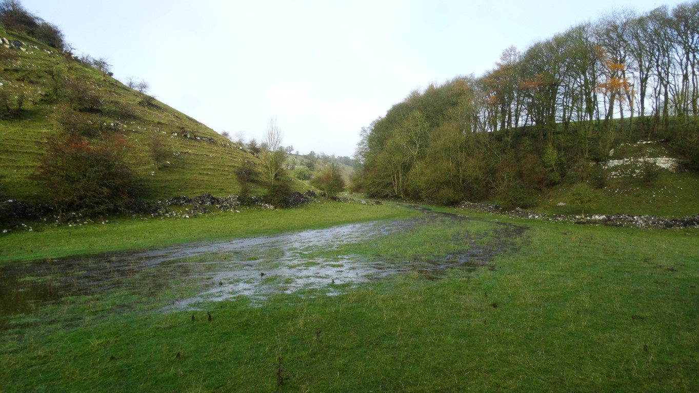
From the bright sunny skies of the Cheshire Plains to a very foggy and frosty Peak District was the order of the day for this medium walk from Hartington. Our little group set off unaware of the challenges that lay ahead on what should have been a straightforward walk. Led by Kathryn Carty we set out east from the village and soon passed the historic Hartington Hall which is now a Youth Hostel. The building dates from 16th century and is Grade II listed. During the Jacobite rising of 1745 it is claimed that Bonnie Prince Charlie stayed there. Since 1934 the hall has been used as a Youth hostel and even boosts a bridal suite! Leaving the road running east out of the village we followed Highfield Lane (a track) southeast to the top end of Biggin Dale. This normally dry valley was anything but dry and swamped by all the recent heavy rain insomuch that the path eventually became impassable. Our only option was to climb steeply out of the valley to make across country for the lane known as Liffs Road. With a morning break en route we made it over to the road and later descended via a frosty valley to Coldeaton Bridge. All was going well until we reached the bottom of the valley when our way ahead was barred by flooded ground. The only alternative was to back track and negotiate an awkward wall. Once over Coldeaton Bridge we had a short steep ascent where we stopped for lunch. With time pressing, we headed into a rather deserted and the very peaceful village of Alstonefield along the track known as Gipsy Lane. In late afternoon sunshine we headed north and soon took a path descending into the shadow of Narrowdale Hill. The walk through Beresford Dale threw up a few more flooding issues but with a few small deviations we got through dry shod. By now the sun was down almost to the horizon with the foggy conditions silently edging in from the east once more as we reached Hartington after an enjoyable and rather an eventful walk.
It’s Biggin Dale Jim, but not as we know it!
Before we gave up on the path down Biggin Dale. At this point we were pushing our way through the bushes on the right.
Our morning coffee break was taken here with the view over a flooded Biggin Dale.
A frosty walk down to Coldeaton Bridge.
Ascending out of Dove Dale
Late afternoon as we descend between Narrowdale Hill and Gratton Hill.
The sun is low and the first signs of low cloud spreading back in as we near Beresford Dale.
Early morning sunlight on St Mary’s Church at the start of my walk.
On my many visits to Bristol each year, I usually get a walk in on my journey down or on the way back and over the past couple of years I have been nibbling away on walking the Shakespeare’s Avon Way which runs 92 miles from Tewkesbury to Naseby in Northamptonshire. Some of my walks have been linear where public transport is fairly straightforward but there are parts where public transport is near on nonexistent and so the only option has been to do the walk as a circular. The other problem as many of us are all too well aware of at present is flooding. The ‘Shakespeare’s’ Avon is all too prone to bursting its banks over the winter months and this autumn has very much proved the point.
A couple of weeks ago I was planning to walk another section of the Shakespeare’s Avon Way but bad weather was forecast. Having walked the path between Tewkesbury to Warwick, my original plan had been to walk the next section between Warwick and Ryton on Dunsmore and then catch a bus to Coventry then another bus back to Warwick. This would have meant a longer walk and certainly a finish in wet weather. I decided therefore on re-planning the day with an early start and doing a circular walk at the easternmost end of the Shakespeare’s Avon Way. For one thing, this walk was a bit shorter and wouldn’t require catching any buses. Furthermore, given an early start I probably could finish the walk before lunch time and hopefully prior to the rain setting in.
I left home early (5am) under starry skies and drove down to Welford in Northamptonshire but the journey was fraught with foggy patches. Dawn was breaking as I joined the M1 motorway and I reached Welford just at sunrise.
Parking in the village all was very quiet as I donned walking boots and wrapped up in warm clothing. It was minus three centigrade with a heavy frost and with all the recent heavy rain the road surfaces were very slippery.
Leaving Welford and following the Shakespeare’s Avon Way across frosty fields. A change in the weather is just apparant on the horizon.
Crossing frosty fields towards the shallow Avon valley east of Welford.
Setting out at 7.30am, the first rays of the morning sunshine was lighting up the warm coloured stonework of St Mary’s Church in the village. I crossed the main road and took a frosty path northeast. My plan first was to follow the Shakespeare’s Avon Way to Naseby and the location of the source of the river and my route initially was along the shallow valley of the infant River Avon. The meadows were a frost hollow and were choked with shallow fog. It was almost magical in the surreal light with the low morning sunlight casting long foggy shadows along the fields. Despite a heavy frost, the ground along the valley was waterlogged in places. I later crossed the River Avon near the former Sulby Abbey. Today a farmhouse lies on the site of the abbey which was founded in 1155 as daughter house of the Abbey of St. Mary and St. Martial in Newsham and in its heyday covered around 1500 acres. It was destroyed during the Dissolution of the Monasteries in 1538. I crossed more fields and gradually ascended to the Naseby Road. I would stay with this road all the way to Naseby, and with the fog being very much present it gave the opportunity for some interesting atmospheric photography. High cloud was edging in from the southwest and I knew that the magic of the early morning would soon be gone.
A magical morning with low sunrise across frosty fields along the River Avon valley.
The infant River Avon east of Welford.
The road had a coating of black ice much of the way to Naseby and I quite often found easier walking along the grassy verges and in any case most passing drivers seemed oblivious to the underlying road conditions as they sped by. It was always safer to leap up onto the verge well before a vehicle reached me.
The fog returns as I head towards Naseby but it makes an unusual atmosphere.
Sunlight through the trees as I near Naseby on this magical start to the day.
The foggy outline of All Saints’ Church Naseby eventually came into view. The church has a fine slender spire which was added much later than the 14th century tower. I explored the churchyard then stopped at a seat surrounding a tree in the centre of the village for a short break. The village hadn’t really come to life but as I tucked into my morning break the silence was broken with the church bell striking 9am. Unknown to me and very close by was a cone shaped monument which marked the source of the River Avon so this will mean another visit to find this one day. Several other rivers have their source in the area including the Nene and the Welland which both flow eastwards into The Wash.
All Saints’ Church in Naseby and time for an early break.
Naseby is far better known for its famous battle during the First English Civil War fought on the 14th June 1645. The Parliamentarians defeated the Royalists in this decisive battle and within a year the Parliamentarians had won the first civil war. Today I wasn’t visiting the battle site and instead headed through the village to take the minor lane to Thornby. Along this road the fog closed in and with the cloud edging in, the sunshine was soon watery. The frost was going quickly and the black ice along this lane was less of an issue.
In Thornby I crossed the main road and took a wander around the foggy churchyard of St Helen’s Church before taking a field path west to join the Cold Ashby Road.
En route to Cold Ashby, the fog suddenly lifted to reveal quite a grey day. In the village I made for the interesting church and took a look inside. The colourful east window was of a modern design and I was impressed by the modern metal seat outside commemorating World War 1. This modern bench seat is one of many such seats that are appearing in various villages up and down the country and made by David Ogilive Engineering of Kilmarnock.
The historic church at Cold Ashby but now the weather is beginning to change.
A modern bench seat outside St Denis’s Church commemorating World War 1
From the village I followed the lane west with views opening out to the south but at the same time rain bearing clouds were evident to the south and west. I did have thoughts of extending my walk but now, with the weather on the change it didn’t seem such a good idea. Just off this road I made a short detour to visit the Cold Ashby Trig Point but this is no ordinary trig point. Some could say it’s the ‘Cathedral of trig points’ as this is where it all started and a plaque on the trig point commemorates that this was the trig point from where the first observations were made for the re-triangulation of Britain on the 18th April 1936. I had been here before and on my previous visit, when the trig point stood in the middle of a field but since then a hedge has been planted so that it is now partially obscured.
The ‘famous’ Cold Ashby Trig Point where the re-triangualtion of Britain started in 1936.
Returning to the lane I continued over some marginally higher ground and veering north in the process. Descending, I re-crossed the A14 and soon took a bridleway on the right to skirt around towards the Northampton Road. The fields were now quite mucky and I picked up plenty of mud of my boots in the process. Way-marking wasn’t all that wonderful as I crossed fields but I came to the conclusion that at least this path had some footfall. I reached Court Lane and followed this west for a short distance then took an overgrown path north and had to scale a small gate. The path continued across fields to reach Welford and I pressed on into the centre of the village before following a couple of side roads back to the car. By now it had turned a very grey day and the rain that had been forecast didn’t seem that far away.
It had been a magical start to the walk but my journey down to Bristol via the Cotswolds was through torrential rain with some minor flooding.
Despite the Saturday weather forecast to be the drier day of the weekend this walk turned out to be on the wet side. Tony Littler led a party of eight setting out from Broadbottom.
Early into the walk there was the promise of a fine morning but the brighter skies weren’t to last.
We set off at10am soon crossing the swollen River Etherow before following the riverside path then cutting up to Broadbottom Railway station to see if anyone had arrived by train.
Crossing Mottram Road we ascended a flight of steps and later took a field path ascending to Hillend. Here we turned right and soon right again taking another field path which later descended through an overgrown area. Our descent continued to the Etherow Valley and we stayed on tracks all the way. Once across the River Etherow we ascended to Lower Gamesley and took an overgrown side path which Tony had cleared on his previous visit. Crossing some rough ground we were soon at the remains of the Melandra Roman Fort and the stopping point for our morning break. The Roman fort is still clearly visible as a square embankment but the site is very overgrown and neglected. The fort dates from the first century AD and was originally built with wooden fence along the embankment. The origin of the name ‘Melandra’ is unclear but it is thought that the Roman name was fort was ‘Ardotalia’. The wooden fort was soon replaced with a stone fort but the site is believed to have been only occupied for around ninety years. The stone was later robbed for local buildings, road construction and stone was even used in the construction of Mottram Church.
Our walk continued up through the housing estate at Gamesley to reach the A626 and soon afterwards we turned left on an extremely waterlogged path pitted with holes from horse hoofs. We inched our way across the quagmire with liquid mud up to the top of our boots. Conditions did become better as we reached Simmondley and Tony decided that it would be better to keep to residential roads in this area.
To get up to Cown Edge we took an uphill path which was quite narrow and slippery with plenty of muddy patches. We toiled up with rain bearing clouds beginning to close in. Our progress was slow, and as we reached the ridge so the weather closed in with a dense fine rain and lowering cloud. It was time for a late lunch and the only feasible spot was to stop at an area of woodland to get what little shelter there was. Some of us found a good spot which kept the rain off but over lunch the cloud settled in on the hill top. What a miserable day it had turned out to be.
The lunch stop was quite short and we set off along a very foggy Cown Edge with no views whatsoever. Another group came the other way appearing out of the gloom. For the afternoon and we pressed on along the cliff top over Coombes Tor and again Tony opted to take a firmer route rather than ploughing through more mud. We descended by passing Robin Hood’s Picking Rods hardly pausing as we passed this monument. Clad in full wet weather gear and heads bowed we pressed on in silence in the steady fine rain.
We later cut across a waterlogged field and followed a track, lane then field path down to Chisworth. Despite it being only mid afternoon the light was so bad with the cloud base well down on the slopes around us.
We crossed the A626 again and descended via a slippery and muddy path to the former Kinderlee Mill. This site is now modern apartments but the location is very much hemmed in the valley with no views. The decision was taken to stay on lanes now as the path through Tom’s Wood was near on impassable according to Tony. It meant a slightly longer route but at least it would provide some better walking underfoot. At the foot of the valley we re-crossed the River Etherow once more then it was back along our outward route in fading light despite it being well before sunset.
Sorry no photographs this time as the weather was so gloomy.
One area I have never
explored on foot is the countryside covering the vast peat lands which occupy
the area between Doncaster and Scunthorpe and include the Isle of Axholme. This
would make a walk of three days covering the permissive paths that cross the
Thorne and Hatfield Moors and a sparely populated area. During the summer of
2019 I set out along this trail on an adventure which didn’t quite go to plan.
The latest Ordnance Survey maps show the route plotted and from my research I
was expecting the trail to be well signposted but as it turned out, way marking
was virtually nonexistent.
Following the Peatlands Way across the Isle of Axholme. Good paths under big skies.
Day 1 – When the number 87 bus saves the day
The Peatlands Way, is a
relatively new recreational path around an area not normally associated with
walking. I had planned this trek out carefully by using buses and trains and so
on this first day it was merely a case of catching the train from Crowle Railway
Station where I had parked the car, to Hatfield and Stainforth Railway Station
and then walking back. The train was on time and I nearly had a free journey as
the conductor only reached me as we pulled into Hatfield and Stainforth
Station.
To reach the Peatlands Way it
was a walk through this ex mining community which today has little appeal but there
has been a settlement here since Anglo Saxon times.
On the northern edge of the
community I looked for way markers for the Peatlands Way but there were none. I
crossed the narrow and busy road bridge over the River Don and struck out north
eastwards along a good riverside embankment with little to note in the flat
countryside. I later left the embankment to enter the far more attractive
village of Fishlake. People were out tending public gardens and a host of women
were cleaning the church. This as I soon found out was the ‘Monday Club’ a
group of retired residents who looked after the village. What a good idea I
thought. I had a wander around the church and entered via the fine Norman south
door. Much of this fine church dates from the 14th and 15th
centuries. According to Wikipedia there is a local myth called “The
Cockatrice of Church Street”. The story goes that the mythical beast resides
near the Churchyard, and those unlucky enough to hear it’s call are said to
never sleep again. Let’s say that after a good day walk I always get a good
night sleep and I never heard anything untoward.
Entering the attractive village of Fishlake.
The fine Norman south door at St Cuthbert’s Church in Fishlake.
I returned to the embankment
and shortly took a path to the left through trees then over a road before
following a series of enclosed tracks which gradually became overgrown but
improved again later. Reaching the next road I found the road bridge over the
River Don closed due to refurbishment and my negotiations with the workmen to
cross the bridge failed. This was a major blow and after studying the map, my
only option was to return to Stainforth which was almost back to where I
started out. I was fuming as I headed back but this time I followed the embankment
the whole way despite it not being a right of way. Nearing Stainforth I walked
closer to the River Don as this was the true right of way but a route few used.
I had however at the start of my walk today noted the bus timetables when I set
out from Stainforth earlier and knew that there were buses every twenty minutes
towards Thorne. It was the only sensible thing to do was to catch a bus to
Thorne and pick up the trail again there. From the bus stop timetable, a bus
was due anyway and the number 87 whisked me through to Thorne. If I had walked
the whole way to Thorne it would have been around twenty three miles of walking
today.
Alighting in Thorne I
calculated that I was only around an hour behind schedule but I felt a bit like
Julia Bradbury or Tony Robinson who set out on a walk when they are presenting
a television programme only to ‘cheat’ by hitching a ride part way through the
walk.
I now headed through the town
along Finkle Street, lined with small shops, and today quite a bustling place.
Beyond, it was a case of following residential streets before following a path
across wasteland full of bramble bushes and tethered gipsy horses on any grassy
areas. A further downside was the amount of fly tipping in this area. It was lunch
time as I reached another ex mining community of Moorends entering via
Bloomhill Road and leaving via Grange Road. This community was quite an unattractive
place with many shops boarded up and even vandal bars at places of worship.
There were youths hanging around and I really just wanted to get out of the
place as soon as possible. Leaving the community I did find a recreation ground
with a vandal prove seat which was adjacent to the Thorne Colliery Football
Club. It wasn’t the best of places to stop for lunch with youths riding mopeds
around with no helmets.
I was keen to set off and
soon rounded the abandoned area in which was once Thorne Colliery. Still I had
no way markers to follow but at least I had marked up the route of the
Peatlands Way on my Explorer Maps. A reasonable track led out onto Thorne Waste
or Moors which formed part of the massive Humberhead Peatlands National Nature
Reserve. This area forms the largest lowland peat bog in Britain and I was
about to cross it. Now route finding wasn’t going to be too clever but I
reached the point where there were several information boards. Crikey! This
place is full of snakes I thought as I read the details and warnings on the
information boards. Adders and grass snakes were in abundance in this part of
the world and there were several signs to remind you. Out came the walking pole
so that I could prod the ground in front of me if required.
I thankfully came across the
first of several way markers for the Peatlands Way – a symbol of the nightjar
and these moorlands is one of the best areas in Britain where they can be found
not that I saw any.
Information boards on Thorne Waste. Beware of the snakes was not an under estimationas I was soon to find out.
I nearly stood on this fellow as it blended in with the ground. Backing off I got my camera out to get this photograph before it slithered into the undergrowth.
With eyes peeled to the
ground I set off along a series of paths looking for any movement in the grass.
The only trouble was that the grass hadn’t been cut for some time and so it was
more than ankle deep. Way-markers were often hidden in wayside vegetation and
so I stopped several times and estimated how many minutes it was to where I had
to look for a turn. In places I was walking between tall reeds and half
expected to meet Doctor David Livingstone coming the other way. After several
twists and turns I eventually came to an straight track which I would follow
east southeast for around one and quarter miles and I estimated that this would
take me around twenty five minutes before looking for a path on my right. The
countryside was very flat and full of lakes and bogs and the only sign of the
modern day world was a distant chimney of a power station and the top of
distant wind turbines. Time to get moving I thought so I upped my pace and less
scanning the ground ahead of me as I was now on a clear track. After a quarter
of a mile I stopped dead in my tracks as I was about to tread on a fully grown
adder. I carefully backed off and got my camera from my rucksack before
creeping up on the reptile to get some close up photographs before it slithered
away into the undergrowth.
For the next few miles I paid
more attention on what was on the path ahead of me as again the path made
several turns. Timing the points to look for a turning was paramount as missing
a turning on this sort of terrain would have been time consuming. I was always glad
when I found a way marker. I was still on the correct route when I came across
an information board which routed the Peatlands Way a completely different way
to how I had marked it up. I decided to ignore it as the path looked more
overgrown. It was almost late afternoon as I emerged from the ‘jungle’ and
somehow relieved to be walking on a surfaced lane towards Crowle. Reaching the
village, I didn’t really have the appetite to explore the place. My feet were
beginning to get tired and this part of the village didn’t have much appeal.
The area does lie on slightly higher ground being at the northern end of the
Isle of Axholme with Crowle Hill rising to a staggering twenty metres. By
Violet Hill Farm I took a track south crossing mildly undulating countryside
and reaching the next village of Ealand, I joined the village street to get
back to the car.
So I had completed the first day and thankfully the bus number 87 had saved an otherwise very long walk. As for the Peatlands Way, the way marking had been virtually nonexistent and it had run through some very unattractive areas. Crossing the Thorne Waste had it own interest and would have suited someone far more who had a keen interest in ornithology.
Day 2 Crossing the Isle of Axholme
A fine morning for my second walk starting out from the village of Haxey and heading first towards the fine village church.
For this second walk along
the Peatland’s Way I wanted a nice day as it crossed slightly higher ground
over the Isle of Axholme and passed through more interesting villages. I drove
into Scunthorpe then walked to the bus station and with plenty of time to spare
I had time to walk around the shops before catching bus 399 to Haxey. There
were very few passengers for the journey and I alighted in the village centre.
Haxey is quite a fascinating
place and I made my way towards the village church pausing on the way to study
an information board. A great fire in the village on the 28th-29th February
1744 which started in a flax manufactory destroyed sixty two houses. Further up
the village I stopped to look at the fine St Nicholas’s Church which is a Grade
I listed building dating from the 12th and 13th centuries. The building has
been described as ‘The Cathedral of the Isle’.
Turning right I now followed
a minor lane to the edge of Upperthorpe and here turned right on a path running
north. Sadly deliberate attempts had been made to block this path with garden
rubbish and dog waste. It was most unpleasant and a little beyond, a maize crop
had been planted at right angles to the path and there was simply no way
through. I forced my way around two sides of a field to reach the Peatland’s
Way. This was certainly a poor start.
I was now on the Peatland’s
Way and despite it now being a good path, there were no ‘Peatland Way’ signs
again. I crossed a road at Coney Garth and skirted around to the northern edge
of Haxey before joining the road east to reach the A161.
A glorious day for the walk across the Isle of Axholme with good paths and big skies. This photograph was taken near High Burnham.
What now followed was some
fine walking on good field paths with wide views all the way to Epworth. The
countryside here was marginally higher than the surrounding area and it made
for some very pleasant walking in the warm sunshine but shower clouds were
around. One such shower was well to the southwest but heading my way and was developing.
In excellent light for photography I stopped several times for photographs as I
neared Epworth and passed the remains of Thompson’s Flour Mill as I entered the
village. From my map the route of the Peatland’s Way avoided the village centre
which was a pity as Epworth in my opinion is the most interesting village on
the whole trail. I therefore opted to divert and turned left passing the Old
Rectory which is now a museum. This was the home of Samuel Wesley who with his
wife had nineteen children one of which – John Wesley was one of the founders
of the Methodist Church. I continued through the village then up to the St
Andrew’s Parish Church which unfortunately was locked. The churchyard contains
the grave of Samuel Wesley. On the north side of the church I found a suitable
place to sit for lunch but rain clouds were bearing down and through the trees
that surrounded the churchyard, the countryside to the north had misted away under
a veil of rain.
Threatening clouds as I near Epworth on the Peatlands Way.
The Armada Beacon north of Epworth and the view towards Brooks Mill. For now, gone were the sunny skies of earlier.
After lunch, and keeping an
eye on the heavy clouds around I decided to continue north but the next part of
the walk was very much through open countryside with no shelter should the
heavens open. After following an open field track, I crossed the A161 by Brooks
Mill which dates from 1812 and made my way to Maw’s Mill, which dates from
1783. Both mills had been restored but are minus their sails. To rejoin my
route I skirted around the edge of a wheat field then descended to join the
track bed of an old railway which had been converted into a path cum cycleway.
This was once the Axholme Joint Railway which ran between Goole and Haxey. I
stayed with the railway path up to and through Belton which passed a visitor
centre on the way. The visitor centre was merely a cafe with information boards
and nothing in the way of local literature to pick up.
I did have thoughts of
visiting the church at Belton but the link path from the railway was full of
nettles and impassable.
With a bit of a push I would
time it just right for the 15.07pm train from Crowle to
Scunthorpe and as the service
was hourly, I didn’t fancy spending an hour on Crowle Station even if it was a
fine afternoon.
A good track ran northeast
from Belton and later I continued via an accommodation bridge
over the M180 motorway then
doubled back along the northern side of the motorway. Heading north on a grassy track I got caught
on the tail end of a shower and by Temple Drain I opted to shelter under some
trees rather than donning waterproofs. I continued alongside Folly Drain before
passing beneath an old railway viaduct then west along a wide track between two
drainage channels. The rain suddenly came on again but with limited time I just
pressed on. Reaching the A161 I had no choice but to follow this busy road
north. It was a very unpleasant half mile and having to leap up onto grassy
banks every time a vehicle sped past. This road was also frequented with much
heavy traffic and I was glad to get over the A18. At least on the far side
there was a path which was initially well away from the road. I next crossed
Crowle Bridge which spanned the Sheffield and South Yorkshire Navigation and
the railway before turning right on the road leading around to Crowle Station.
If I had done my research, I could have caught a Scunthorpe bound bus here as
one came by as I neared the station.
At the station I still had a
few minutes to spare and anyway, the train was running a few minutes late. I
was the only person to board and the conductor never even bothered to come and
take my fare.
So summing up day two I felt that this part of the Peatland’s Way which crosses the Isle of Axholme is in many respects the most interesting part of the trail but the bit at the end on the A161 is very unpleasant. The weather had given some good opportunities for photography.
Day 3 Filling the gap
This was my third and last
walk along the Peatland’s Way and today I set off to drive to Haxey. As it was
school holiday time, I parked the car in the primary school lay-by and walked
down through the village to the bus stop by the Co-op. I was in good time and
the number 291 bus arrived on schedule. En route to Doncaster we picked up many
passengers so that the bus was almost full. At the large underground bus
station in the Frenchgate Shopping Centre in Doncaster, I just missed my bus
connection by seconds but the number 87A would be along in ten minutes. Catching
this, I alighted in Stainforth and set out east along Thorne Road and Kirton
Lane. From my observations a couple of days earlier from the bus, I noted a signed
path leading off over an old spoil heap. The Peatland’s Way however was marked
on the map detouring around this area and
would have added an unpleasant mile of road walking then along a muddy track.
East of Stainforth I decided
to leave the road and take the path south which climbed steeply over disused mine
spoil workings. First of all I had to cross a ditch which had been made to stop
scrambler bikes from accessing the area. A steep but short ascent followed onto
a level area of rough grazing but no sign of any path. Thankfully I came down
about the right spot as there was a bridge over the railway ahead of me. The
walk south was along enclosed tracks through an area of dereliction and rough
grazing. Fly tipping was everywhere and indeed this seemed to be an area where
fridge freezers came to die. A new development known as the Hatfield Link Road
was in the early stages of construction which will bring much needed investment
into the area. Overall I was glad to leave this part of the world and cross the
M18 motorway via a farm accommodation bridge. I now had to follow the A1146 for
a short distance before setting off on a field path east then south to cross
the A18 to reach the village of Hatfield Woodhouse. It had been spitting with
rain for some time and it was turning out a very grey day. I turned left in the
village along the A614 before turning right on Remple Lane then Hollin Bridge
Road and later continued with Moor Dike Road which I expected from my map to be
a track but this as it turned out was a surfaced lane. Prior to White Bridge
Farm I stopped at some concrete blocks under a tree for lunch. The weather was
closing in with driving fine rain and before I set off I donned full waterproof
gear as the weather forecast indicated a wet afternoon.
A typical view across the Hatfield Moors with a combination of bog, heath and scrublands.
There was very little of
interest in this flat and rather drab landscape on a day like today. The
surfaced road continued but where it went onto towards Lindholme Hall, I turned
off along a good path running between ponds and woodlands. I now was skirting
the western then southern edges of Hatfield Moors and unlike my walk across the
Thorne Moors two days earlier, the paths and tracks here were well defined. In
the meantime the rain hadn’t materialised and so I found a seat to remove my
waterproofs. There wasn’t a great deal of interest with a high security fence
and the H.M. Prison Lindholme dominant on my right and thick woodland on my
left. I continued south passing a semi empty car park before veering left along
the southern edge of Hatfield Moors. There was the occasional Peatlands Way
marker but they were a bit patchy on the ground. At least I had the route
marked on my map and followed it around to the north of Ellerholme Farm and
afterwards I carefully looked for the path going south to reach Moor Lane.
After what seemed like hours of walking through the tree canopy I emerged into
open countryside. What a gloomy afternoon it was with bad light and little of
interest. Reaching the East Ring Drain I met a local dog walker and so I asked
if it was feasible to walk east along the river embankment rather following the
long road route around via Wroot. She told me that I could cross the footbridge
north of Common Lane and then follow the southern bank of the
channel to Tunnel Pits Bridge
even though it wasn’t shown as a right of way. From what I could see, it was a
far better route even though it was along straight riverside embankments. Furthermore
it would save me walking along two and a half miles of straight roads. I
thanked her and set out along this route hoping that I wouldn’t need to back
track. Ironically the footbridge over East Ring Drain even had a Peatland’s Way
sign on it.
I was glad I found this footbridge over East Ring Drain.
I reached Tunnel Pits Bridge
without any problems then continued east on a straight and low level road with
little interest but at least it was quiet. Later I turned right along a private
drive which later continued as a track beside Greenholme Lane Drain. About a
mile and a half along here I turned left onto a pleasant wooded path through
Haxey Turbary Nature Reserve. By now the rain had returned but it was only very
light and not enough to warrant donning waterproofs. I pressed on and later
turned right to join the path soon passing Haslams Farm. Beyond here, the
ground started to rise and I later turned left with the track. In another quarter
of a mile I had completed the circuit of the Peatland’s Way.
The attractive path through the nature reserve at Haxey Turbary.
I now turned right uphill and
continued over to Cross Hill and turned left along this lane. The weather was
closing in with rain to the south misting away distant power stations along the
Trent Valley into the afternoon gloom. I set a good pace towards Haxey, taking
a track to the north of the village before turning left again along the road
called The Nooking. The rain was getting heavier and yet I was so close to the
car. If I had caught the bus I had just missed in Doncaster earlier in the day I
would have been back to the car by now. It was raining steadily as I reached
the car and hurriedly changed out of walking boots as the rain turned quite
heavy.
Summing up the Peatlands Way,
my impression is that overall I was disappointed with the lack of signage along
the trail. It will appeal to the ornithologist and naturalist as the trail
passes through several nature reserves but in some places I questioned the
reason why the trail had been routed via a less interesting route using roads
when a suitable nearby path was available.
There are however a few areas
where the walking is interesting especially crossing the Isle of Axholme where
‘big skies’ are the order of the day. On the other hand there are some grubby
areas the trail also visits.
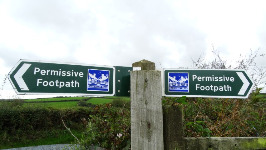
One of many good direction signs along the Dart Valley Trail.
Having just completed a walk of 54 miles in three strenuous days along the South Devon coast between Kingswear and Exeter which included more ascents and descents than I can remember it was time to turn my sights inland with a walk along the Dart Valley Trail between Dartmouth and Totnes.
Walking to Paignton Bus Station with the threat of a bit of moisture to come.
It’s mid October and the weather forecast for the day isn’t good and indicates a plethora of heavy showers especially in Southwest England. I don’t need to get away early as it is just a short drive into Paignton where I park not far from the Paignton Bus Station. Already there are showers around with a vivid rainbow to the west. From the car it is just a ten minute march to Paignton Bus Station and I just make it before the heavens open for a few minutes. The bus number 120 is on time and I take a seat upstairs at the front for the scenic ride down to Kingswear where it is just a short walk to catch the Lower Ferry over to Dartmouth by which time it had turned fine and sunny.
Dartmouth on a fine sunny morning at the start of my walk.
Today my intention is to follow the Dart Valley Trail to Totnes, a distance of around thirteen miles along an undulating route. To start with, it is a delightful walk through Dartmouth in the bright morning sunshine. It’s already 10.30am so I take an early break on a seat overlooking the River Dart before setting off in search of the start of the Dart Valley Trail. With so many narrow lanes and alleyways to chose from I set off by heading too low and have to take a right turn steeply uphill to join my intended route. It is quite a stiff ascent up through the town passing St Clement’s Church as I reached the top. I cross over the A379 and my walk continues now via a long descent down Old Mill Lane back to sea level again but this narrow lane is surprisingly busy and I often have to press myself into the hedge to allow traffic to pass. The head of the well wooded Old Mill Creek is the site of a couple of well hidden boatyards. On the far side of the creek I follow a minor lane then track which soon runs through woodlands. Little streams are still in spate after the recent rains as I head east and I stop at one point to photograph Hermitage Castle on the southern and opposite bank of the creek. The castle was built really as a folly in the 19th century in what were once landscape gardens. I continue with a delightful permissive path ascending alongside field boundaries to reach Fire Beacon Hill where I briefly joined an exceptionally muddy lane if you can call it a lane. I soon turn right onto field path and the descent towards Dittisham is a delight to walk with lovely views over The River Farm to the River Dart beyond.
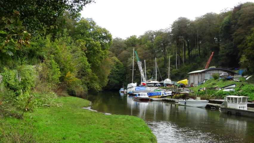
One of the hidden boatyards on Old Mill Creek.
Hermitage Castle on Old Mill Creek and once a feature in extensive landscape gardens.
In Dittisham I follow the narrow road through the village passing many picturesque cottages and make for the churchyard for my lunch stop. It is a lovely spot in the bright autumn sunshine under deep blue skies, and for now, no signs of any showers. St George’s Church has a fine tower and there has been a church on the site since the 14th century but there have been many alterations over the centuries. I don’t venture inside as there is some building work going on.
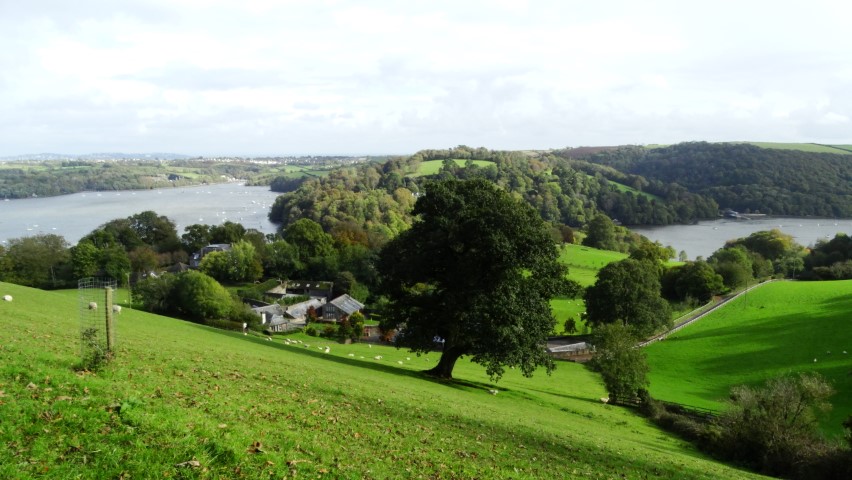
A most delightful walk on the descent into Dittisham with views to the River Dart.
Time for a spot of lunch and I find a pleasant seat just inside the churchyard at Dittisham.
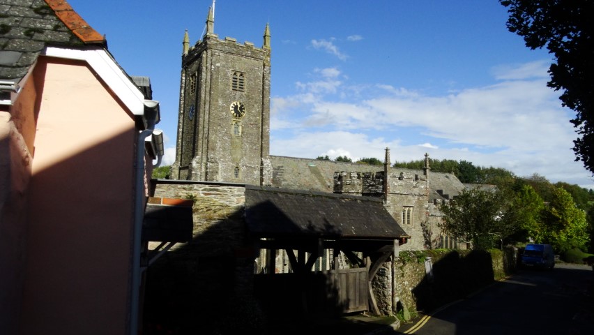
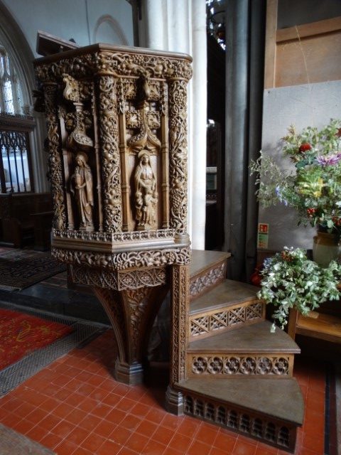
From the village I head west on the lane and later take a pleasant field path to the hamlet of East Cornworthy passing the attractive Brambletorre Mill en route. Narrow lanes are again followed to Barberry Farm and here I continue with a watery track crossing the swollen stream at the mossy and shady Poor Bridge. I now have a long ascent via an enclosed track which is almost a watercourse. Reaching Longland Cross I pause where I have a good view west towards Dartmoor where the weather isn’t looking quite so bright. From this spot, I have a good view towards Cornworthy Church with its fine tower. A lane is followed into the village and passing the fine St Peter’s Church en route which dates mostly from the 14th century. In the village I decide on a detour to visit the remains of the Priory Gatehouse. It was founded in the early thirteenth century, for Augustinian nuns, and existed until 1536 but was destroyed during the Dissolution of the Monasteries leaving only the gatehouse. My diversion is a waste of time as the ruin lies the other side of a thick and high hedge with no access or close up view whatsoever. I therefore return to the Dart Valley Trail and follow the path down through Charleycombe Wood. The woodland and an area beyond is owned by the Woodland Trust. I soon reach Tuckenhay on the muddy Bow Creek. The tide is out but the streams entering the creek are very much in spate. In the hamlet I join a lane and pass two riverside pubs. The stepping stones across the upper part of the creek is the right of way for the Dart Valley Trail but are well under water due to the swollen stream so I carry on with the lane and make the ascent to the attractive village of Ashprington. I head for the interesting church of St David’s with its slender and tall tower. The church dates from the 13th century and I opt to take a quick look inside. The font dates from Norman times and I am impressed by the richly decorated wooden pulpit.
St Peter’s Church at Cornworthy and a typical Devon church tower.
Shower clouds building up as I near Totnes towards the end of my walk.
My route north now lies through the Sharpham Estate which is now run as many ventures including a vineyard and meditation centre. The path cum cycleway towards Totnes is initially surfaced but the cycleway heads off later at a higher level and my path descends towards the marshlands of the upper end of the estuary. It is a pleasant walk along this peaceful section of the valley in the late afternoon sunshine but towering shower clouds are now not that far away. The town of Totnes is soon in view and I soon divert on a very new path to enter the town. My timing is fairly good for the return bus journey to Paignton and I don’t really have the time to explore the town. The bus is on time and I am glad that I am on it as the weather to the west has taken on an inky look with heavy rain not far away. The bad weather ‘chases’ us all the way to Paignton where I smartly head back to the car just making it before it turning quite wet for the next half hour but I am rewarded afterwards with a fine rainbow as viewed from the cafe in Morrisons.
Overall I was quite impressed by the Dart Valley Trail and signposting was excellent the whole way which can’t be said for the coast path where many wooden signs had rotted or were missing altogether.