We still have places left on this workshop. Please contact Maggie Swindells maggieswindells@gmail.com if you’d like to join us.
Author Archives: Maggie Swindells
A brief history of East Cheshire Ramblers
Early History of East Cheshire Ramblers
The inaugural meeting of what was to become East Cheshire Ramblers was held at Roe Street Sunday School in Macclesfield on the 4th October 1973. It was organised by Lesley Meadowcroft from Manchester Ramblers Association and about fifty people attended the first meeting.
The meeting covered Rights of Way and the need for a definitive map for Cheshire. Some of those present at the meeting expressed some concern about potential confusion with Macclesfield Rambling Club and not everyone was keen on the idea of public rights of way! Concerns were raised about walkers leaving gates open, climbing walls, letting dogs loose and “How would you like people walking through your garden?” One person was particularly vocal about walkers trespassing on Big Low, Rainow.
Despite the views aired, twenty people were keen to start Macclesfield Ramblers Association and a committee of ten was established. It was made up of Chair Tom Chalmers, Secretary David Hughes, Footpath Secretary Pat Bowyer, Treasurer Alan Pedlar, Publicity Pauline Pedlar and committee members Sid Forse, Henry Trufit, Mike Corfield and Margaret Oldfield. Later Marjorie Cooper became Chair and Anne Court became the Secretary.
One of the first tasks was to create a copy of the Definitive Map of Cheshire showing the Public Rights of Way in the Macclesfield area. The only maps, available at six inches to the mile, were held in the Cheshire County Council Offices in Chester and the Macclesfield library. The committee spent hours creating maps with a scale of 2.5 inches to the mile with each footpath drawn in by hand. These maps still exist today. Routes were colour coded: Purple (Footpaths) Green (Bridleways), Yellow (Parish Boundary). They created a “real treasure trove of footpaths”. In addition a great deal of time and effort was spent to ensure that every right of way was inspected annually. In order to achieve this, footpaths were divided into Parishes and each member agreed to inspect the footpaths in two Parishes. As we do today, the data was collated centrally. In the early days it was sent through annual reports to Pat Bowyer, the Footpath Secretary. Complaints about ‘obstructions’ were passed to Cheshire County Council who, it has to be said, at that time, ‘moved very slowly in the plains’! The Committee achieved more progress in Peak Park area where the support of the Countryside Rangers was invaluable. Pat Bowyer also had great support from Donald Lee of Peak and Northern Footpaths Society.
The Committee faced a constant battle to prevent developers building over footpaths, particularly on new housing estates. In addition, major issues arose over the proposed route of the Silk Road through Dumbah Hollow. Over the years careful negotiation was required when farms were converted into private residences. No one wanted a public right of way through their new back garden. Paths were moved away illegally from farms and often via unsuitable diversions.
The group gained publicity and increased members through Pauline’s articles in the Macclesfield Express, where they allowed her a ‘few inches’ each week. A particularly difficult confrontation with a farmer on a footpath in Wincle required the intervention of the local police. Fortunately, the constable was familiar with the Definitive Map and the walkers were allowed to proceed. This resulted in some welcome but unexpected publicity! The Macclesfield Express ran with the headline: “POLICE CALLED IN OVER FOOTPATH DISPUTE”. Numbers in Macclesfield Ramblers doubled as a result! The path in question now has a stile, gate and footpath.
The group also offered support to Chris Bamsey, one of the Country Side Rangers. Together they put in stiles, improved muddy paths and helped install the bridge over Shell Brook. Another major legacy is the work the group did to secure the Gritstone Trail. Initially the route was to be called the Cheshire Ridgeway as Derbyshire Ramblers were setting up the Gritstone Way. It was eventually agreed to call the route the Gritstone Trail to match and complement the Sandstone Trail in the West of Cheshire. It’s proved to be a great success and has certainly increased footfall over the years. Forty miles of the trail were walked in the 40th Anniversary year and this year fifty miles were walked to celebrate our Golden Anniversary year.
With grateful thanks to Alan Pedlar
ECR Dolgellau Weekend Away 14 – 16 June 2024
A group of 28 East Cheshire Ramblers spent the weekend in Dolgellau. Everyone found their own accommodation and evening meals were organised for Friday and Saturday. On Friday, 19 ramblers enjoyed a meal at the Royal Ship Inn with very attentive service and substantial plates of food. We had a private area of the pub, enjoyed catching up with old friends and making new ones. A good start to the weekend. On Saturday, a group of 21 enjoyed a varied menu at Y Sospan, where we had our own little area on the raised dais of what used to be the Dolgellau Courtroom.
As for the walking, despite absolutely dire weather predictions, we had perfect walking weather on the walks. A big thank you to all the walk leaders: Steve Rawlings, Ann Thompson (doubly for leading 2 walks), Jane and Frank Gay, Sue Munslow and Jane Rawlings.
Saturday 15th June Long Walk (Steve Rawlings)
13 miles / 2330ft ascent (OS)
With the heavy rain miraculously ceasing around 9am, we started off at 9.30 on the steady, gentle ascent to Precipice Walk (PW). As we were a small group (of six) and paths were quiet, we chose to include PW – a fine decision, it transpired. Elevenses just after PW, then on around the base of Foel Offrwm. Photo-shoot under the massive arch known as Y Garreg Fawr. Partial success through the tricky bit around Ty-hir; the mire avoided but some impromptu stile-building required.
Lunch near Tyn-Twll, then a beautiful stretch through Planfa Fawr woodland. Steady ascent up Torrent Walk in dappled sunlight, and a refreshment break at the top. Mainly downhill after that, on quiet paths through Tabor and Trefeilia. Super day.


Saturday 15th June Medium Walk (Ann Thompson) – 10.3 miles, moderate, 1500 ft ascent
BARMOUTH TO DOLGELLAU
18 ECR members met at the bus stop in Dolgellau and caught the bus to the edge of Barmouth. We started by feeding the troll with £1 coins as an honesty payment to cross the rail bridge. We made it across just before the 10km Barmouth race started and only came across them once when we needed to cross their path. Our coffee stop was at the delightful Arthog church. The route then took us steeply up the nearby waterfall with splendid views of tumbling water. Crossing open land, the lunch spot was reached providing picnic tables and a toilet adjacent to Llynnau Cregannen. The afternoon saw us walking adjacent to open moorland via Kings Youth hostel, up over Craig Castell moorlands on a narrow stony drove lane and descending into Dolgellau. A varied route enjoyed by all and mostly good weather – just of couple of short showers.


Saturday 15th June Short Walk (Jane & Frank Gay)
7 miles, 910 ft Ascent (OS Maps)
Six walkers met at Penmaenpool Car Park (near George III pub) and followed the Maddach trail in an easterly direction to the bridge where the A493 crosses Afon Wnion. We climbed up to Bryn Farm, through the woodland and over the hillside around Dolgledr to Cae n y-coed. After crossing the A493 we followed the streamside path through Abergwynant to join the Maddach trail again back to the starting point, finishing with a well-deserved drink in the pub.

Sunday 16th June Long Walk (Ann Thompson)
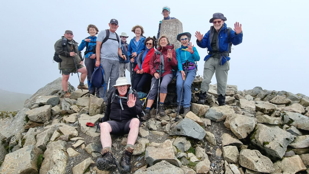
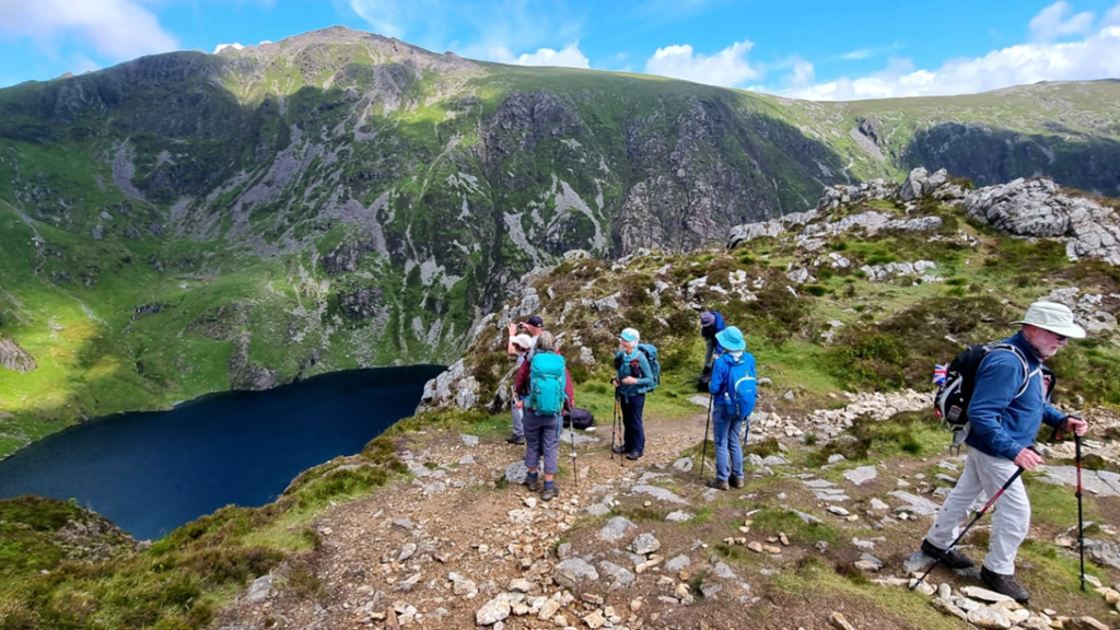
9 miles, 3100 ft Ascent, Cader Idris using the Minffordd path.

Twelve of us met for the 9.02 bus to Minffordd which was a scenic run over and down Afon Fawnog valley. After a short warm up through woodland we were soon climbing steeply on steps and rocks beside a splendid waterfall. Passing a slate bridge, the gradient lessened and eventually Lyn Cau came into view. It sits in the hollow of a splendid cwm with some vertical walls. More tough ascent took us to the top of Craig Cau, followed by an even steeper descent and final ascent on some loose rocky material to reach the Trig Point on the summit of Cadair Idris. The views were magnificent for most of the day with some brief spells of low cloud. After lunch on the top, we followed the ridge to Myndd Moel and Grau Graig then descended quite steeply to Bwlch-Coch. The return to Dolgellau was down minor roads and lanes with some attractive woodland sections in between. A really good mountain walk in excellent weather.

Sunday 16th June Medium Walk (Sue Munslow)
10 miles, 2136 ft Ascent
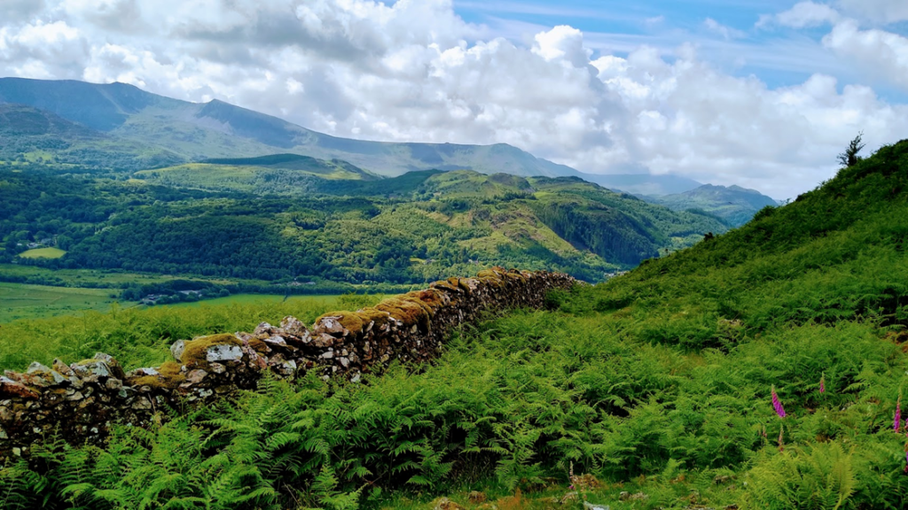
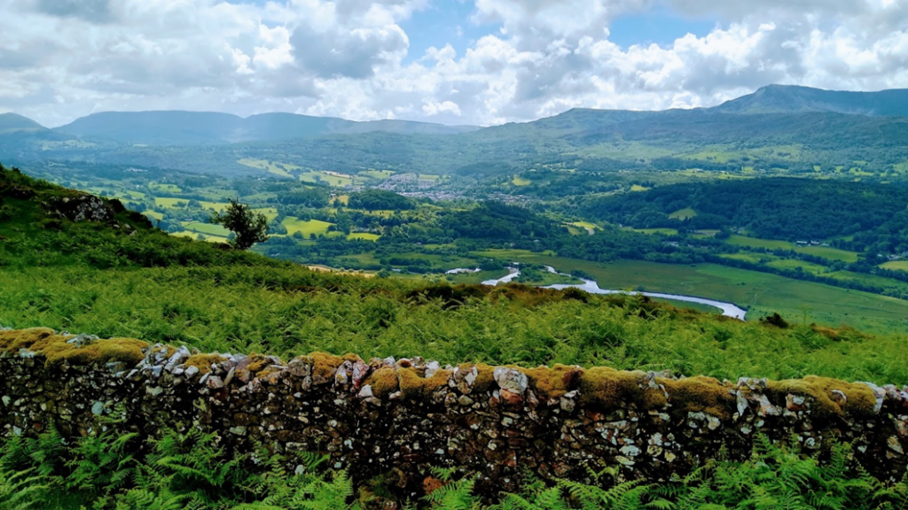
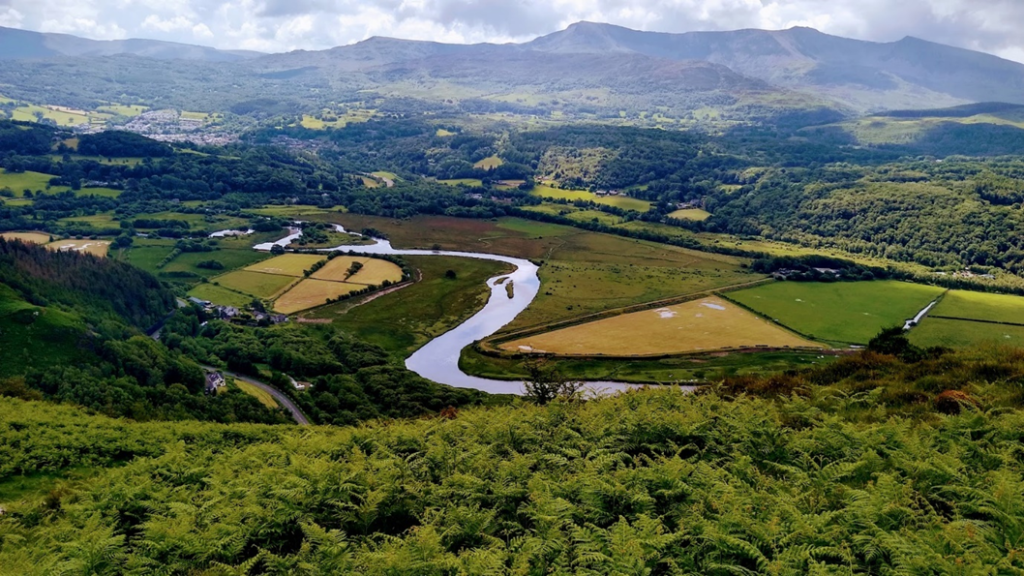
Four ramblers met at Fiddlers Elbow, just outside Bontddu. The route took us steadily up to the tops of the moorland where we found a flat, smooth old mining track along the side of the upper moorland, which is now referred to as the New Precipice. As it was a lovely sunny day we had spectacular views in every direction. We looked across the valley southwards at Cadair Idris Mountain and surrounding ridges.
Below was the meandering river and estuary of the Afon Mawddach as it flowed towards the sea at Barmouth. To the east we could see the other Precipice Walk as it wound its way around the hillside.
We continued to walk through an area of wild upper moorland with occasional cottages before walking down by a beautiful river valley of spectacular waterfalls and a gold mine. Finally, we walked along the edge of the Afon Mawddach again with a lovely view of the river back to the CP. We completed our walk with tea and cakes at Y Sospan back in Dolgellau.

Sunday 16th June Short Walk (Jane Rawlings)
6 miles, 1050 ft Ascent
A group of ten ramblers enjoyed the sunshine and company on the Sunday short walk. We followed an undulating route through the wooded areas south of Dolgellau. Using footpaths, tracks and quiet lanes we passed through Pandy, Tabor, Pandy Gadar and Esgeiriau. We were fortunate to have good views of the surrounding hills. We ended up in Dolgellau where we sampled cake, ice cream, soft drinks and beers.


East Cheshire Ramblers Committee Minutes 7th June 2024
Please see below the minutes of the meeting, reports and committee papers
ECR Social Calendar June 2024 v2
June Mabon
Dear Members
I’m writing to you all to share the sad news that June Mabon, a very long standing and active member of Cheshire East Ramblers, sadly passed away on Tuesday 7th May, just short of her 80th birthday.
As an active member of East Cheshire Ramblers, June was Chair of the group in the 1990s. In addition, June was very involved with the Peak & Northern Footpath Society and she co-founded Trafford Ramblers at the request of the Manchester Area. In 2015 June applied to have a 500 metre footpath in Timperley added to the Definitive Map. She secured a successful application and ensured an attractive, off-road path in a busy area was preserved forever. In 2014, at the Ramblers’ General Council AGM in Liverpool, June was presented with the ‘Protecting Where We Walk Award’ and gave a short acceptance speech.
June led walks across all distances and levels of difficulty and I’m sure many of us had the privilege of walking with her appreciating the fact that she took her responsibilities as a walk leader very seriously. Walkers always felt extremely safe under her excellent leadership. June was very clear that we all had to walk according to the Ramblers’ rules and if a walker decided to walk in front of the leader then they were “deemed to have left the walk”! Fellow walkers have spoken about her kindness and how she helped and encouraged walkers who were new to the pace and demands of long walks, ensuring they returned to enjoy many more.
June appears in the Ramblers ‘Volunteer Welcome’ training video where she describes her role as a footpath inspector, a job she took very seriously and which led to others taking up the role. If you wish to access the piece please follow the steps below.
Kind regards
Maggie Swindells

Volunteer Welcome
- Sign into Ramblers – using user name and password
- Click ‘Support Us’
- Click ‘Volunteer’
- Click ‘Online Training’
- Click ‘Training Library’
- Sign in again – using username and password
- Click ‘Volunteer Welcome’ and start the sequence
- On the menu choose ‘Volunteer Stories’ June’s contribution is the second one
Ramblers General Council April 2024
Please see below the papers for this year’s General Council on the 20th April. If members have any questions/issues they wish to raise please contact Steve Butterfield stephen.butterfield6@icloud.com or Trevor Park tjpark@btinternet.com as they will represent Cheshire East Area at the General Council in April.
There are other documents available (mainly about procedures etc) at www.ramblers.org.uk/about-us/general-council
