Zero Points on the National Grid

new new masthead
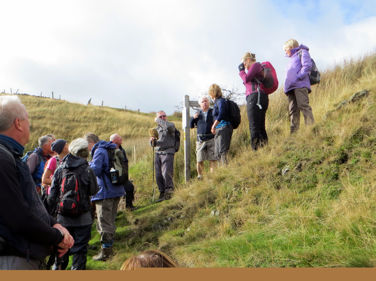
The inspiration for this article was Ralph’s August ‘Noughty’ walk from Padfield during which we visited the National Grid point SE0000000000 on the Swineshaw Moor near Stalybridge. This point is as at the junction of grid squares SE, SD, SJ and SK.noughty gps 
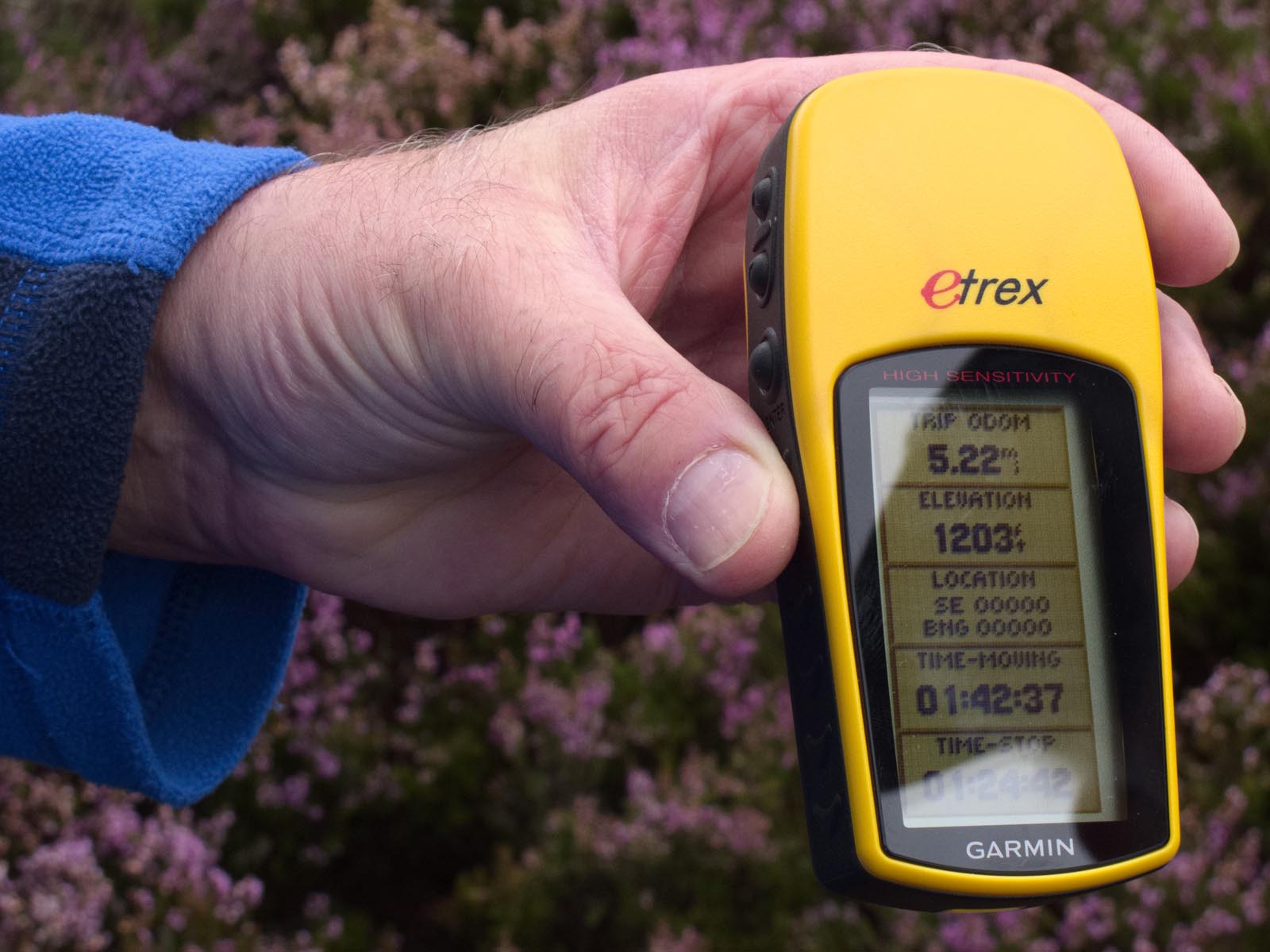
To prove the point Roger took this photograph of my GPS showing the grid point. This was achieved after considerable wandering about in the heather to get to the exact one-metre square and Ralph’s invaluable help in acting as a screen to cut down reflection. The location was only about 5 metres from a small cairn presumably built by previous visitors in search of the spot, which is not bad considering that the accuracy of a GPS is probably only about 10 metres.

The rules governing the National Grid are somewhat arcane. A grid reference consists of two letters and a variable number of digits depending on the precision required. Four digits will specify the point to the nearest kilometre and ten digits will give it to the nearest metre.

The grid is based on 500 kilometre squares arranged as below. Note that there is no I in GRID.

OS gridEach of these squares is further divided into 100 kilometre squares using the same pattern. Thus two letters are needed to specify each square. The first half of the digits then specify the distance from the west of the square (logically called ‘the easting’) and the remaining letters specify the distance from the south of the square (called ‘the northing’).

Because the earth is not flat the grid does not coincide with latitude and longitude lines except that the line dividing squares SJ and SK is at 2 degrees west. This line meets the English coast just north of Berwick-upon-Tweed and leaves it on the Isle of Purbeck south of Poole. In 1997 Nick Crane walked between the two points keeping within one kilometre of the line. A feat that will probably never be repeated since it involved a considerable amount of trespass, crossing lakes with the help of local sailing clubs and military escorts across Salisbury Plain and various airfields.

In practice Great Britain is covered by only five of the large squares – Ireland is not covered. These are:

N – North

S – South

H – Highlands or Hebrides, although the square only covers Orkney and Shetland

O – Offshore (but see below)

T – There’s no obvious mnemonic, but it covers south-east England

Looking at points similar to the one we visited on Ralph’s walk that have two letters followed by ten zeroes, there are only 22 which fall on land. These are conveniently listed on the following web site. http://www.geograph.org.uk/article/In-Search-of-OV0000

The strangest of these is probably OV0000000000 because in the whole of the O square there are only a few square metres of land, and those happen to include that point. The point lies on the beach below Beast Cliff in North Yorkshire. Apparently if you want to reach it, you are advised to go equipped with ladders, ropes and other climbing gear, and be prepared to wade knee deep through vegetation packed with ticks and adders. However there are reports of at least two species of beetle when you get there, so our editor is probably organising an expedition at this very moment. The web page at http://www.geograph.org.uk/photo/3715407 shows a photograph of a dead deer on the beach.

Of the other 21 points one is on the uninhabited island of Taransay off South Harris, and several are probably on private land or otherwise inaccessible. As far as I can see none of them is actually in the middle of a private house, although one does seem to be dangerously close to an electricity substation. All in all visiting each one would be a pointless exercise.

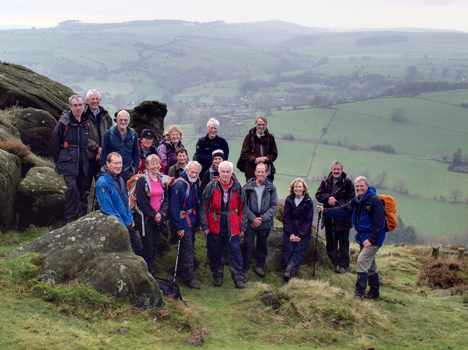
The party indicating the noughty spot with their poles

Steve Hull

Membership Matters

If the schedule for producing a report on membership for the AGM had been put back a fortnight the number of ECR members would have been 624, rather than the 619 I reported. Even so at 619 the total number of members is only ten less than reported at the 2013 AGM. Over a number of years our membership has been declining, and at a much faster rate than this year.

Does our total membership number matter? Our full programme of walks are generally well attended; we have no problems in filling a coach for a day’s walking away from our home area; over the past year our footpath clearance programme has been underway with a group of our members as volunteers working under the dedicated direction of Brian Richardson showing visible improvements to some of the paths in our area; weekends away are booked up and sometimes waiting lists have to be created for social events and meals when they are oversubscribed. This suggests a vibrant, sociable and active core membership exists irrespective of our total membership numbers. Nevertheless membership numbers do count when Ramblers Central office decide how much grant they will allocate to each group. Perhaps, more importantly, if our numbers are haemorraging greatly year on year, this might indicate the group is not functioning well to meet all its members’ needs, even after account has been taken of uncontrollable macro factors, like the economic recession and deferments of retirements, are taken into account to explain this decline.

While not considering our decline in membership had reached a critical point – it had fallen to 614 at its lowest point this year- I contacted the head of membership services at Ramblers Central Office in March to ask if research had been conducted on why Ramblers membership is declining. He confirmed declining membership was not unique to our group, and was in much steeper rates of decline in other areas of the country. More people renewing their subscriptions by direct debit were helping to stem the number of leavers. He told me they were trying to implement a more robust early alert system to other people not using direct debit to remind them when their annual subscriptions are due. Only 12 in our group have subscribed to the ideal; taking out life membership, by calculating their longevity- hopefully- will more than recoup their initial outlay.

Following my request for research I was emailed a 36 page document, with page upon page of histograms , breaking down membership into age groups, gender ,motivations for walking, years of membership etc., accompanied with the apology it had been conducted in May 2011 and now needing updating! Wading through all this, and not wishing to bore fellow committee members at our next meeting with it all, there seemed two salient points. There was a spike in the number of people not renewing membership after 7 years, which did not seem to be explained- perhaps it is the Ramblers equivalent of a seven year itch supposedly occurring in marriages. Even more noticeable, however, was that by far the largest group of people not renewing their subscriptions was after only one year of membership. The overall conclusion- setting aside such specific complaints by new members that the group they were walking with were too old, walked too slowly or too quickly- was that every effort needed to be made to make new members feel welcome when they started walking. Because the new member liked walking did not mean they would automatically enjoy walking with a Ramblers group. Sometimes new members complained they felt as though they were excluded by an established clique of walkers. The message is that as a group we cannot be complaisant about the welcome we are giving to new members, assuming , for example, no effort on our part is required and that they will `pick it all up as they go along`.

There are a number of possible reasons why our membership numbers have only declined by ten this year. It is possible that the group’s excellent website has helped, including accessibility to the walking programme. In order to maintain this attractive and comprehensive programme throughout the year, however, there is a constant need to retain and recruit new walk leaders. Since April this year, organised by Roger Norton, articles accompanied by pictures have regularly appeared in the Macclesfield and Wilmslow Express, which has helped in maintaining our public profile as an enjoyable and worthwhile activity available in our area. Next year I will endeavour to ask all new members how they came to join our group, in order to be more precise whether this is, for example, coming across our website, reading one of our articles in the local paper, or having a friend who had joined, as well as members who have belonged to other groups but have moved to our area.

Finally, Ramblers Central Office has a crucial role to play in maintaining membership numbers. Their efficient administration is important if members are not to feel frustrated and disillusioned. I genuinely believe there has been an improvement overall in the quality and speed with which queries have been dealt with by Central Office over the past year, although there have been some notable, but now infrequent, exceptions to this, and that applications to join appear to be processed more expeditiously than when I joined six years ago. They have instigated a new initiative to help answer frequently asked questions by the memberships, details of which were circulated by email to our members on the 19th November. To repeat, the email addresses to contact them on to answer` frequently asked questions` is http://www.ramblers.org.uk/membershipenquiries . I feel intrigued to know what these frequently asked questions might be.

Mike Bull

Risk Assessments Sub-Committee

Brian Griffiths reports that in this age of increasing litigation, the Ramblers insurance company has requested that each group carries out risk assessments in order to minimise claims. The critical areas identified are listed below:-

  • Climbing over wooden stiles.
  • Climbing over stone stiles
  • Descending steep, wet and grassy slopes.
  • Ascending rocky gullies.
  • Traversing boggy moorland.
  • Traversing streambeds
  • Crossing ploughed fields.
  • Crossing golf courses.
  • Passing fields of ewes with lambs.
  • Walking with Brian Griffiths and Ralph Atherton

Brian will chair a subcommittee with ten members each of whom will take responsibility for producing one of the above risk assessments. Brian expects he will easily enlist ten ECR members to serve on his subcommittee. Please ring him to volunteer, and act quickly to be sure of your place. Meanwhile he asks all members to take care and use common sense when out and about.

Brian Griffiths

Our AGM – November 2014

Our AGM was held on Saturday 15th November, 2014 at Macclesfield Tennis Club, and 38 members attended. It was preceded by a 6 mile walk from the Tennis Club, led by Frank Gay, and 27 people enjoyed the walk.

A new venture was held over lunch. Louise Winstanley organised a Bring and Buy walking equipment/clothes sale. The sale raised £69.30 for our Group, and will augment the funding of our Footpath Maintenance Team. Thank you Louise, for all your effort, and members who supported the sale.

Our Chairman, David Gylee retired from the position after 3 years of leading the group, giving valued leadership and guidance. David thanked the many members involved in the running of Ramblers East Cheshire Group in providing a first class service that benefits everyone.

The position of Footpath Secretary remains vacant, but to-date no one has volunteered for this position. The Footpath Committee operate successfully thanks to the many years of knowledge held by the members in footpath matters.

All members of the Committee with the exception of the Chairman stood for re-election and were elected unanimously.

John Edwards was proposed as our new Chairman by Ian Mabon, seconded by Jane Gay. The meeting majority elected John to Chairman.

Next Year’s Budget has been approved by Central Office. Funds for footpath projects and maintenance are available.

The Footpath Maintenance Team led by Brian Richardson has made good progress through the year, and since the start, 123 person day’s attendance with a total of 596 hours being worked.

Membership has declined slightly. However, over the past year, three or four people joined our group each month.

Social programme has been successful, and enjoyed by all who attended the events.

Publicity organised by Roger Norton with the Macclesfield and Wilmslow Express newspapers to publish articles on our walks. Also, thanks to Helen Richardson for co-ordinating the publicity for our walk articles. This publicity has helped to attract new members to our group. Walk articles with a photo are encouraged.

Currently there are insufficient members coming forward to be walk leaders, and the group is addressing this situation.

Ramblers Central Office have issued two documents, “A new governance structure for the Ramblers”, and “The Ramblers: proposals for the next ten years”. Secretary to email these documents to members. Ramblers Central Office is looking for feedback by 31st December 2014, and members are encouraged to respond.

In closing the AGM, Jane Gay on behalf of the Committee and all members presented the outgoing Chairman with a gift to say thank you for his leadership and hard work over the past 3 years. – Well done David.

A walk survey was undertaken for the month of September 2014, and compared with the survey of September 2013. The walks at Patteredale undertaken in September 2013 were excluded to make the two periods comparable. The results are appended this article.
Overall, it was an enjoyable day, and many thanks to Jane and Frank Gay, for leading the walk, and organising the venue, and refreshments

David Bates

Footpath Maintenance and Improvements by the ECR Footpaths Project Team

Would you like to help to look after our footpaths? I mean specifically, the footpaths which East Cheshire Ramblers’ forty or so Footpath Inspectors check and report to our database on unsatisfactory conditions. In summer 2013 East Cheshire Ramblers Footpaths Projects Team was formed and that September commenced tasks of maintenance of our footpaths, and we have already carried out significant improvements on twelve footpaths. Our tasks are varied and have, so far, consisted of:

  • Heavy vegetation clearance, such as tree branch removals, sapling removals, holly, hawthorn and similar shrub major cut-backs and removals. Grubbing out the roots suckers and runners of bramble and holly complexes. (Strimming excess grasses, nettles, and brackens is left to CEC PROW’s strimming contractor after the path is freed of the former obstructions)
  • Finger post and waymarker post placements.
  • Stile and steps refurbishments.
  • Gates installed.
  • Major drainage installed.
  • Minor re-surfacing.

Our range of work is widening.

Our team of men and women elect to attend in the scheduled dates when they can. We currently have nineteen active members who contribute some days to our work. A day’s project usually has a variety of tasks, and team members each carry out the tasks they feel they are capable of contributing to, and ‘have a go’ at new skills as they help others with tasks. Most of us are at retirement age and older, and are limited in what we may do by ailments, and perhaps, our body strength and fitness. The tools we can use includes hand pruners, longer geared branch loppers, small and longer saws, hammers, spades and shovels, post-hole diggers, mattocks etc. We have several of each of the most-used tools. Some team members bring their own tools of choice.

We wear old clothes, strong walking boots and durable gardening gloves. We come prepared for some showers, bring picnic lunches, have coffee and lunch breaks, and appreciate the scenery – especially when we need a breather.

I look after the Projects Team’s range of equipment. Thus, I have spare leather gauntlets for sharper shrub-work, protective lightweight and comfortable safety glasses and helmets where needed for overhead work etc. We carry a comprehensive first aid kit to the working area – unused so far.

The Ramblers Central Office have a record of ECR FP Projects Team members. This is required because each member is thereby insured against Civil Liabilities and for Personal Accident claims. I maintain this record with Central Office. As a Team Member, we should have a Letter of Authority issued by Cheshire East Council PROW unit to carry out the tasks on CEC’s public footpaths. (Our footpath inspectors each should have such a letter already). I can assist in your application to CEC PROW.

I prepare a diary of works, and send group-emails to our team members stating where and what time we are meeting (description and OS Map reference) and what tasks we hope to complete. We meet at 9.30 am and finish about 1.00 ~ 4.30pm (dependant on tasks), but members occasionally finish early. We have lunch and coffee breaks.

I shall try to set dates well in advance so that members can plan their diaries and offer attendance dates. There is flexibility since we are all volunteers who have commitments arising unexpectedly. We have cancelled, because of inclement weather, only once, so far. Everyone seems to enjoy the company, conversations, banter, tiring work, and satisfaction at what the team has completed that day.

Please come and join us. If our team expands, we can cope with a range of tasks with less reliance upon each one of us. If you come to help, even for one trial day, I shall need to add you to our Project Team list registered at The Ramblers Central Office for insurance cover (outlined above).

Please email me at projects@eastcheshireramblers.co.uk or ring me on 01625 520 486 if you would like to ask for more details and to join us, – even for just a trial day.

Brian Richardson
ECR Footpaths Projects Team Coordinator.

Bollington Walking Festival 2014

The 5th Bollington Walking Festival took place in October with a record breaking 600 walkers taking part.

East Cheshire Ramblers contributed 6 walks to the Festival, ranging from 10 to 19 miles. On the first weekend Steve Hull led a 14 mile walk to Teggs Nose, Nessit Hill, Forest Chapel and back via Rainow. The following day Chris Brear’s 10 mile walk took walkers up the Harrop Valley to the new permissive path where Brian Griffiths explained how the Ramblers had developed the path and we admired the work of the footpath team in improving a notorious muddy section. We continued via Jenkin Chapel and back to Bollington. On the Tuesday our luck ran out with the weather. 13 hardy souls turned out for David Gylee’s ‘Trail to the Chapel and Back’ in strong wind and driving rain. By the Thursday the weather had improved again and 28 people to enjoyed Sandra Edwards’ 11 mile walk taking in Macclesfield Forest and the reservoirs. Ken Edwards’ led his long walk on the final Saturday, 19 miles and 4000 ft of ascent to Eccles Pike and back. 26 people completed the walk, ending with a welcome pint in the Vale. Some of them were out again the following day to join the 29 walkers on Mike Bull’s route to Teggs Nose and back. We were delighted to welcome walkers from other parts of the country as far afield as Sussex and Wiltshire who spent a few days in Bollington. A number of local walkers expressed an interest in becoming members of ECR, at least two have already joined and we hope to see them again soon.

BWF Brian Griffiths explains work done by ECR to develop new permissive pathThe Bridgend Centre acted as a hub for the week and provided the ‘Walkers Cafe’ where welcome refreshments and home made cakes were served to hungry walkers. A welcome innovation for this year was the inclusion of 3 walks led by Marple Ramblers. Other highlights during the Festival included an early morning wildlife spotting walk, a stargazing night walk led by a local astronomer, an evening celebrating the Kinder Trespass, orienteering and geocaching walks. New for this year, the Ghost Walk was enjoyed by 67 people young and old. The Bollington Belles sang beautifully eerily and a ghostly apparition was seen at an upstairs window. They returned to the Bridgend Centre for a warm welcome with hot dogs and hot chocolate provided by Walkers are Welcome.

The Walking Festival organisers would like to thank all the walk leaders and back markers for their help during the Festival. We appreciate the work involved in developing new routes and being prepared to lead larger than usual groups. Planning for 2015 has already started. Offers of help to lead a walk or help with the organisation of the festival would be very welcome. We are a friendly group who meet every few weeks between February and August to put the programme together and plan publicity. Please contact Chris Brear, cbrear@btinternet.com if you are interested.

Chris Brear

VISTAS AND VALLEYS FROM PYM CHAIR

From Andrew’s Edge with Lamaload Reservoir in the distance.

The summit of Shining Tor, at 559m, is the highest point in Cheshire. It is situated on a fine ridge walk, popular with East Cheshire Ramblers, and affords superb views towards local landmarks, such as Shutlingsloe (506m) and ‘The Cat & Fiddle Inn’ on Buxton New Road. The ridge forms part of the border between Cheshire and Derbyshire, and follows an old packhorse route used to carry salt from Cheshire and lime and coal from Derbyshire.

Shining Tor was the first of several high points on a recent nine mile walk, when twenty-two Ramblers set off from Pym Chair Car Park, led by Andrew Davies. After their gradual climb along the ridge and time to admire the summit vista, the ramblers descended steeply, tracking generally west then northward along Andrew’s Edge on rough grassland. They enjoyed a short break overlooking picturesque King’s Clough and Lamaload Reservoir, before continuing across rather boggy moorland to Redmoor Farm, then down and up a short steep stretch of road to Jenkin Chapel.

A more gradual ascent on tracks and paths took them past Green Booth to Summerclose and Charles Head Farms, though they paused on the way for a picnic lunch gazing across the steeply-sided valley towards Windgather rocks, which they would reach later along their route. Soon they were once again descending steeply, this time to cross Todd Brook, before climbing more gradually on its far side past Near Carr Farm to Five Lane Ends. As the walkers turned south to walk along Taxal Edge and Windgather Rocks, the low sun to the west broke through the clouds, and faint shafts of sunlight against the mid-afternoon mist lent a rather mystical quality to the landscape. A final mile along this ridge brought the ramblers back to the car park, where all agreed it had been a very enjoyable walk.

Helen Richardson

View towards Shutlingsloe from Shining Tor


RAMBLING ON THE SOUTH CHESHIRE WAY

Afternoon break at the lock on the Trent & Mersey Canal at Thurlwood

Mow Cop Castle folly is a landmark dominating the Staffordshire skyline for miles around. The folly, built 260 years ago and now belonging to the National Trust, was the location of the first stop of the day on a recent twelve mile walk by eight members of the East Cheshire Ramblers, led by Colin Park.

After a wet night, the Ramblers set off from Little Moreton Hall along the South Cheshire Way. Soon after crossing the Macclesfield Canal the group ascended towards the Old Man of Mow. The summit however was just within the cloud base, and so on this occasion, only the grey outlines of both the Old Man and nearby Mow Cop Castle loomed out of the mist as mystical grey outlines, and there were sadly no views from these high vantage points. A descent was followed via a maze of lanes through Mow Cop Village, which is famed for the birthplace of the Primitive Methodist movement. On the edge of Kidsgrove, the group then followed a section of the Trent & Mersey Canal to reach their lunch stop in the church yard at Church Lawton.

The church which stands on a mound has been a religious site for near on one thousand years. The present church was built after a fire in 1798. One hundred and forty six years earlier the church was struck by lightning killing eleven people inside.

Rejoining the canal towpath again the group crossed Snape’s Aqueduct to reach Thurlwood. Here it was time for another brief break before setting off along field paths in bright afternoon sunshine, following once more the South Cheshire Way for much of the way back towards Little Moreton Hall.

Colin Park

Walking along track south of Higher Smallwood near Thurlwood


DRAGON’S BACK FROM PILSBURY CASTLE

Lunch at Sparklow

Situated on the Manifold River, and above the River Dove valley, the village of Longnor provides a good starting point for walks exploring the upper reaches of both rivers. Ten East Cheshire Ramblers gathered in Longnor’s cobbled market square on a chilly morning for a recent ten mile walk south along the Dove Valley to Pilsbury Castle. The chill lessened as they gained their stride, walking down into the Dove Valley. The morning coffee stop was taken at Pilsbury Castle, where earthworks and an earth mound on a limestone outcrop are all that remain visible of the Norman motte and bailey construction with a wooden perimeter wall, built in the eleventh century to control the upper Dove Valley. From here, through a haze of thin white mist, could be seen the distinctive grey outlines of Parkhouse and Chrome hills, – for their shape, also known aptly as ‘dragon’s back’.

Their route, led by Mike Bull, crossed sheep pasture limestone uplands to reach the High Peak Trail, which follows the course of the old High Peak railway, constructed in the nineteenth century to link the Cromford Canal on the eastern side of the Peak District with the High Peak canal on its western edges, and with Manchester, then a rapidly developing cotton manufacturing centre.

Good views of the hills were enjoyed as they made their way along the flat track bed, stopping for lunch at picnic tables at Sparklow, which had been one of the railway halts.

The Trail took them back towards Earl Sterndale, where a wooden bridge crosses the Dove. This was followed by a short, steep ascent out of the valley back to Longnor. Some of the group lingered over well-earned hot drinks and cakes in the market square café -another attraction in starting the walk from Longnor – before their return home, contented with the tranquillity and beauty of the ramble.

Mike Bull

PLAGUE VILLAGE AND STARTLING ROCK FORMATIONS

On Frogatt Edge

Eyam, a picturesque village in the Derbyshire Dales, was the start point of a recent walk by eighteen East Cheshire Ramblers. Known as the “plague village”, Eyam is famed for the fortitude of its villagers, who isolated themselves to reduce spread of the bubonic plague outbreak there in 1666.

Fortunately, the downpour that greeted the walkers on arrival in the car park ceased by the time they set off, led by Ken Hobbs, to climb past a herd of bedraggled alpacas to Eyam Moor. Low cloud obscured their expected vista, but occasionally the sun broke through to throw a spotlight on the village of Hathersage below.

Beyond Stoke Ford, the cloud lifted and they enjoyed a vista of Highlow Wood opposite, and a glimpse of the sun shining on Stanage Edge and Higger Tor in the distance. Soon they passed the charming 17th century Hazelford Hall, a Grade II listed building, then dropped down to cross the swollen Derwent at Leadmill Bridge. After walking alongside the river through Coppice Wood, they began to climb and enjoyed lunch overlooking the river and woods beyond

They continued to Grindleford Station before climbing up through the National Trust Hay Woods, accompanied by the sound of cascading streams. On reaching Froggatt Edge the ramblers were rewarded by views of startling rock formations, backlit by a low sun breaking through clouds. There followed a zigzag scramble downwards through Bee Wood to Froggatt Bridge, also dating from 17th century, where they re-crossed the Derwent.

Finally, they climbed from the river to pass “Riley Graves”, the resting place of John Hancock and six of his children who died within a week from the plague. Eyam Church clock was striking three as the ramblers passed by to complete their 11.5 mile walk.

Ken Hobbs

Admiring the view to Higger Tor at break time