

Setting out along the Letterkeen Loop Walk along easy forest tracks to begin with.
Having climbed Nephin in the wild northwest corner of County Mayo back in 2016, I decided this summer to take on its little brother Nephin Beg. These two mountains are not juxtaposed but lie some ten miles apart and whereas the 808 metre Nephin can be ascended and descended in a half day, Nephin Beg is a much more serious undertaking.
I have waited for a fine day to venture into this remote area and drive west through the busy and bustling town of Ballina to reach the smaller town of Crossmolina from where I continue a short distance on the R315 then R316 which is the Irish equivalent to our B class roads. Turning off, my drive continues across country initially on good country lanes for several miles and scattered with isolated farmsteads. The countryside gradually becomes wilder with vast low level moorland with bogs, broken only by occasional blocks of forestry. I am entering what is known as ‘Wild Nephin’ and it’s not long before I am driving on a road consisting of two strips of tarmac with a copious line of grass along the middle. Using the 1:50,000 Irish Ordnance Survey map the yellow road shown becomes grey indicating I’m on what is called ‘other road’. After a few more miles of twists and turns ups and downs I turn off along a forest track to reach my start point. This is the start of the ‘Letterkeen Loop Walk’, a 12 kilometre way-marked trail which I will follow partly on my outward and return trial to reach Nephin Beg.

For a few miles I am walking parallel with the Holes River. At this point the forest has been felled to provide some views.
The car park is deserted albeit one four by four parked up and in the silence of a perfect sunny morning and armed with the excellent 1;25,00 map entitled ‘Wild Nephin’ I donned walking boots and set out from the deserted and peaceful car park. Heading north I follow a good forestry track beside Holes River. There seems a real sense of remoteness all around in this landscape devoid of hardly any human settlement. After a mile or so of walking a car draws past me despite this area being within a gated forestry area. I reach the car sometime later which is now parked up in a forest clearing. I press on for another couple of miles through mostly a forested area passing on the way an emergency shelter.

Walking deeper into the remote country and for now staying on the good forestry track.
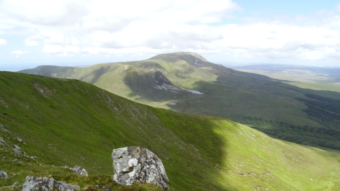
On the eastern flank of Nephin Beg with a view north to Slieve Carr which is said to be the remotest mountain in Ireland to reach.
Where there is a forest break on my left it is a good spot to leave the track and head uphill to gain the eastern flank of Nephin Beg. Initially the tussocky terrain makes it slow going, but as I gain height, so the walking becomes easier and after a stiff ascent of around 450 metres I reach the eastern ridge leading along towards the summit of Nephin Beg. The views have opened out along the summit ridge and it’s a relatively short walk to the summit cairn at 627 metres.

The summit of Nephin Beg marked by a prominent cairn. This view looks west towards Achill Island. Time for my lunch stop.
After taking a few photographs I chose a spot just to the southeast with a view for lunch. After a rather warm ascent it is nice to feel the cool breeze and to enjoy the sunny intervals. The landscape is a sea of mountain, moorland and forest with virtually no sign of human habitation. To the north lies the higher mountain called Slieve Carr which is said to be the hardest summit to reach in Ireland as it is so remote but it’s on my bucket list to do one day.

Time for my descent from Nephin Beg via this broad ridge with plenty of boggy bits to avoid.
For the return leg, I set off south down the easy broad ridge passing on the way a few peaty areas with peat hags. Two people are coming the other way as I cross the col and start out on the ascent of the lesser hill called Cruckgarru. It is the two ladies that past me in the car on the forestry track who as it turned out are local to the area and know that the forestry gates will be open all day. They have two small but boisterous dogs that are delighted in jumping up on me as I chat with them. They are surprised to come across anyone out on the mountains.
Once over Cruckgarru, I descend towards the Lough Avoher Emergency Shelter which consists of enclosed shed but open to the weather on the northeast side. Before reaching it, the ground becomes quite boggy. Not far from the shelter I pause awhile in this truly remote landscape. A sign points along the Bangor Trail which runs through this remote area and is a serious undertaking and it has been described as the loneliest place in Ireland. Another notice warns that a bridge along this trail is down and the only way across a river was to wade. At least I’m not going that way.

The junction with the Bangor Trail close to the Lough Avoher Emergency Shelter which leads into a even remoter area.

Looking back along the Bangor Trail on the return which concurs with the Letterkeen Loop Walk.

One of the metal footbridges which span the many streams on the Bangor Trail.

Towards the end of my walk the Bangor Trail runs through this attractive bracken filled valley.
Meanwhile I set off along the Bangor Trail in the opposite direction and towards the car on this fine summer’s afternoon. The trail is quite rocky underfoot and so progress is slow and I stop several times to take photographs. Little metal bridges span the streams and later the path runs through a shallow bracken covered valley before veering left to reach the car park to complete a most enjoyable walk.
Details of Letterkeen Loop Walk;-
www.mayowalks.ie/WalkingTrails/LocalisedLoopWalks/LetterkeenLoops
Detail of map used for this walk;-
www.eastwestmapping.ie/product/wild-nephin-folded