
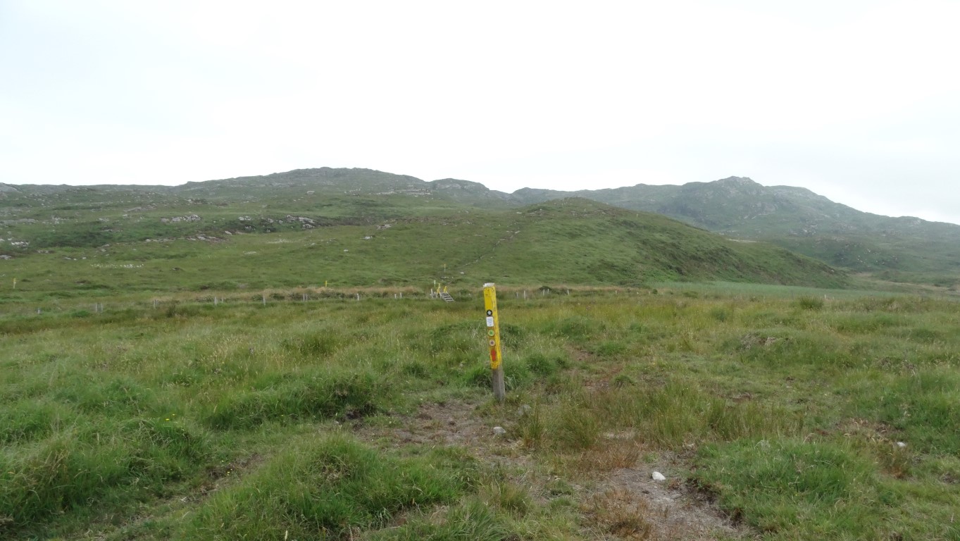
One of several way-markers on the Cahergal Loop Path. Here I’m heading towards Caher Mountain.
Of the five fingers of land which thrust out into the Atlantic in counties Cork and Kerry, Sheep’s Head is the smallest and probably the least known, but for me, it was a real gem waiting to be discovered and I was very much taken by this peninsula.
After a full Irish breakfast cooked by professional chef and host Chris at my Airbnb, I set off for the drive via Bantry out along the road called The Goats Path and park up at the small car park at Black Gate. I plan a circular walk taking in the western end of the peninsula but first I head uphill taking a farm track then well signed footpath with frequent way-markers on what is known as the Cahergal Loop. This is one of several signed looped paths in the area. High on the hillside I leave this trail to follow another set of way-markers which ascend to one of the high points on the ridge. This is the Peakeen Ridge Walk and provides a rocky but short climb to the summit of the 338 metre Caher Mountain. On the summit I rest awhile and have my morning break. Visibility is poor but I have a view across Bantry Bay to the north and Dunmanus Bay to the south.

The restored dwelling which once belonged to Tade Carthy. there are remains of several dwellings in the area where once families egged a meagre living of the bleak hillside.
Afterwards, I back track and descend to rejoin the Cahergal Loop Path. On my descent I pass and speak to another family making their way to the summit. Following the Cahergal Loop Path north, the trail is very undulating to say the least and involves some steep but short descents and ascents. Without the path, this terrain would have been very difficult to cross. Eventually I make it down to cross the road and set out west on the extremely well signed Sheep’s Head Way. Never have I seen so many way-markers and each one numbered. It is a bit like a ‘dot to dot puzzle’ except you are walking between each post. I follow the coast on a path and soon pass the ruins of a hamlet. One house has been restored and on its door is the name of the family who once owned it ‘Tade Carthy. These simple dwellings had a door facing west and one east so that there was a through draft for the smoke from the fire to escape the building. These houses had no chimney and living in these parts life was hard with no shops or facilities anywhere nearby. Part of this area was known as Crimea (pronounced crymay) as it got its name by two quarrelling families who didn’t get on at the same time as the Crimean War was taking place.

On the Sheep’s Head Way at a spot where it comes close to the cliff edge.

The ruins of the miner’s cottages can just be made out above the bracken. there are several mine shafts in the area but copper mining never really made a profit.
I head west to spot where there were once copper mines and today I found old shafts cordoned off only by wool-tufted barbwire and a line of miners cottages, roofless and half hidden in the bracken. In its heyday it was home to 24 miners and experienced Cornishmen were brought over to work the mines not that they were all that profitable. It is at this spot where the path comes close to the cliff edge and a rope has been provided for security for anyone with vertigo. A little further west I stop for lunch on a rocky spur where I could stair out onto the Atlantic and what a peaceful spot this is on this fine summer’s day. Nearby at a spot which I didn’t find on this walk is a man made blowhole and the story tells of a local farmer who blasted a hole in the cliff so that the waves would force sand onto his land to make it more fertile but the plan however never worked.

On the Sheep’s Head Way en route towards the Sheep’s Head and providing many miles of first class coastal walking. Way-markers are are frequent intervals so it is near on impossible to get lost.
I set off skirting around a little rocky cove and take a good enclosed track up to a minor road. For the next three miles I simply followed the empty coast west following an endless line of way-markers. The path is undulating and becomes rockier as I near Sheep’s Head and over this section I meet several people out walking. Off the path, the going would have been tricky. At the headland, a sign points down to the lighthouse which is initially out of sight. The lighthouse was built in 1968 to guide tankers towards the Whiddy Island Oil Terminal. It is perched high above the cliffs and is only seven metres tall. A flight of concrete steps with red railings lead down to the building. Nearby, I stop on the cliff top for a rest with a view out towards the open Atlantic.
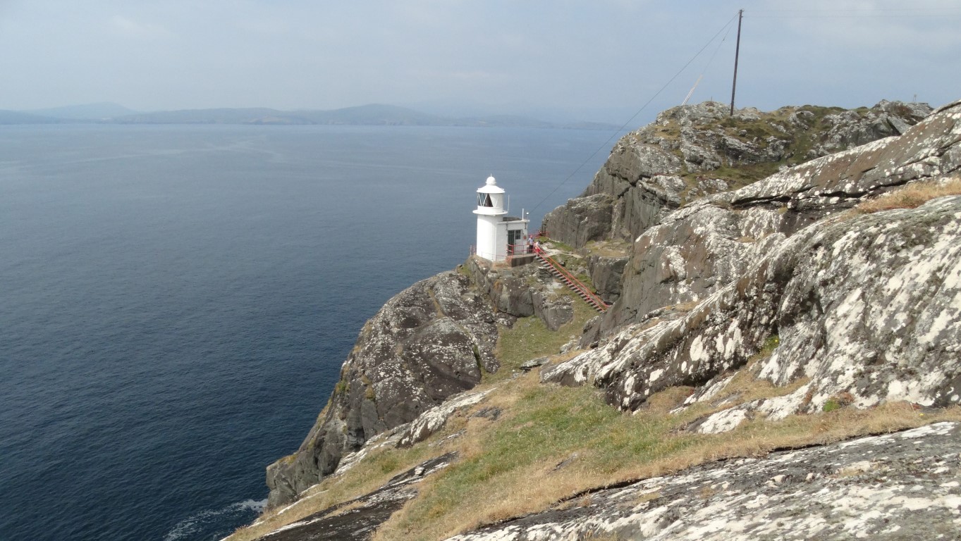
The lighthouse at the Sheep’s Head, perched high on a cliff and hidden from view until you are almost there. This view looks out across Bantry Bay.

The western end of Sheep’s Head thrusting out into the open Atlantic Ocean. The next landfall is North America.
For the return walk I follow a good path back to the first settlement of Tooreen . On the way I unknowingly pass close to one of the eighty two ‘Eire’ signs. These signs also known as neutrality signs were placed on strategic headlands around Ireland coast to show Ireland’s neutral position during World War II. Many of these signs have faded into obscurity but there are plans to restore some of them. The signs were made of boulders painted white and large so that they could be seen from aircraft.
At Tooreen I visit the tea rooms which I would consider as having one of the best views anywhere in Ireland and perched high on the ridge with far reaching sea views.
Setting off I now follow the path along the rocky ridge gradually climbing to a trig point at 239 metres. I chat with a couple of English walkers here and in our conversation the man shows me a book about the Sheep’s Head Way. It is such an excellent guide, full of local history and so many things that I had missed on my walk today that I just had to buy it when I got back home.

The trig point at 239 metres at Ballyroon Mountain which lies east of Tooreen.

A good way-marked path leads all the way along but often high above the southern coast. Either side you have views to the sea. Caher Mountain is visible in the distance and visited early in my walk before heading out along the north coast to the left of the photograph.
Continuing, my route I head east along the highest part of the ridge with glorious views everywhere and bursts of late afternoon sunshine behind me. I pass the remains of an old signal tower before making a long gradual descent to reach a minor road where I turn left then right. The path continues east, still with those very frequent way-markers. I had joined the path in the morning where the way-markers were numbered just over two hundred but now I was passing way-markers with numbers in the three fifties. A small signed diversion off the route leads to the Caherulagh Marriage Stone. This fine standing stone has a hole through the middle where a couple would join hands perhaps before a marriage ceremony. Unlike a similar stone I visited on Cape Clear Island a couple of days earlier, this hole was easy to fit my arm through. It is believed that these standing stones date back to the Bronze Age.

The Caherulagh Marriage Stone possibly dates back to the Bronze Age.
Turning right downhill across some fields it is then just a short lane walk back to the car. In many respects it is a shame that this was the end of the walk. On reflection some walks when you get near the end you start to count off the last few miles but this one I just wanted it to go on. So full of history with excellent views this place was just magical insomuch I’ve just got to go back some day.