
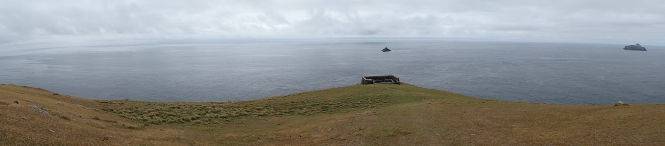
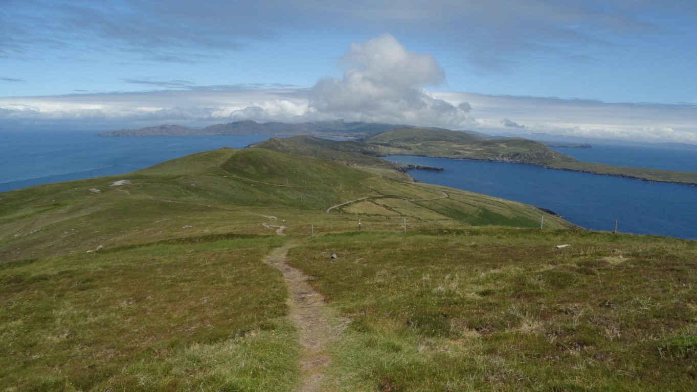
A panoramic view at Dursey Head. Offshore is The Calf (centre) and The Cow (right).
It’s the last place where the sun sets in the British Isles on December the 31st and it is a land where a few hardy souls eke out a meagre living working the thin soils on this windswept and tree less island. The only fixed connection to the Irish mainland is via a cable car which looks little more than a workman’s hut slung on wires which plies to and fro across the Dursey Sound all year round. Well it sounds like a good place to visit.
I first came here in 1980 with a few friends and ventured out across the island on a rather dull and damp windy day. On that occasion we didn’t see much but here I was again with an opportunity to explore Dursey Island in depth on what I hoped would be a better day.
I’m leaving a very sunny Glengariff on a warm summer’s morning for the drive along the southern side of the picturesque Beara Peninsula. Now, what’s this? Within a few miles of setting off the bright sunshine has been replaced by a soft Irish morning and it’s the first time I’ve had to use windscreen wipers on the car since my arrival in Ireland about two weeks ago. This is not on the weather forecast today!
As I drive through Castletown Berehaven and onwards to the end of the road at Dursey Sound, the cloud has settled well down on the hills and a thick drizzle has set in. Having driven this far I am not likely to be in the area for many years to come so rain or shine I opt to go for it.
One’s first impression of the cable car is a bit overwhelming. A little box hanging on cables high above the Atlantic. At either end are two tall steel structures which have taken on a very rusty look.
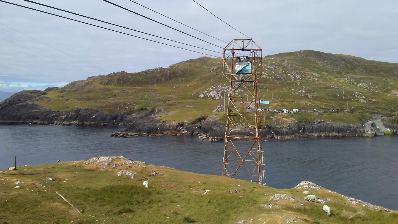
Dursey Island Cable Car. Viewed during the afternoon. The morning was too misty for any decent photographs. Is it me, but does the tower look a tad rusty? The cable car can be seen as it passes through one of the towers.
It’s €10 for the return trip on the cable car and even on a dull morning like today there is a small queue. With a maximum capacity of six persons you can work out how long the wait is going to be as the round trip by the cable car across the sound takes fifteen minutes. Now for the downside; Residents on the island take priority on the cable car and can jump the queue and furthermore they are carried free. On the small exposed platform a small group of tourists clad in brightly coloured waterproofs are waiting their turn. At least it is just drizzle but I can imagine you could get jolly wet just waiting for the cable car.
After a forty minute wait which can be passed by chatting with other tourists and listening to their experiences in Ireland we are off. With the cable car just attached to the cables every time someone boards the cabin it sways outward from the platform.
Silently we are moving with a gradual ascent to pass through the first steel tower before our ‘little box’ lurches over the grey waters of Dursey Sound. If you wish, you can look down between the slats in the floor to see the grey waters far below. The cable car is not only used for passengers but you might have to share your little confined place with a few sheep. Inside are pasted details in the event of an emergency including the use of a two way radio or how to use the seventy five foot long rope ladder which allegedly will stretch down to any rescue boat should the worse happen. Alongside is a copy of Psalm 91 which one of the group takes great delight in reading out.
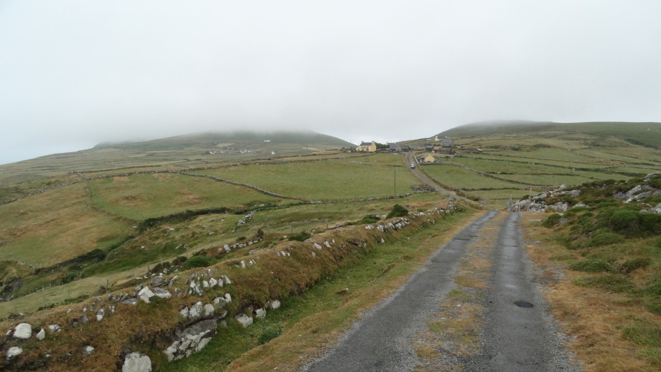
Heading west on the lonely road towards Ballynacallagh.
Safely on the island, it’s time to decide where I am going. My plans is to walk the four and a half miles one way to Dursey Head via the island road and return along the spin of the island, which is another four and a half miles and as the hill cloud is well down I wisely opt to follow the road west. Surprisingly enough there are several cars and four by fours on the island, none of which would pass their MOT as most vehicles are rusty and have wings or bumpers missing to say the least.
I set out on the minor road which crosses the island. I seem to recall that on my visit in 1980 that this was just a mere track. The population of the island hovers around a half dozen. You’ve got to like remoteness if you want to live here as there are no shops or facilities and you can be cut off from the outside world for days on end.
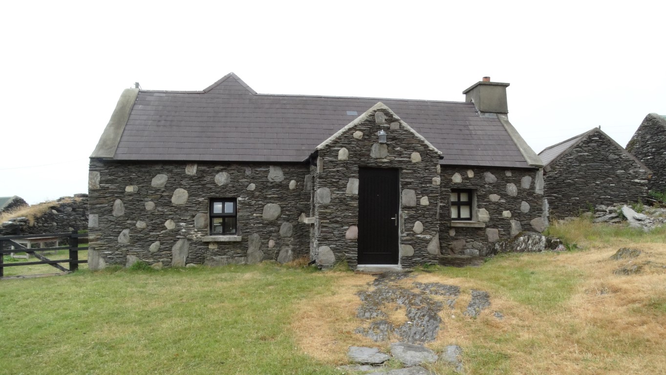
A restored house in Ballynacallagh. I like the way they have done the stonework.
About a half hour walk brings me to the first village of Ballynacallagh which comprises of a few houses clustered together and some quite recently renovated. Here and there are dotted many other properties now only stone shells with roofs fallen in. This reflects on a once much larger population a century ago. There was a castle here once and in 1602 it was a garrison of the O’Sullivan Beare family. About this time the island was attacked by the English murdering all three hundred islanders.
I press on, soon passing through the next village hamlet of Kilmichael. The road continues and gradually climbs along the steep hillside with a steep slope plunging to the Atlantic hundreds of feet below whist above me the hillside disappears into the mist. Someone with a sense of humour has erected some road signs along the next section and I pass a bus stop sign and a sign indicating a speed limit of 100kph. As the road contours around the highest hill I get a view to the western end of the island and the last settlement. It looks so bleak even on a summer’s day with a line of ruinous houses dotted along the south facing slope and one lonely lived in farm at the far end. This place is called Tilickafinnal and is certainly a place to get away from it all. Head in the same direction southwest and your next landfall would be Florida! At least now the weather is showing signs of improving and the cloud is slowly lifting, which I hope will provide a rewarding walk back along the spine of the island.
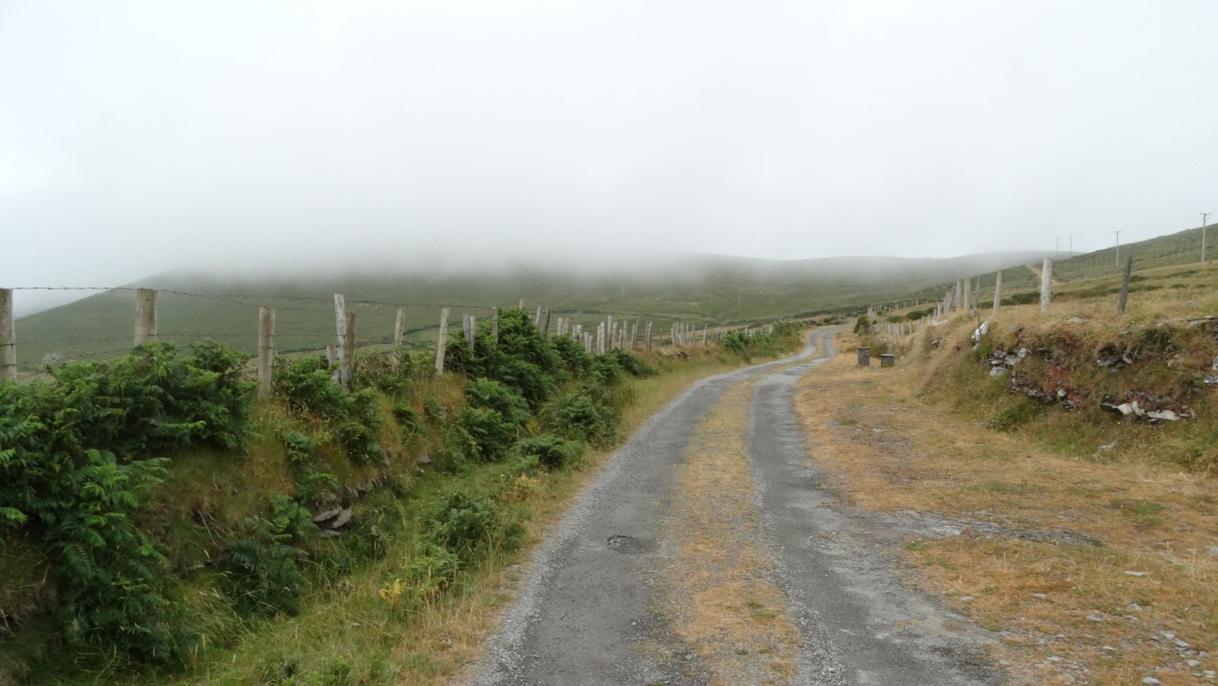
The road continues west and mist still clings to the higher ground. hopefully it will lift by the afternoon.
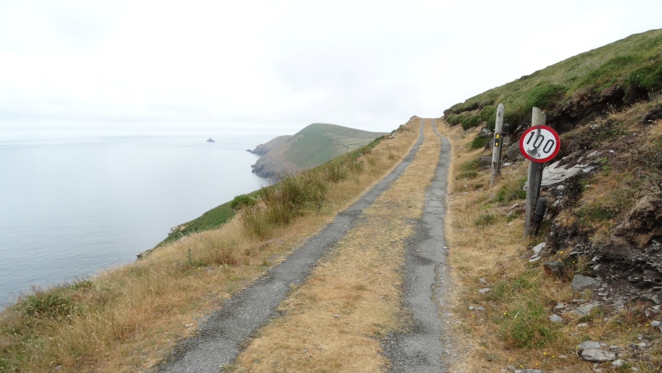
I wouldn’t really want to do 100 kph on this road. There is no barrier and the Atlantic is 400 feet below you.
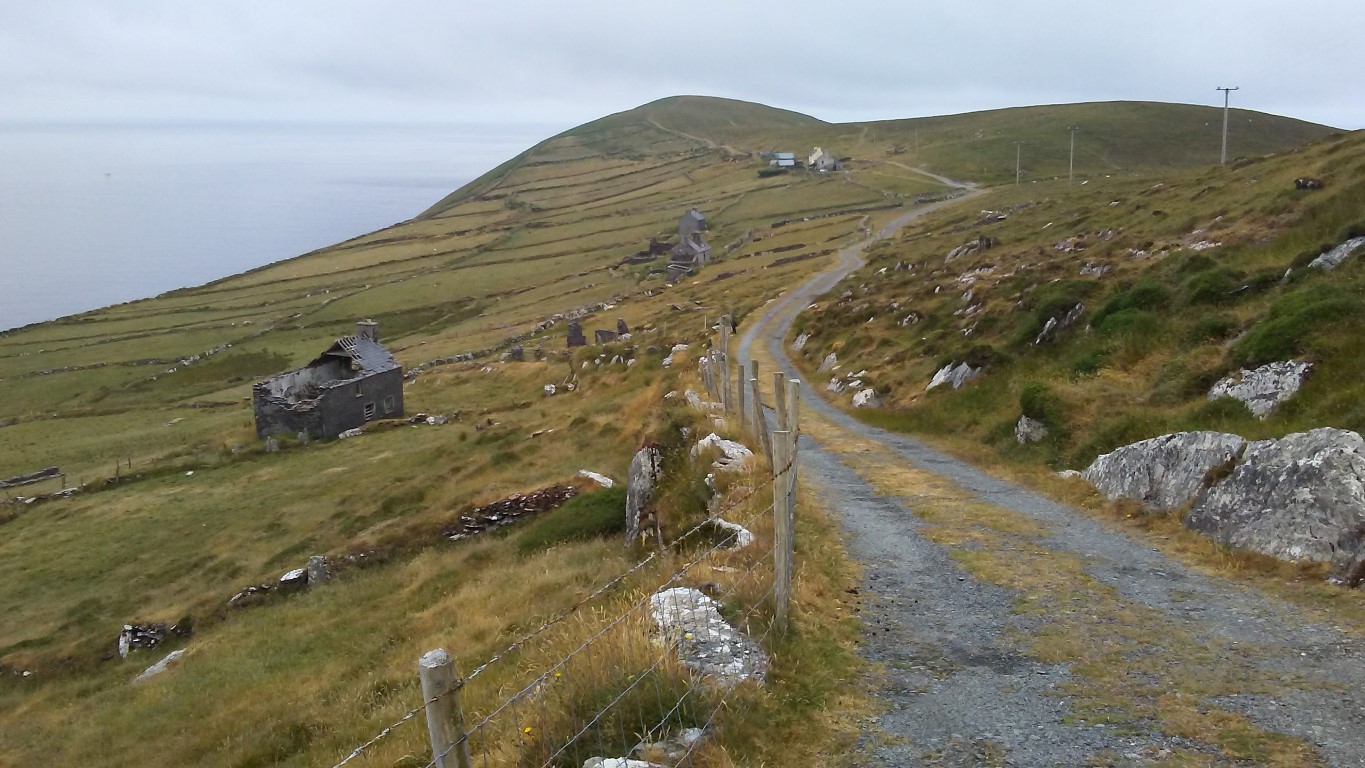
The last village of Tilickafinnal consists mostly of long abandoned houses but there is a lived in farm at the far end. This is what you call getting away from it all.
I pass the last farm and now I am on bare hillside with vegetation growing little more than a couple of inches. It probably blows here most of the time but I am being blessed with a calm day and the sea is quite smooth. Now the area is famed for whale and dolphin watching but knowing my luck I have never seen anything in my lifetime.
There are a few day visitors around most of which have ventured to the point where the land starts to descend towards the last headland. I want to press on to the very end. Out to sea are remote rocks which include such names as The Bull which at 302 feet high is crowned with a lighthouse together with auxiliary buildings and is so far out that it doesn’t appear on the 1;50,000 scale Irish Ordnance Survey Map. As it is, I am on an inset part of the map. Nearer at hand are rocks called The Cow, The Calf and The Heifer.
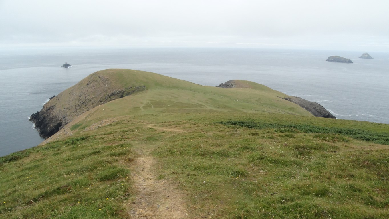
The path leading down to Dursey Head. No more civilisation until you reach Florida!
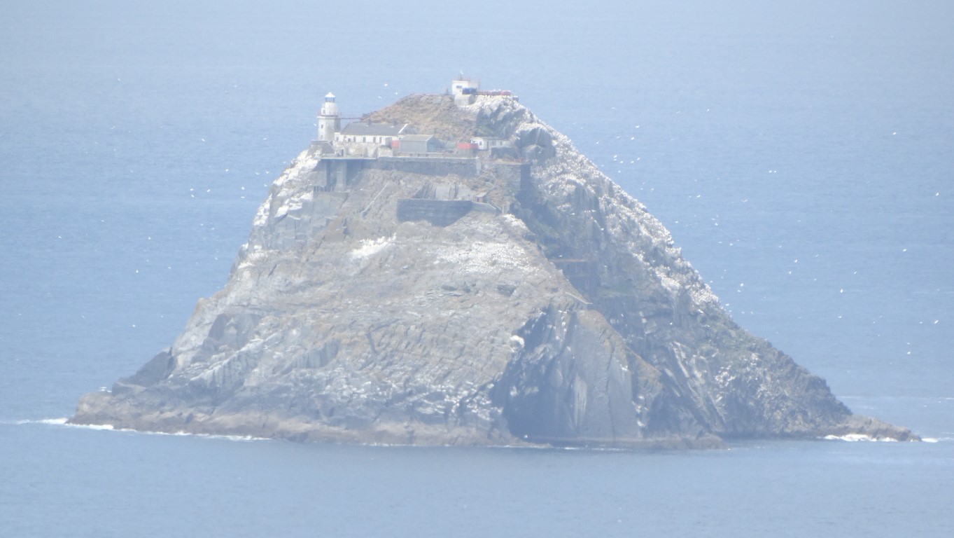
This is The Bull, a 302 foot high rock complete with lighthouse and auxiliary buildings. It’s quite amazing how they built all this at such an exposed location. So far out in the Atlantic, its even beyond the inset of the 1;50,000 Irish Ordnance Survey Map!
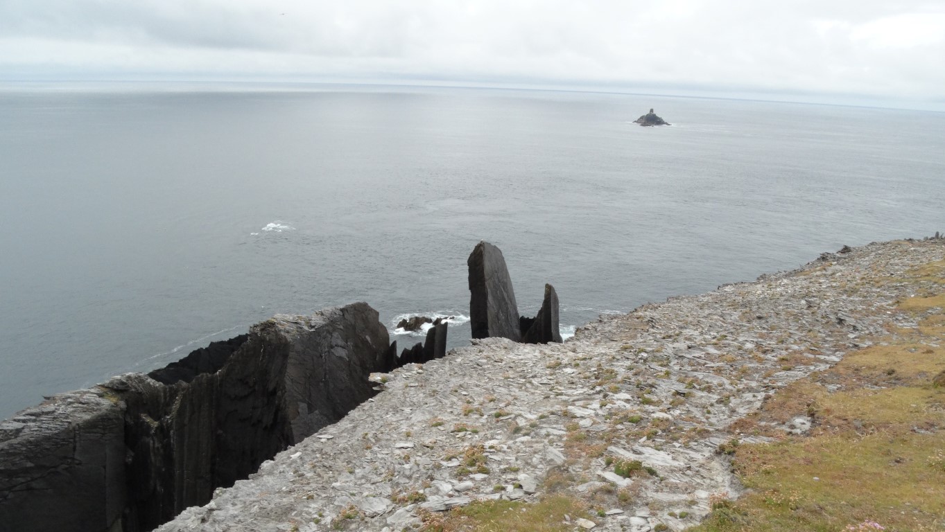
The end of the land at Dursey Head. A series of fang like rocks dominate the end of the island. It is here I sat and watched the dolphins and whales whilst eating lunch.
As I reach the very end of Dursey Island the land falls away as a series of ‘fangs’ where the rock strata have been turned on end. A small group of visitors are excited and tell me that there is a school of dolphins just offshore and sure enough I don’t have to wait long before the school break the water. With it being so still, there are no waves breaking and so the dolphins are easy to spot and can be seen swimming just below the surface. Occasionally they rise out of the water to belly flop sending a cascade of water into the air. If that is not enough excitement we next see whales breaking the surface further out and a couple of times they send up columns of spray from their blowholes.
What better way to sit and have lunch whale and dolphin watching from a cliff top and staring out onto a smooth Atlantic knowing that there is no landfall for many thousands of miles.
Well it’s time to drag myself away and head back and by now the weather is improving. The mist has lifted from the islands’ hills and patches of soft blue sky are edging in from the Atlantic. I backtrack initially before taking a good path with marker posts up to the island highest point at 252 metres. The summit has a trig point, together with a prominent but ruinous signal tower. The tower was built as a chain of lookout towers to warn of possible invasion during the Napoleonic Wars.
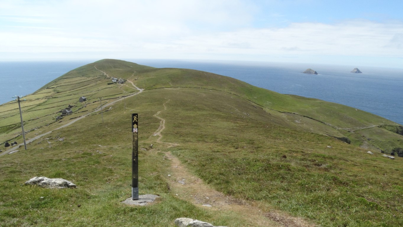
A good path follows the spine of the island. This view looks back towards Dursey Head.
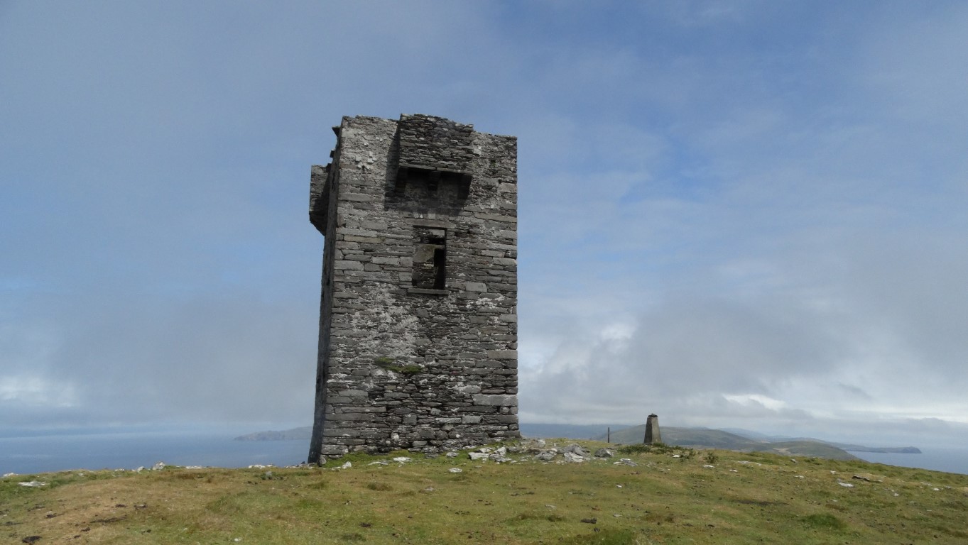
The Signal Tower and trig point at the highest point on the island. (252 metres).
What a superb afternoon for this walk along the spine of the island and a good path the whole way. Walking at it’s best!
I press on along the spine of the island keeping over all high ground. It is turning a fine and sunny afternoon and the light is almost magical. At the last hill I can see down to the waiting point for the cable car. It’s going to be a long wait and indeed it is. It’s one hour and ten minutes before it’s my turn to join another five tourists for the return crossing to the Irish Mainland. Thankfully it’s dry but there is nobody who wants to enter into conversation, but I think they are all non English speaking people. So how do you spend an hour and ten minutes waiting for a cable car? Well you can calculate the length of time it takes for a return trip. Count the number of people ahead of you in the queue and work out how long it’s going to be before it’s your turn. Secondly hope that no island residents turn up. Watch sheep eat grass – I’m getting desperate now! But what amazes me is that this cable car is unsupervised. There doesn’t seem to be anyone to stop extra people getting on board. Each time the cable car arrives at the little platform the next group of six board in an orderly fashion, with the first person opening the door and when there are six aboard the last one closes the door and the cable car moves off. I suppose that if the cable car was overcrowded and came to a halt halfway back, not many people would fancy climbing down a seventy five foot long rope ladder!