

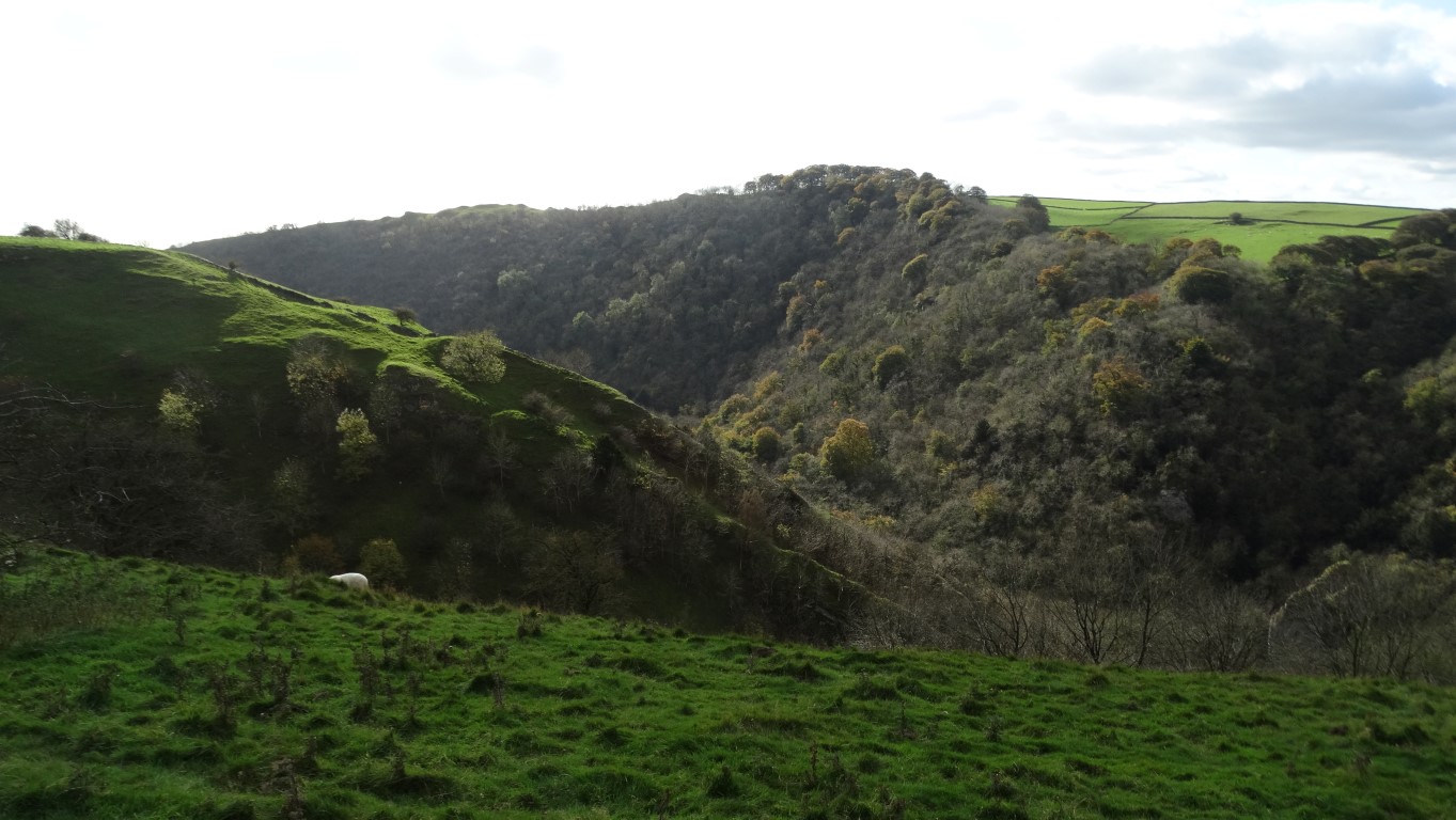
Walking the Dove Dale rim on a fine October day. This view looks down Sharplow Dale.
To date I have visited most of the trig points in the Peak District but there is just a handful left, and most of these don’t lie on any path and hence it will usually mean a trespass of sorts. For this walk I wanted to make a detour to a trig point that is well off a path and secondly I want to look at a possible path that was shown as a dotted line only on the 1;25,000 map which runs partly through open access land skirting the eastern rim above Dovedale but possibly not all the way but it was time to find out.
It’s October and the morning is dawning bright, cool and sunny. It’s therefore a good day for a walk and I travel down to park in the deserted car park in the village of Alstonefield, a location frequented often by the East Cheshire Ramblers. I’m setting off through the village and the autumn colours are probably at their best. First of all I want to visit the churchyard of the St Peter’s Church to get some photographs. The churchyard has some fine Saxon crosses and several more cross fragments are to be found within the church suggesting that the site was a ‘school of carving’.
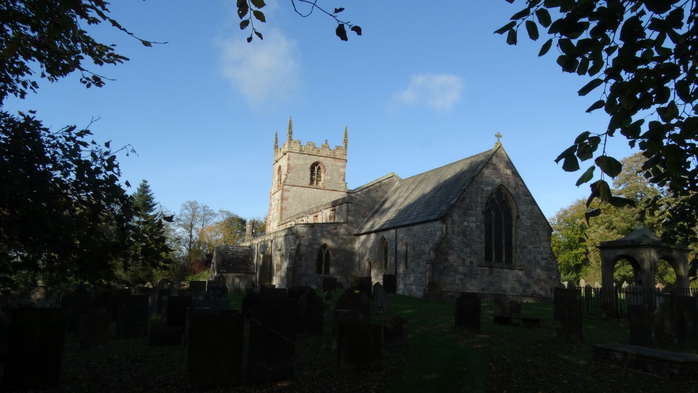
St Peter’s Church in Alstonefield. There are some fine Saxon crosses in the churchyard.
Leaving the churchyard I’m heading east on a field path passing through fields of grazing cows before dropping down to the deep valley of the River Dove. The valley is still in shade and crossing from Staffordshire into Derbyshire I take a National Trust path parallel with the road. Taking a right turn, it is a short steep ascent to easier ground to cross several grassy fields. At the top it is merely a case of crossing several more fields to Bostern Grange Farm and most of these fields are full of grazing cattle. At Bostern Grange Farm, several farm hands are in the yard with a number of newly born calves. I press on, as I now have thoughts on getting to Reynards Trig Point. This trig point, which is at 369 metres lies well off any path and I want to be out of sight of any farm to get there. From other visitors to this trig point, it seems that the best approach was from the east. Further south, I veer away from the path across a pasture field towards a gate which I cross then scale another gate nearby. My only route now appears to be over a low wall which proves fairly easy to cross and I keep my eye on a field of cattle which thankfully carry on grazing. I soon reach an interesting archaeological site which is known as Cromwell’s Bowl Barrow where an excavation in 1848 revealed many finds including a rock cut grave covered with limestone slabs. By now I can see the trig point ahead of me which simply means crossing a pasture field. The high dry stone wall and associated bard wire fence presents more of a problem as the trig point on the other side. Why is it that trig points always are located on the opposite side of a wall? Leaving my rucksack and pole I carefully scale both and armed with my camera I am able to get some close up photographs. The views are quite good but it is a cold spot. Re-untied with my rucksack and pole I am keen to get back on the right of way, so retrace my steps to the path. Satisfied, I now head south but soon stop for my morning break at an old lime kiln but there is really nowhere suitable to get out of the cold wind.

The trig point at Reynard’s is a good viewpoint but unfortunately doesn’t lie on a right of way.

A interesting round limekiln above Thorpe Pasture.
I now continue on a good path south noting several ruins of lime kilns to my right, and later I join a gated lane before taking a path towards Thorpe after passing the isolated Pike House. I skirt around to Lin Dale where the cold wind is funnelling up the valley so this is not a place to stop for lunch. The stepping stones in Dove Dale are surprisingly busy and a large school party is there, possibly on a field trip.
The path along the eastern rim of Dove Dale gives a different prospect of this popular area. Its a part of Dove Dale you’ll likely have to yourself.
I start out on the path through popular Dove Dale, and at Lover’s Leap take the good path on the right which is only shown as a dotted line on my map. From the calm conditions in Dove Dale, the wind is getting up again and I want somewhere sheltered to stop for lunch. At the top of the ascent I climb a stile and settle down behind a wall for my break but it isn’t the best spot as the gusty wind soon makes it feel chilly. At least there is a good view over Dove Dale and I have the place to myself. A way-marker here points towards Tissington and hence this seems to be a new path running east which is not marked on my map.
I now set off north along what is shown as a dotted path, and on the ground there is a path. I soon came to a stile, and I am pleased to find a way-marker with the words ‘National Trust Concessionary Path’. Confident, I press on and the route is giving a new prospect of Dove Dale from a different angle. The path contours along the eastern rim and soon skirts around the upper end of Sharplow Dale and later on, descends then ascends across a dry valley. Later the path is wooded as it begins its descent into Dove Dale to reach the valley floor at the large caves at Dove Holes. I explore the entrances but they don’t go back that far. These caves were carved out by melt waters in the last ice age and since then were used by Neolithic man as a burial site.
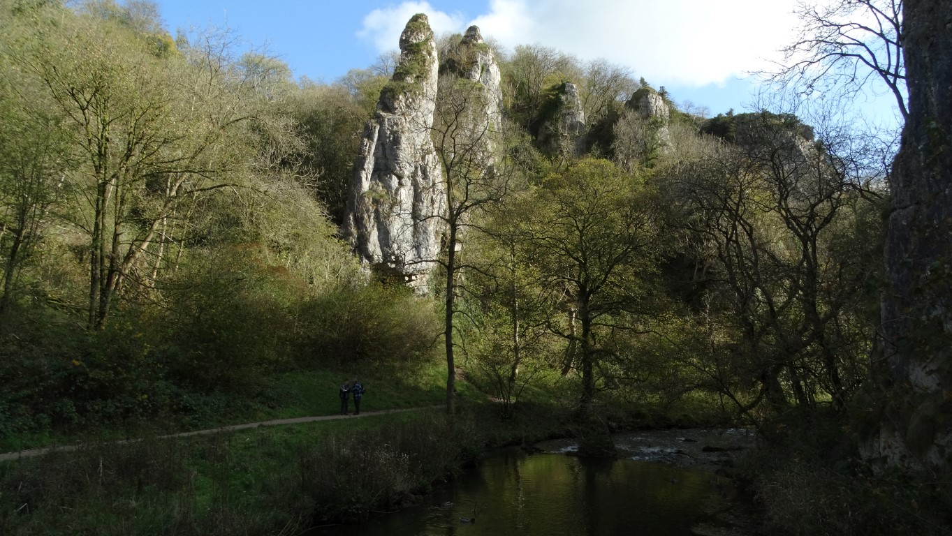
The rock spires at Pickering Tors as seen from the footbridge below Ilam Rock.
I set off down Dove Dale to the bridge over the river at the impressive Ilam Rock. On the eastern side of the valley here is the equally impressive Pickering Tor with several rock spires. I am now in the shade as I make my way up to Hall Dale. Hale Dale is also in the shade as I ascend towards the small village of Stanshope. In the afternoon sunshine I head north on a good track then path with a steep descent then ascent across Dale Bottom. Here, there is a cottage with a lovely garden full of flowers including many varieties of dahlias. An afternoon ascent takes me via a field path to Alstonefield and the end of a lovely walk.

Nearing the end of a sunny day and the sign points to Alstonefield and the end of my walk.
I will be leading this walk for the group on the 20th February but in the opposite direction as described here. The walk will NOT visit the trig point at Reynard’s or Cromwell’s Bowl Barrow as both these locations are not on a right of way but do come along to see Dove Dale from a new angle. Details on the ‘Notice Board’.