
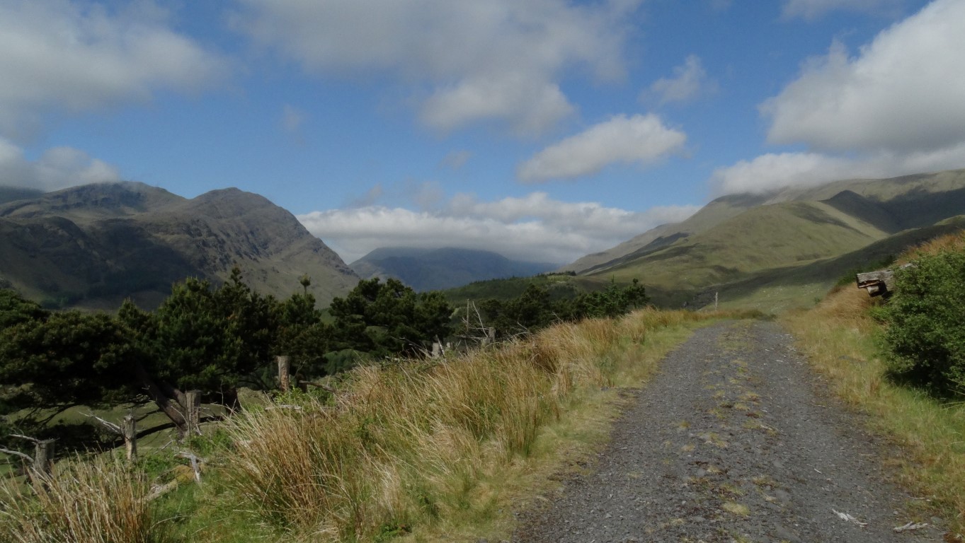
A good forest track leads well up the southern flank of this range of hills then suddenly stops a little beyond this photograph. The mountains on the left is Ben Creggan, climbed a few days later.
Now you have probably not heard of the Sheeffry Hills and if you take into account that they rise well over 2000 feet they are not really hills but a mountain chain that make a formidable west-east barrier along the northern edge of Connemara in the west of Ireland. On a previous visit to Connemara, I didn’t manage to get a walk along the ridge but on my latest visit, this range was at the top of the list for a walk.
With the promise of a fine day I’m heading south via Louisburgh to park beside remote Doo Lough. From a very sunny Westport I have now run into cloudier weather conditions and cloud is flirting with the hills and not showing much sign of lifting so I decide to do the low level part of the walk first.
I set out by walking east along the quiet Sheeffry Pass Road for several miles, and with a spring in my step cover the ground quickly. It seems however, that most of the farms on the northern side of this road don’t want walkers on their land, but in any case I am heading further east and intended taking a forestry track to gain the hillside.
The low cloud is showing signs of lifting as I leave the road and the forestry track provides some easy graded walking as I zigzag up the hillside. Much of the forest has been felled which provides some good views. As expected the track suddenly end at a high point and I have no alternative than to scale an easy fence and make my way up through a short stretch of felled forest and this proves much easier than expected.

I’ve now reached the southern spur so this was a good place to stop for my morning break and the sun is finally making an appearance.
At the top edge I have a double fence to cross which isn’t as easy as the top strand is barbed wire. A steep ascent follows up the grassy hillside beside an old rusting fence to the crest of the hill and this is a good place to stop for my morning break. The sun has now made an appearance and the way ahead looks inviting via a grassy ridge.

Not the highest point but the trig point stands at 762 metres at a minor high point along the ridge. What the photograph doesn’t relay is the gale force wind blowing from left to right.
Setting off, I made steady progress with another ascent to reach a stony and rather featureless plateau. I set a course to the eastern summit of Tievebinnia 742 metres and the top isn’t really apparent until I was almost there but at least the low cloud has cleared his area. This featureless summit could have been easily missed in fog as it is only marked by a small cairn and I even have my doubts as to whether this is really the highest point as everywhere the ground looks about the same height. I don’t linger as the wind has got up to gale force and the place doesn’t warrant stopping for a photograph.
I now set off south westwards along the broad ridge with a steep slope on my right hand side. The low cloud comes and goes from time to time but the real problem is the wind which has risen to gale force from nowhere. I am buffeted along the ridge and decide not to stop until I reach the trig point at Tieveummera 762 metres. The low cloud is being blown across the ridge from left to right and so my visibility is often reduced to a few hundred yards.

Looking east along the ridge of the remote Sheeffry Hills provides several miles of good upland walking.

The best part of the ridge is nearing the western end where it narrows before the ascent to Barrclashcame, (behind me) and the highest point at 772 metres.
I take a few photographs at the trig point but decide to press on as it is just too windy to stop for lunch here. The ridge now narrows somewhat to make this next section the most interesting part of the walk with a rocky slope on my right and a steep slope on my left. It is such a pity that the wind is so strong that I decide not to linger on this stretch. A final ascent takes me to the summit of Barrclashcame, which at 772 metres was the highest point of the day and the ridge. The summit is marked with a small cairn but with time getting on I want somewhere to stop for lunch. I head a little distance north from the rounded summit and find a slightly less windy spot but it is by no means perfect. Cloud sweeps over the top of the mountain and is being funnelled down the lee slope in spirals. It is fascinating to watch but I am anxious to move on as soon as I have finished lunch.
From my observations on my outward route it is easier to descend from Barrclashmore on the ridge that runs south, southeast before bearing right nearing the foot, as the western slope overlooking Doo Lough is steep with crags. I set off down what is quite a steep slope zigzagging my way to find the easiest ground. Forty five minutes sees me at the foot of the mountain by which time the weather has improved immensely. A leisurely road walk along the shore of Doo Lough takes me back to the car. Starting a couple of hours later on this walk would have given me far better weather.

Down at base, the weather has improved. This little harbour is beside Doo Lough .