

A panoramic view from Collard Hill on the Polden Hills. An excellent view despite its modest height.
Somerset is a county I know well and for many years was my childhood home prior to the days of the 1974 boundary changes when a northern chunk of it became overnight part of the new county of Avon. Even though I’ve been away from the area for near on forty years, I love going back.
The northern edge of the county is dominated by the Mendip Hills whilst to the south rise the Blackdown Hills. The west is dominated by the Quantock Hills with Exmoor forming the westernmost part of the county. Between these areas is the Somerset Levels which I find a fascinating area. This part of the county may be low lying but is pierced by countless ‘island’ hills which often rise abruptly from the surrounding flat countryside. One such string of little hills dissect the Somerset Levels and rise no higher than around 120 metres and taper towards the west near Bridgwater and this little ridge is known as the Polden Hills. A little while ago I picked up a leaflet detailing a walk along the Polden Way. As trails go, this is a short one at a mere six miles, but to walk its entire length in a day I will need to tag a bit on either end so that I can catch a bus to the start of the walk. So now let’s set off to explore this little known part of Somerset.
It’s a real summer’s day with a bit of warmth and all too rare this year. I have earmarked this walk for some time to walk the short Polden Way and use Somerton as the start point and the finishing point in Street. This was the only feasible way to walk this path as I can catch a bus.
I reach Street in good time and have time to wander around the town which is famed for the Clarks Retail Outlet Village before catching bus number 77 to Somerton.
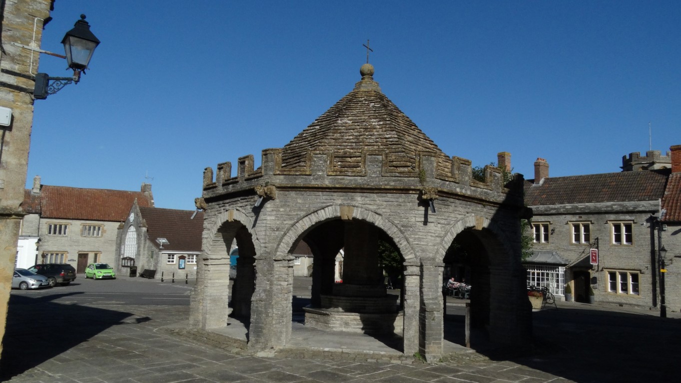
The Buttercross in the centre of Somerton dates from 1673.

St Michael All Angels Church in Somerton has an unusual octagonal tower.
Alighting Somerton by the Buttercross which dates from 1673, I first decide to take a look at the parish church. Its tower is unusual in that it is octagonal. The building dates from the mid 15th century with later alterations carried out in 1889. Somerton itself has a long history and was possibly the capital of Wessex for a time. In 949AD records show it was the site of the Witan, which was a form of Anglo-Saxon Parliament. Furthermore, the town gives its name to the present day county of Somerset.

Striding out along the lane towards Hurcot with the Polden Hills beyond on a perfect late summers day.
I walk east from the town and soon descend via a lane to reach the busy B3151 where I have a surprisingly long wait to cross. I am just glad to get onto the quiet lane towards Hurcott.
I pass beneath the railway line and soon see my first Polden Way logo sign.
The Polden Way is not marked on any Ordnance Survey Map but it is signed on the ground with fairly regular way-markers. The path which was opened a few years ago runs through an area which until prior to its creation was out of bounds.
The path initially leads uphill through pastures including passing through one field of bellowing cows. At the top I enter the extensive Copley Woods but with no path being marked on the map, and only a basic map leaflet to follow, it is essential that I keep an eye out for way-markers. At New Hill the path briefly leaves the wood to give an excellent view west over the Somerset Levels which here are dotted with little hills which rise above the levels like islands. It is a good spot to stop for my first break of the day.

A tantalising glimpse through the trees towards Castley Hill.

A view towards Dundon Hill which rises above the Somerset Levels, and like so many other hills in the area has a hill fort.
Back in the woodland, the path runs northeast towards Wickham’s Cross to avoid a deep wooded valley known as Combe Hollow. The path then continues along the crest of the well wooded Polden Hills with the occasional tantalising glimpse of the wide views beyond. I have some views at Hatch Hill before reaching the tall monument on Windmill Hill. This is the elaborate Hood Monument, which is a 110 foot Tuscan column and is now a grade two listed structure. The doorway at the base was sealed up in 1990. The monument was paid for by public subscription and designed by the architect Henry Goodridge. It was originally linked to the Hood family home at Butleigh by a mile long avenue of cedar trees.

The Hood Monument on Windmill Hill is a prominent feature in this area.
After crossing a minor road, I soon walk over the more open Collard Hill which is an excellent spot to stop for lunch and probably one of the best places I’ve stopped for a picnic lunch this year. There are wide views all round on this pleasant sunny day and the outline of hills over in South Wales is just visible.

One of many wild flower meadows passed en route and this one overlooks the village of Compton Dundon.

Time for a lunch stop and with a view like this on such a fine and warm day you are reluctant to move on. Brent Knoll which rises above the M5 motorway can be seen in the far distance. (centre right)
Setting off again, the B3151 is not easy to cross once more, as it is so busy. Walking along Ivy Thorn Hill I pass Street Youth Hostel where during my youth I spent a free weekend there on a YHA work party painting the gents toilets. I just wonder if the deep blue paint still graces the walls! The next section is well wooded again then becomes more open as I transverse Walton Hill. The western end has an old windmill which is now converted into a private dwelling and out of bounds. At a field corner I reach the end of the Polden Way but my walk isn’t over yet. I have done the easy bit, but now I have to negotiate several fields back to Street. The path north towards Walton is to say the least poorly signed and overgrown and in the first field I have to push my way through a crop of maize and with some relief find the wobbly wooden stile at the far end. Here, I do find a good hedge full of blackberries and find time to fill my sandwich box in a few minutes. A little beyond I have to squeeze through a hole in a hedge to take the path running east to reach Veal Lane. At the end I turn right and later left to continue on little used field paths to reach Street, but thankfully I have no more path issues. I walk through a quiet residential area to get back to the car and I still have time to walk up Nyland Hill, another so called ‘island hill’ near Cheddar which rises steeply on all sides to a modest 249 feet and crowned with a trig point on my return to base.

Nyland Hill rises to just 249 feet and has steep slopes on all sides. It is a spectacular place to view the Somerset Levels.