
I’m on a journey from Portrush to Carrickfergus in Northern Ireland and the last full walking day before catching a flight back from Belfast City Airport so it’s a good opportunity to get another walk in the Antrim Hills. I want to get to Glenarm on the Antrim coast road where I can catch the morning bus into Larne but on the way there I want to make a diversion to visit one of Northern Ireland’s most photographed locations. It may be only a country lane I’m heading for but this lane is no ordinary country lane and I am keen to get some photographs before the tourists arrive. Dark Hedges is a fine avenue of beech trees featured in the television series ‘Game of Thrones’. I am not disappointed as on this early Monday morning I have the place to myself with just the occasional commuter passing by. The main approach to Gracehill House which itself was built in 1775 was planted with an avenue of beech trees which have become a main tourist attraction in Northern Ireland. Visit this place in the right atmospheric conditions you could imagine that it is straight out of a scene in the Lord of the Rings. This half mile long section of road is lined with mature beech trees with massive limbs forming a fascinating tree tunnel.

The mysterious Dark Hedges in a rural part of County Antrim.
I reach Glenarm at 09.30am giving me twenty minutes to don boots and to catch the bus to Larne. Alighting from the bus in the town I soon bump into a couple of people from Canada that I had spoken with at length on the previous day not far from the Giants Causeway. Larne is well known as a terminal for car ferries from Stranraer and Carinryan on the Scottish coast but in my opinion the town has little else to offer so I walk through the town centre and take a break at a seat before heading west through the outskirts on several residential roads including Mill Brae and Ballyhampton Road to reach the open countryside. It is now a rather long uphill walk on the straight Mullaghsandall Road to gain the Antrim Hills Way which runs concurrently with the Ulster Way. This proves to be the least interest part of the walk as there are no buses which come anywhere near this part of the world. The Antrim Hills Way is very well way-marked with regular posts displaying the Antrim Hills Way in name and a white fern symbol on a purple background so there is no excuse to wander off the trail.
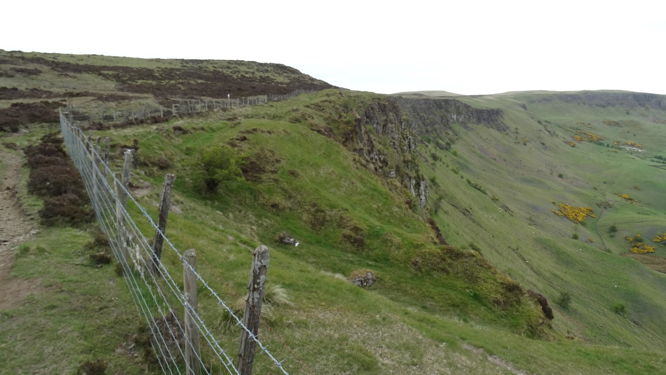
Sallagh Braes where the basalt plateau gives way to a massive semi circular valley (In appearance its looks very similar to Cown Edge).
I am glad to be walking across fields on this well signed path but the first stretch proves to be a bit boggy underfoot. Within a half mile I am at Sallagh Braes at the edge of a massive semi-circular basalt escarpment that was created when glaciers cut into unstable slopes and caused a massive landslip. (In appearance it’s very similar to Cown Edge). I soon pass two other walkers heading south and now the terrain is turning more pleasant with firm ground and short cropped grass. I make good progress for several miles over Robins Young Hill then down to cross the Feystown Road. With a picnic site symbol marked on the map, I had hoped to stop here for lunch but there are no picnic benches and it is a rather cold spot. I chose a sheltered location just on the northern side of the road with a view east towards Scotland on what has turned out to be a rather grey day.
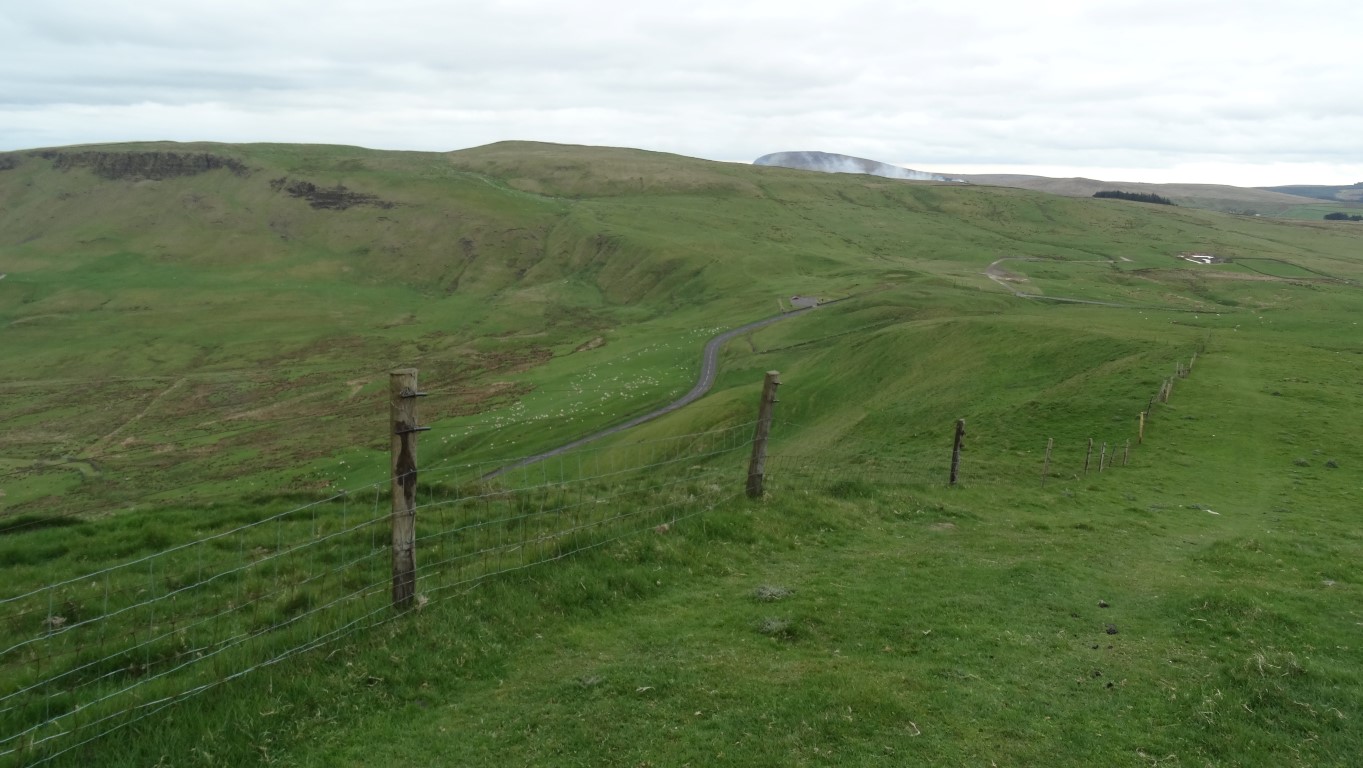
Miles of easy walking on short cropped grassland and marvellous views stretching to Scotland. This view looks south from just north of the Feystown Road.
Despite the day being very dull and cloudy, the next part of the walk proves very interesting with easy walking over Ballycoos, Scawt Hill to reach Black Hill on short cropped grass. The route is frequented with many way-markers and really there was no need for a map on this section. Several way-markers have fold out information panels which gave an insight to the rich geology of the area. Scawt Hill is the location where several rare minerals have been found including Larnite, Rankinite and Scawtite. These minerals were discovered within the last century and occur as a result of magna being thrust up through the ground and heating the limestone. (Look at Google Wikipedia to get more information about these rare minerals and their chemical element).

Frequent waymarkers keeps you on the right route for several miles of hill top walking. Scawt Hill is in the distance. The rare mineral Scawtite takes its name from this hill where it was first found.

Several way-markers have fold out information panels many of which explain the complex geology of the area.
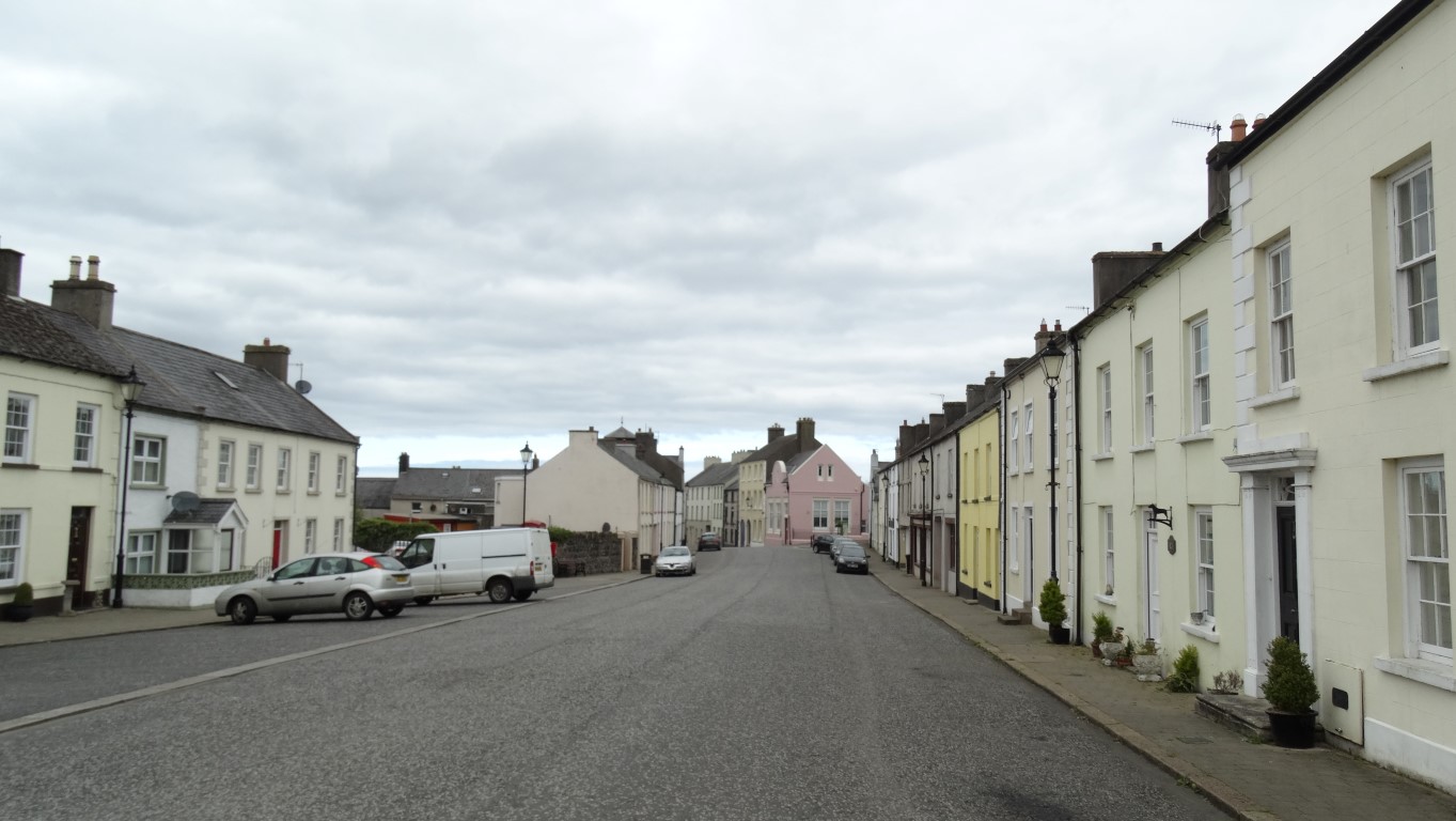
Glenarm claims to be Ulster’s oldest town and has little changed over the centuries and an ideal spot for period film drams.
Glenarm is claimed to be the oldest town in Ulster and Altmore Street is lined with Georgian houses. Running off it, Castle Street leads to the barbican gatehouse which leads into Glenarm Castle and the seat of the Earls of Antrim. These streets lie just off the main Antrim coast road and are prone to be missed by most tourists and the locality makes a good period film set. (Some scenes from the recent BBC 1Television period drama ‘My mother and other Strangers’ were set in the village). I take a wander around the village before heading back to the car after a most enjoyable walk.
It’s now time to drive the Antrim coast road to Carrickfergus which is an interesting town on the northwest shore of Belfast Lough and dominated by its fine Norman castle built by John long man de Courcy in 1177. The castle was once almost surrounded by water but land reclamation and the construction of the harbour means that only one side overlooks the water.

Evening sunlight on Carrickfergus Castle. A perfect way to end the day with a wander along the seafront and around the harbour.