
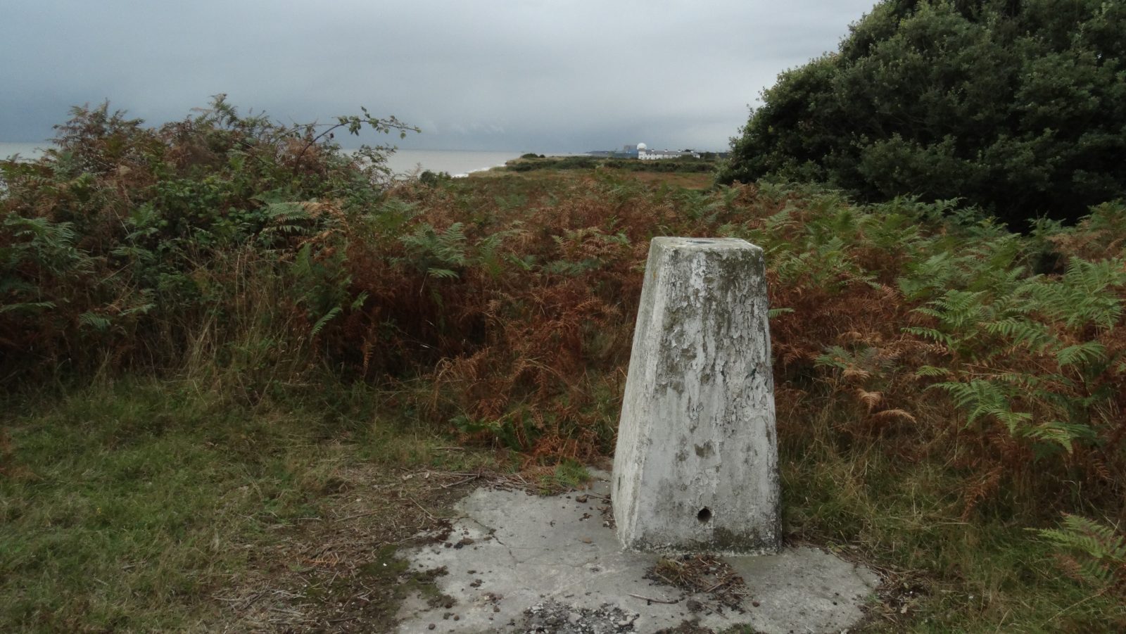
 The trig point on Dunwich Heath lies well hidden in the bracken but is located only a matter of a few metres from the cliff edge. This view looks south and is dominated by the Sizewell Nuclear Power Station. Now I wonder how long that rain is going to hold off!
I’ve decided to give up on catching rural buses in Suffolk on this trip and have opted to do walk the remaining part of the Suffolk Coast Path as two circular walks over two days. It does mean that the day I intend to visit the war time radar installations at Orford Ness will have to wait for another visit in the future.
It is a grey morning when I park in Leiston and I set out towards the coast on a different route than the one I took a couple of days earlier. This time I take a route further north towards Leiston Common before joining a track then following the road into Sizewell. In the hamlet I’m turning north to walk alongside the dominating Sizewell Nuclear Power Station with its large dome which is visible from many miles around. Built between 1961-67 the power station has now been de-commissioned but a further nuclear power station adjacent to the site is planned. The path now runs through an area of sandy heath land with not a great deal of interest. The coast line is straight and looking inland beyond Sizewell Power Station the view stretches across marshes where stands the ruins of the medieval Eastbridge Chapel, long abandoned due to the problems with flooding. Beyond, the inland area is dominated by the Minsmere RSPB Reserve and here I see several ornithologists wandering about. I decide to stop at one of the many wooden hides for elevenses and the one I chose is on two levels. I quietly creep into the lower deck and listened to the conversation above. Watching birds on a grey day on a series of ponds doesn’t really appeal to me but for some people it’s a real hobby. In five minutes I am en route again making my way towards Dunwich Heath. By now the weather isn’t looking too good with rain inland and out to sea but locally it’s remaining dry. I venture into the National Trust Information Point on the edge of Dunwich Heath and have a long chat with one of the wardens.
Setting off I cross Dunwich Heath but the heather is well past its best but I gather from some of the pictures in the information point it is probably well worth a visit in August. I am making a loop of my walk here so that I can connect up with my walk on the following day which means that at the end of my trip I will have not omitted walking any part of the Suffolk Coastal Path. I want also to visit the trig point which stands above the cliff top at Dunwich Heath. I am expecting an easy walk to the trig point but I couldn’t be more wrong as the trig point is located in an area of high bracken and a carpet of low gorse and well hidden from any path. I venture from the National Trust path in and out the same way and from the cliffs I have a fairly good view both north and south. I next re-cross the point close to the National Trust Information Point and set off inland and west through the woodland area of Westleton Walks. There were many paths to choose from and the walking is quite pleasant despite the grey day. At Saunder’s Hill I find an isolated seat with a view towards the sea to have lunch before setting off again for the short leg back to Leiston.
Heading south I soon join the lane into the little village of Eastbridge. It was just to the west of the village where on the morning of the 17th June 1917 the German Zeppelin L48 was shot down killing sixteen of the crew. The Zeppelin had been on a bombing raid over East Anglia but had lost power and attempted to head for home with a tailwind but losing height it became a sitting target and was shot down resulting in the crash west of the village. The area became a local tourist attraction in the following days and a ring of soldiers had to be enforced around the crash site to stop the members of the public taking souvenirs.
Leaving Eastbridge, I continue with a quiet lane before taking a track south passing Upper Abbey. I take a field path next towards Leiston where I joined Valley Road into the town. With plenty of time in hand I visit the very interesting Long Shop Museum and two hours are well worth spent. The museum was once an engineering works and is dedicated to the history of Richard Garrett & Sons specialising in the manufacture of agricultural equipment and steam engines. It was interesting to read the accounts of how the area suffered due to the many air raids during both World Wars.
It’s now time to visit the other place of interest I want to see before the end of the day. I want to visit Blythburgh Church which is one of the finest in Suffolk. Unlike Covehithe Church visited the previous day where the original church is now just a shell, Blythburgh Church has changed little since it was built in the 1400’s. Prior to the railways, Blythburgh once lay on the lowest bridging point on the River Blyth between Lowestoft and London but being so far upstream on a river prone to silting it never became a prosperous port. At one time it was one of the richest communities in Suffolk. Major setbacks including the Black Death and the decline in the wool trade meant that the village never developed into a town. Today even the river banks have been left to return to nature and have been breached at a number of points. Despite footpaths shown on the Ordnance Survey maps running along the embankments these are now impassable and even upstream from Blythburgh the riverside path had been closed due to embankment erosion on my recent visit.
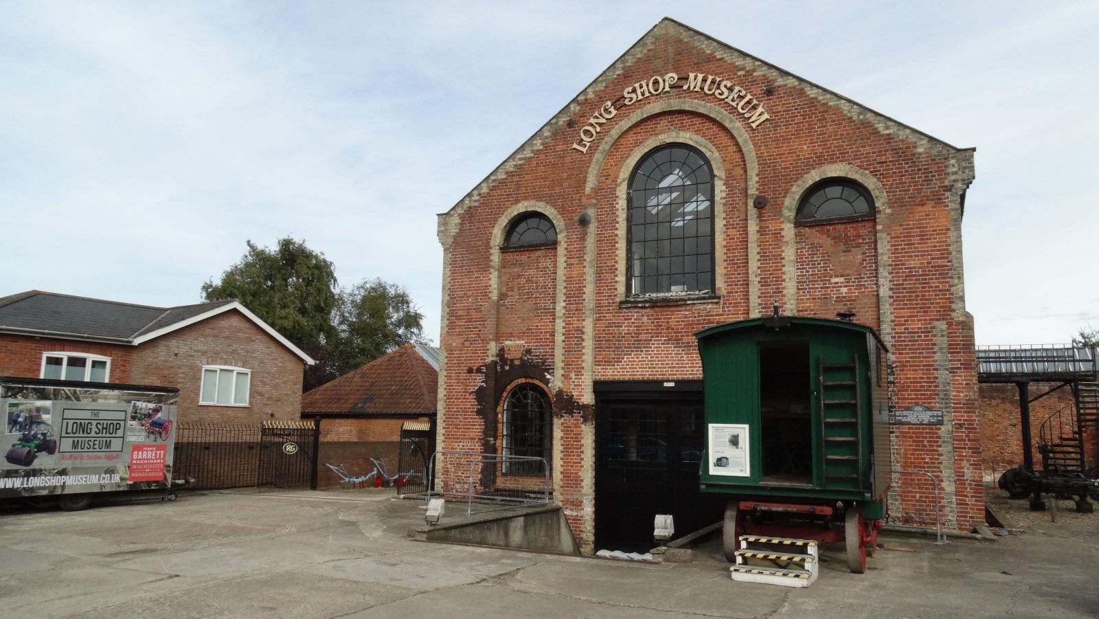 The Long Shop Museum in Leiston is well worth the visit and depicts the development of agricultural machinery and steam engines over the past two centuries. There is also extensive information on how the area coped during both World Wars.
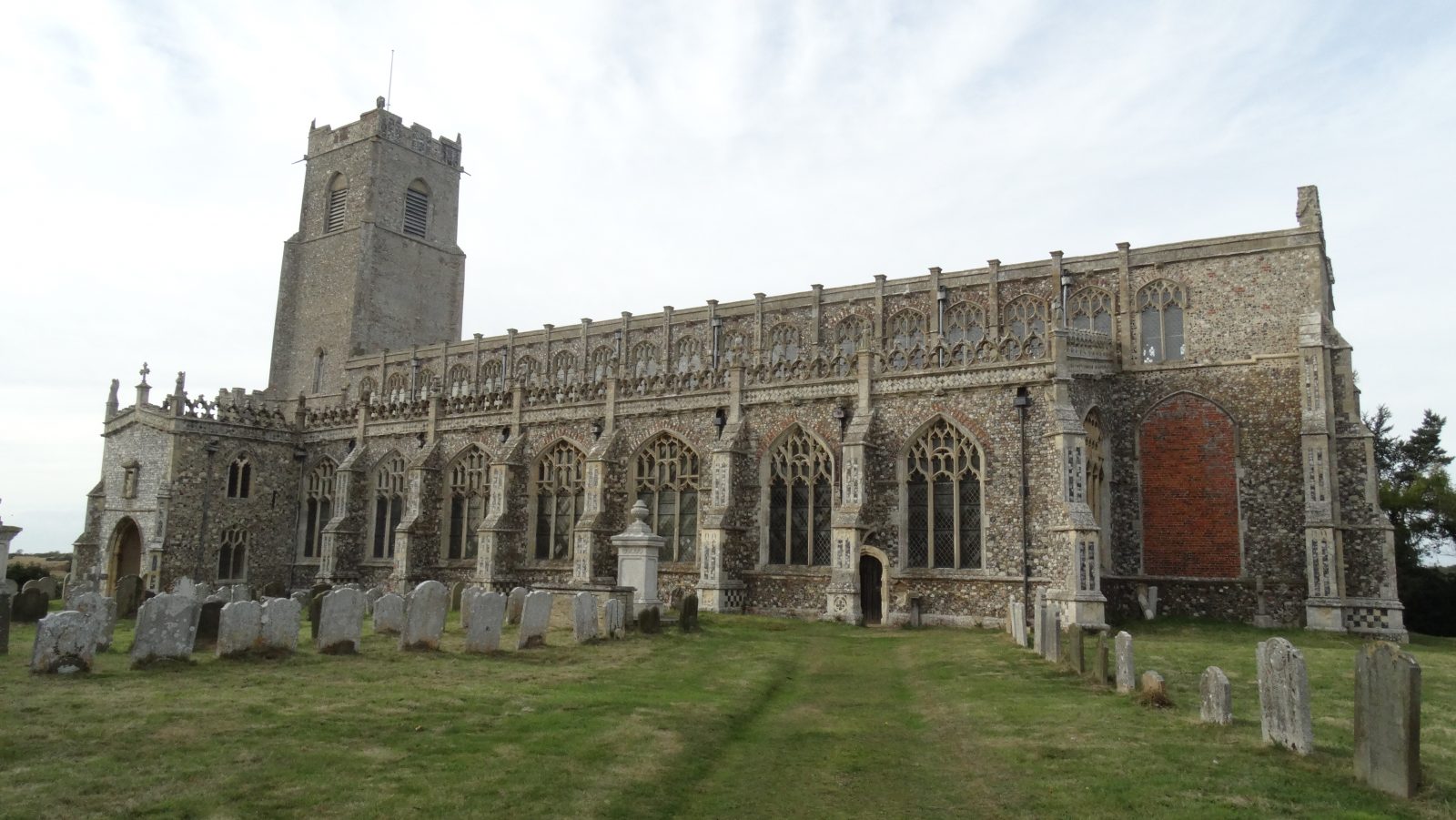 Holy Trinity Church at Blythburgh is well worth a visit. It is such a grand church for a small village that wouldn’t look out of place in a medium sized town. It was built in the 1400’s.
 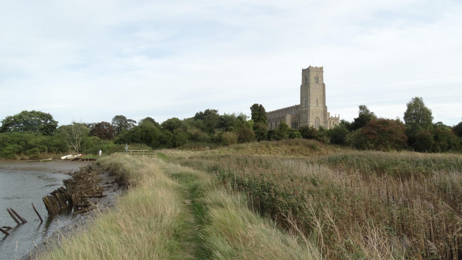 Blythburgh Church dominates the surrounding area and overlooks the River Blyth. The river has become heavily silted up with the river banks breached in places to allow sea water to flow in and out of the marshes on the right of this picture. You will note a fence across the path in the distance and from this point westwards the path is now closed. It doesn’t look as if repairs are going to take place and a little west of this point the embankment is breached and so the days of this right of way look to be a thing of the past.