
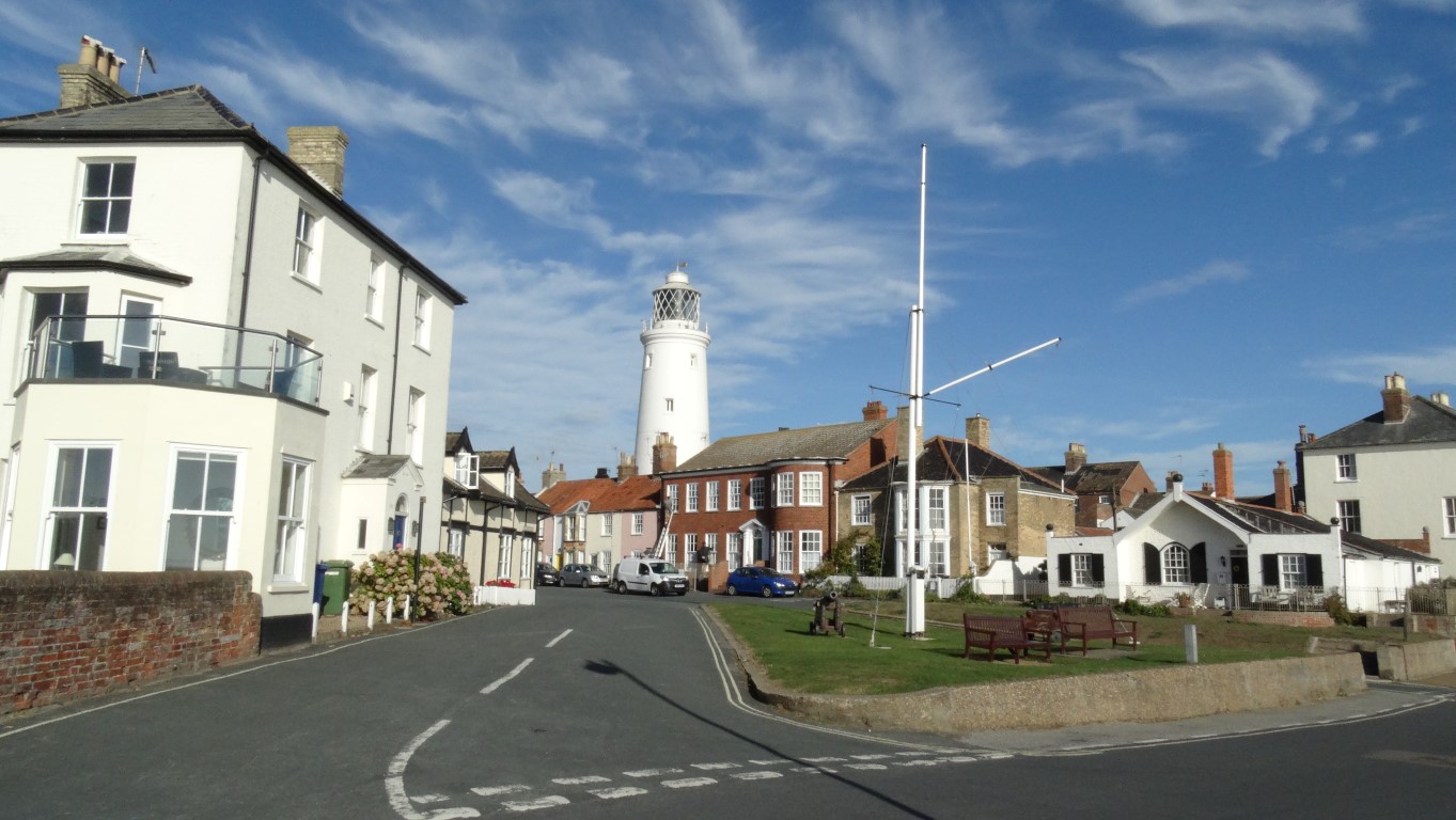
 A glorious late September morning. The schools have gone back so I’ve almost got the place to myself. This is Southwold and the slender tall white lighthouse dominates the town.
It’s day three of my walk along the Suffolk Coastal Path and I am all set to walk the next section between Leiston and Southwold. This sixteen mile section involves getting a rural bus from Southwold inland to Halesworth and an onward connecting bus to Leiston where I can walk out to the coast to connect with the Suffolk Coast Path. Well that is the plan but all the best plans can be thrown into turmoil as this is exactly what happened today.
I am driving to Southwold and have plenty of time to spare which is just as well as finding the bus stop takes longer than expected as the stop is adjacent to a long gone public house. At least I am confident that I am at the right spot and so I wait and wait for the bus to Halesworth which never does turn up but as time slips by if it does turn up it will be too late for me to get my connection from Halesworth to Leiston so it looks like it’s back to the drawing board.
It’s now time for plan B, and the walk I intend doing in two days time I am now bringing forward to today so I’m going to walk to Lowestoft and catch a bus back. I don’t know the bus times and so from the bus stops on both sides of the road I calculate the time a bus takes to get to Lowestoft from Southwold then cross over the road to the bus stop on the other side to view the arrival times of the buses from Lowestoft to Southwold. By subtracting the journey time I should in theory know what time buses leave Lowestoft. I calculate that the last bus would be around 5pm and with time pressing on I know that I couldn’t afford to hang about too much as its at least sixteen miles and no guarantee that I can walk along the beach between Kessingland and Lowestoft otherwise it’s a trek inland.
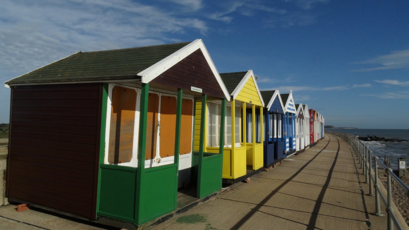
Colourful beach huts line the seafront in Southwold as I leave the town.
I’m setting off later than I would have liked and walk along the sunny seafront at Southwold adorned with its brightly painted sea huts. A little distance north of the pier I have to turn inland for several miles. The only other way ahead is along the beach and I don’t fancy many miles of shingle crunching. Once through the village of Reydon my route follows field boundaries and is quite pleasant and very peaceful on this glorious late September morning. The last of the harvest is being gathered in as I pass alongside one field on the approach to Frostenden Corner but at this time of the year most of the sandy soils of this part of Suffolk have been ploughed already to plant the next crop. I next join a lane which sees very little traffic and make my way to the isolated church at South Cove and this is a good spot to stop for my morning break on a churchyard seat but I find this historic thatched church itself is locked.
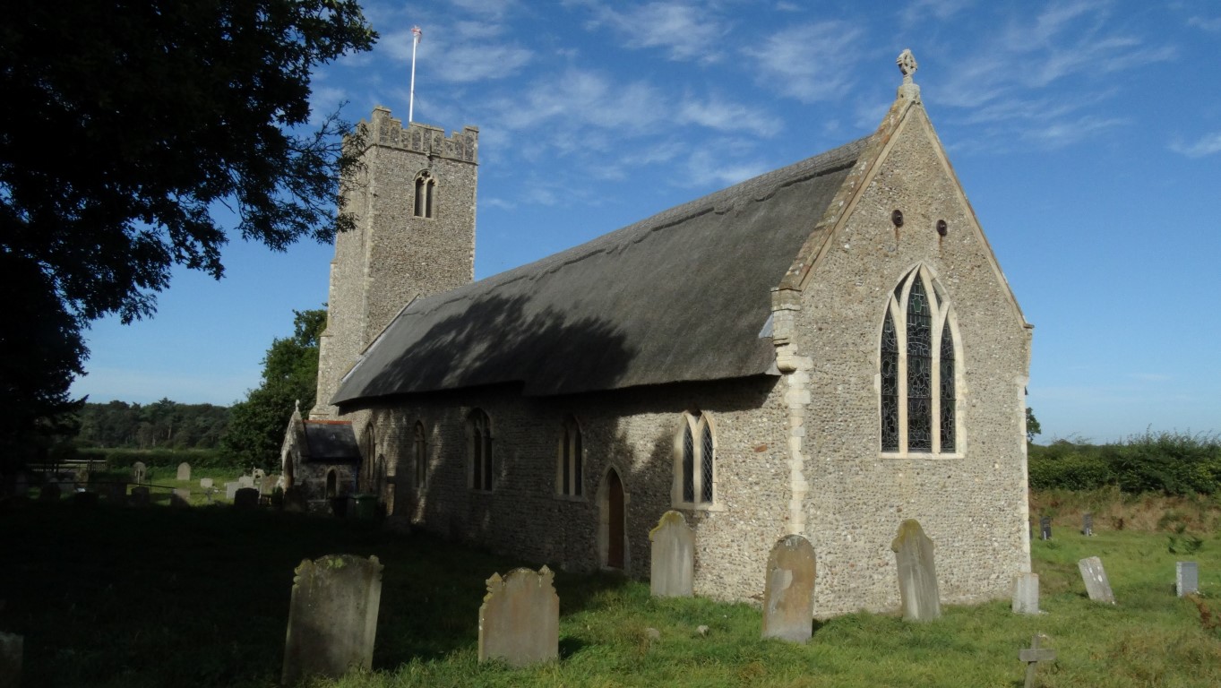 Time for my morning break and the historic church at South Cove makes an idyllic spot to sit awhile in the churchyard.
I am looking forward to the highlight of the day and that’s a visit to the church at Covehithe but to get there I need to walk along a short section of the busy B1127 but at least there is a wide grassy verge. I then follow a straight and quiet lane directly to the hamlet of Covehithe. Since a visit this church many years ago this place has always fascinated me. The present church lies in the shell of a much larger ruinous church which means that the village was once much larger but most of the village has been lost to the North Sea which is only now a few hundred metres to the east. To get an idea of what the church may have looked like in its heyday my plan is to visit the impressive church at nearby Blythburgh the following day. I want to make a short diversion here and wander out to the coast where the lane plunges off the edge of a soft cliff. Erosion along this section of coast has been very prolific in this part of the country as the soft sandy cliffs erode at quite an alarming rate.
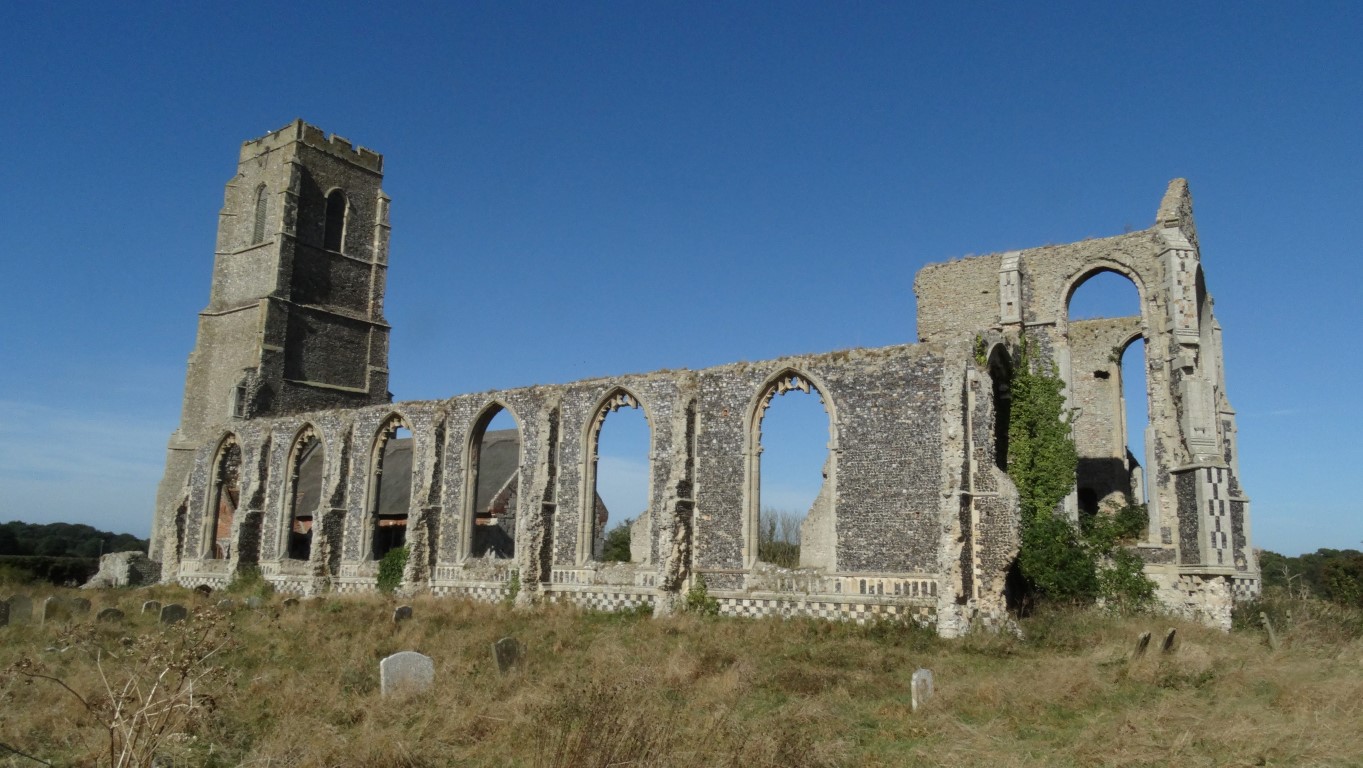 The present church at Covehithe sits within the shell of a much larger building but its days are numbered as the North Sea is steadily eroding away the nearby soft cliffs. In a few hundred years what is left of this building will be lost to the ever encroaching North Sea.
On my last visit you could drive to the end of the lane but now it is gated off with many warning signs not to venture. Before leaving Covehithe I am pausing to take a longer look around the church before taking the quiet lane inland leading to Holly Grove. Turning right here I follow a good track north before joining another lane. The Benacre Estate owns much of the land here, and there are plenty of private signs not to trespass on any adjacent fields or tracks. It’s now lunchtime but there is nowhere suitable to stop but eventually I do find a farm trailer to sit on.Checking how far I have to walk it is still a fair distance to reach Lowestoft and after lunch I make my way down to the coast reaching it close to Beach Farm. My intention is to stay on the coast all the way to Lowestoft and for the next mile I take the faint path through an area of sandy scrub with the odd patch of soft sand to reach Kessingland. The walking is proving a bit slow due to the sandy areas and this is one area where the coastal material is being deposited. Rather than be forced to walk alongside the A12 north of Kessingland I’m opting to stay on the beach. The cliff top path had crumbled into the sea long ago as there is much evidence of material and plants tumbling down the soft cliffs north of Kessingland. Again the going is slow with areas of soft sand to cross but as I reach the beach below Pakefield Cliffs I’m walking on firmer sands but Pakefield Cliffs looked very unstable indeed.
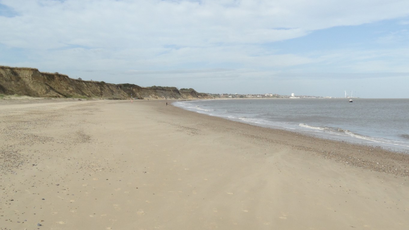 After walking along soft sand, this fine stretch of firm sand below Pakefield Cliffs makes a welcome change and thankfully the tide is out.
A little distance north of Pakefield I opt to get onto the wide promenade and for once, walking on tarmac has an appeal. I next make a brief diversion inland which enables me to check the bus timetable and ironically the bus to Southwold is passing by but it is too early for me to set off back and anyway I haven’t finished this stage of the coastal path. I’m still in good time and will be in Lowestoft in ample time to catch the 4.10pm bus back to Southwold. Back on the promenade I stop for an ice cream before walking the last mile into Lowestoft and with a quick look around the shops I catch my intended bus back to Southwold.
So where does this leave me? I’ve now got a sixteen mile gap in the coastal path to walk and with unreliable buses how will I complete this section. Find out in the next episode.