
This autumn I completed walking the fifty mile long Suffolk Coast Path which runs from Felixstowe to Lowestoft but walking this route can throw up a few problems from using the infrequent buses, coastal erosion and high tides that all need to be taken into consideration. Basing myself first in Felixstowe and later in Lowestoft, planning the trip using public transport to get to the start of the walk each day needed much planning. Having walked the section from Felixstowe to Felixstowe Ferry a few years ago as a circular walk this time my starting point would be Bawdsey on the north side of the River Deben which throws up the first problem is how would I get there using public transport. I am aiming at four days to get to Lowestoft and the plan is to drive to the end point of each walk each day then use public transport to get to the start so in many cases my start time is later than I would like.
My first day walking the Suffolk Coast Path is proving to be quite ambitious with two buses to catch to get to the start of this linear walk the second of which is a demand response bus. If anything is going to go wrong then today will be it. My internet research has shown that there was really no way to get to Bawdsey without using the demand response bus service and so my enquiries start some weeks prior to my proposed walk. From a telephone conversation I need to book the mini-bus two weeks in advance to get the first choice where it is going. Other passengers booking later would just need to fit in around me – well that is the plan. Everything is arranged and I decide to drive and park at Iken and walk the short distance to Snape Maltings where I will catch the number 65 bus to Woodbridge. The reason for parking at Iken is that I will walk the short distance to Snape Maltings whilst the tide was out as from a previous experience this boardwalk gets covered at high tide and I don’t want to walk it at the end of the day when there will be a high tide and the light with be possibly going.
The first bus from Snape Maltings to Woodbridge is at 09.40am which means a leisurely one mile stroll from the deserted car park at Iken towards Snape Maltings. I’m in good time and what seems a lengthy wait, my bus turns up on time and I am soon at Woodbridge. Now for the demand response bus which I have arranged for 10.30am. It turns up early and I am the only passenger so we set off before the allotted time. The service operates like a bus service and you need to book your journey in advance. The mini-bus collects and drops passengers almost anywhere in a set area rather than a service bus running around at set times virtually empty. Today I am the only person travelling, and for £3.50 for the ten mile journey it is jolly good value. The loss making service is subsidise by Suffolk County Council but it’s cheaper than running a service bus. I ask the volunteer driver if it would be possible to drop me off at Bawdsey Quay which will save me a couple of miles of road walking.
So alighting at Bawdsey Quay I am well ahead of schedule. Ahead lies around seventeen miles of walking and I have planned that this will get me back to the car before dusk. Crunching my way around the headland below Bawdsey Manor the beach ahead is almost all shingle and there are numerous groynes to negotiate. Bawdsey Manor dominates this headland and has a fascinating history. The estate was acquired by William Cuthbert Quilter in 1873 who over the next twenty years built this large house incorporating a variety of styles and threw lavish house parties. In 1936 the site became the home to the development of early Radar technology and was top secret and this led to the first of the Chain Home Low towers that protected Britain during World War II. What is also interesting is the 110 metre long artificial cliff on the seaward side of the premises which looks remarkably real.
I set off along the coast but there is now a problem as I soon reach a sign saying the path ahead is closed due to erosion but on close inspection of the sign it states that the closure is for only twenty metres. Being hemmed in between the high fence guarding Bawdsey Manor and the sea the question is can I get through? If I have to go back I would lose all the time I gained. I decide to press on and the path blockage I find is more of a health and safety issue rather than a physical block. Material had been washed out behind steel piling making a twenty yard section full of boulders to negotiate. Once beyond this obstacle the shingle continues. I soon need to get up onto the cliff top as the recognised route turns inland but there seems no way up the steep soft sandy slope which is crowned with thick vegetation. I press on for two miles along the shingle crunching beach and I am glad that I’m not walking this at the end of the day. Ahead of me a Martello Tower dominates a small promontory but why isn’t this on my map. It soon dawns on me that rapid erosion since my map was published means that rather than being a hundred of so yards inland, the Martello Tower is now almost in the sea! Nearby pill boxes lie broken on the beach with one complete pill box one just offshore which shows how much coast has been lost since World War II. I briefly skirt inland around behind some houses but this is not really on a path. I do gain the path proper beyond, and walk much of the way along an embankment towards isolated Shingle Street. This small and exposed community was once home to pilots that guided vessels into the River Ore. More shingle crunching follows and off shore there are many exposed shingle and sand banks which don’t really tie up with my map. I turn inland after a mile to round a muddy creek and the roof of a pillbox provides a good spot to stop for lunch.
For the afternoon part of my walk I continue along this isolated and open western embankment of the River Ore. Few people walk here as it’s far from anywhere. Inland lies the empty Boyton Marshes backed by slightly higher farmland and after walking for a while I veer away from the River Ore to follow the western bank of the Butley River to reach Butley Ferry. At this time of the year the ferry only runs at weekends and is manned by volunteers and from here anyone using this service can continue on foot towards Orford. There has been a ferry here since the sixteen hundreds but the service has been intermittent. The information board makes interesting reading and one story tells that a past ferryman was either drunk or was in prison. I sit awhile having an afternoon break beside this peaceful river before setting off over Burrow Hill. It might only have been fifteen metres high but there was quite a gradient. I now continue inland following field boundaries to the hamlet of Butley Low Corner and beyond towards the village of Chillesford passing many fields full of pigs. This is certainly pig rearing country and I suppose the sandy soils are idea for them.
I join a quiet lane to enter Chillesford and in the village I find a seat to have a rest. Returning to tracks the landscape now changes as I make my way through the extensive Tunstall Forest with tall stands of pine trees. It was now late afternoon as I emerged from the forest to continue alongside more pig farms and the only sounds around are the sounds of snorting and squealing. Crossing a minor road I drop down to the estuary of the River Alde. It was now high tide and a short walk takes me back to an empty car park.
Well that is day one but the adventure continues so watch this space!
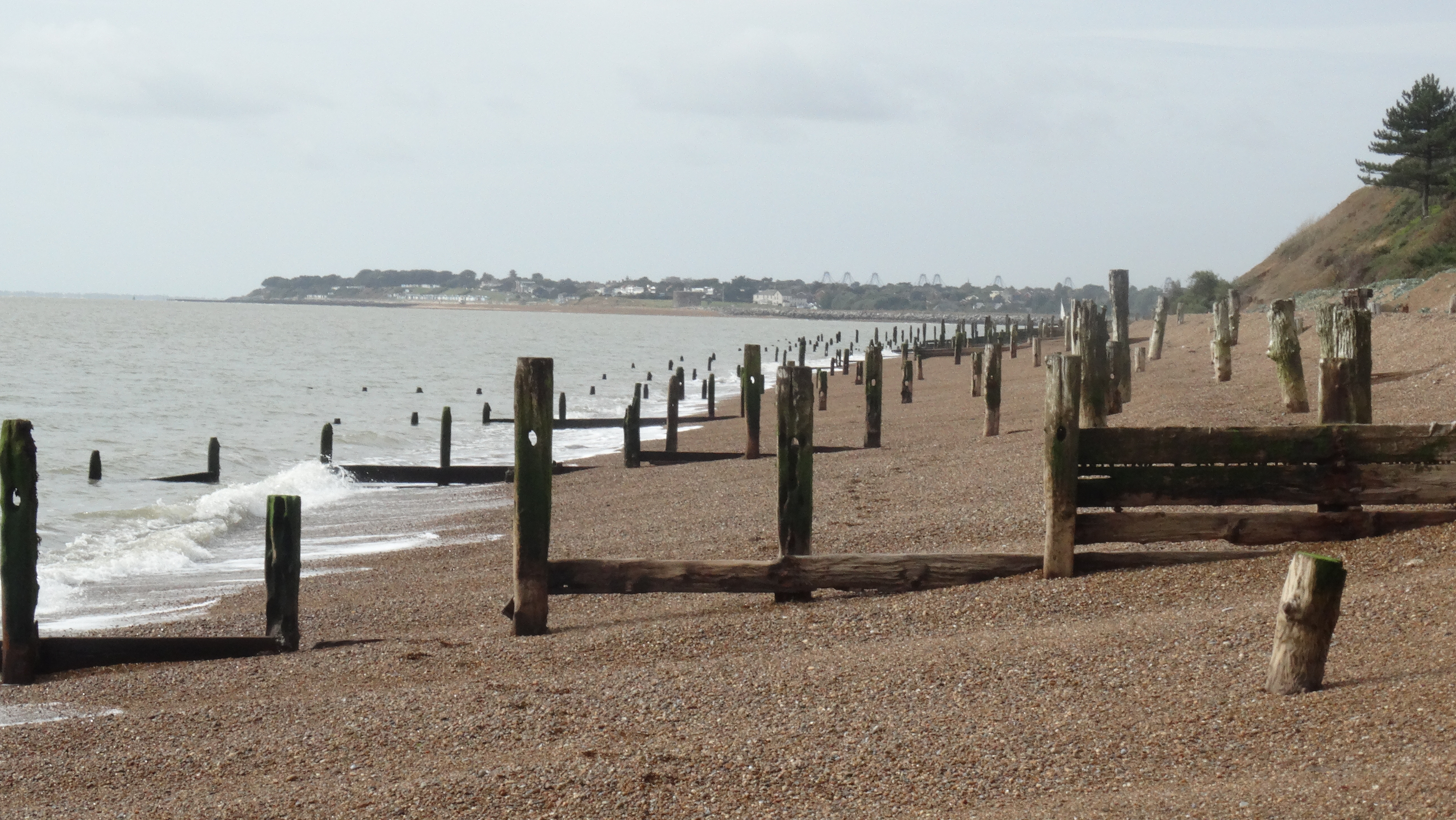 Shingle crunching miles! You could walk almost the whole of the Suffolk coast along the beach but fifty miles of shingle crunching would probably put you off.
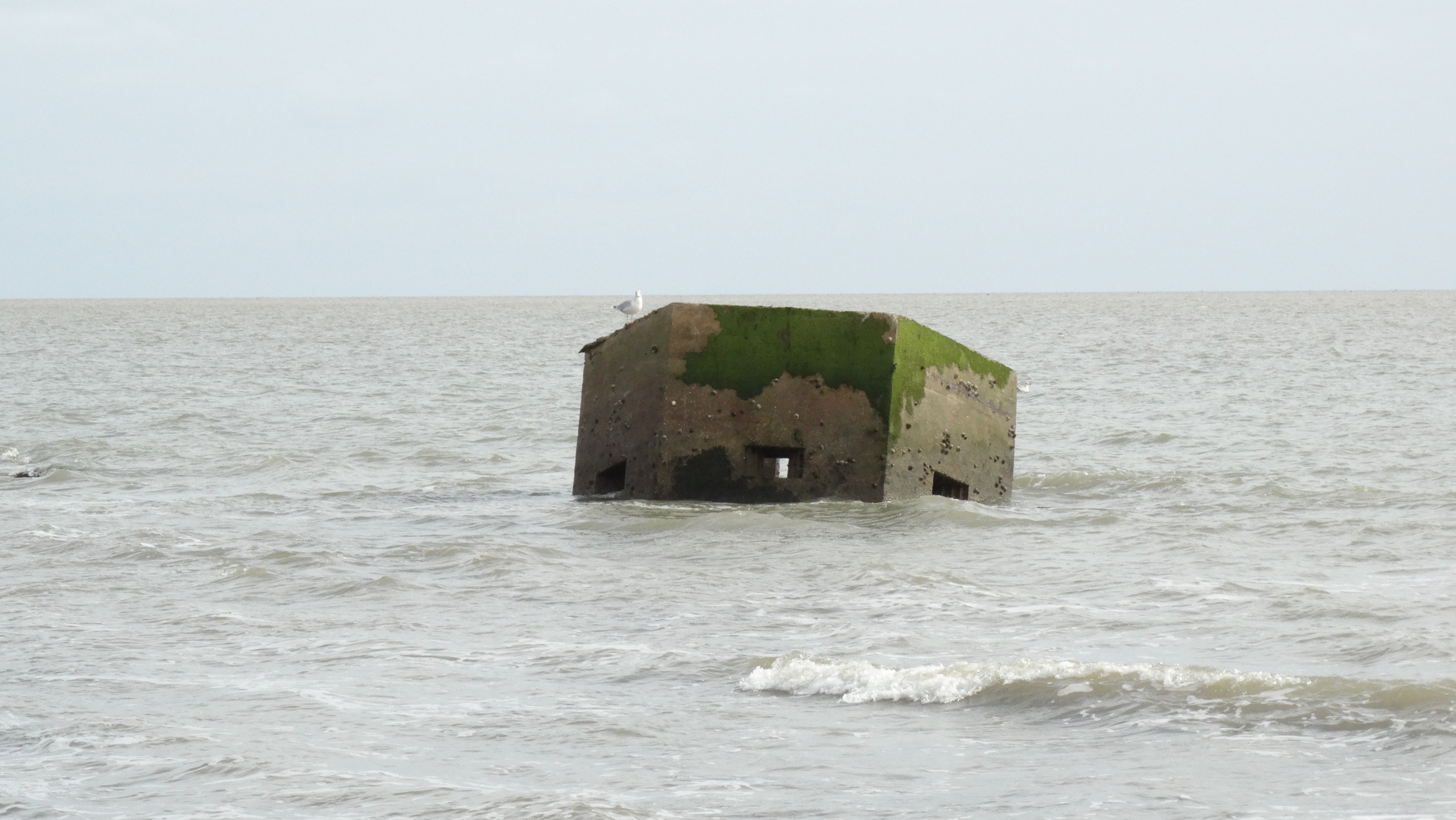 It is not normal for pill boxes to float away but this one lies now in the north Sea which shows how much erosion has taken place in seventy years.
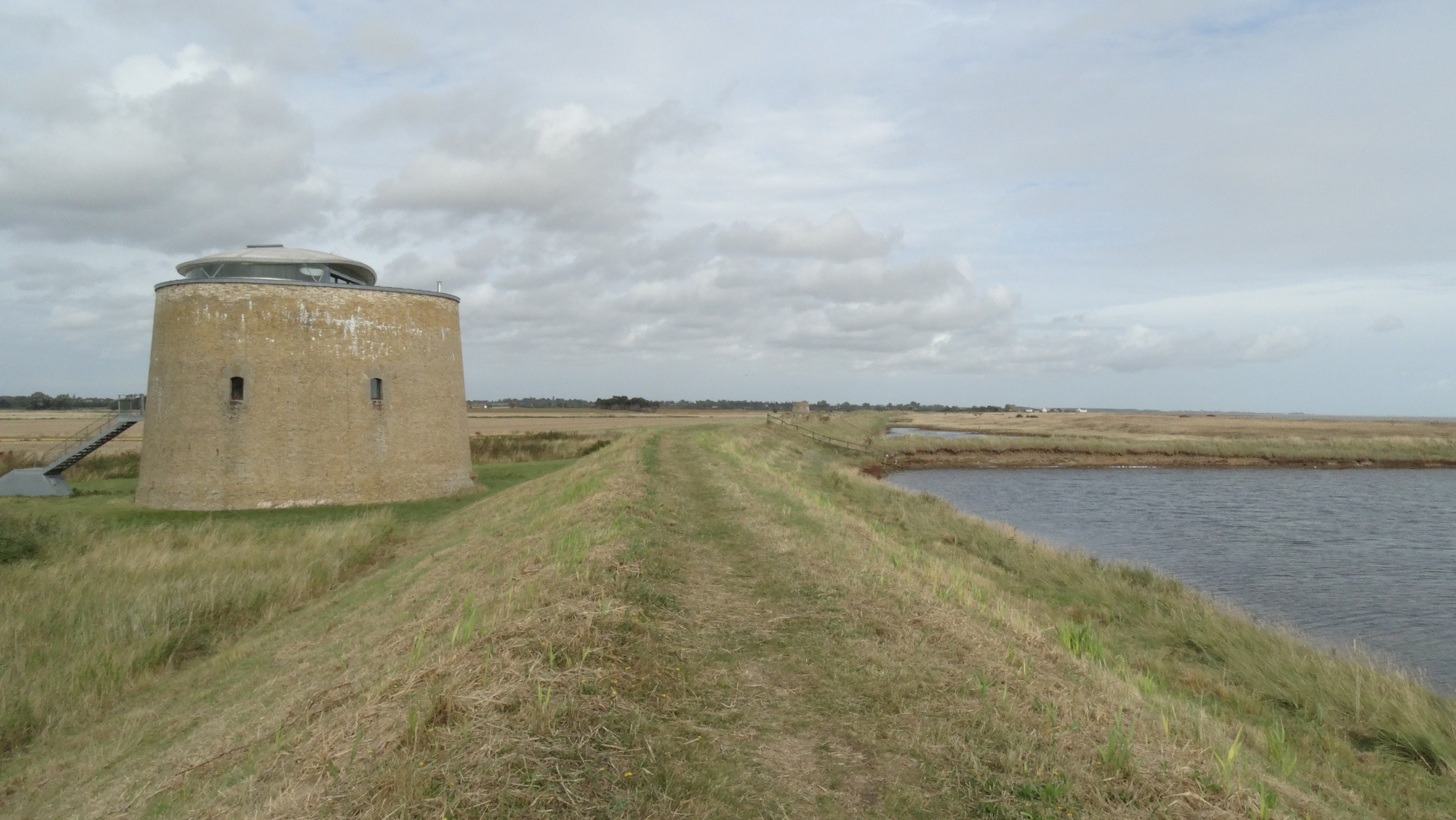 Much of the days walk runs along a good embankment providing fine views and lines with a series of Martello Towers.
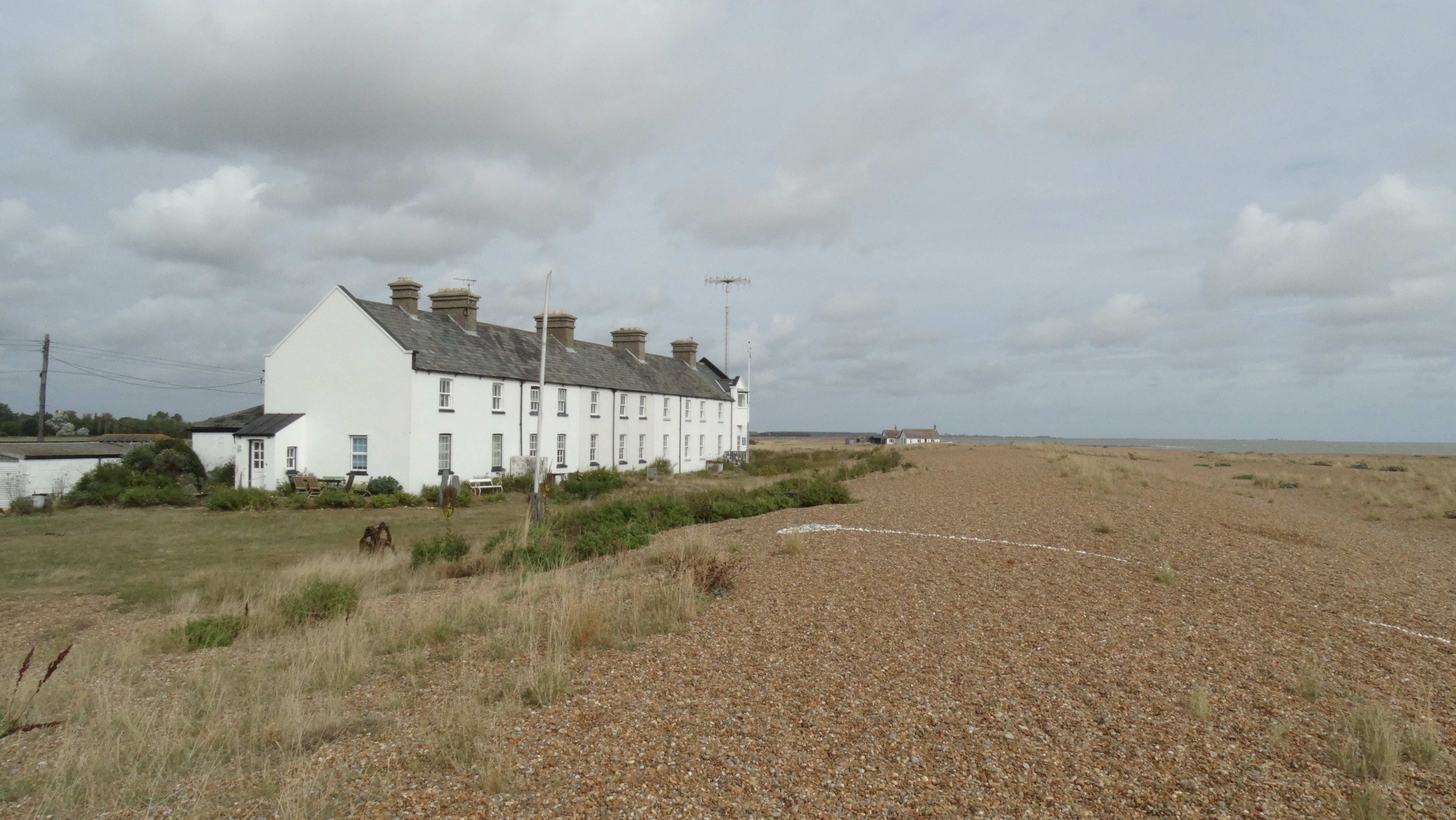 Isolated Shingle Street, once home to the pilots who guided ships up and down the nearby River Ore.
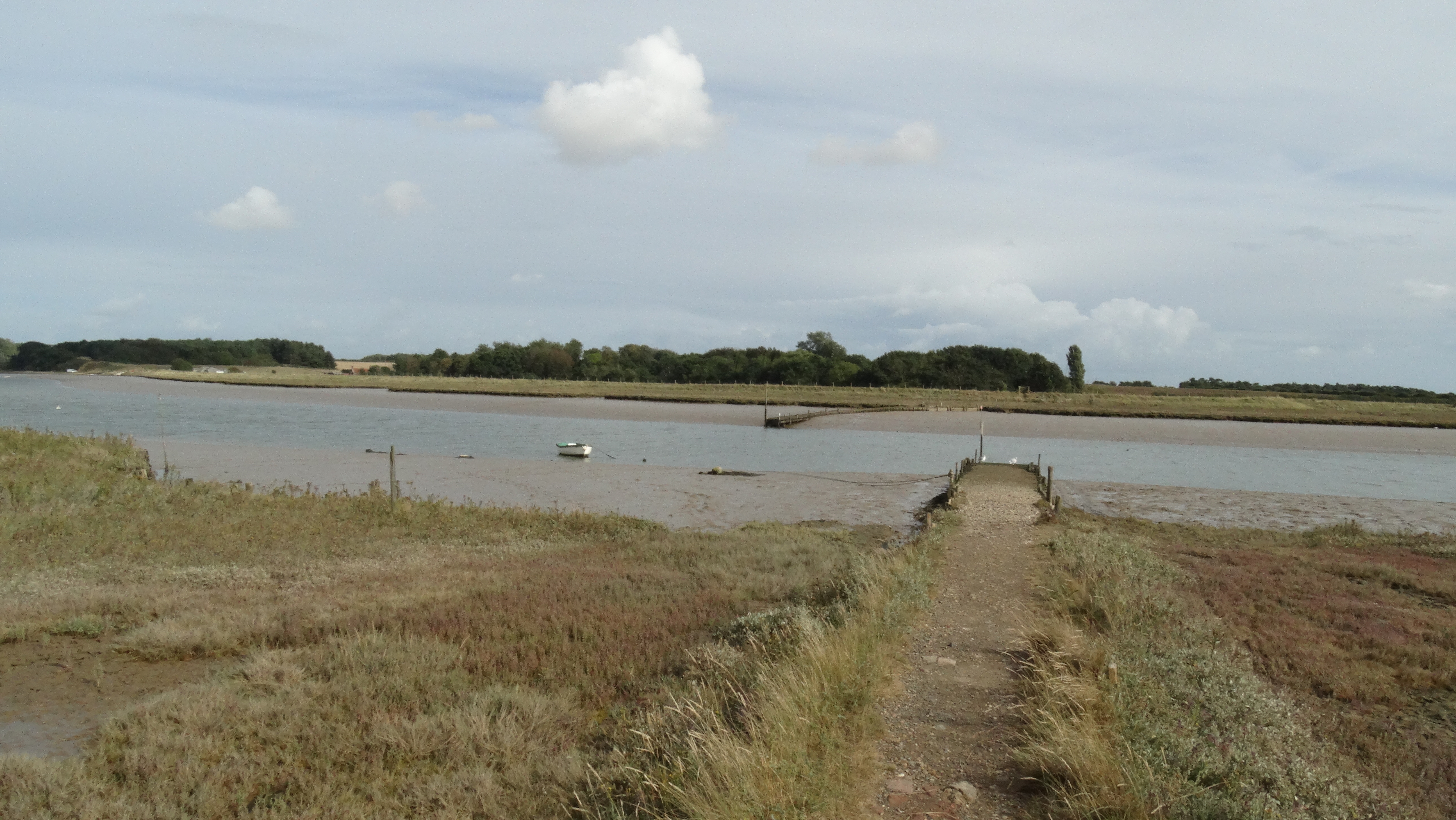 Tranquil Butley Ferry on an peaceful autumn afternoon.
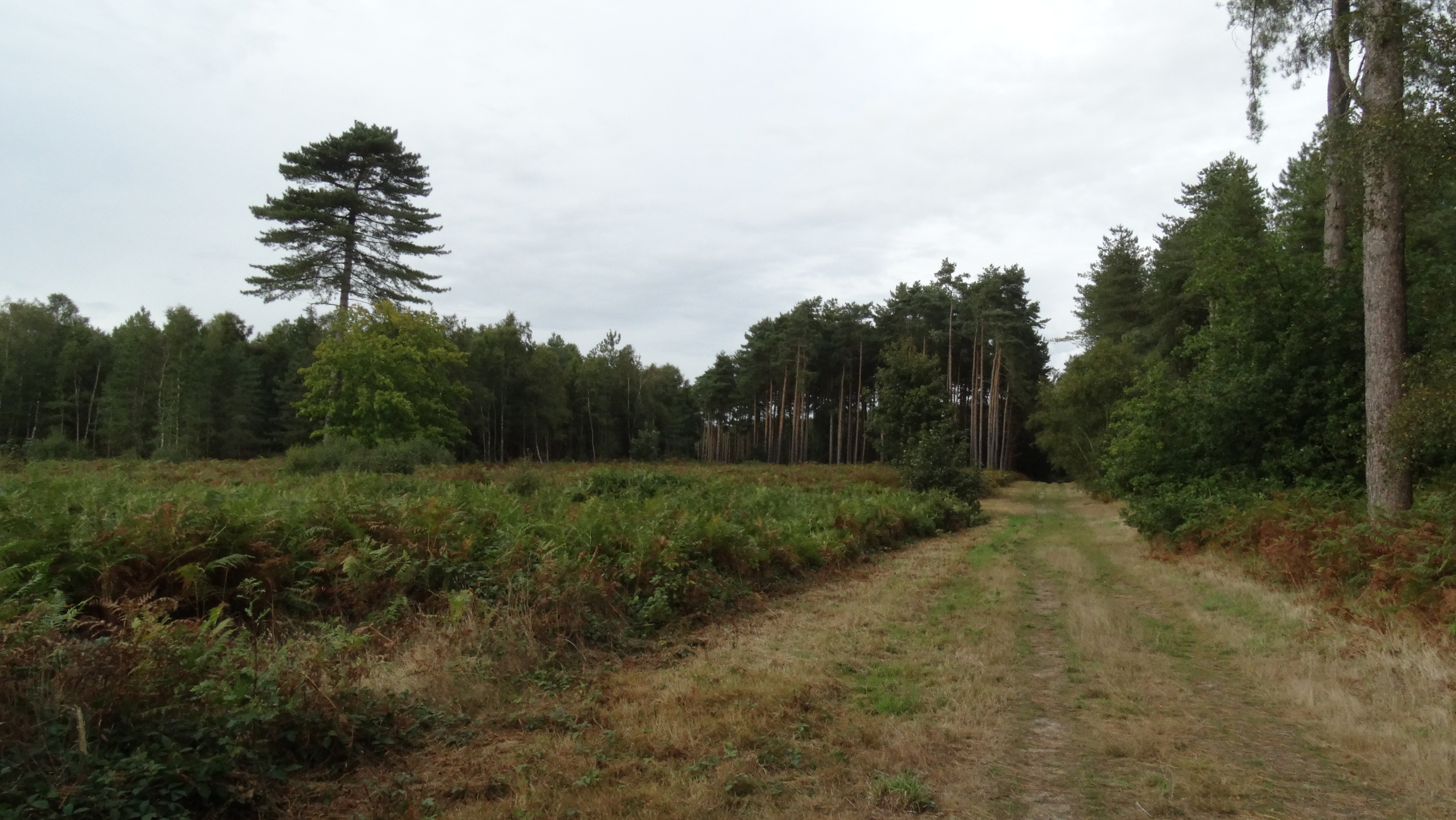 One of the many good paths that run through Tunstall Forest.