
I have skirted around the edge of Kinder Scout many times and even crossed the plateau on one or two occasions usually en route to bag on of its three trig points but I have never until now gone with the aim of searching for the highest point. You can’t really call it a point as it’s just a spot marked on the map as 636 metres on a rather featureless five square miles of peat bogs.
My walk is going to start from the attractive village of Hayfield and on a fine sunny August morning I set out southeast from the village following the quiet Highgate Road before branching left on a hill track which leads up to pass between the outlying shapely hills of Mount Famine and South Head. With the sunny skies now rapidly disappearing I stop for my morning break, and despite it being 11am there are very few people around. I decide to make a small detour to visit Brown Knoll which until recently stood in a sea of peat but thankfully has a new flag-stoned path to the summit coming in from the northwest. I am pleased to see that work will shortly be in progress to pave the route towards Rushup Edge which will halt the erosion to this fragile moorland area.
Heading north I now make my way to Kinder Low and now it’s time for lunch so I chose a spot close to the trig point. This is where the fun begins as my route now is ‘off piste’. With a compass bearing I leave the path to start out on a trek towards the point marked on the map as 636. Initially the going is easy and after some fifteen minutes I reach the area which I feel is about the highest spot and from this area Kinder Low is still in sight as well as Crowden Tower to the south. So where is the highest spot? The answer is hard to say but to make sure I am visiting a couple of small cairns which may be contenders for the highest spot and a post which again could be the summit. Looking round, the actual top could be a number of places but for me, I am satisfied that I have bagged this illusive summit.
With the sunshine returning I going to venture next across the bleakest area of Kinder Scout by way of Crowden Head to reach the northern escarpment. With another compass bearing I set out generally northeast but now I am finding the terrain becoming increasingly difficult. The summit plateau has been re-seeded in recent years and in an effort to return the area to a wet boggy plateau to stop any further peat erosion, virtually all the peaty gullies have been dammed by a series of barriers driven virtually into the peat but too narrow to cross on foot. This makes them into long lines of watery peat bogs. My progress is becoming slow as I search for ways to cross this desolate waste but I fine that by keeping to the highest ground I’m finding a way through but it’s taking much longer than expected. I’m glad to find the terrain becoming easier as I make for the northern escarpment and a good rest on one of the rocky spurs.
I’m now going to walk west as its some time since I last walked along The Edge but first I need to skirt around the upper end of Fair Brook before taking another rest on Fairbrook Naze where there is a welcome breeze.
The Edge, which overlooks, Black Ashop Moor displays a large variety of fine rock formations and I want to find the ‘Boxing Glove Rocks’. Use your imagination and there are other strange rock formations you could put a name of your choosing to.
It’s soon time to leave the plateau and today I am descending via William Clough, a narrow path which repeatably crosses the small stream. Taking the path high above Kinder Reservoir and I am now rewarded by a fine display of heather especially in the vicinity of the Shooting Cabin on Middle Moor.
Finally I will follow the Snake Path down to Hayfield on this hazy, warm sunny afternoon. The path was opened in 1897 and was one of the first successes of the Peak and Northern Footpaths Society in their mission to win public access to the moors. This section of the walk passes through several historic kissing gates erected when the path was originally opened.
Anyone attempting to cross the Kinder Plateau should be confident with map reading and using a compass. Crossing the area presents many problems with deep peaty gullies and dangerous boggy areas and plenty of time should be allowed. Low cloud and fog can suddenly engulf the plateau.
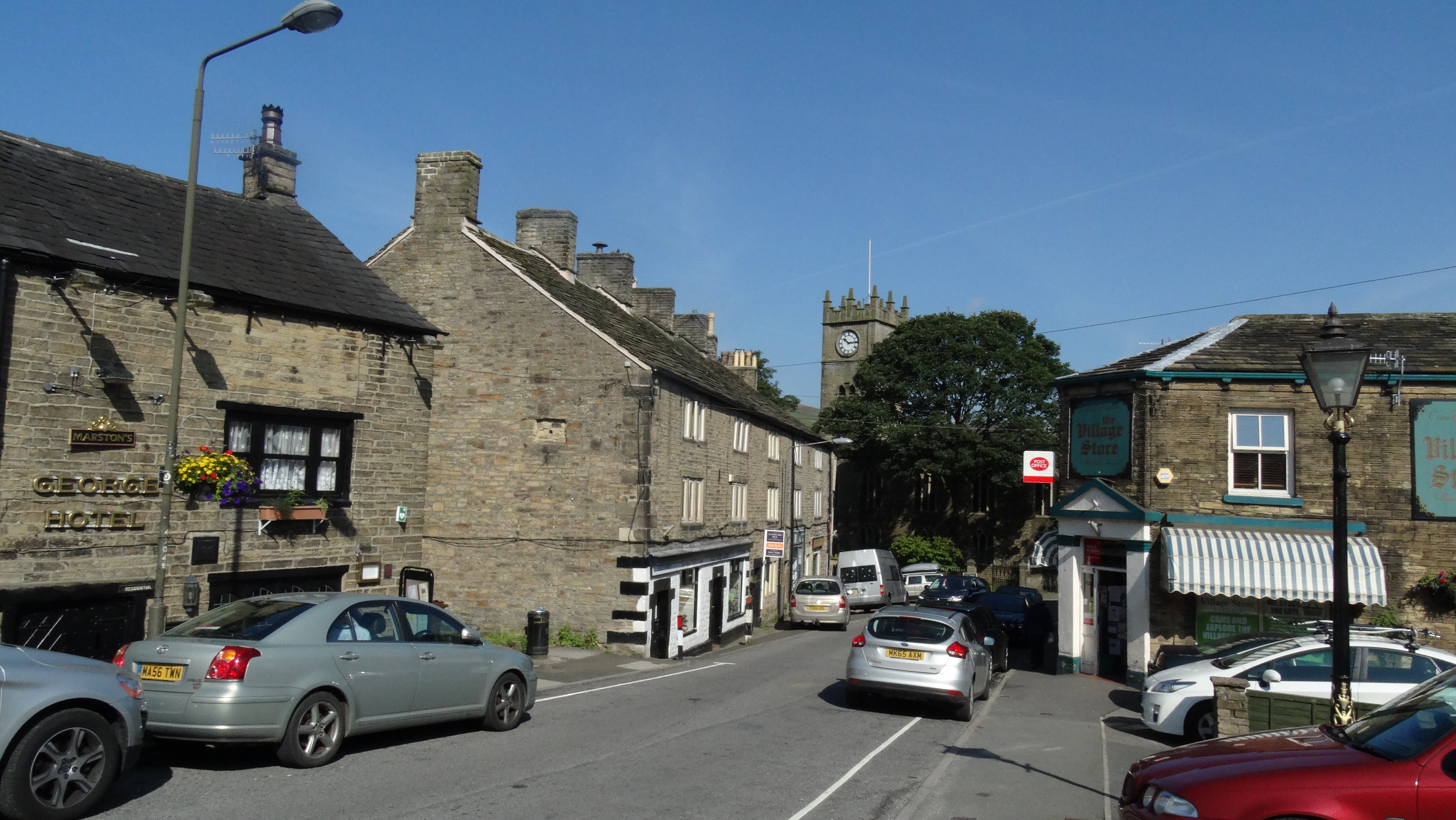 Hayfield on a fine sunny August morning.
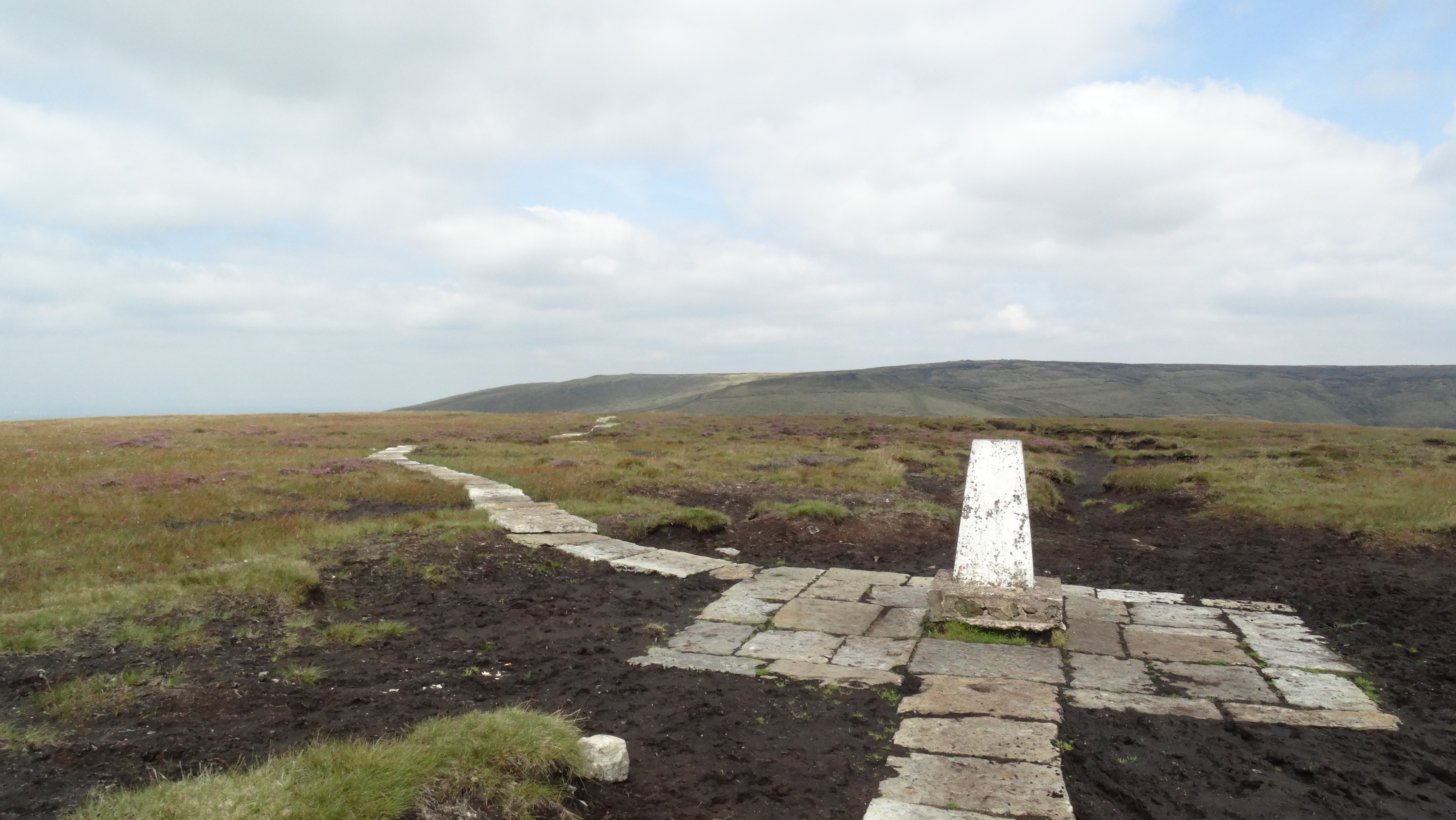 The summit of Brown Knoll and new flag-stoned path.
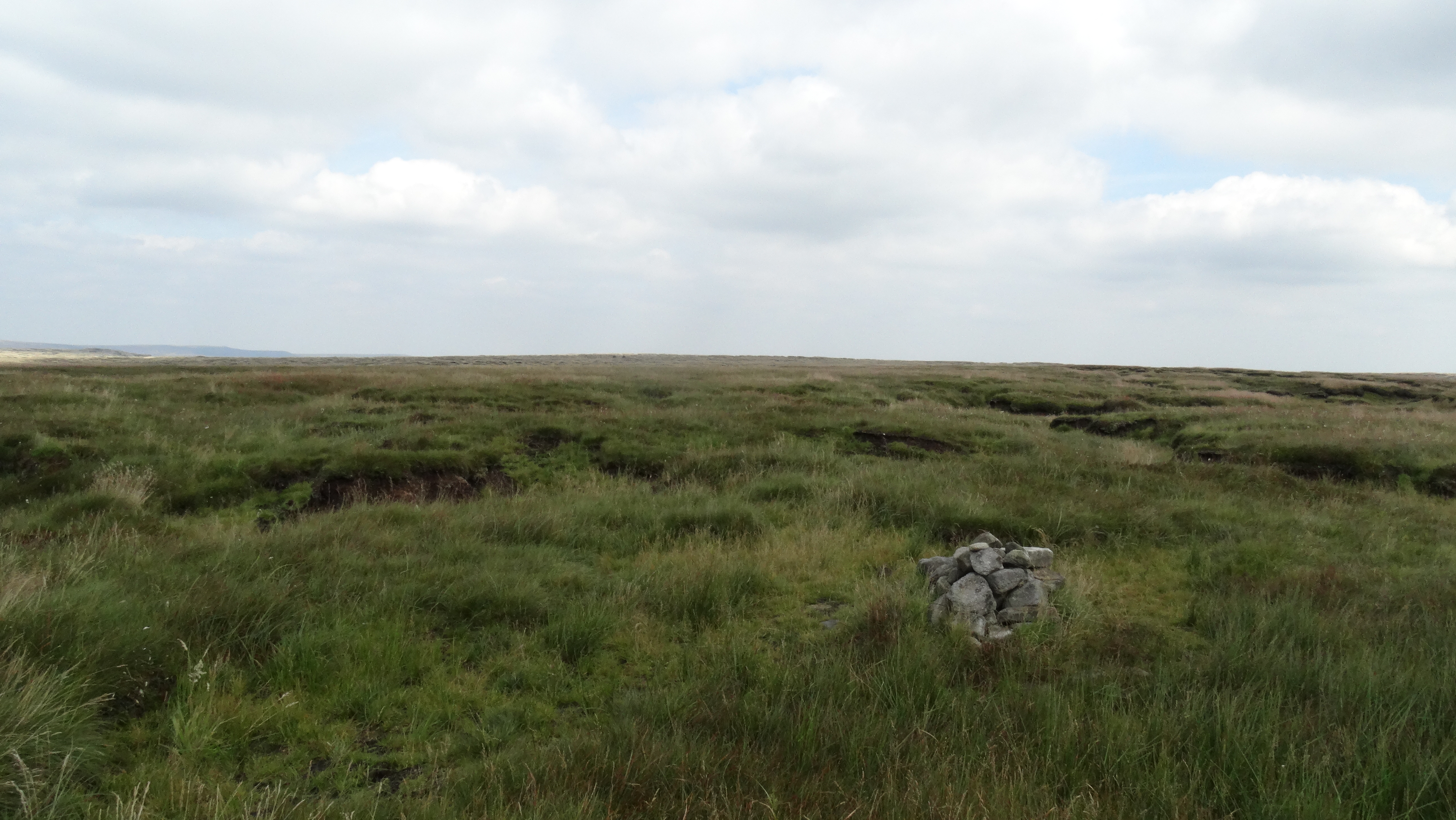 One of the summit cairns on Kinder Scout.
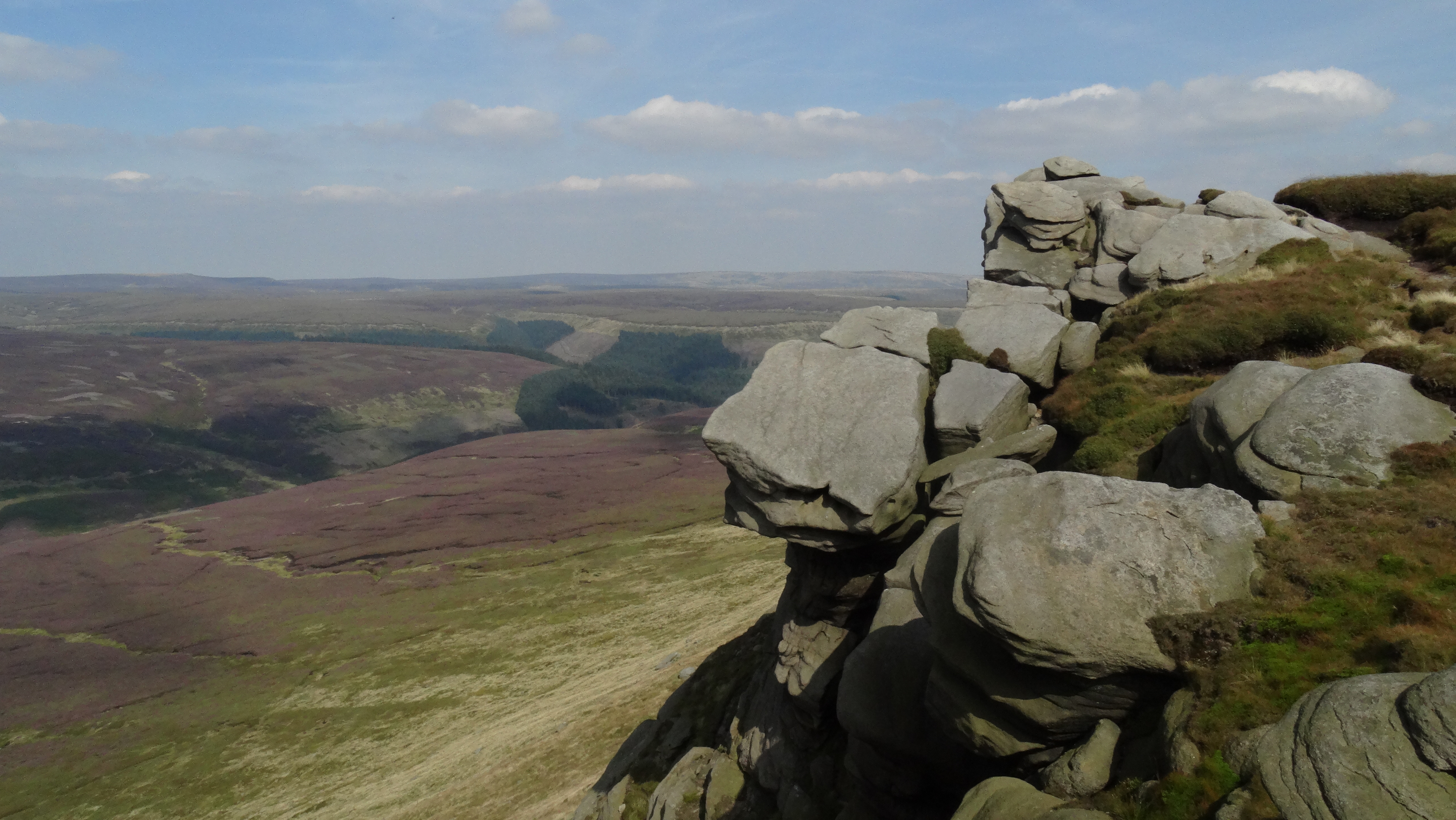 Rock outcrop on The Edge, Kinder Scout
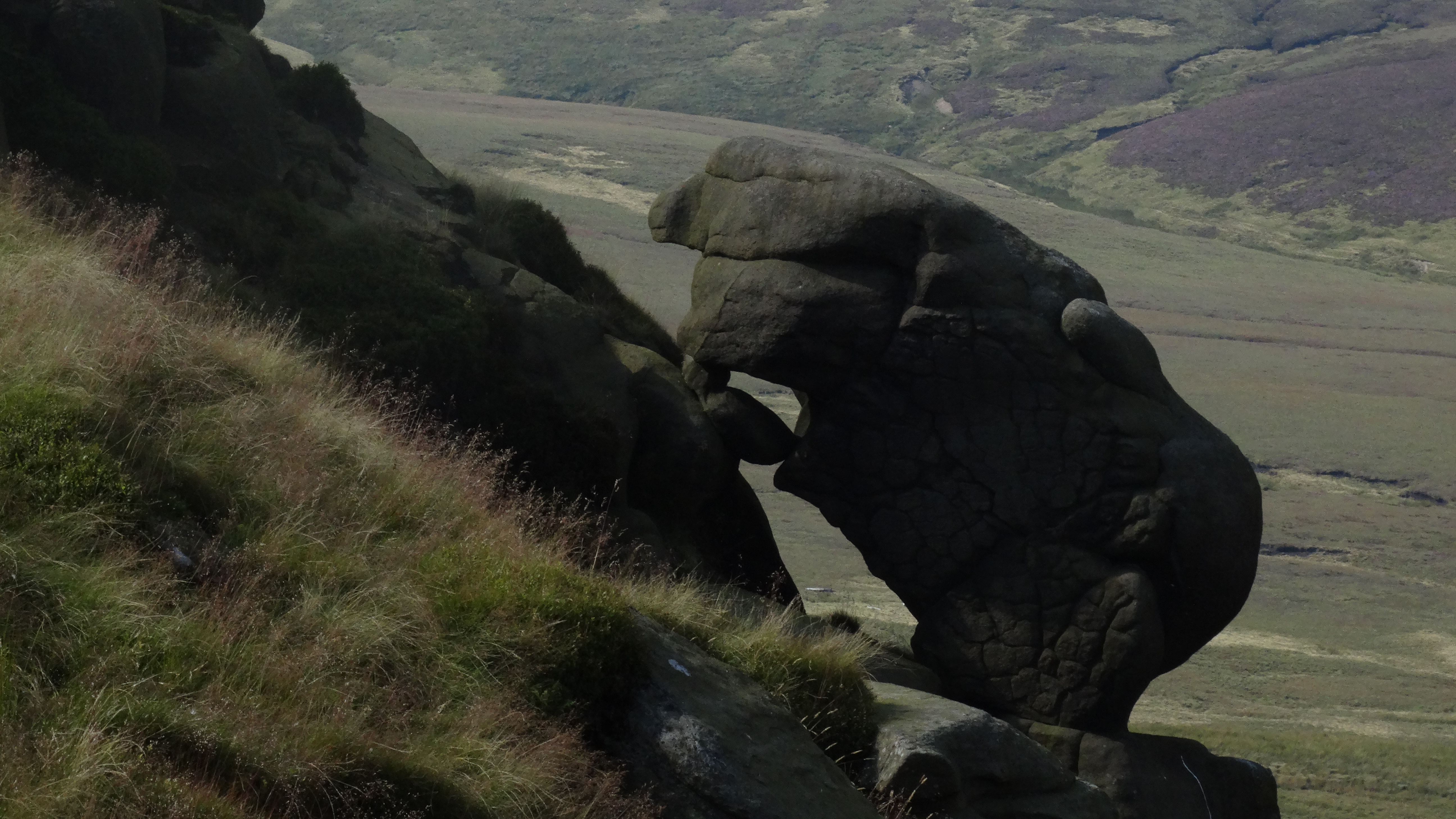 Beware of this rock eating monster on The Edge!
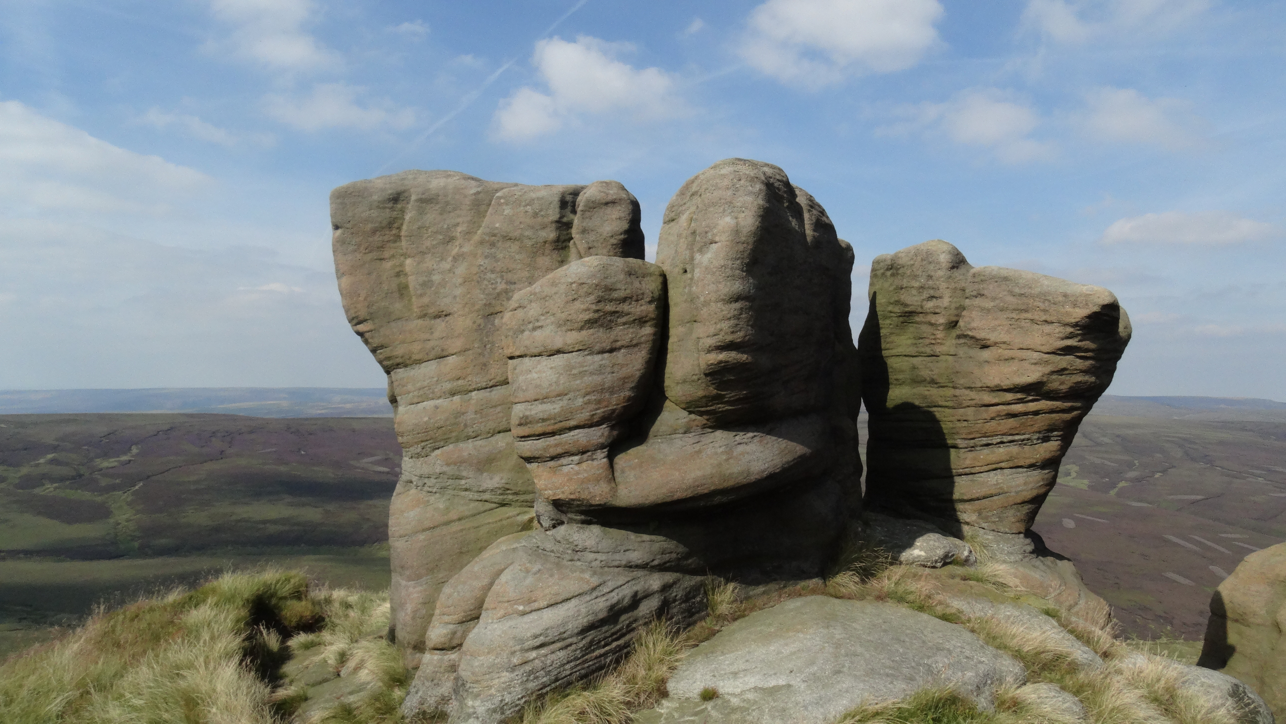 Boxing Glove Rocks on The Edge, Kinder Scout.
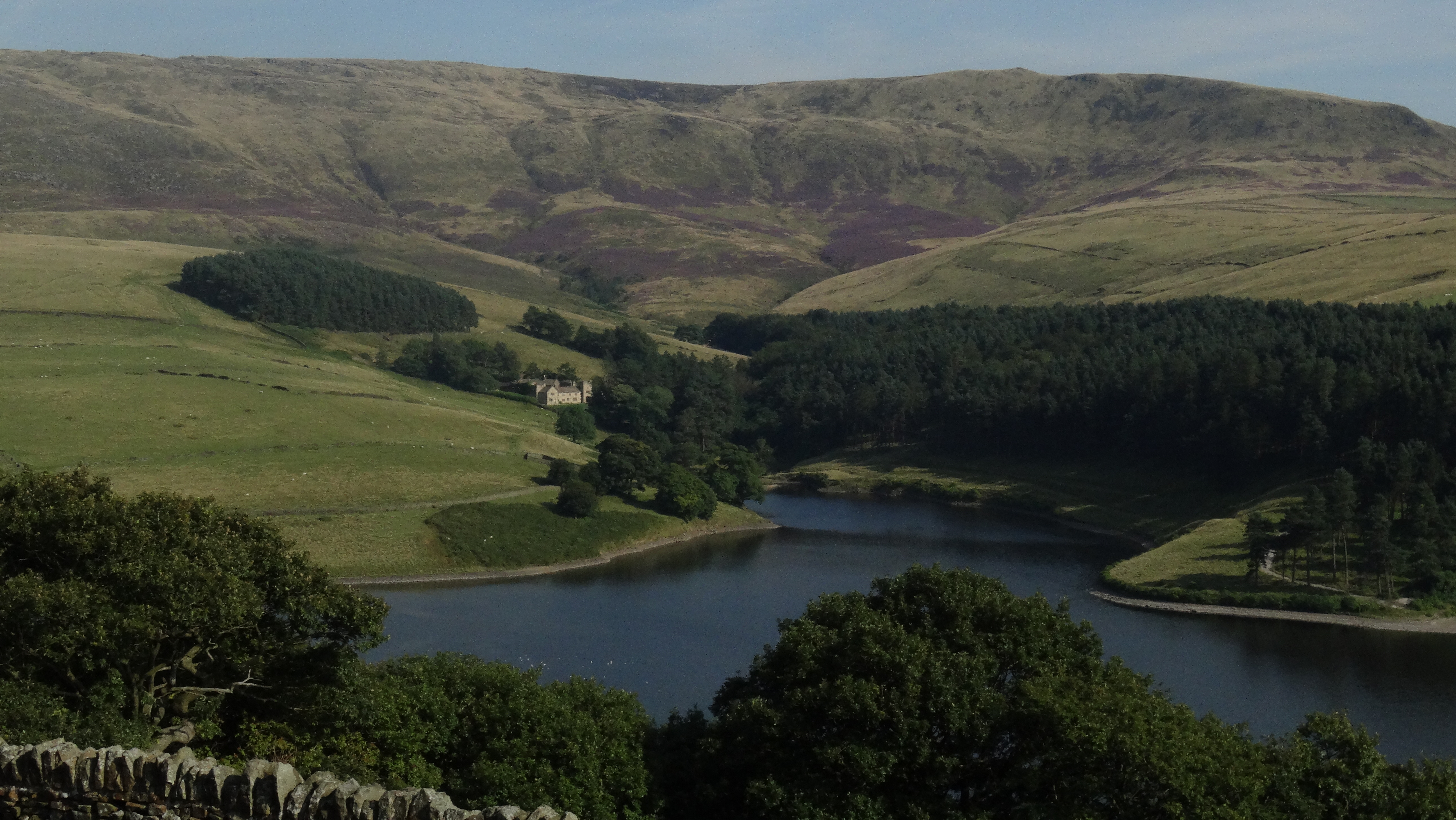 A fine August afternoon above Kinder Reservoir.
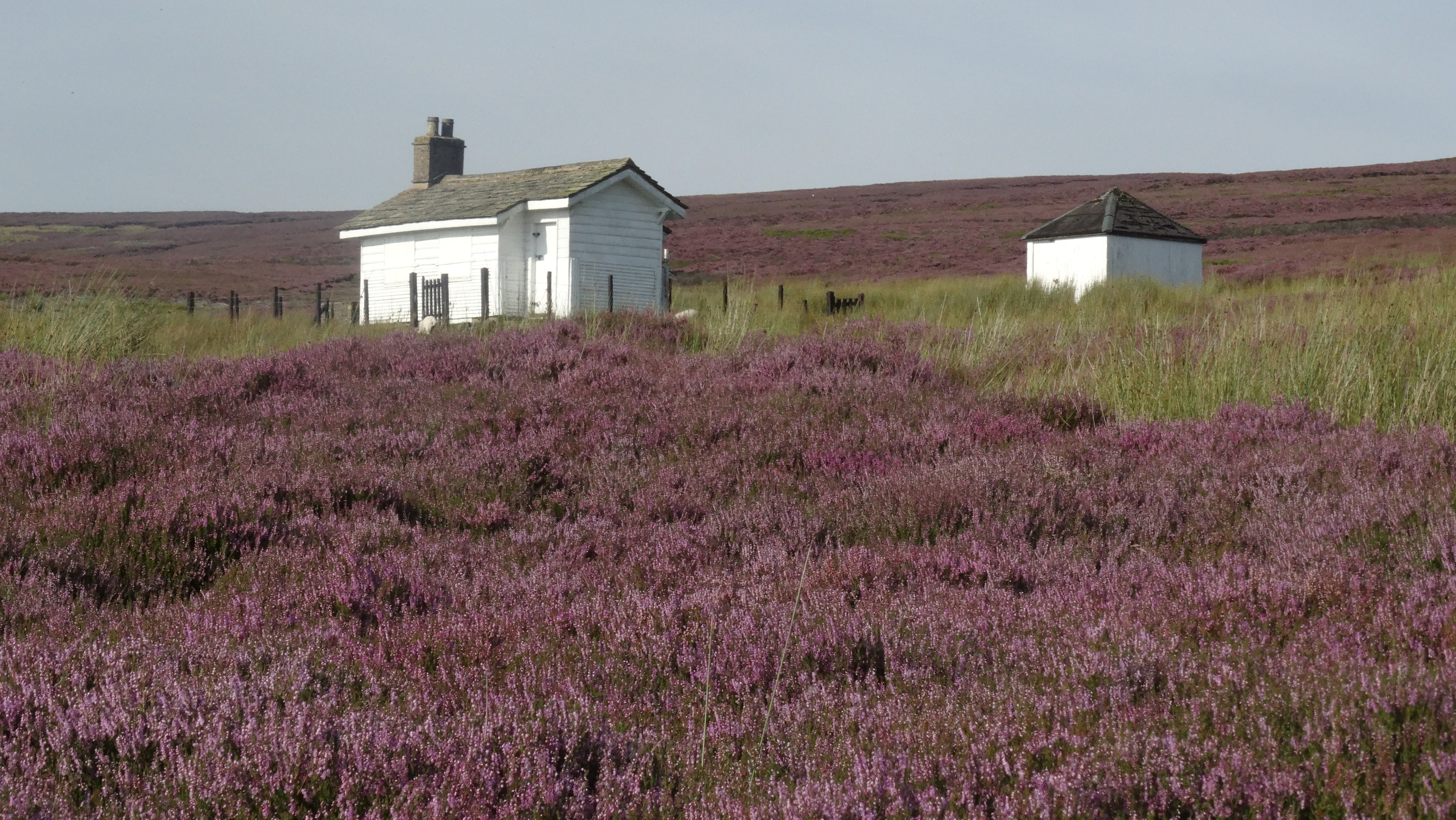 The Shooting Cabin on Middle Moor above Hayfield. The heather should be at its best in late August.
 Hayfield – somewhere between Timothy Whites and the Novelty Rocking Horse!