FOUR VILLAGES AND A HAMLET – A WALK IN THE WHITE PEAK

John in conversation with Brian during the climb to Longstone Edge

The ‘plague village’ of Eyam in Derbyshire was the starting point of a recent 12-mile circular walk by East Cheshire Ramblers.

Eyam is best known for an outbreak of bubonic plague in 1665 when the brave villagers chose to isolate themselves rather than flee in order to prevent the disease from spreading.

As well as numerous graves and moument that can be seen among its quaint stone-built cottages, the ten walkers passed one of several boundary stones around the village where incoming food and supplies were exchanged for coins saturated in vinegar.

With perfect timing, light drizle just before the start soon gave way to sunshine (causing walk leader John Goodman to utter some words about sunshine and the righteous) and indeed, the weather remained fine, if a little gusty, all day.

In Stoney Middleton the group noted the early 19th century octagonal toll bar house, now a thriving fish and chip shop.

Coffee overlooking the wooded Coombs Dale was followed by an ascent to Longstone Edge and its outstanding views. Formerly a productive mining and quarrying area, the Edge has now been widely reclaimed by nature.

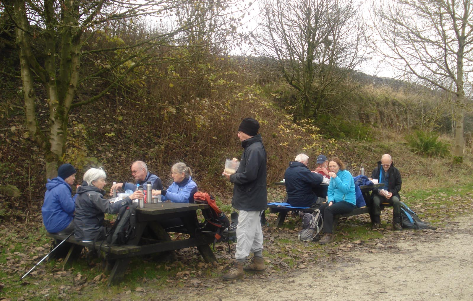
The next objective was the attractive village of Great Longstone, which was approached through colourful meadows. Appropriately, on a Test match day, lunch was taken on benches at the village cricket ground, again with extensive views.

The fourth and final village of Little Longstone was the next objective, before the party headed up to Longstone Moor, and a wind-assisted return to Eyam via the hamlet of Housley.

As well as various places of historical interest, including a pre-historic ‘double dyke’, the group also spotted a rare bee orchid in full bloom.

A bright and breezy day on Longstone Edge

John Goodman

Rambling in the Dane Valley

Pausing for a group photo on the lane towards Hanging Stone

Our walk on April 18th started at Danebridge, from where the party of eleven walkers set off in glorious sunshine to the Ship Inn, then following a footpath passed Wincle Grange, towards Dumkins. High overhead, we spotted two buzzards circling effortlessly.

As we gained height, we enjoyed spectacular views, with the countryside opening up all around. Rolling hillsides were revealed, covered in many shades of fresh green vegetation, all lit up in the bright Spring sunshine.

We descended to Whitelees Farm and had morning coffee break beside the River Dane, glimpsing the occasional yellow flash of busy grey wagtails.

Our route ascended from the valley once more, passing Bearda Mill, with its old water wheel visible from the road. As we crested the hill we were surprised to see a bust of Karl Marx staring down at us from an open barn window.

The dramatic Hanging Stone was our next waypoint, and on the descent through woodland our party was amazed to come upon a group of kilted Scottish warriors, en-route to battle, complete with faces painted – Braveheart style – with blue woad.

The Warriors

We crossed the River Dane once more to pass the former Youth Hotel at Gradbach, shortly before lunch. The afternoon saw us visit the picturesque Three Shires Head, where the boundaries of Cheshire, Staffordshire and Derbyshire meet, before traversing the moorlands leading to Wildboarclough.

After another waterside coffeebreak we crossed Hammerton Moss before returning via Wincle to the start point, having covered a total of 13 miles.

Michael Murphy

Outside the Ship Inn at the end of the walk contrasted with a photo taken around 1935


The Three Highest Peaks in Cheshire

On Whetstone Ridge

In spite of the forecast of a very windy day, seven members of the Ramblers met at Clough House Farm car park to face the challenge of climbing the three highest peaks in Cheshire. Their route started along Cumberland Brook and on towards Three Shires Head. Crossing over the packhorse bridge, the group headed over rough moorland to join the Dane Valley Way and the made their way over uneven stepping stones across the swift flowing River Dane. After sheltering for a brief stop in the now abandoned Danebower sandstone quarries, they headed into the bitterly cold gale force winds across Danebower Hollow and ascended over tussocks of grass and heather to the first summit being Whetstone Ridge at 547m (1795 feet).

Crossing the River Dane


Hurrying across the A537 at the Cat and Fiddle Inn, the next target was Shining Tor, the highest peak in Cheshire at 559m (1834 feet). By this time the wind seemed even stronger and, combined with snow and ice under foot, made the ascent quite a battle. Little time was spent admiring the view from the summit. Dropping down across the rough track over Chest Hollow the route progressively descended before climbing again to reach Macclesfield Forest and some welcome shelter. Leaving the trees behind, the windswept steep sided summit of Shutlingsloe, sometimes called ‘the Matterhorn of the Peak’, at 506m (1660 feet) lay ahead. The group was greeted on the top with glorious views in the late afternoon sunshine, pausing awhile in spite of the unrelenting bitter wind. Finally it was back down to reach the car park after a memorable winter’s day in the hills.

Roger Thompson

On Shutlingsloe – the final summit of the walk


GALES BUT GREAT VIEWS ON KERRIDGE RIDGE

Prepare for take-off ! The walkers were buffeted by fierce winds on Kerridge Ridge.

Sixteen doughty East Cheshire ramblers battled through near gale force winds on a recent 10-mile walk led by Caroline Finlayson which passed along Kerridge Ridge where they were rewarded by stunning views over Bollington and the Cheshire Plain as far as the Welsh hills

Starting from Riverside Car Park on the edge of Macclesfield town centre, the walk travelled through residential neighbourhoods in order to cross the Silk Rd by the timber footbridge. Moving on to Clarke Lane the group joined a footpath on the sharp bend beside Endon Lodge and climbed steadily through fields to reach Kerridge End where they swung north along the ridge towards the trig point in the teeth of fierce winds sweeping in from the Plain.

They were therefore glad to take shelter behind White Nancy – a well-known local monument resembling a beehive which was erected by a local farmer in 1817 to commemorate the Battle of Waterloo. Last year it was painted with giant poppies to mark the 100th anniversary of the end of World War 1.

After descending from White Nancy the route zig-zagged through muddy fields between Rainow and Bollington to re-enter the town and ascend a steep flight of steps beside Bollington Aqueduct where it joined the towpath alongside Macclesfield Canal. The ramblers followed the towpath back to the car park past Victorian mills, gaily-painted narrow boats and roving – or turnaround – bridges which were designed to enable horses to remain hitched to the narrow boats as they crossed over from one side of the canal to the other.

Caroline Finlayson

Caroline Finlayson leads the walkers over Macclesfield Canal on a ‘roving’ bridge.


A Wintry Walk with Brian

The hardy winter ramblers in Cavedale

Seven (fool) hardy souls set off from Peak Forest on Tuesday 20th January. The snow had already started to fall before we set off up Old Dam Lane. Leaving the lane to cross the fields vision dropped to 100 metres due to mist and snow,and it was almost impossible to make out the footpath. The decision was taken to follow the country road into Castleton ,rather than getting lost in the mist over the fields. The road itself was impassable to traffic. As we descended into Castleton the mist lifted opening up a wonderful snow covered landscape. Castleton itself was almost deserted; unusual for such a tourist trap.

After lunch we ascended Cavedale, arguably the most attractive dale in Derbyshire,and certainly one of the most  challenging. Footprints in the snow indicated that there had literally been only one man and his dog before us all day. All the more surprising then to be caught up by a woman on Nordic skis.It really was  amazing how fast she moved uphill. Eleven miles in the snow felt more like 15 miles in normal conditions. But at least we all got back safely,even though most of us slipped once or twice : the snow cushioning the falls.

All in all quite an exhilarating day.

Brian Griffiths

Wanderings Around Gawsworth

The party on a swing bridge over the Macclesfield Canal

Fairways Garden Centre at Sutton Lane Ends was the starting point for this eleven mile ramble. Sunny skies greeted the sixteen strong group who set off south via Parvey Lane to reach the frozen Sutton Reservoir which was built as a feeder canal to replenish the nearby Macclesfield Canal. Heading west, the group crossed fields to reach the parish church at Gawsworth and a convenient stop for elevenses in the shadow of the fine ashlar sandstone church. The present building dates from around 1430 and is a local landmark.

It wasn’t our last visit to Gawsworth on this walk as the group headed south on a popular path before skirting around via High Lane and The Mollards to re-enter the village on the western side for lunch in sheltered Gawsworth Park. The village sign depicts a picture of a jester known as Maggoty Johnson who was jester to Gawsworth Hall and his grave is located at nearby Maggoty Wood.

Another loop was made to the north of the village for the afternoon leg of the walk via Dalehouse Farm and Danes Moss Farm before crossing the Danes Moss Nature Reserve in low afternoon sunshine. Finally, the towpath of the Macclesfield Canal was followed back to the Fairways Garden Centre for a most welcome cup of tea and cake to round off the day.

Colin Park

Audrey making a presentation to Gwen in recognition of her excellent backmarking skills


RAMBLERS SEE IN NEW YEAR WITH KEITH’S SHERRY WALK

East Cheshire Ramblers celebrated the New Year with Keith’s ‘Sherry’ Walk – a 12-year-old tradition started by long-standing member Keith Hartley from Bollington, who has since stepped down from running the event but is still a regular attendee.

Jointly organised by Lorraine Tolley, Melanie Davy and Jake Ezair, this year’s walk attracted a record crowd of 38 ramblers, including four new members, who set off from Jackson’s Brickworks, Higher Poynton, and made their way along the Macclesfield Canal and through farm fields towards Ryles Wood .

After a brief pause for coffee at Parkgate, the party entered Lyme Park and climbed the incline outside Lyme Hall to reach the Cage where Lorraine and Melanie handed out beakers of sherry to toast in the New Year, accompanied by a generous supply of mince pies provided by Jake.

Suitably refreshed the group then returned to Higher Poynton by heading downhill and crossing a footbridge to exit the park at Bollinghurst Brook and then following the Goyt Way along the brook to rejoin the canal back to the brickworks.

“It was a particularly mild day, with nice temperatures for walking but, being Cheshire, there was a lot of mud“ said Melanie ruefully. “A bit of frost might have made the going a lot easier ! Even so, it was very enjoyable and a great way of seeing in the New Year.”

VISTAS AND VALLEYS FROM PYM CHAIR

From Andrew’s Edge with Lamaload Reservoir in the distance.

The summit of Shining Tor, at 559m, is the highest point in Cheshire. It is situated on a fine ridge walk, popular with East Cheshire Ramblers, and affords superb views towards local landmarks, such as Shutlingsloe (506m) and ‘The Cat & Fiddle Inn’ on Buxton New Road. The ridge forms part of the border between Cheshire and Derbyshire, and follows an old packhorse route used to carry salt from Cheshire and lime and coal from Derbyshire.

Shining Tor was the first of several high points on a recent nine mile walk, when twenty-two Ramblers set off from Pym Chair Car Park, led by Andrew Davies. After their gradual climb along the ridge and time to admire the summit vista, the ramblers descended steeply, tracking generally west then northward along Andrew’s Edge on rough grassland. They enjoyed a short break overlooking picturesque King’s Clough and Lamaload Reservoir, before continuing across rather boggy moorland to Redmoor Farm, then down and up a short steep stretch of road to Jenkin Chapel.

A more gradual ascent on tracks and paths took them past Green Booth to Summerclose and Charles Head Farms, though they paused on the way for a picnic lunch gazing across the steeply-sided valley towards Windgather rocks, which they would reach later along their route. Soon they were once again descending steeply, this time to cross Todd Brook, before climbing more gradually on its far side past Near Carr Farm to Five Lane Ends. As the walkers turned south to walk along Taxal Edge and Windgather Rocks, the low sun to the west broke through the clouds, and faint shafts of sunlight against the mid-afternoon mist lent a rather mystical quality to the landscape. A final mile along this ridge brought the ramblers back to the car park, where all agreed it had been a very enjoyable walk.

Helen Richardson

View towards Shutlingsloe from Shining Tor


RAMBLING ON THE SOUTH CHESHIRE WAY

Afternoon break at the lock on the Trent & Mersey Canal at Thurlwood

Mow Cop Castle folly is a landmark dominating the Staffordshire skyline for miles around. The folly, built 260 years ago and now belonging to the National Trust, was the location of the first stop of the day on a recent twelve mile walk by eight members of the East Cheshire Ramblers, led by Colin Park.

After a wet night, the Ramblers set off from Little Moreton Hall along the South Cheshire Way. Soon after crossing the Macclesfield Canal the group ascended towards the Old Man of Mow. The summit however was just within the cloud base, and so on this occasion, only the grey outlines of both the Old Man and nearby Mow Cop Castle loomed out of the mist as mystical grey outlines, and there were sadly no views from these high vantage points. A descent was followed via a maze of lanes through Mow Cop Village, which is famed for the birthplace of the Primitive Methodist movement. On the edge of Kidsgrove, the group then followed a section of the Trent & Mersey Canal to reach their lunch stop in the church yard at Church Lawton.

The church which stands on a mound has been a religious site for near on one thousand years. The present church was built after a fire in 1798. One hundred and forty six years earlier the church was struck by lightning killing eleven people inside.

Rejoining the canal towpath again the group crossed Snape’s Aqueduct to reach Thurlwood. Here it was time for another brief break before setting off along field paths in bright afternoon sunshine, following once more the South Cheshire Way for much of the way back towards Little Moreton Hall.

Colin Park

Walking along track south of Higher Smallwood near Thurlwood


DRAGON’S BACK FROM PILSBURY CASTLE

Lunch at Sparklow

Situated on the Manifold River, and above the River Dove valley, the village of Longnor provides a good starting point for walks exploring the upper reaches of both rivers. Ten East Cheshire Ramblers gathered in Longnor’s cobbled market square on a chilly morning for a recent ten mile walk south along the Dove Valley to Pilsbury Castle. The chill lessened as they gained their stride, walking down into the Dove Valley. The morning coffee stop was taken at Pilsbury Castle, where earthworks and an earth mound on a limestone outcrop are all that remain visible of the Norman motte and bailey construction with a wooden perimeter wall, built in the eleventh century to control the upper Dove Valley. From here, through a haze of thin white mist, could be seen the distinctive grey outlines of Parkhouse and Chrome hills, – for their shape, also known aptly as ‘dragon’s back’.

Their route, led by Mike Bull, crossed sheep pasture limestone uplands to reach the High Peak Trail, which follows the course of the old High Peak railway, constructed in the nineteenth century to link the Cromford Canal on the eastern side of the Peak District with the High Peak canal on its western edges, and with Manchester, then a rapidly developing cotton manufacturing centre.

Good views of the hills were enjoyed as they made their way along the flat track bed, stopping for lunch at picnic tables at Sparklow, which had been one of the railway halts.

The Trail took them back towards Earl Sterndale, where a wooden bridge crosses the Dove. This was followed by a short, steep ascent out of the valley back to Longnor. Some of the group lingered over well-earned hot drinks and cakes in the market square café -another attraction in starting the walk from Longnor – before their return home, contented with the tranquillity and beauty of the ramble.

Mike Bull