 The inspiration for this article was Ralph’s August ‘Noughty’ walk from Padfield during which we visited the National Grid point SE0000000000 on the Swineshaw Moor near Stalybridge. This point is as at the junction of grid squares SE, SD, SJ and SK.
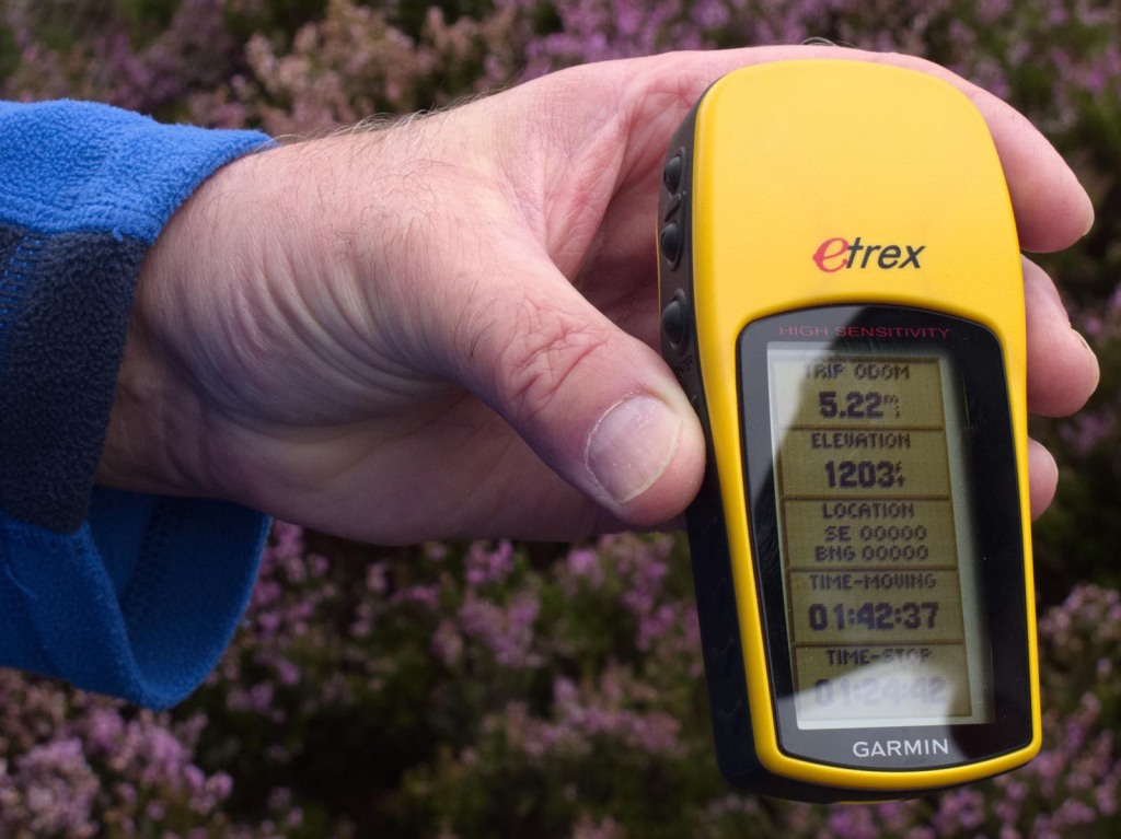
 To prove the point Roger took this photograph of my GPS showing the grid point. This was achieved after considerable wandering about in the heather to get to the exact one-metre square and Ralph’s invaluable help in acting as a screen to cut down reflection. The location was only about 5 metres from a small cairn presumably built by previous visitors in search of the spot, which is not bad considering that the accuracy of a GPS is probably only about 10 metres.
The rules governing the National Grid are somewhat arcane. A grid reference consists of two letters and a variable number of digits depending on the precision required. Four digits will specify the point to the nearest kilometre and ten digits will give it to the nearest metre.
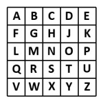
The grid is based on 500 kilometre squares arranged as below. Note that there is no I in GRID.
 Each of these squares is further divided into 100 kilometre squares using the same pattern. Thus two letters are needed to specify each square. The first half of the digits then specify the distance from the west of the square (logically called ‘the easting’) and the remaining letters specify the distance from the south of the square (called ‘the northing’).
Because the earth is not flat the grid does not coincide with latitude and longitude lines except that the line dividing squares SJ and SK is at 2 degrees west. This line meets the English coast just north of Berwick-upon-Tweed and leaves it on the Isle of Purbeck south of Poole. In 1997 Nick Crane walked between the two points keeping within one kilometre of the line. A feat that will probably never be repeated since it involved a considerable amount of trespass, crossing lakes with the help of local sailing clubs and military escorts across Salisbury Plain and various airfields.
In practice Great Britain is covered by only five of the large squares – Ireland is not covered. These are:
N – North
S – South
H – Highlands or Hebrides, although the square only covers Orkney and Shetland
O – Offshore (but see below)
T – There’s no obvious mnemonic, but it covers south-east England
Looking at points similar to the one we visited on Ralph’s walk that have two letters followed by ten zeroes, there are only 22 which fall on land. These are conveniently listed on the following web site. http://www.geograph.org.uk/article/In-Search-of-OV0000
The strangest of these is probably OV0000000000 because in the whole of the O square there are only a few square metres of land, and those happen to include that point. The point lies on the beach below Beast Cliff in North Yorkshire. Apparently if you want to reach it, you are advised to go equipped with ladders, ropes and other climbing gear, and be prepared to wade knee deep through vegetation packed with ticks and adders. However there are reports of at least two species of beetle when you get there, so our editor is probably organising an expedition at this very moment. The web page at http://www.geograph.org.uk/photo/3715407 shows a photograph of a dead deer on the beach.
Of the other 21 points one is on the uninhabited island of Taransay off South Harris, and several are probably on private land or otherwise inaccessible. As far as I can see none of them is actually in the middle of a private house, although one does seem to be dangerously close to an electricity substation. All in all visiting each one would be a pointless exercise.
Steve Hull

