[caption id="attachment_1740" align="alignnone" width="1363"]

At Roonagh Pier awaiting the ferry to go out to Clare Island on a glorious sunny morning.[/caption]
A stepping stone between Connemara and Achill Island and a mere six square miles, Clare Island lies at the entrance to Clew Bay on the west coast of Ireland. Today the population is again on the increase and has risen to 168 on the 2011 census but in 1841 the population was a staggering 1615 but that was just before the Irish potato famine of 1845.
I am based in Westport for the week and high on my list is to visit Clare Island. It is now or never and thankfully the Friday on my week in the area dawns a perfect day. It’s my last full day in the area and I’m setting off with plenty of time to spare to reach Roonagh Pier west of Louisburgh.
The MV Sea Sprinter is the ferry for the island on this fine morning and with a one other tourist and a few workmen, a friendly black Labrador called Oscar and a few perishable groceries we set off under sunny skies for the short crossing to Clare Island.
What a day with hardly a cloud in the sky as I step ashore from the quay and make my way around to the sandy harbour. The harbour is guarded by a now ruinous castle, which was once the stronghold of the pirate Queen Grace O’Malley. Even today the O’Malley surname crops up everywhere on the island. My aim is to walk clockwise around the island and to catch the 4.45pm ferry back to Roonagh Pier and from my calculations I will do the twelve miles comfortably.
[caption id="attachment_1741" align="alignnone" width="1363"]

The sandy harbour on Clare Island. The main ferry is beached for repairs. Suddenly the pace of life has slowed down.[/caption]
It ‘s not even 10am as I set out west along the almost deserted lane along the southern coast of the island. Of the few vehicles on the island, it’s a place where cars and vans come to die. They have seen better days on the mainland and many vehicles have large dents and or have missing bumpers.
[caption id="attachment_1742" align="alignnone" width="1363"]

The empty lane west along the southern coast of Clare Island. I see only two vehicles over four miles of walking along this delightful undulating lane overlooking a sparkling sea dotted with little islands.[/caption]
Almost two miles west I make a small diversion to visit the ancient church known as St Bridget’s Abbey which is believed to date from the 12th century but unfortunately it is locked although there are some interesting ancient crosses in the churchyard. Nearby the photographic little post office is doing very little trade and during my walk it is the only shop I find on the island. From my observations, there are several new houses on the island and many old properties have fallen into decay.
[caption id="attachment_1743" align="alignnone" width="1363"]

A peaceful setting for the 12th century St Bridgets Abbey and its graveyard dotted with ancient crosses.[/caption]
[caption id="attachment_1744" align="alignnone" width="1363"]

The island's only shop with only the likelihood of two hens as possible customers.[/caption]
I have a further two miles of lane walking west passing a few scattered houses on the way. A handy seat is a good spot for my morning break on this most pleasant day overlooking a sparkling blue sea towards Connemara. The lane finally runs out at a small cluster of houses and a farm at Loughanaphuca. From here I follow a track for a short distance before heading across the short cropped grass towards the shaky ruins of the Napoleonic Signal Tower built in 1804 as one of several along the Irish coast. The tower was abandoned after the threat of invasion passed and is now very unsafe so I keep my distance. The walking is easy as at this exposed location facing the open Atlantic where very little grows above about an inch or two. To the southwest is Beetle Head, a low promontory where it is said that the Spanish Galleon El Gran Grin met its fate after the Spanish Armada.
[caption id="attachment_1745" align="alignnone" width="1363"]

Beetle Head on the southwest corner of Clare Island. Just offshore lies a Spanish Galleon which met its fate after the Spanish Armada in 1588.[/caption]
[caption id="attachment_1746" align="alignnone" width="1363"]

The western side of Clare Island few people see as it faces out to the Atlantic and no one lives here. I was now setting out to climb to the summit of Knockmore, by far the island's biggest hill.[/caption]
It is now time to change direction and a fine grassy slope with steep broken cliffs on my left leads up to Knockmore which at 462 metres is by far the highest point on the island. After a stiff climb I reach the summit plateau and make my way to the trig point. I have picked the most perfect of days with a very light northerly breeze, good views and unbroken sunshine. In the distance sea mist is rolling over a low ridge on Achill Island like a waterfall. To the east is the hazy outline of Croagh Patrick, Ireland’s Holy Mountain. This will make a perfect spot to stop for lunch. I’m making good time and over lunch I plan my route back to the ferry and calculate my intended timings at certain points. For once there was no need to hurry as I will be still in good time. Next on the agenda is to follow a route along the top of the spectacular cliffs to Clare Island Lighthouse. It is undulating route of two and a half glorious miles. Despite no path as such, the going is easy and initially I walk down a steep grassy descent before I divert slightly inland to avoid a few coastal cliffs.
[caption id="attachment_1747" align="alignnone" width="1363"]

Picnic sites don't come any better than this. I'm 450 metres up overlooking Clew Bay on the west coast of Ireland. There is hardly a breath of air on this perfect sunny day. In the distance, sea mist is rolling over a ridge on Achill Island. Pure magic![/caption]
[caption id="attachment_1748" align="alignnone" width="1363"]

On the cliff top walk between Knockmore and Clare Island Lighthouse. Two and a half miles of walking at it's best.[/caption]
Other than that there are two only easy fences to cross but a more awkward boggy stream where I have to go to the cliff edge to cross. By 2.30pm I am at the lighthouse. Today the lighthouse is private and a holiday let but I get a good view from the cliffs as I approach. Built in 1806 by the Marquis of Sligo the lighthouse saw seven years service before it caught on fire. Having been restored it was badly damaged during a lightning strike in 1834 and it was finally decommissioned in 1965.
[caption id="attachment_1749" align="alignnone" width="1363"]

Clare Island Lighthouse lies at the northernmost point on the island. This was the view on the approach.[/caption]
[caption id="attachment_1750" align="alignnone" width="1363"]

The sandy beach by Clare Harbour. Time stands still here and its a magical place to be on a day like today.[/caption]
I sit on a nearby rocky knoll for a break in the warm afternoon sunshine before moving on. I follow a track south for a mile before it becomes a minor lane leading back to the harbour. With still time to spare I go in search of a drink. A ragged Guinness flag on a pole gives a clue of a pub hidden just around the corner and so it is a quick drink at the Sailor’s Bar before wondering down to the harbour for the return boat trip to Roonagh Pier.
[caption id="attachment_1751" align="alignnone" width="1363"]

Waiting for the ferry back to the mainland at the end of a perfect day.[/caption]




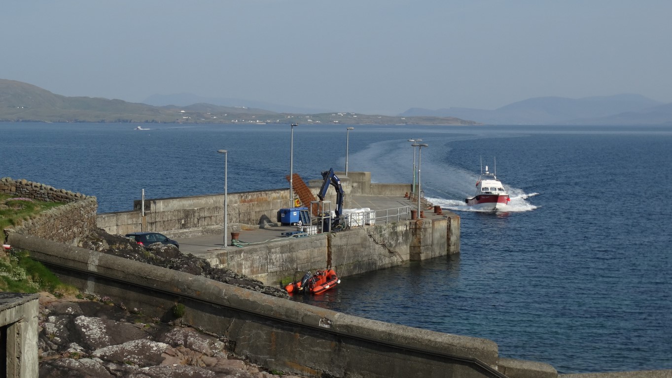 At Roonagh Pier awaiting the ferry to go out to Clare Island on a glorious sunny morning.[/caption]
A stepping stone between Connemara and Achill Island and a mere six square miles, Clare Island lies at the entrance to Clew Bay on the west coast of Ireland. Today the population is again on the increase and has risen to 168 on the 2011 census but in 1841 the population was a staggering 1615 but that was just before the Irish potato famine of 1845.
I am based in Westport for the week and high on my list is to visit Clare Island. It is now or never and thankfully the Friday on my week in the area dawns a perfect day. It’s my last full day in the area and I’m setting off with plenty of time to spare to reach Roonagh Pier west of Louisburgh.
The MV Sea Sprinter is the ferry for the island on this fine morning and with a one other tourist and a few workmen, a friendly black Labrador called Oscar and a few perishable groceries we set off under sunny skies for the short crossing to Clare Island.
What a day with hardly a cloud in the sky as I step ashore from the quay and make my way around to the sandy harbour. The harbour is guarded by a now ruinous castle, which was once the stronghold of the pirate Queen Grace O’Malley. Even today the O’Malley surname crops up everywhere on the island. My aim is to walk clockwise around the island and to catch the 4.45pm ferry back to Roonagh Pier and from my calculations I will do the twelve miles comfortably.
[caption id="attachment_1741" align="alignnone" width="1363"]
At Roonagh Pier awaiting the ferry to go out to Clare Island on a glorious sunny morning.[/caption]
A stepping stone between Connemara and Achill Island and a mere six square miles, Clare Island lies at the entrance to Clew Bay on the west coast of Ireland. Today the population is again on the increase and has risen to 168 on the 2011 census but in 1841 the population was a staggering 1615 but that was just before the Irish potato famine of 1845.
I am based in Westport for the week and high on my list is to visit Clare Island. It is now or never and thankfully the Friday on my week in the area dawns a perfect day. It’s my last full day in the area and I’m setting off with plenty of time to spare to reach Roonagh Pier west of Louisburgh.
The MV Sea Sprinter is the ferry for the island on this fine morning and with a one other tourist and a few workmen, a friendly black Labrador called Oscar and a few perishable groceries we set off under sunny skies for the short crossing to Clare Island.
What a day with hardly a cloud in the sky as I step ashore from the quay and make my way around to the sandy harbour. The harbour is guarded by a now ruinous castle, which was once the stronghold of the pirate Queen Grace O’Malley. Even today the O’Malley surname crops up everywhere on the island. My aim is to walk clockwise around the island and to catch the 4.45pm ferry back to Roonagh Pier and from my calculations I will do the twelve miles comfortably.
[caption id="attachment_1741" align="alignnone" width="1363"] The sandy harbour on Clare Island. The main ferry is beached for repairs. Suddenly the pace of life has slowed down.[/caption]
It ‘s not even 10am as I set out west along the almost deserted lane along the southern coast of the island. Of the few vehicles on the island, it’s a place where cars and vans come to die. They have seen better days on the mainland and many vehicles have large dents and or have missing bumpers.
[caption id="attachment_1742" align="alignnone" width="1363"]
The sandy harbour on Clare Island. The main ferry is beached for repairs. Suddenly the pace of life has slowed down.[/caption]
It ‘s not even 10am as I set out west along the almost deserted lane along the southern coast of the island. Of the few vehicles on the island, it’s a place where cars and vans come to die. They have seen better days on the mainland and many vehicles have large dents and or have missing bumpers.
[caption id="attachment_1742" align="alignnone" width="1363"] The empty lane west along the southern coast of Clare Island. I see only two vehicles over four miles of walking along this delightful undulating lane overlooking a sparkling sea dotted with little islands.[/caption]
Almost two miles west I make a small diversion to visit the ancient church known as St Bridget’s Abbey which is believed to date from the 12th century but unfortunately it is locked although there are some interesting ancient crosses in the churchyard. Nearby the photographic little post office is doing very little trade and during my walk it is the only shop I find on the island. From my observations, there are several new houses on the island and many old properties have fallen into decay.
[caption id="attachment_1743" align="alignnone" width="1363"]
The empty lane west along the southern coast of Clare Island. I see only two vehicles over four miles of walking along this delightful undulating lane overlooking a sparkling sea dotted with little islands.[/caption]
Almost two miles west I make a small diversion to visit the ancient church known as St Bridget’s Abbey which is believed to date from the 12th century but unfortunately it is locked although there are some interesting ancient crosses in the churchyard. Nearby the photographic little post office is doing very little trade and during my walk it is the only shop I find on the island. From my observations, there are several new houses on the island and many old properties have fallen into decay.
[caption id="attachment_1743" align="alignnone" width="1363"]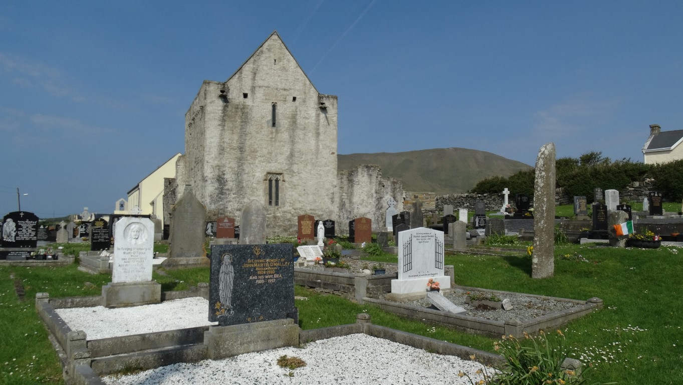 A peaceful setting for the 12th century St Bridgets Abbey and its graveyard dotted with ancient crosses.[/caption]
[caption id="attachment_1744" align="alignnone" width="1363"]
A peaceful setting for the 12th century St Bridgets Abbey and its graveyard dotted with ancient crosses.[/caption]
[caption id="attachment_1744" align="alignnone" width="1363"]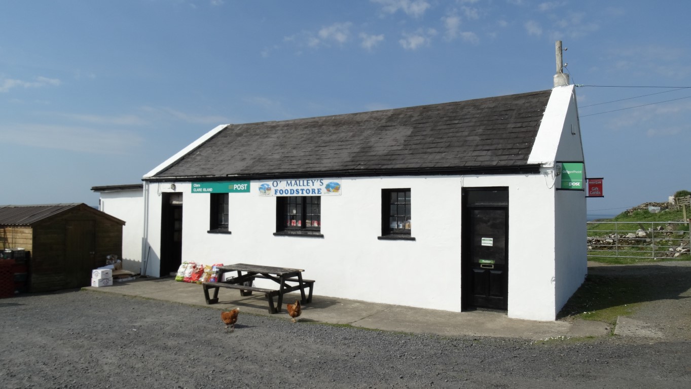 The island's only shop with only the likelihood of two hens as possible customers.[/caption]
I have a further two miles of lane walking west passing a few scattered houses on the way. A handy seat is a good spot for my morning break on this most pleasant day overlooking a sparkling blue sea towards Connemara. The lane finally runs out at a small cluster of houses and a farm at Loughanaphuca. From here I follow a track for a short distance before heading across the short cropped grass towards the shaky ruins of the Napoleonic Signal Tower built in 1804 as one of several along the Irish coast. The tower was abandoned after the threat of invasion passed and is now very unsafe so I keep my distance. The walking is easy as at this exposed location facing the open Atlantic where very little grows above about an inch or two. To the southwest is Beetle Head, a low promontory where it is said that the Spanish Galleon El Gran Grin met its fate after the Spanish Armada.
[caption id="attachment_1745" align="alignnone" width="1363"]
The island's only shop with only the likelihood of two hens as possible customers.[/caption]
I have a further two miles of lane walking west passing a few scattered houses on the way. A handy seat is a good spot for my morning break on this most pleasant day overlooking a sparkling blue sea towards Connemara. The lane finally runs out at a small cluster of houses and a farm at Loughanaphuca. From here I follow a track for a short distance before heading across the short cropped grass towards the shaky ruins of the Napoleonic Signal Tower built in 1804 as one of several along the Irish coast. The tower was abandoned after the threat of invasion passed and is now very unsafe so I keep my distance. The walking is easy as at this exposed location facing the open Atlantic where very little grows above about an inch or two. To the southwest is Beetle Head, a low promontory where it is said that the Spanish Galleon El Gran Grin met its fate after the Spanish Armada.
[caption id="attachment_1745" align="alignnone" width="1363"]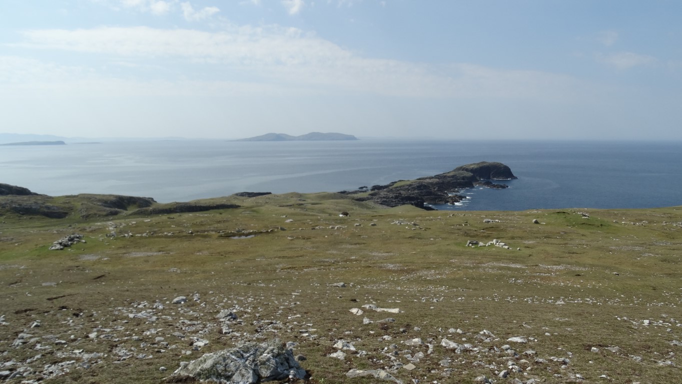 Beetle Head on the southwest corner of Clare Island. Just offshore lies a Spanish Galleon which met its fate after the Spanish Armada in 1588.[/caption]
[caption id="attachment_1746" align="alignnone" width="1363"]
Beetle Head on the southwest corner of Clare Island. Just offshore lies a Spanish Galleon which met its fate after the Spanish Armada in 1588.[/caption]
[caption id="attachment_1746" align="alignnone" width="1363"]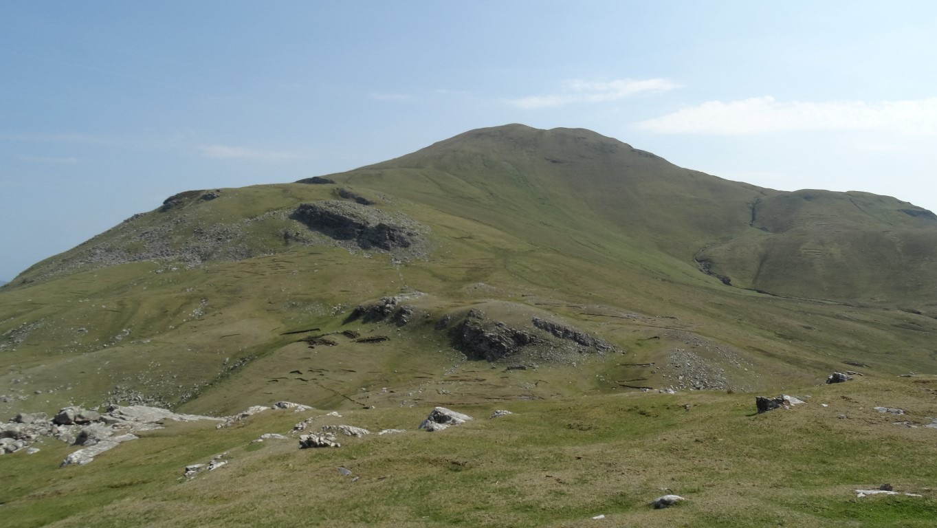 The western side of Clare Island few people see as it faces out to the Atlantic and no one lives here. I was now setting out to climb to the summit of Knockmore, by far the island's biggest hill.[/caption]
It is now time to change direction and a fine grassy slope with steep broken cliffs on my left leads up to Knockmore which at 462 metres is by far the highest point on the island. After a stiff climb I reach the summit plateau and make my way to the trig point. I have picked the most perfect of days with a very light northerly breeze, good views and unbroken sunshine. In the distance sea mist is rolling over a low ridge on Achill Island like a waterfall. To the east is the hazy outline of Croagh Patrick, Ireland’s Holy Mountain. This will make a perfect spot to stop for lunch. I’m making good time and over lunch I plan my route back to the ferry and calculate my intended timings at certain points. For once there was no need to hurry as I will be still in good time. Next on the agenda is to follow a route along the top of the spectacular cliffs to Clare Island Lighthouse. It is undulating route of two and a half glorious miles. Despite no path as such, the going is easy and initially I walk down a steep grassy descent before I divert slightly inland to avoid a few coastal cliffs.
[caption id="attachment_1747" align="alignnone" width="1363"]
The western side of Clare Island few people see as it faces out to the Atlantic and no one lives here. I was now setting out to climb to the summit of Knockmore, by far the island's biggest hill.[/caption]
It is now time to change direction and a fine grassy slope with steep broken cliffs on my left leads up to Knockmore which at 462 metres is by far the highest point on the island. After a stiff climb I reach the summit plateau and make my way to the trig point. I have picked the most perfect of days with a very light northerly breeze, good views and unbroken sunshine. In the distance sea mist is rolling over a low ridge on Achill Island like a waterfall. To the east is the hazy outline of Croagh Patrick, Ireland’s Holy Mountain. This will make a perfect spot to stop for lunch. I’m making good time and over lunch I plan my route back to the ferry and calculate my intended timings at certain points. For once there was no need to hurry as I will be still in good time. Next on the agenda is to follow a route along the top of the spectacular cliffs to Clare Island Lighthouse. It is undulating route of two and a half glorious miles. Despite no path as such, the going is easy and initially I walk down a steep grassy descent before I divert slightly inland to avoid a few coastal cliffs.
[caption id="attachment_1747" align="alignnone" width="1363"]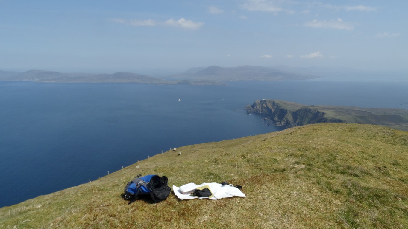 Picnic sites don't come any better than this. I'm 450 metres up overlooking Clew Bay on the west coast of Ireland. There is hardly a breath of air on this perfect sunny day. In the distance, sea mist is rolling over a ridge on Achill Island. Pure magic![/caption]
[caption id="attachment_1748" align="alignnone" width="1363"]
Picnic sites don't come any better than this. I'm 450 metres up overlooking Clew Bay on the west coast of Ireland. There is hardly a breath of air on this perfect sunny day. In the distance, sea mist is rolling over a ridge on Achill Island. Pure magic![/caption]
[caption id="attachment_1748" align="alignnone" width="1363"] On the cliff top walk between Knockmore and Clare Island Lighthouse. Two and a half miles of walking at it's best.[/caption]
Other than that there are two only easy fences to cross but a more awkward boggy stream where I have to go to the cliff edge to cross. By 2.30pm I am at the lighthouse. Today the lighthouse is private and a holiday let but I get a good view from the cliffs as I approach. Built in 1806 by the Marquis of Sligo the lighthouse saw seven years service before it caught on fire. Having been restored it was badly damaged during a lightning strike in 1834 and it was finally decommissioned in 1965.
[caption id="attachment_1749" align="alignnone" width="1363"]
On the cliff top walk between Knockmore and Clare Island Lighthouse. Two and a half miles of walking at it's best.[/caption]
Other than that there are two only easy fences to cross but a more awkward boggy stream where I have to go to the cliff edge to cross. By 2.30pm I am at the lighthouse. Today the lighthouse is private and a holiday let but I get a good view from the cliffs as I approach. Built in 1806 by the Marquis of Sligo the lighthouse saw seven years service before it caught on fire. Having been restored it was badly damaged during a lightning strike in 1834 and it was finally decommissioned in 1965.
[caption id="attachment_1749" align="alignnone" width="1363"] Clare Island Lighthouse lies at the northernmost point on the island. This was the view on the approach.[/caption]
[caption id="attachment_1750" align="alignnone" width="1363"]
Clare Island Lighthouse lies at the northernmost point on the island. This was the view on the approach.[/caption]
[caption id="attachment_1750" align="alignnone" width="1363"] The sandy beach by Clare Harbour. Time stands still here and its a magical place to be on a day like today.[/caption]
I sit on a nearby rocky knoll for a break in the warm afternoon sunshine before moving on. I follow a track south for a mile before it becomes a minor lane leading back to the harbour. With still time to spare I go in search of a drink. A ragged Guinness flag on a pole gives a clue of a pub hidden just around the corner and so it is a quick drink at the Sailor’s Bar before wondering down to the harbour for the return boat trip to Roonagh Pier.
[caption id="attachment_1751" align="alignnone" width="1363"]
The sandy beach by Clare Harbour. Time stands still here and its a magical place to be on a day like today.[/caption]
I sit on a nearby rocky knoll for a break in the warm afternoon sunshine before moving on. I follow a track south for a mile before it becomes a minor lane leading back to the harbour. With still time to spare I go in search of a drink. A ragged Guinness flag on a pole gives a clue of a pub hidden just around the corner and so it is a quick drink at the Sailor’s Bar before wondering down to the harbour for the return boat trip to Roonagh Pier.
[caption id="attachment_1751" align="alignnone" width="1363"] Waiting for the ferry back to the mainland at the end of a perfect day.[/caption]

