

The River Great Ouse at St Ives with its medieval bridge.
You can’t go very far in St Ives Cambridgeshire without some sort of reminder to the town’s most important resident, Oliver Cromwell. Although born in nearby Huntingdon he lived in St Ives for around five years before he became famous.
For this walk we are starting out in Huntingdon as we are catching the bus to St Ives and walking back along the Ouse Valley Way. We are just sampling a short section of this 142 mile long path which runs the whole length of the River Great Ouse from its source in Northamptonshire to the sea at King’s Lynn.
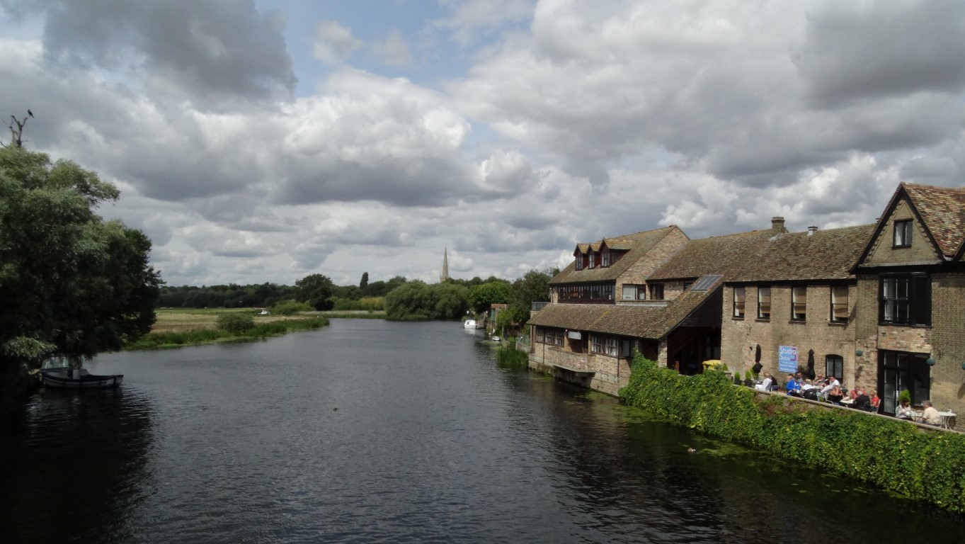
We time it very finely late on a sunny Sunday morning to Huntingdon Bus Station as the bus is about to depart. Having ridden around most of the housing estates in Huntingdon we arrive in St Ives and ready for an early lunch. A south facing seat is found overlooking the River Great Ouse to eat our sandwiches. There is so much to see here from the coming and going of numerous boats negotiating one of the arches under the town’s famous medieval bridge to the array for wildfowl eager to snatch any food going and it’s the sort of place you could linger awhile.
St Ives despite its relatively small size was an important inland port and being eighty miles upstream from King’s Lynn could take fairly large vessels in its heyday. The town owes its existence insomuch that it was once the location of a ford over the river prior to the fine medieval bridge being built. The bridge itself is quite unique as part way across is a surviving bridge chapel which is only one of four left in England today. The chapel was built in 1425 and was once several stories high. The town was once a Royalist stronghold but was taken by the Parliamentarians and under the command of Cromwell ordered the two southern arches of the bridge to be blown up and replaced with a drawbridge as part of the defences. On the southern side of the river, a former granary now converted to apartments was the home to the manufacture of the world’s first pocket calculator.
The view upstream along the River Great Ouse towards All Saints’ parish church as seen from the medieval bridge.
Leaving the Quayside it’s time to set off and heading back into the town the main thoroughfare is dominated by a large statue of Oliver Cromwell. Our pace westwards through the town is slow as there is much to see and the memorial to Queen Victoria in The Broadway is of note. It was given as a present to the town by Mr Elliott Odams, a local brewer having seen a similar memorial whilst at Sandown in the Isle of Wight. Liking the memorial so much he got the architect to built an identical memorial in St Ives with its grand unveiling to take place on the coronation day of Edward VII but alas on the chosen day the King was too ill and the coronation day was postponed until later in the summer but the inscription on the memorial still retains the original date of the coronation.

The memorial in The Broadway with the original date for King Edward VII coronation which has never been corrected.

The area known as The Waits in the oldest part of St Ives. this area was renowned for flooding until these flood defences were implemented.
Before leaving the town we pass All Saint’s Church which stands on the site of the oldest part of the former village here. The church has a splendid 151 foot tall spire which has had a chequered history. The present church dates from around 1470 and stands on the site of an earlier building but the spire is much later. Originally it fell during a storm in 1741 and was rebuilt seven years later and again it was rebuilt in 1879 but it was destroyed yet again when it was hit by an aircraft in 1918 when a trainee pilot lost control, so it must be one of the first church spires to be destroyed by a place crashing into it. The spire today dates from 1924.
The popular path to Houghton is surfaced the whole way and runs through woodland for much of the way with sloping ground on our right. The route we found was frequented with cyclists (if only they all had bells to give a bit of warning).
Houghton itself is busy with many people enjoying the riverbank and the campsite. The mill here belongs to the National Trust but today we don’t venture in due to the crowds. There has been a mill on the site for around one thousand years and the present mill dates from the eighteenth century. For a while it was a Youth Hostel and in my hostelling days it was one of the many Youth hostels I stayed at.
It is time to press on west and into a quieter landscape. It is riverside walking now alongside large meadows before veering off to take a path between large former gravel pits which are now wildlife reserves and all of a sudden we have the countryside to ourselves. Ahead the small town of Godmanchester (pronounced Gumster) draws closer dominated by the spire of St Mary the Virgin parish church. The town dates from Roman times and connected three Roman roads including Ermine Street. Walking through the town we find is much quieter than St Ives but there is still some boating activity to watch. It’s a pity that the earlier sunshine has gone as I wanted to photograph the picturesque Chinese bridge.
To reach Huntingdon there is a very large field to cross. This is Port Holme Meadow, which on my last visit was under water. In thick fog you would need a compass here as the area is quite featureless. Huntingdon draws closer and entering the town we pass beneath the busy and noisy bypass to reach the car.