
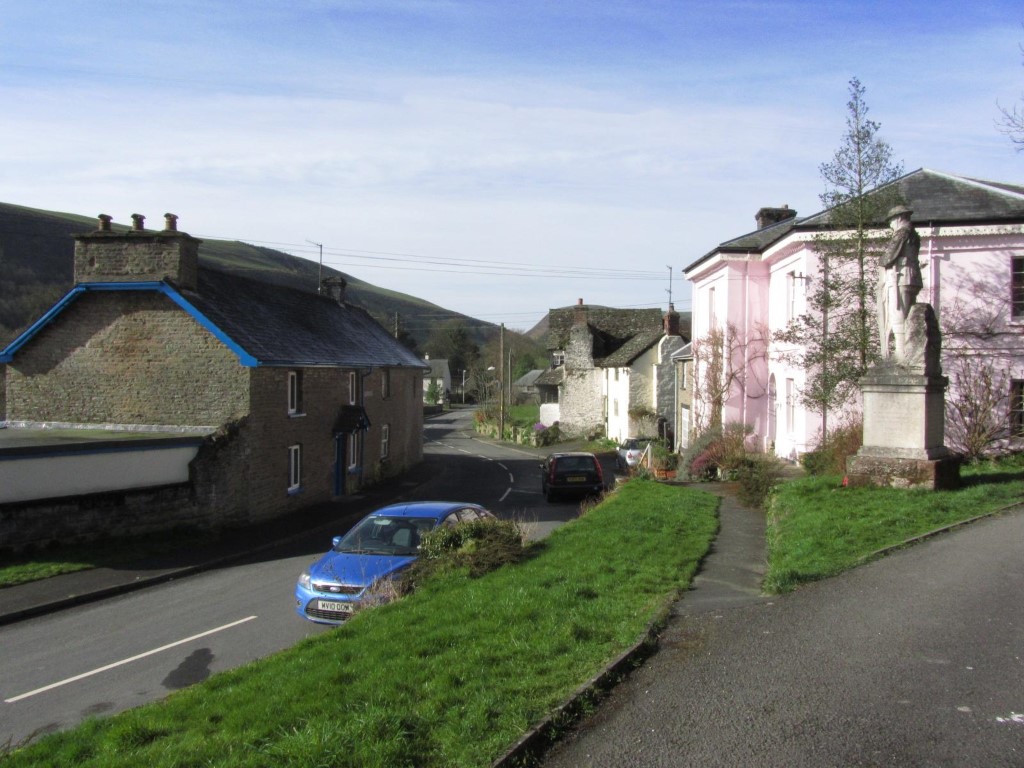
The quiet village of New Radnor in a almost forgotten corner of Powys.
Lying midway Llandrindod Wells and Presteigne the Radnor Forest is one of those overlooked areas of Powys and yet for many miles around it is the highest area with three summits over 2000 feet above sea level. Its northern slopes are cloaked in forestry whilst on the southern side there is a firing range but having said that the area makes for some fine walking where you will meet few people.
I had walked in this area in my youth hostelling days and with nearly forty years since my last visit I thought it was about time to explore the area again. With an early start from Bristol en route to Macclesfield this is a big detour and so I am pleased the day is dawning clear and sunny.
The sleepy village of New Radnor is my starting point but the weather forecast is set to change and even before I start my walk, high cloud is apparent in the west.
Parking in New Radnor presents no problems with a wide street through the village and the place is now bypassed by the A44. It is only 9.15am when I set out through the quiet village before heading up passing the church onto a field path. A right turn takes me onto a minor road before continuing with another field path contouring around to Harley Dingle. For once it feels quite warm but the air is cool on this spring morning and the odd gust of cold wind is just a sign of things to come. The army range in Harley Dingle, which forms a deep valley into the hills on the southern side is quiet and no red flags are flying.
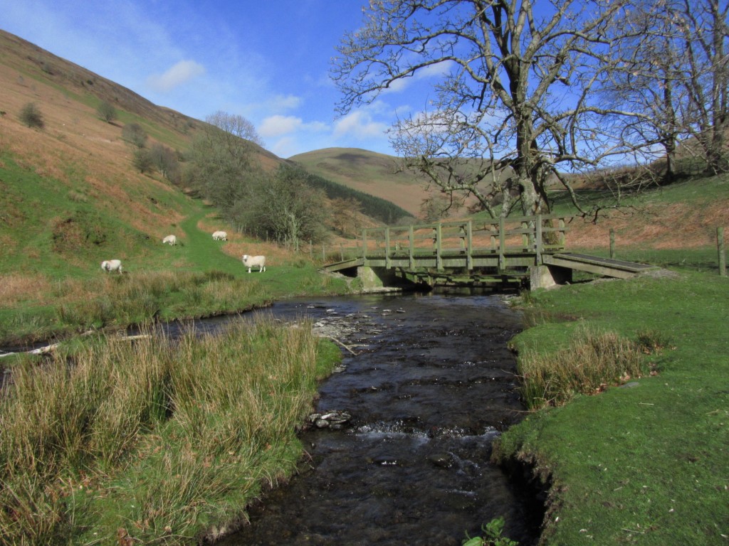
A footbridge over the stream at the foot of Harley Dingle. The valley beyond is an active firing range. On this walk I take the path the hillside to the left.
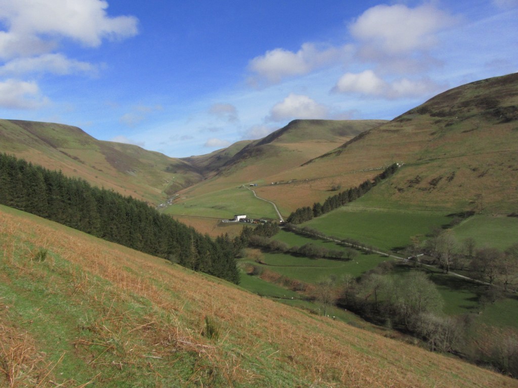
The view you get whilst ascending Fron Hill. Harley Dingle which forms the valley area is unfortunately out of bounds as it is a firing range. Today I skirt the skyline from left to right.
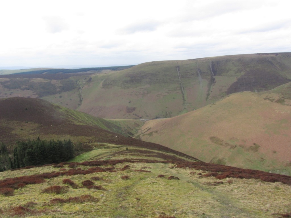
Looking across Harley Dingle to the shapely summit of Whimble but a firing range lies in the valley below.
I’m taking the pleasant hill path to the left of the range ascending the shoulder of Fron Hill. It is a delight to be out on such a glorious morning and an opportunity for photographs. High cloud from the west is edging in but for now I still have the sunshine. Further up on the crest of the ridge I have a view south to the snow-capped Brecon Beacons but the high cloud is silently edging in and it won’t be long before I lose the sun. Veering right I come to a flagpole around which is a red flag tied near the base. I check the path ahead and decide that my route is just outside the army range. Further on, with a cold wind blowing I reach a lone danger sign. It is here I am leaving the track to make for the summit of Great Rhos which at 660 metres is the highest point in the old county of Radnorshire. Despite it being only a short distance to the trig point, it is across very rough tussocky ground potted with watery holes and so I have to tread carefully. The summit itself which is crowned by a lonely trig point is a bleak location and in this cold wind not a place to linger. To the northwest, snow-capped hills are just visible. A peaty path runs north which I follow to join a track which continues northeast towards a forest. This track however has suffered the unfortunate effects of scrambling bikes which had churned up the ground. Once in the forest, I stop out of the wind for my morning break. Shortly afterwards I make a right turn on another churned up track and soon leave the forest. I am now making for the second summit named Black Mixen and this takes me along a good path but I am now walking into an icy headwind which makes my eyes water. Black Mixen is 650 metres and is topped by an aerial mast and today a team of engineers were working at the summit. After a brief pause at the trig point I head east on a good track. By now the sun has gone and it its turning into a cold windy and cloudy day. Reaching the forest I am glad of some shelter as I turned right and head south. A little lying snow fills the hollows and shady places. My next objective is Bache Hill, 610 metres, but with an out of date map I am not sure if this is still open access despite it being moorland. I spot a hill farmer working his dogs so I varied my route slightly to be out of sight of him. I skirt along the bottom end of a field just out of sight before entering a heathery path. Still out of sight of the farmer I turn right uphill to make my way to the summit and the third trig point of the day. (Later research does show Bache Hill as open access).
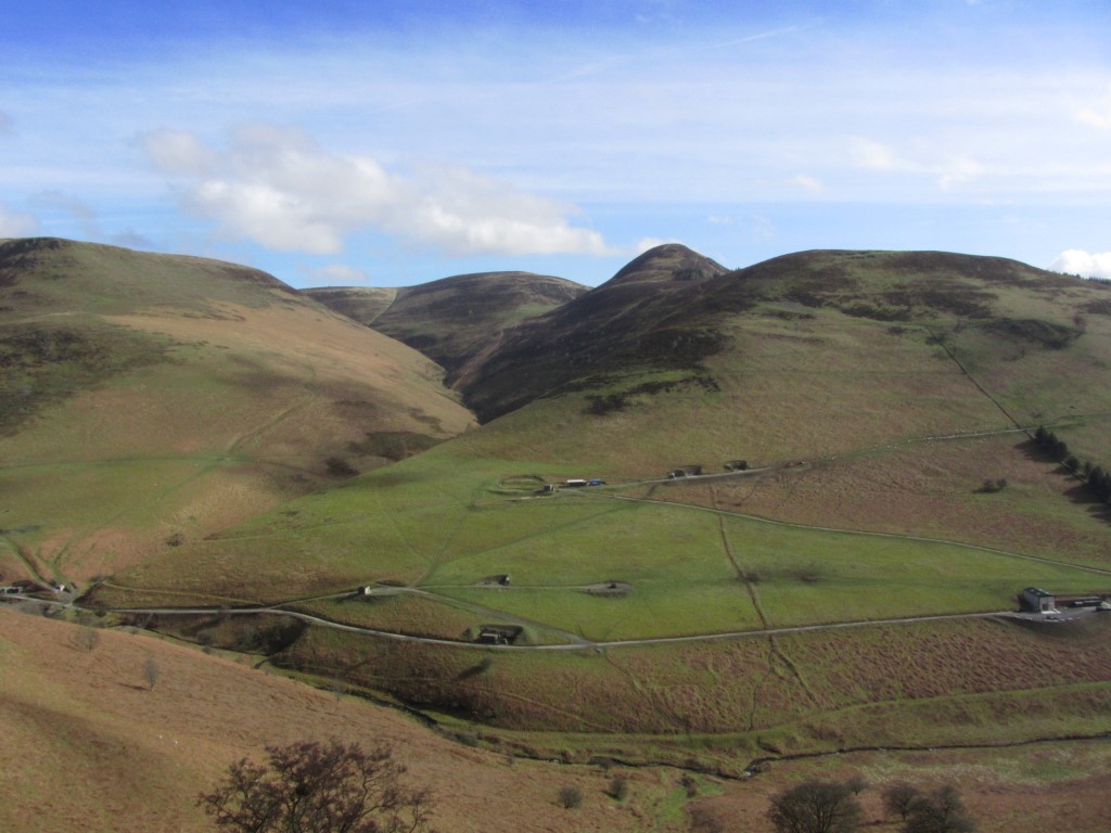
On the descent from Whimble in fine walking country. The ridge in the distance was on my outward route on what started out as a fine sunny day.
I now search for the farmer in case I am trespassing and as I can’t see him and descend on the southern side of the hill. The last hill of the day is Whimble and for much of the way to this last summit I follow a good track along the windy hillside. Now Whimble is open access not that I know that on this walk and there seems to be only one recognised path up to this shapely summit which fails to make the 600 metre mark by one metre. First I have to pass a large shed and beyond I take the direct path to the summit of Whimble. Close to the exposed summit I find several quarried out hollows and ironically a good spot to have lunch out of the bitter wind. It is quite grey now and so lunch is a hurried affair. A steep but defined path leads down the western side before I cross a fence onto the edge of heathery moorland. In the meantime red flags have been hoisted but no sign of any army activity. There now follows a long descent towards New Radnor firstly alongside a forest and here I pass the only other walkers of the day. Eventually I join a steep lane which leads down to the centre of the village and the end of an enjoyable walk. On reflection I feel that this is an undiscovered part of Wales. Take away the firing range the area has the potential to be a first class walking area if a bit of money and facilities were pumped in like a few small car parks, signing, and additional paths.