
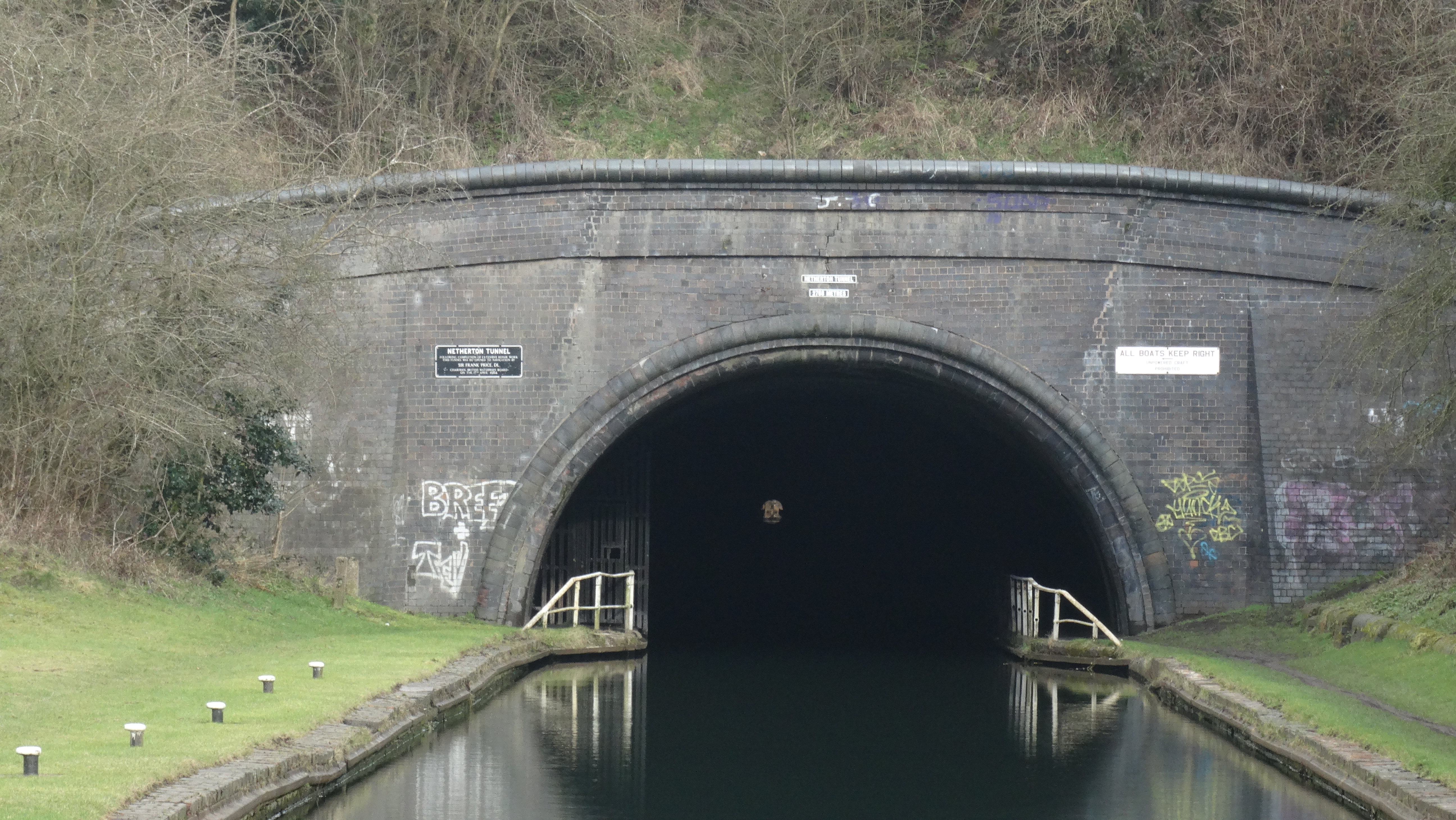
 The 1.72 mile long Netherton Tunnel which you can walk through on either side. fortunately the gate on the left side was unlocked which is the route we took. There is no restrictions on the right side. There are railings between the towpath and the canal the whole way but in a few spots they have rusted through at the base.
If you take a close look at the Ordnance Survey Explorer map of Wolverhampton & Dudley you may spot something a bit unusual. To the southeast of Dudley, the green diamond symbol which donates a national trail or recreational path which in this case is the Monarch’s Way plots a straight line across country passing through the middle of houses, roads and streams.
Now let me explain. This is where this path dives underground for a staggering 1.72 miles or 2768 metres and uses the towpath of the Netherton Canal Tunnel deep below the suburbs of Dudley. The tunnel was the last canal tunnel to be built and opened in 1858 and was much grander than the early canal tunnels insomuch that it was wide enough for two boats to pass and had towpaths on either side. The tunnel was built to relieve congestion in the nearby and parallel claustrophobic Dudley Canal Tunnel where delays were often up to eight hours to get through. In some respects history is repeating itself one hundred and fifty years later whereby the M6 into Birmingham now has an alternative route namely the M6 toll road. So the Netherton Tunnel was the M6 toll road of its day. Building the tunnel cost the lives of nine men and a further eighteen were seriously injured so health and safety has vastly improved over the years.
So this leads me to our twelve mile walk which includes walking through this long tunnel and circumnavigates the town of Dudley. In the planning I wanted a route which would avoid walking through built up areas as much as possible despite this being the heart of the West Midlands Black Country.
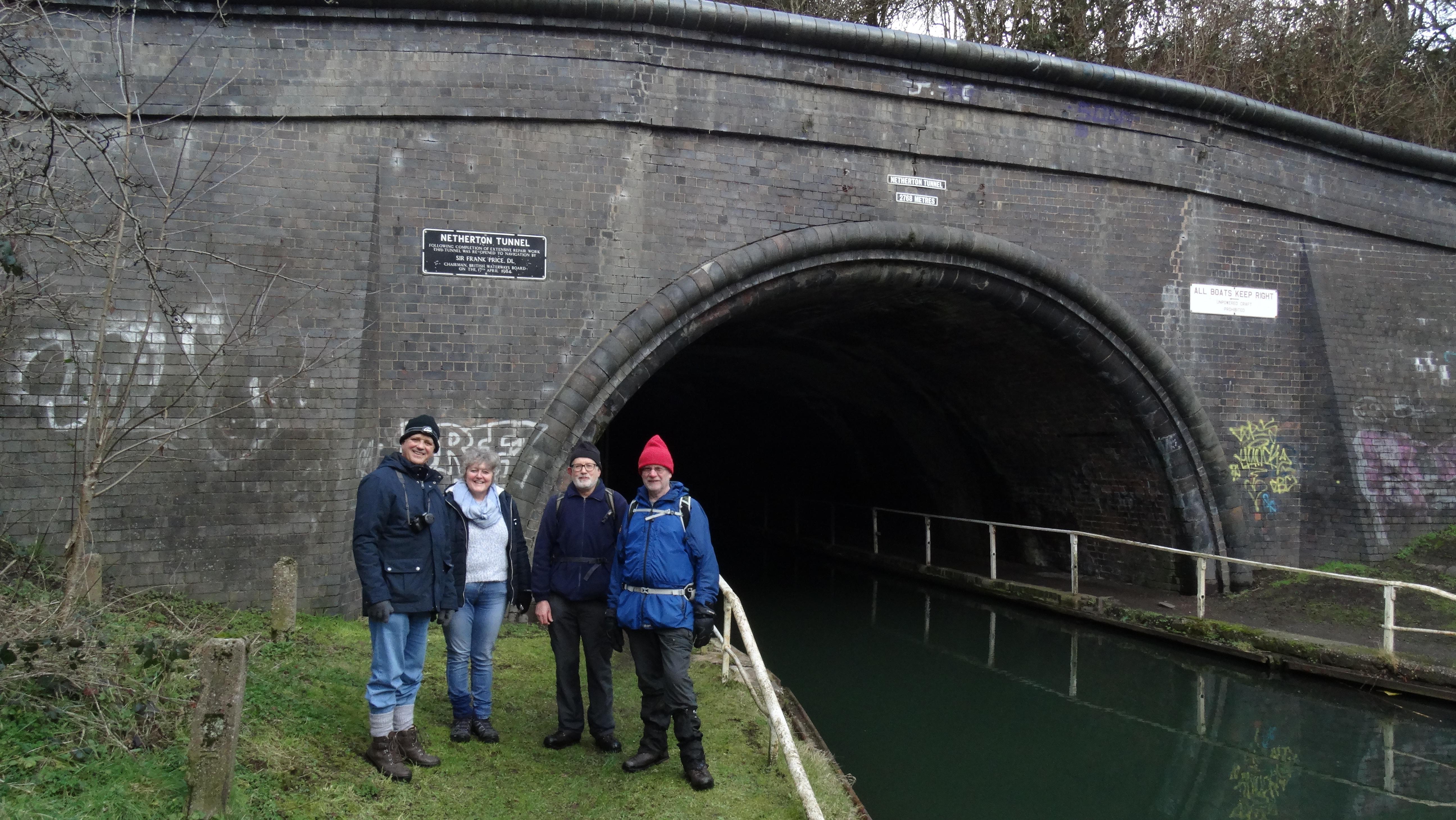 The underground party emerging from a successful walk through the tunnel.
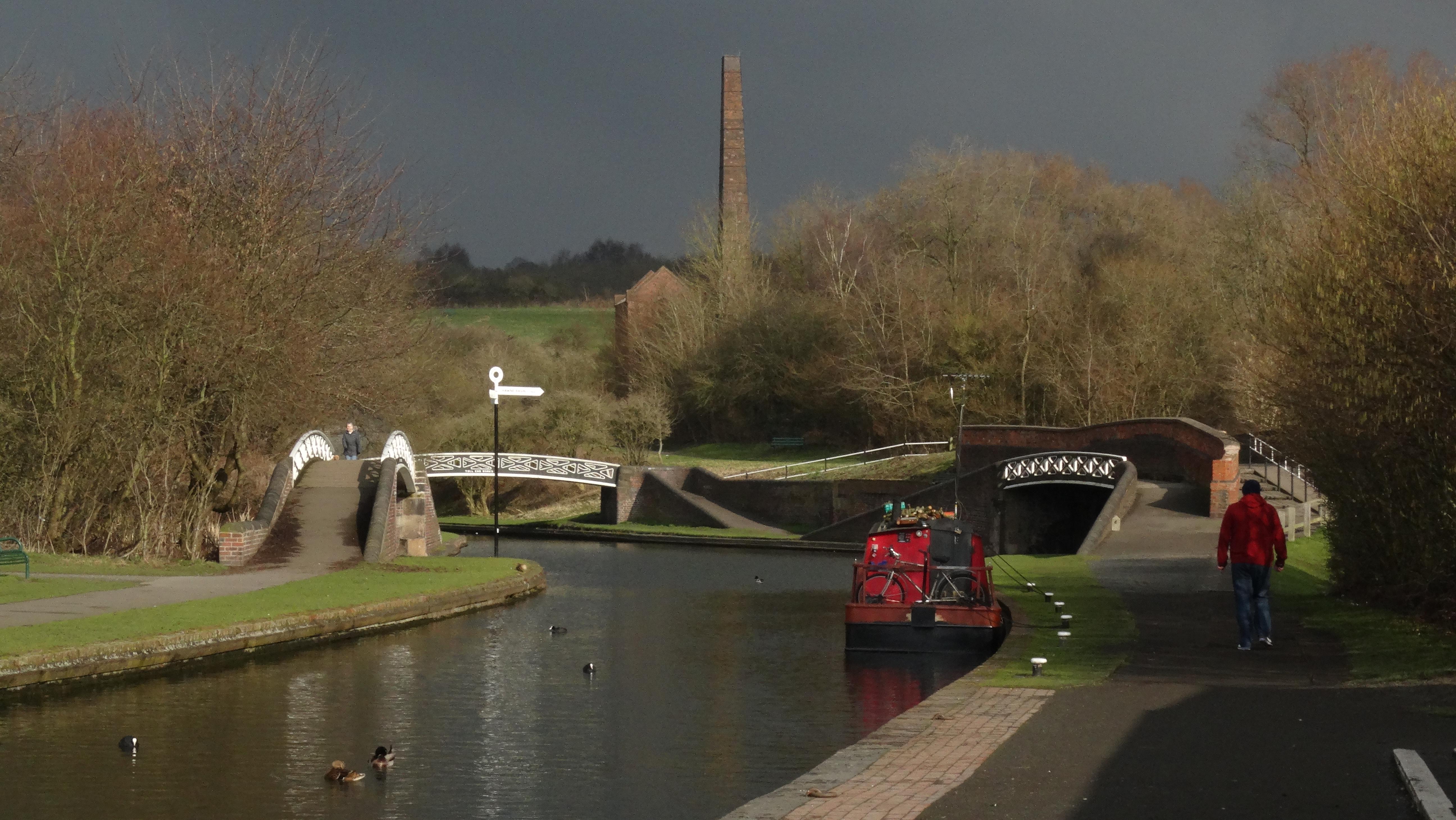 Windmill End at the junction of the Dudley Canal No 2 and the Netherton Tunnel Branch. The chimney and roofless building is the former Cobbs Engine House.
To start with, five of us are setting out with my brother and his wife just wanting to walk the tunnel part of the route which means a car shuttle. With an 11am start and the odd snow flurry in the air we start our walk from a side street in Dudley Port and follow the towpath of the Birmingham Canal the short distance to the spot where it crosses the Netherton Branch Canal. We now drop to a lower level where the dark tunnel looms ahead. A good torch is essential on this part of the walk as the tunnel is now unlit. In single file we enter the abyss and a speck of light at the far end indicates that the tunnel is straight. We now plod on for three quarters of an hour carefully avoiding the long elongated puddles on the towpath. When we do emerge the weather has brightened up and we soon pause at Windmill End where we join the towpath of the Dudley Number 2 Canal. There are some attractive canal footbridges here and surprisingly a little tea shop.
We soon say farewell to my brother and his wife and the three of us press on and now look for somewhere to stop for lunch but only find a wall at a place called Cattle Bridge. Due to the cold, our lunch stop is only a brief one and we press on towards Blower’s Green. On the way we pass several metal information boards which give us an insight into what industries that once lined the canal banks including foundries that cast ships anchors and chains and even a factory where the casings for Barn Wallace’s bouncing bombs were made.
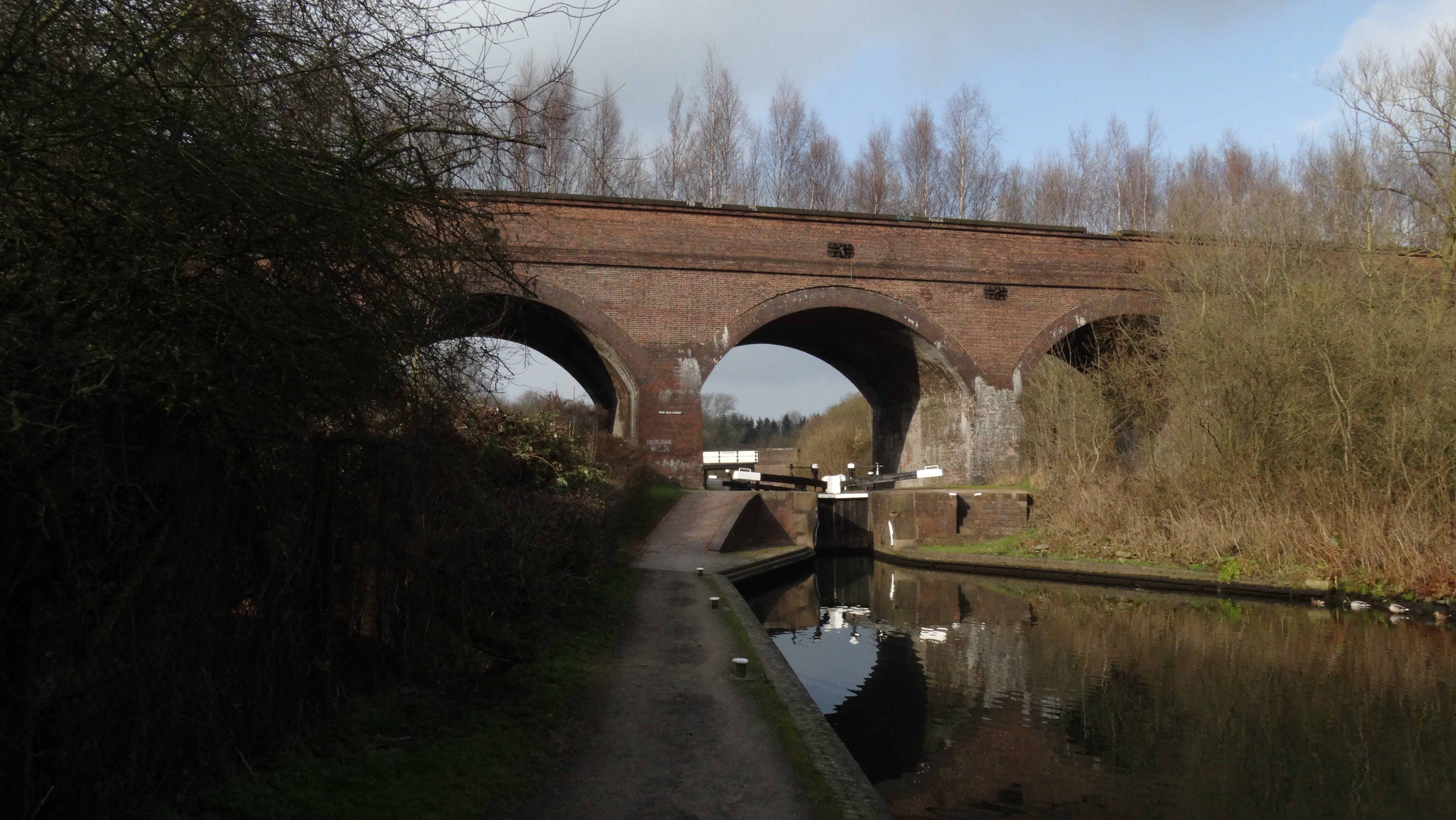 Parkhead Locks and railway viaduct near Dudley. This is where the the canal rises twenty feet towards the Dudley Tunnel entrance.
Blower’s Green is where the Stourbridge Canal comes in from the left and now three locks lifts canal boats twenty feet to the Dudley Tunnel entrance. Dudley Tunnel is even longer than the Netherton Tunnel but has a narrow bore and there is no towpath and the internal combustion engine cannot be used within the tunnel. An electric tug can be hired to tow your canal boat through but other than that you have to ‘leg’ the 3154 yards of darkness. ‘Legging’ on a canal boat involves lying on your back on the boat roof and using your legs to walk along the roof to propel the boat forward.
This is where we leave the canal network and soon we have no alternative but to follow a few streets through Dudley. Dudley is dominated by its castle which stands high at the end of wooded ridge and overlooks the town. The castle is now a ruin and in the grounds is located Dudley Zoo. Originally built after the Norman Conquest the first castle was a wooden motte and bailey before being rebuilt in stone in the 12th century. This castle was destroyed by King Henry II but rebuilt by John Dudley in the 13th century. Again the castle was partially destroyed during the English Civil War and was further destroyed by fire in 1750 to leave the ruins we see today.
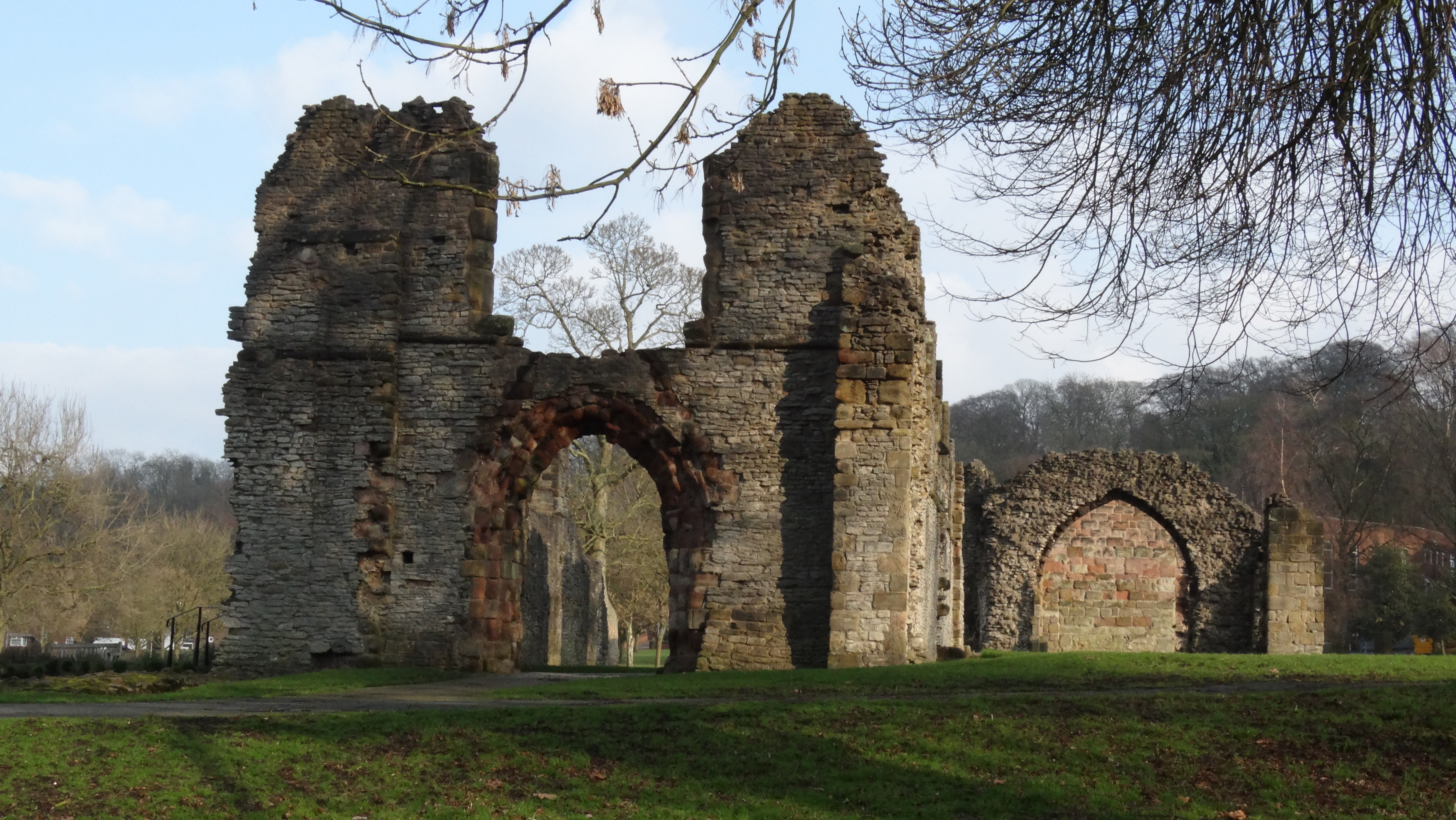 St James Priory in Dudley. founded in 1160 and destroyed during the Dissolution of the Monasteries.
For ourselves we are heading for the ruins of St James’s Priory which lie in a park on the edge of Dudley. Founded in 1160 the priory was established as a dependency of the Cluniac Priory of Much Wenlock. Its days ended with the Dissolution of the Monasteries.
We now continue with a diversion onto the wooded hill north of Dudley Castle which is pitted with centuries of quarrying and tunnelling. The Dudley Canal Tunnel passes deep below this hill. Our next objective is Wren’s Nest Nature Reserve but to get there we have to follow a few residential streets. Wren’s Nest is not really what you would expect to fine in the heart of the Black Country. It consists of a steeply side wooded hill with cliff outcrops especially along its western side but its claim to fame is its geology and is said to be one of the most important geological sites in the country. A trail along its western slope has numerous display boards depicting the geological finds. Many fossils including Trilobites locally known as the Dudley Bug (which is not a bad cold you pick up in the West Midlands) can be found in the Silurian beds laid down in what was a shallow sea around 420 million years ago. What was visible on our visit were the ripple beds laid down in a shallow tropical sea when Britain was located just south of the Equator which are now tilted at a steep angle. The best geological cliffs are now fenced off to stop people chipping away at the rock face and taking souvenirs.
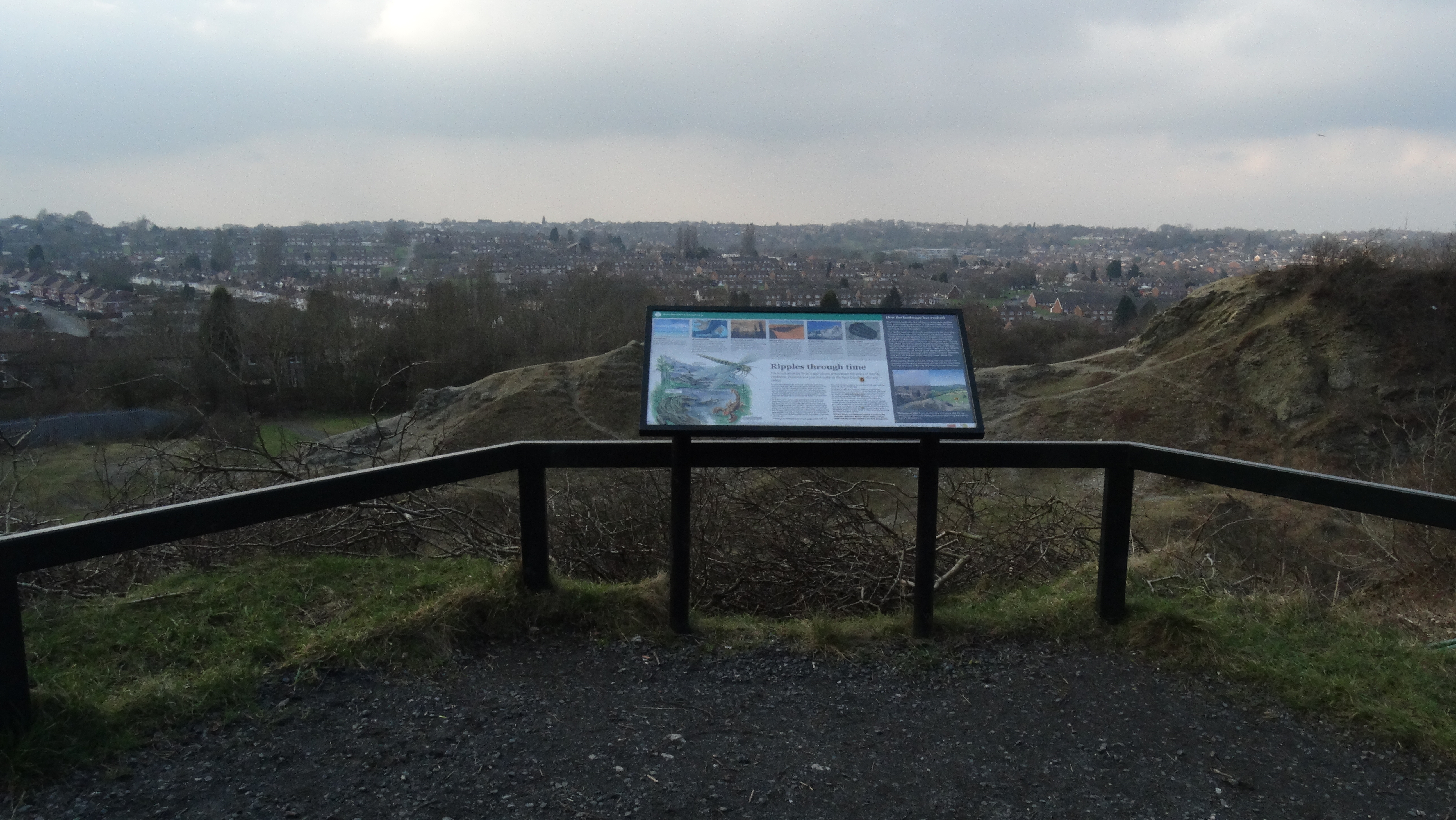 Wren’s Nest is a geological marvel where the Silurian beds are exposed and have revealed many good fossils from around 420 million years ago.
 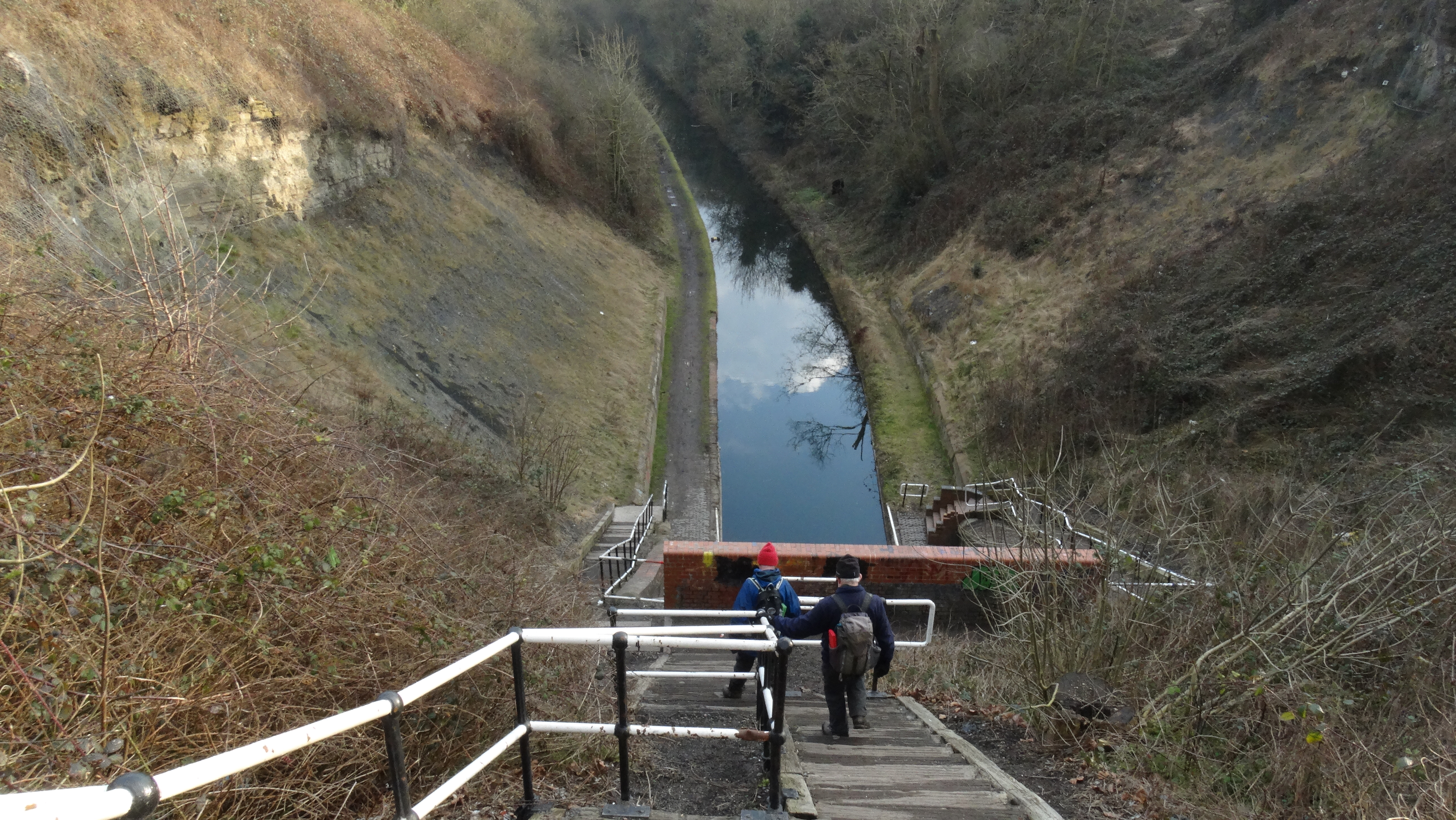 Descending the long flight of steps to join the Wolverhampton Level Canal at the southern portal of Coseley Tunnel.
Beyond Wren’s Nest we continue over the steeply side and wooded Mons Hill which again shows much evidence of quarrying. To reach Coseley Canal Tunnel we now have to walk a few residential streets before descending a long flight of steps to the southern portal of the tunnel. Back on the towpath it is an easy afternoon walk alongside the Birmingham Canal to reach the end of our walk.